

RIC Airport
-
Posts
1,766 -
Joined
-
Last visited
Content Type
Profiles
Blogs
Forums
American Weather
Media Demo
Store
Gallery
Posts posted by RIC Airport
-
-
21 minutes ago, Conway7305 said:
18z EURO Ensembles look good again for 16-17 storm setup
It's too bad the 18Z EPS only goes out to hour 144, everything looks good at 500mb. Snow maps only had a little east of the mountains through 18z on the 15th, but of course, that's not quite within range yet. Hopefully, all that means is that the 00z runs will be even more favorable.
-
 1
1
-
-
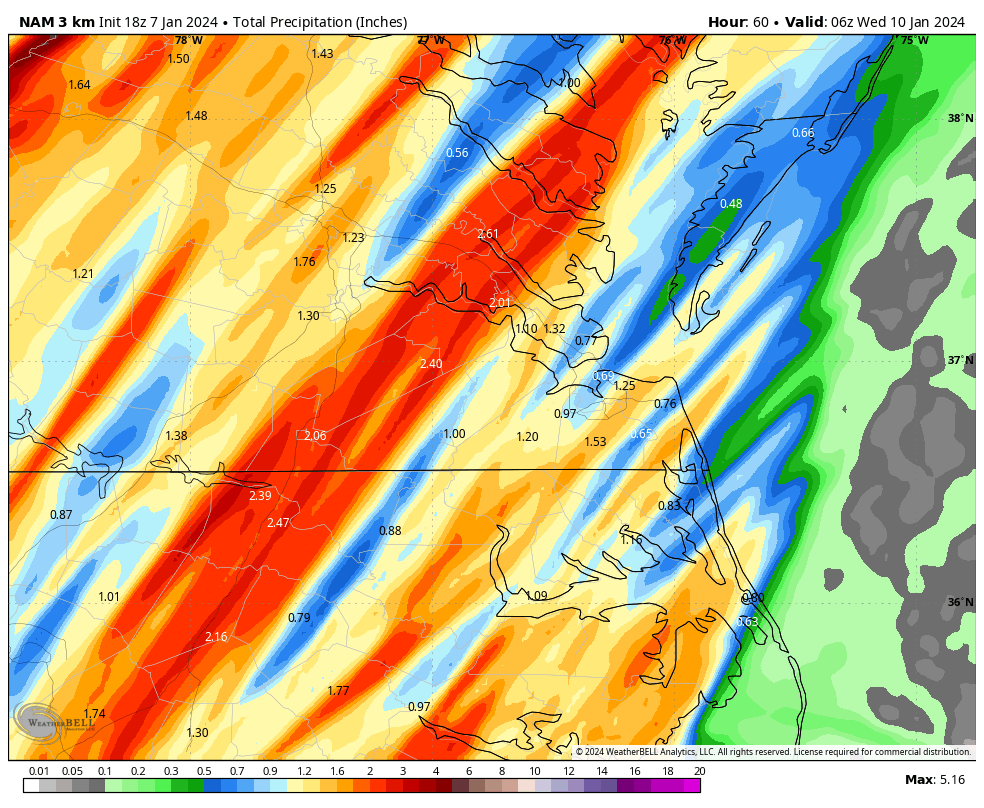
It looks like the storm total at Richmond will be 2.60", a new daily record. The CLI will be sent around 1:30am, but if that is correct, today will go down as the 2nd wettest January day on record.
The below dates featured the previous top 3 wettest January days at RIC.
Date	         Value
01/06/1962	 3.31"
01/23/1935	 2.51"
01/28/1952	 2.07"
Also, RIC had a wind gust to 59mph at the 9pm ob so the higher winds that the NAM showed yesterday looks to have verified, at least in spots.
-
 1
1
-
-
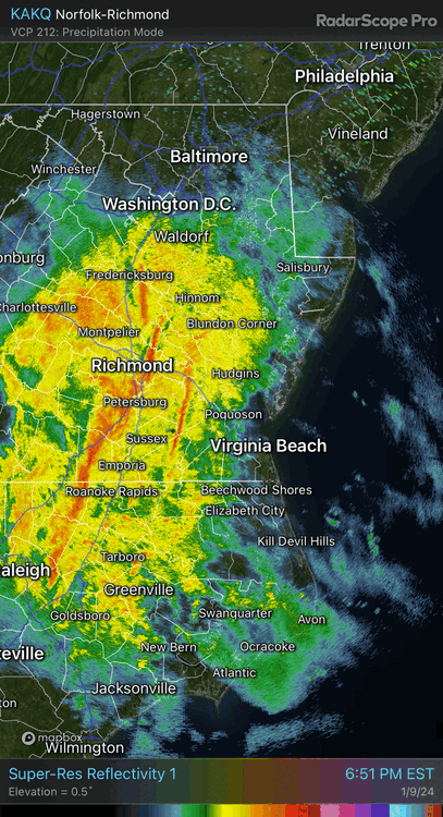
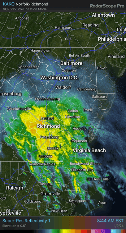
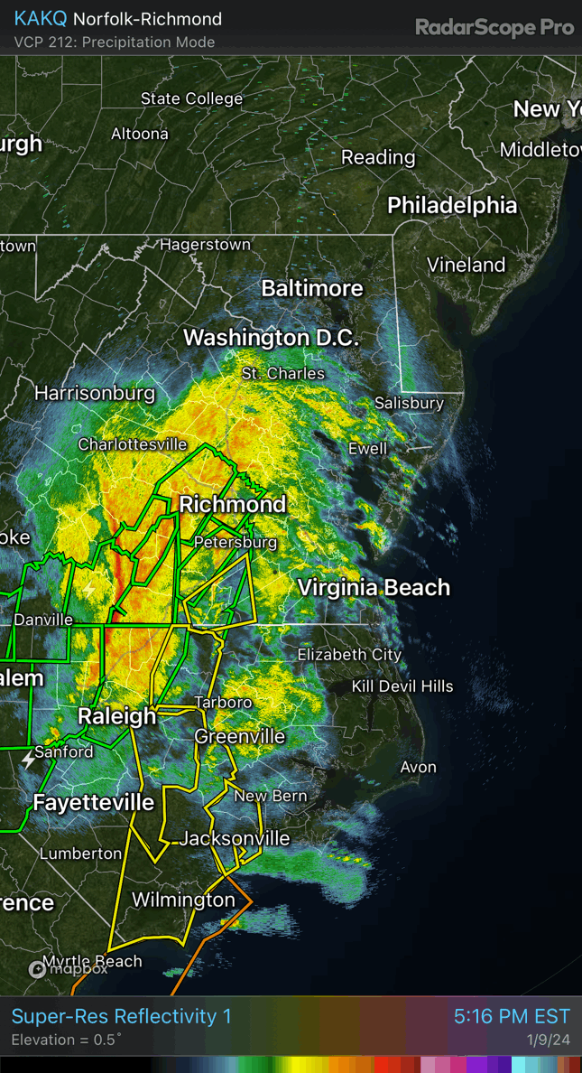
The back end of the squall line is entering the Hampton Roads area. Definitely reminded me of a summer downpour when it passed through here. Just wind and rain, no thunder or lightning.
-
3 hours ago, ldub23 said:
Getting better
The 18Z GEFS mean was a step back from 12Z, but it still has an accumulating snow signal for the 16-17th and around the 20-21st. Hopefully, the 12z's numbers are closer to reality. The 18Z operational run was unremarkable.
12Z GEFS MEAN

18Z GEFS MEAN
-
On 1/9/2024 at 6:16 PM, mikeeng92 said:
Power outages are starting to add up. KRIC is officially up to 1.53" of rain through 7pm and counting. The daily rainfall record was 1.41" set back in 1932.
-
Getting into the thick of it. Flash Flood Warning now. And there is a Tornado south of Petersburg.

-
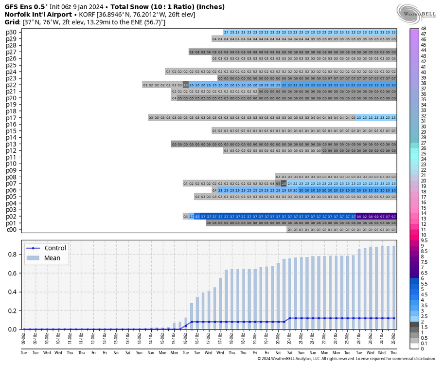
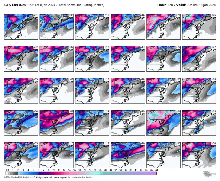
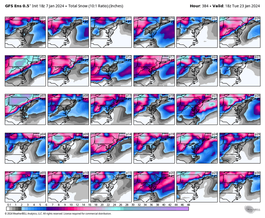
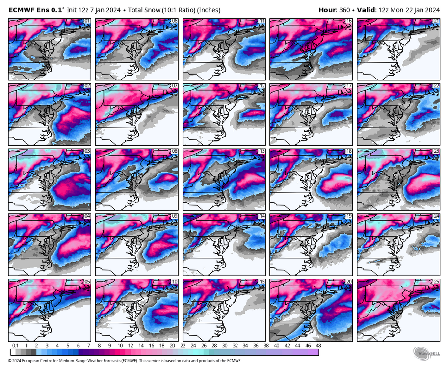
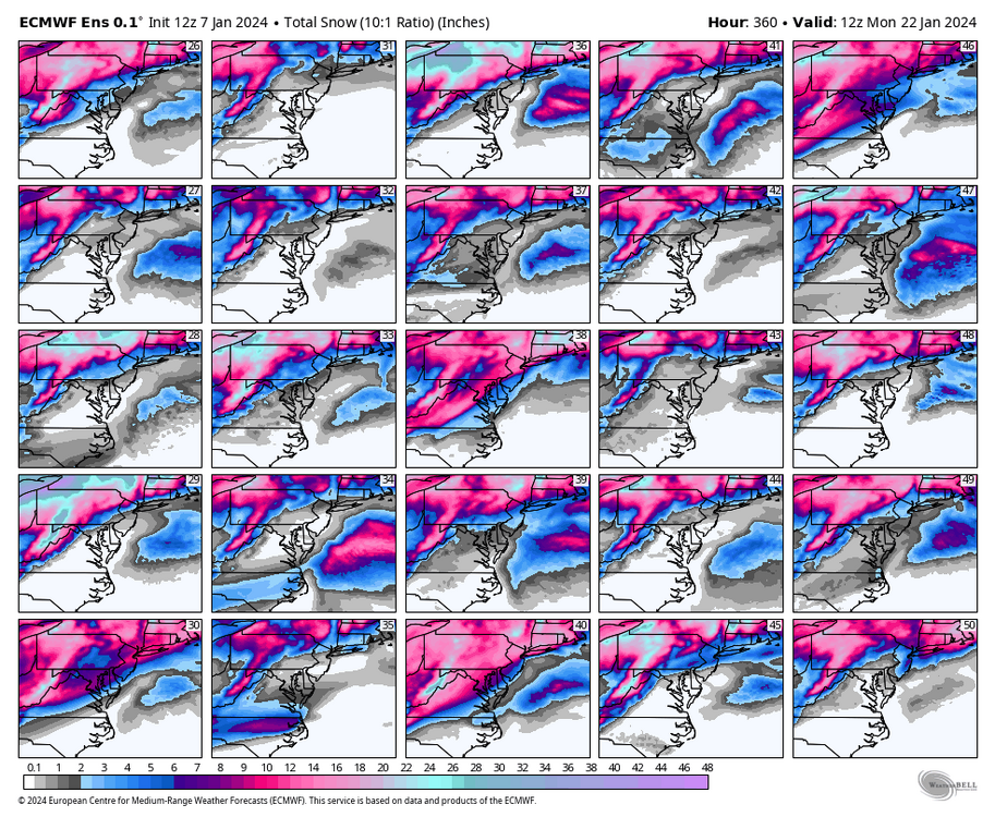
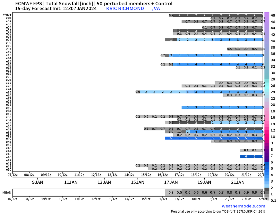
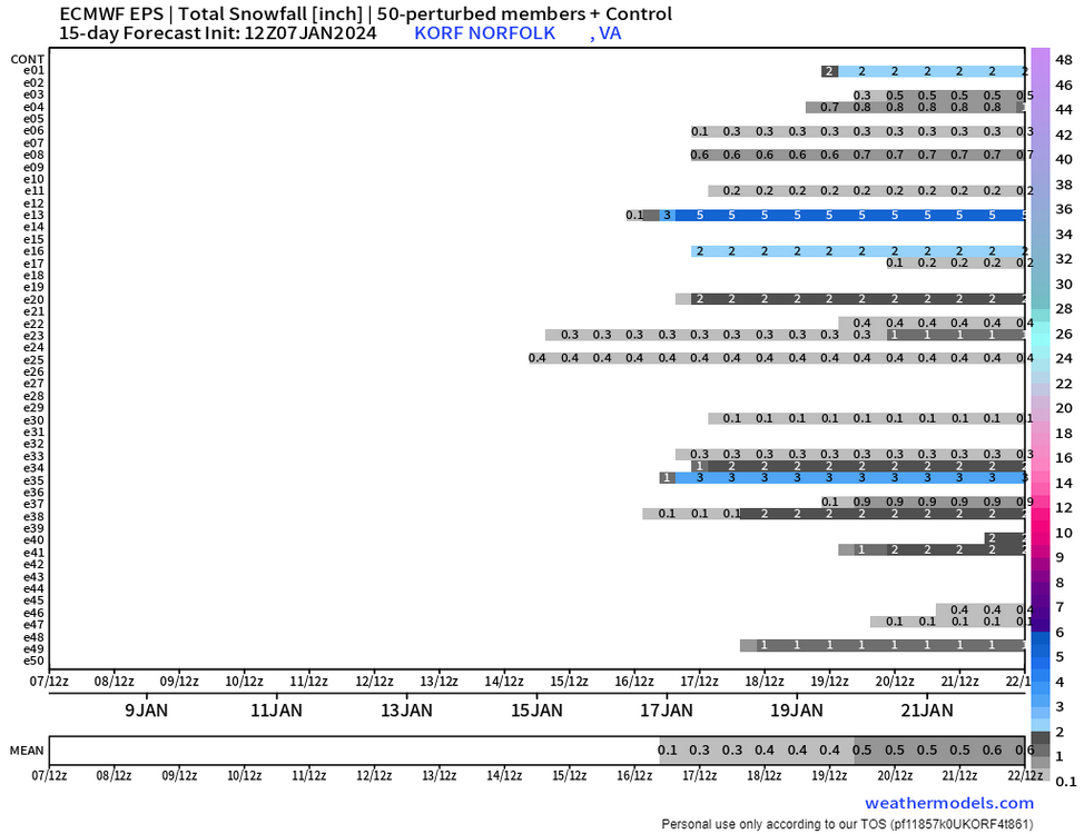
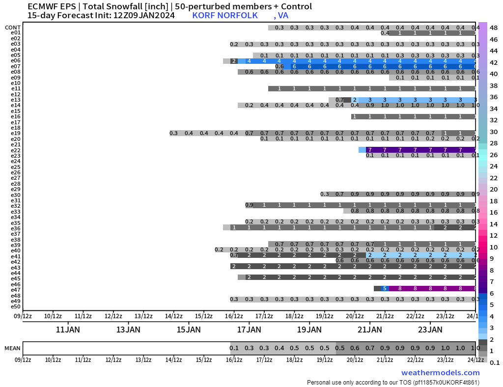
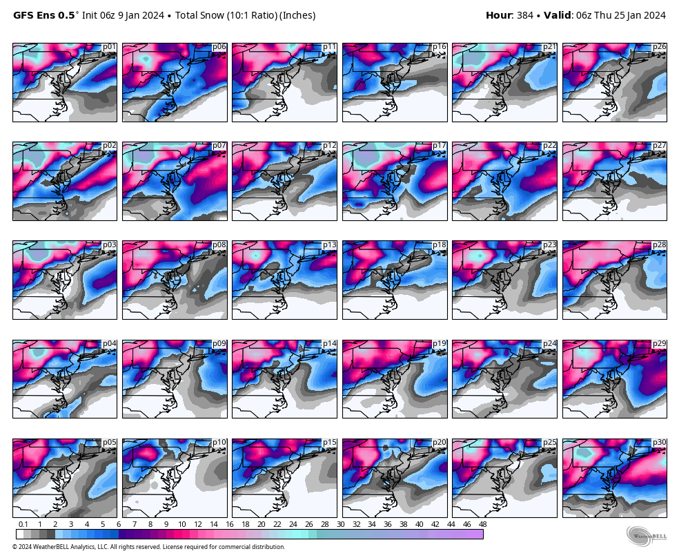
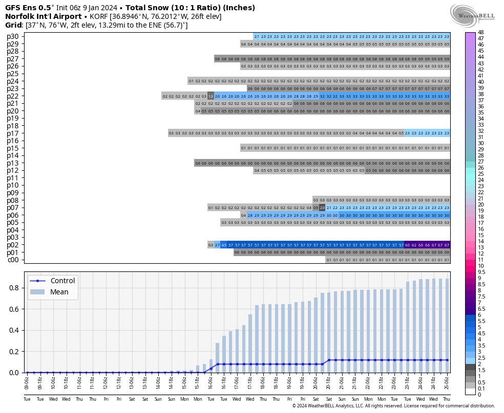
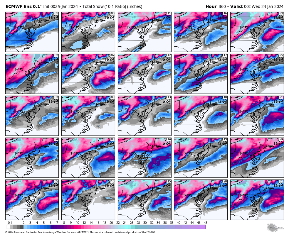
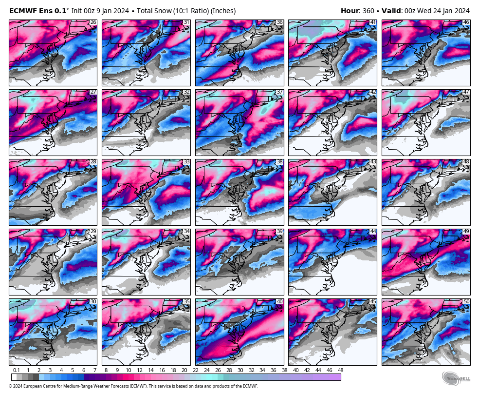
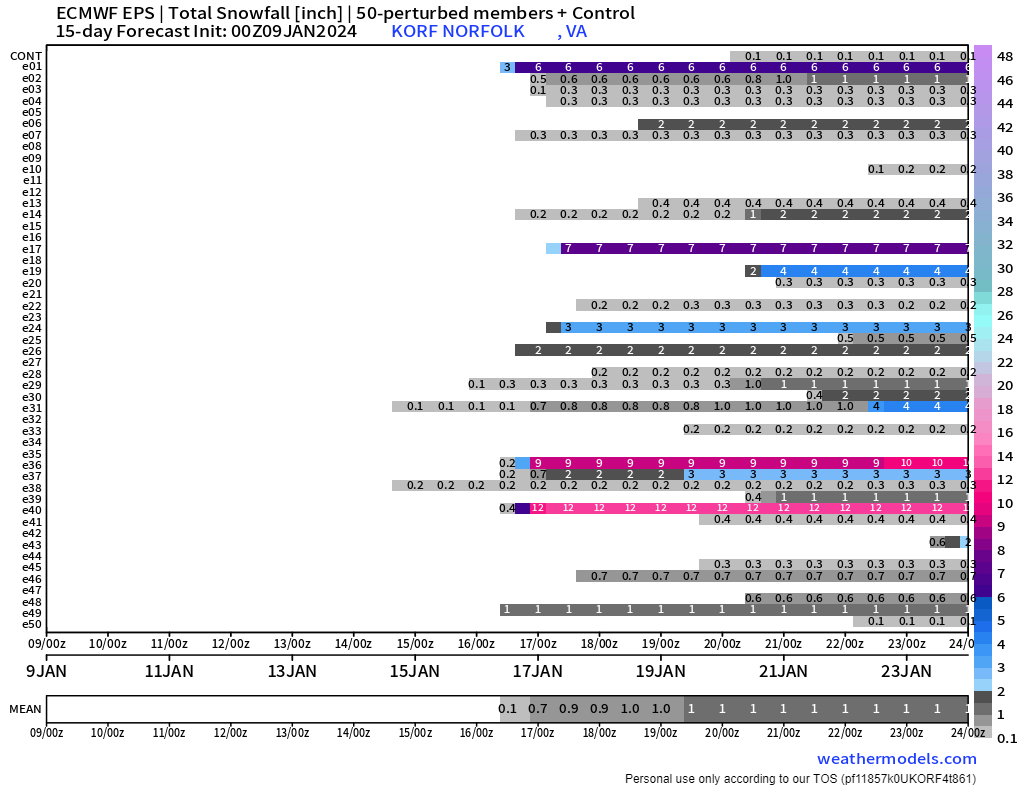
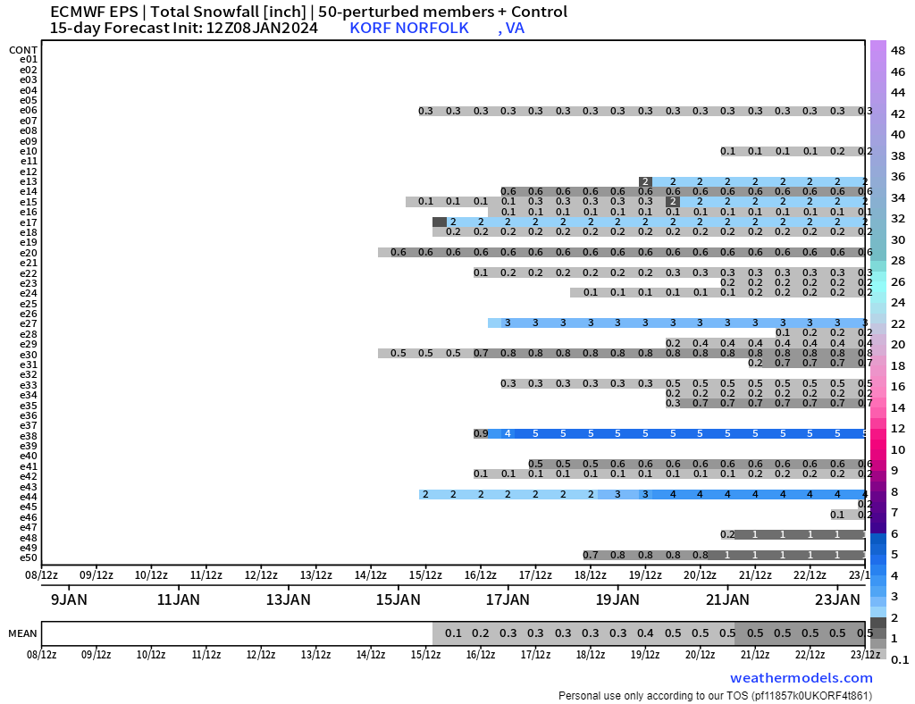
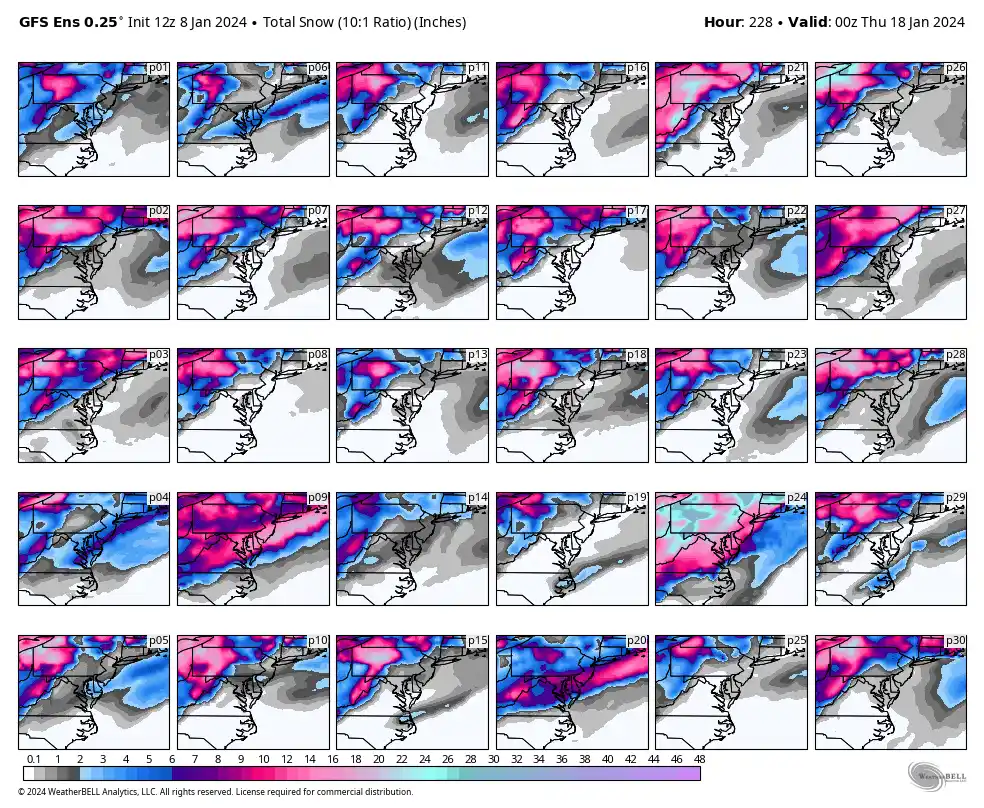
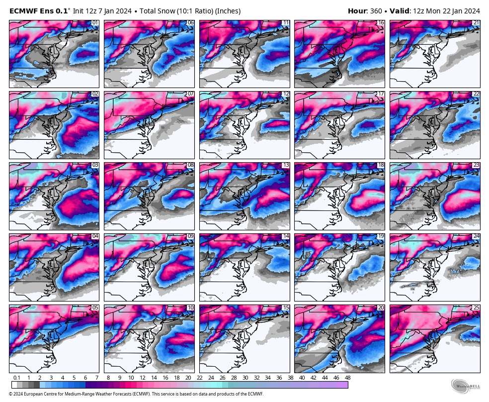
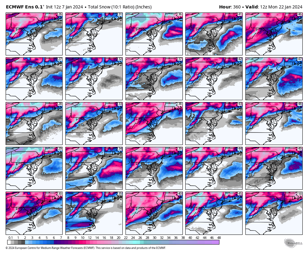
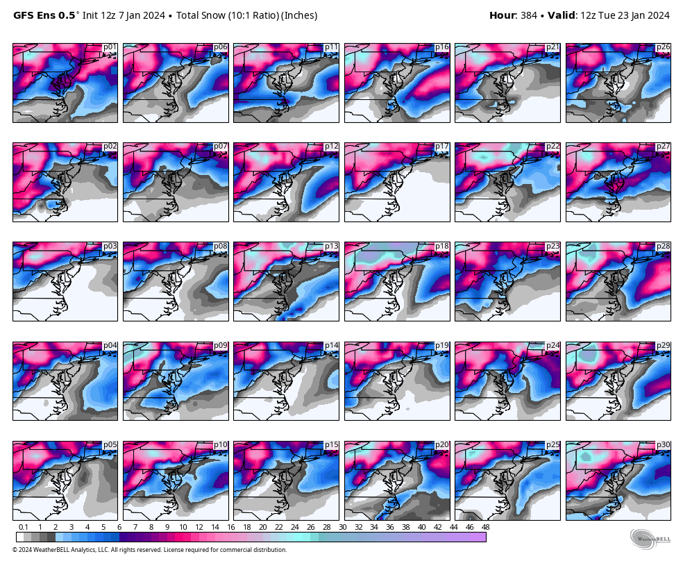
Here are the 12Z EPS snowfall outputs. Definitely a handful of big hits. E-11, 14, and 32 were the snowiest members for the January 16th-17th period, especially for Richmond. Sharing the individual member snow maps for your enjoyment! Lets hope the EPS improves and the GFS/GEFS get on board in the coming days.
")
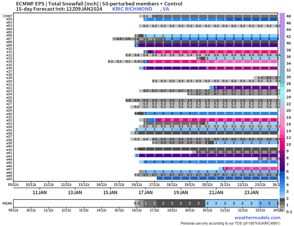
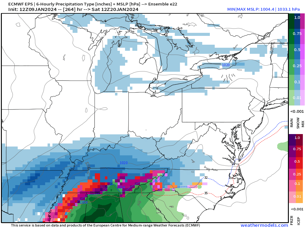
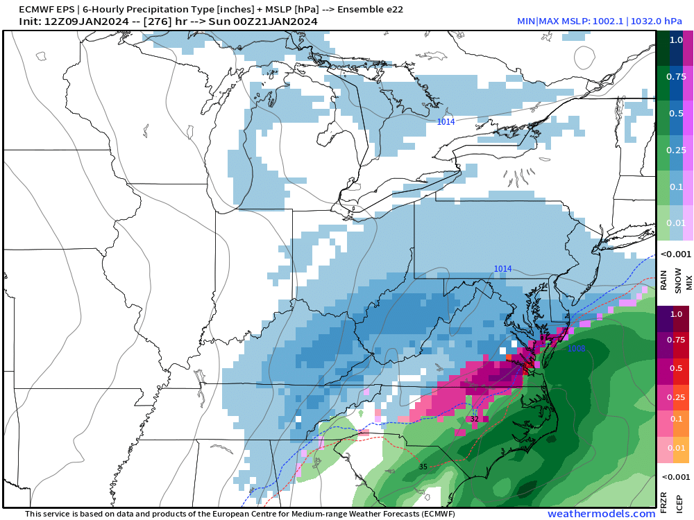
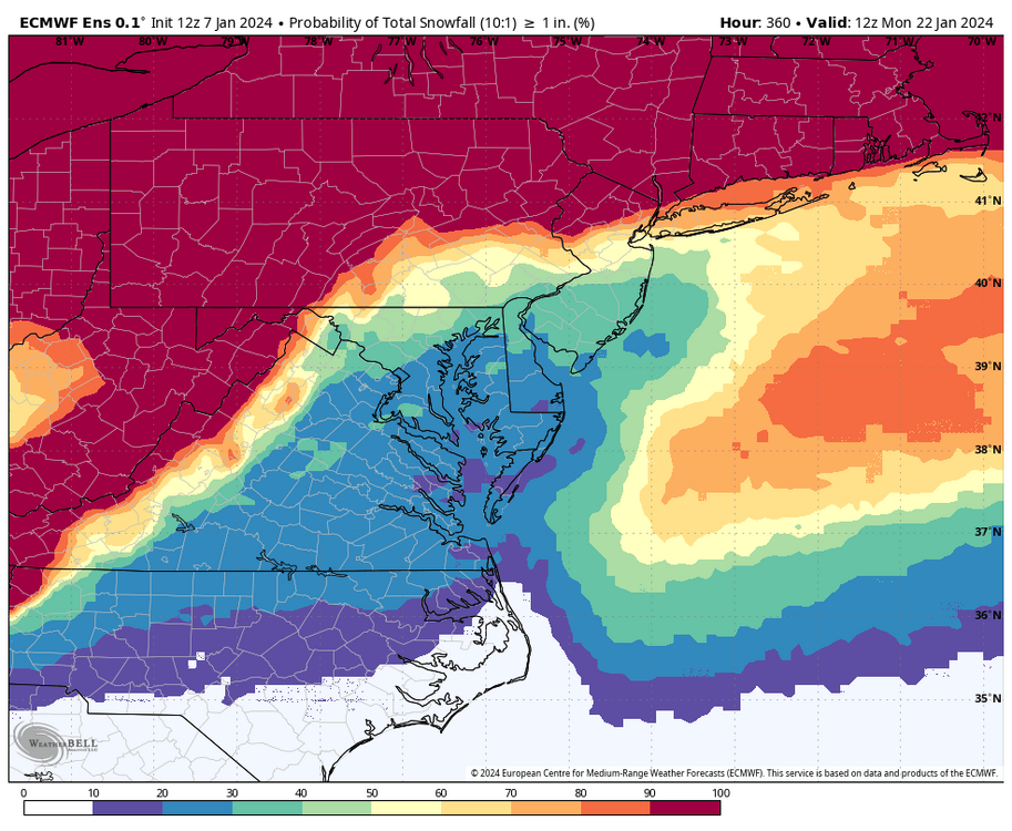
For our entire region, including all of SE VA and NE NC, E-22 and E-47 were the snowiest from what seems to be another threat around the 20th-21st.


-
1
-
1
-
-
I was just looking at the EPS, some good hits and the mean is among the highest we've seen. Charts are still processing but I'll post everything within the hour. Definitely encouraging.
-
2
-
2
-
-
2 hours ago, ldub23 said:
More cold overall
Our area is still in the game for snow, too.


-
1
-
-
3 hours ago, Stormpc said:
A lot harder to get snow down my way so I don't even bother looking that far until I see a cold pattern established in the east. Richmond and West can LUCK into certain events but not for us down in the Tidewater or outer banks. We need a hefty Continental snow pack and established cold with Southern stream riding underneath us to hope to grasp anything. Let's see how the deck is shuffled after these two cutter bombs clear.
Anyway it might be an active day. Be safe out there. Check in later if anything interesting is happening.
I agree with this, and hopefully we all, including NE NC, can cash in soon. 12Z GFS, at least verbatim, liked SE VA and NE NC.
Steadier rains off and on into the Richmond area, but nothing too crazy yet. Certainly the higher winds have yet to arrive.
-
37 minutes ago, wasnow215 said:
6z GFS promising for midweek next week.
Unfortunately, todays 6z GEFS were not as great as the previous 4 runs.


-
1
-
1
-
-
36 minutes ago, wasnow215 said:
6z GFS promising for midweek next week.
Last night's EPS also werent bad, certainly an improvement from yesterday's 12Z EPS. A handful of decent hits. I would not rely on a single scenario right now.


-
2
-
-
7 hours ago, RIC Airport said:
The 12Z GEFS still showed a signal for a decent event around the 16th to 17th. Curious to see what the Euro and EPS does.
I know we are tired of looking at these maps with no result. But, FYI, there was a slight uptick with the 18z GEFS snowfall mean compared to the 12Z run. The 16th-17th and then around the 20th is where you see the upticks when looking at the individual members.
We are ways out, so much can still change. Keep the faith. Winter is far from over.


-
1
-
1
-
-
FWIW,
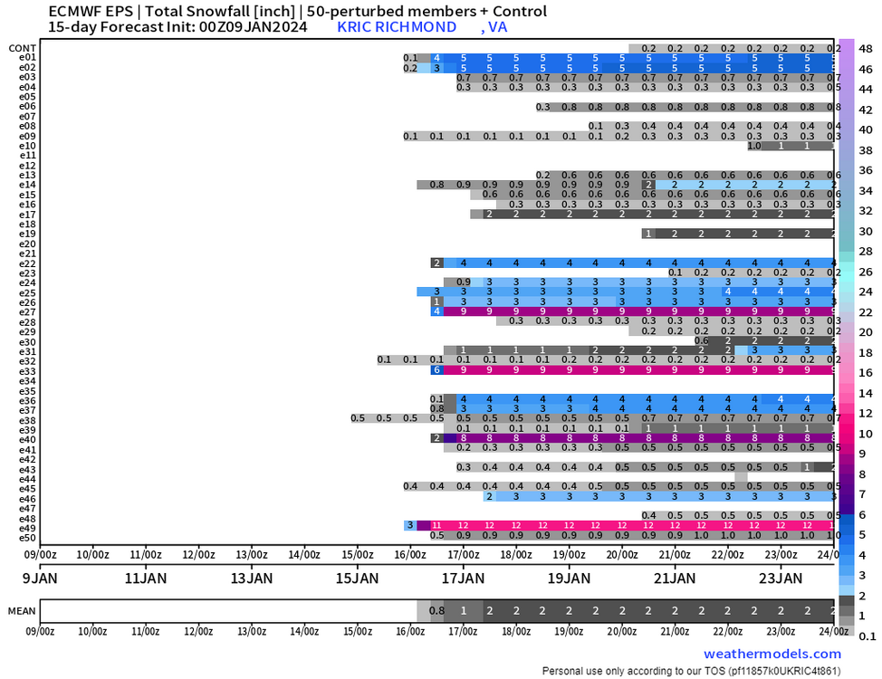
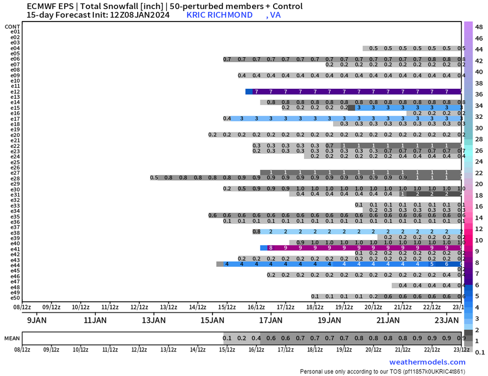
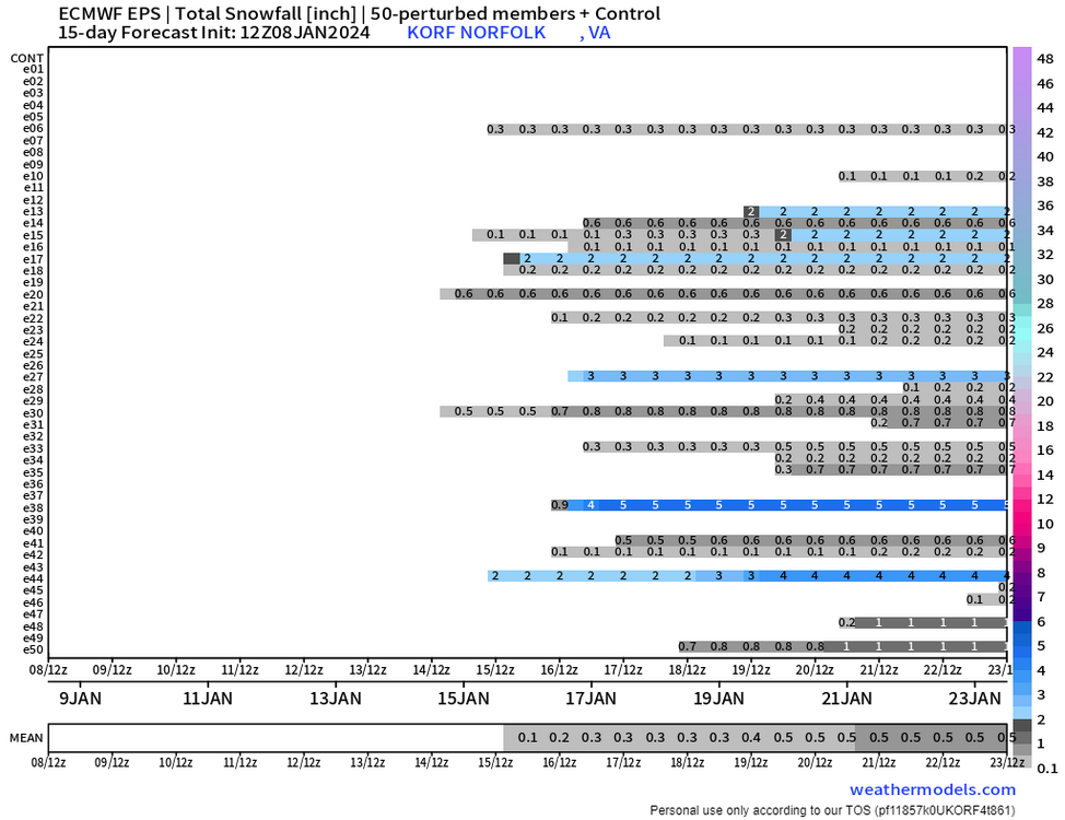
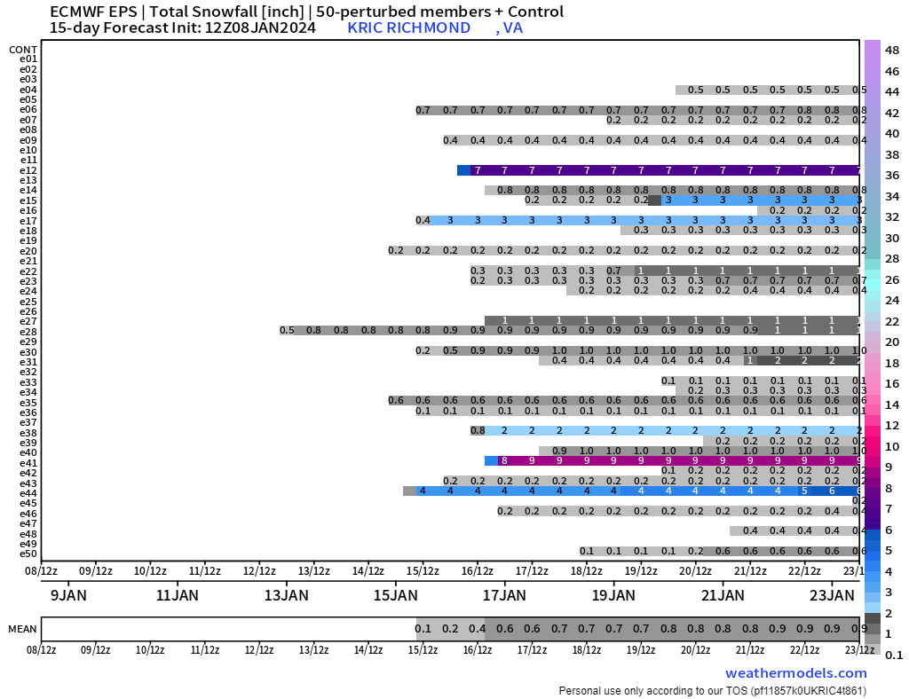
12Z EPS outputs for RIC and ORF. Definitely a step back from 00z. Afternoon runs as a whole did not increase confidence.
-
 2
2
-
-
The 12Z GEFS still showed a signal for a decent event around the 16th to 17th. Curious to see what the Euro and EPS does.

-
1
-
-
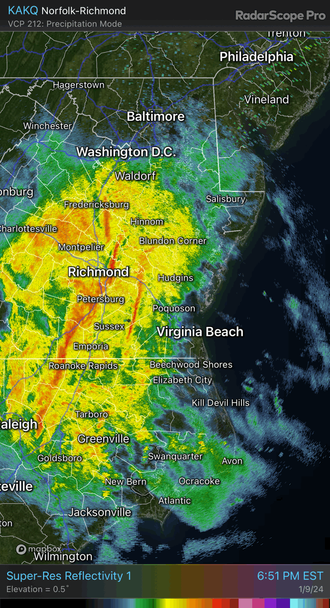
4 hours ago, Stormpc said:
In the immediate we need to look out for possible spin-ups along that Squall line tomorrow evening. Not so sure about the winds even at the vulnerable Coastal locations but some widespread severe may be possible. Interested to see what happens down south later today. The once modeled widespread Heavy Rain event looks more like some showers during the day then a concentrated Squall line to finish it off. I don't think our locales will have any issues with Urban Street flooding. Severe is something to watch for sure. Great job @Ric Airport chasing down possible winter scenarios for the region. Always a nice read. Thank you for that.
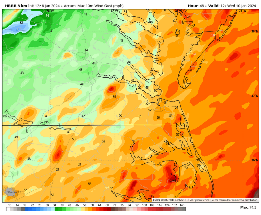
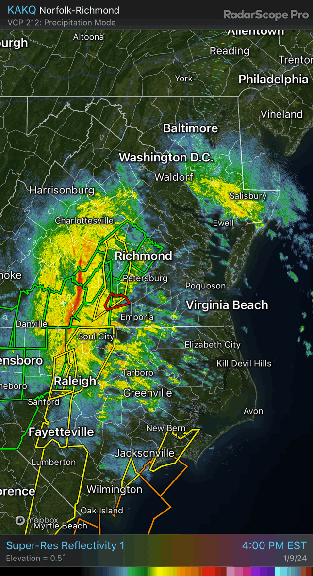
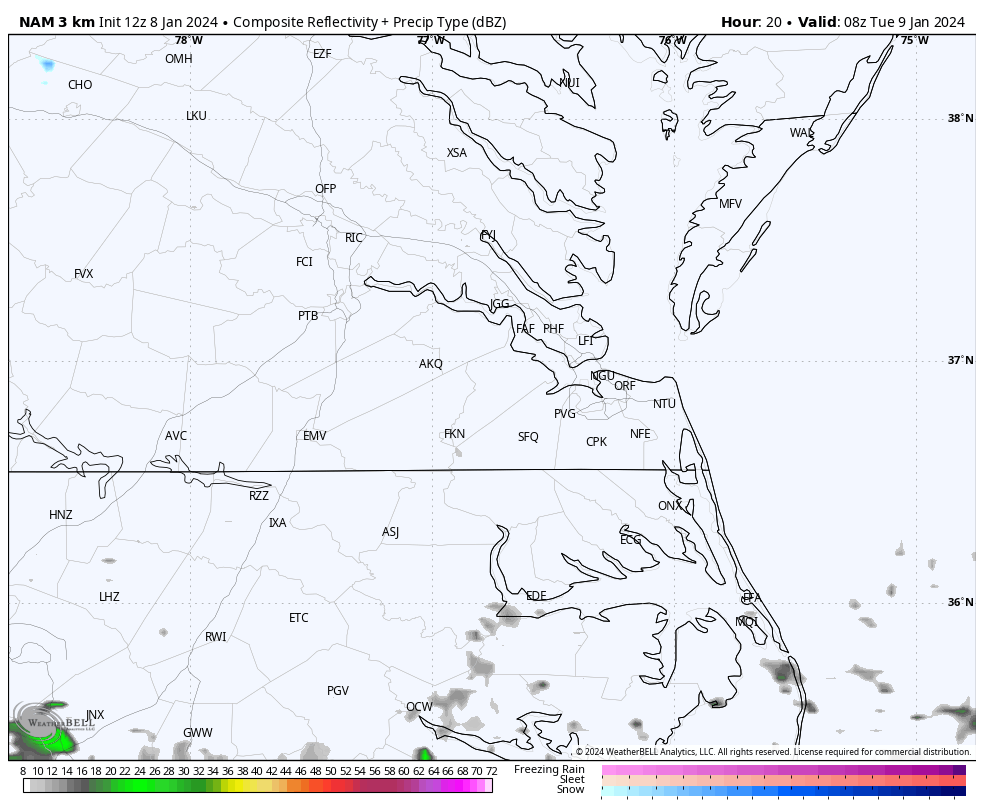
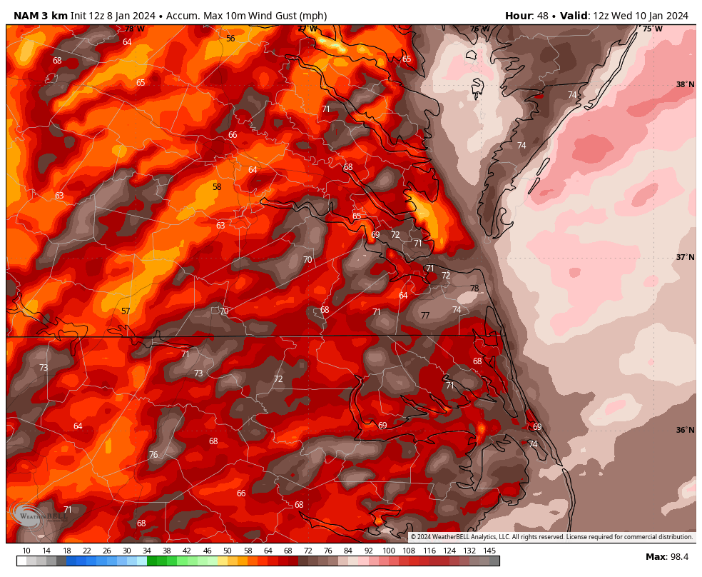
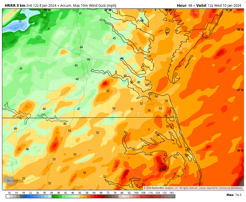
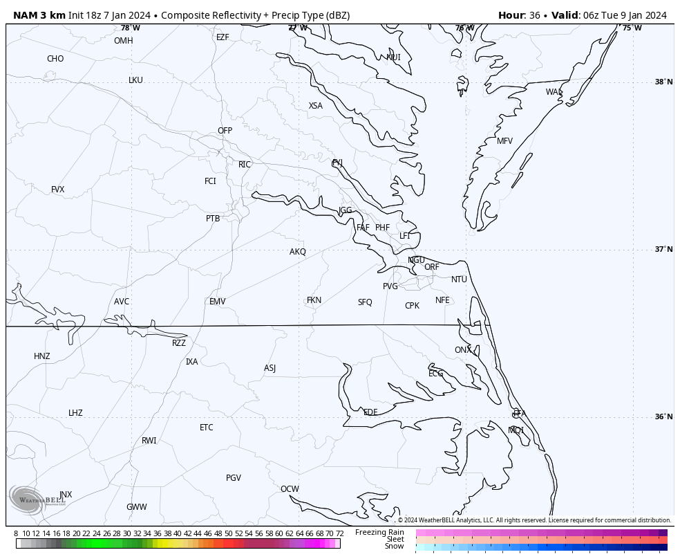
From what I can glean, the 12Z HRRR and 3K NAM had tomorrow’s rain arriving between 6 am and 8 am, with it being off and on and steady in spots from its onset. Wind gusts also increase to 20-30mph after sunrise but will start exceeding 40mph and approach 60mph, especially along the coast. As the squall line approaches, higher gusts could be embedded in storm cells. The squall line looks to enter our region between 5 pm and 1 am. 12Z HRRR had an earlier arrival, and NAM a bit later. The 3K NAM was aggressive with the winds showing widespread 60-75mph even for places west of Richmond. I'm unsure if winds that high will couple down to the surface though. HRRR wasn't as high as it had generally 40-50mph inland and 50-60mph along the immediate coastal areas. Nonetheless, it looks like tomorrow afternoon and evening will be windy.
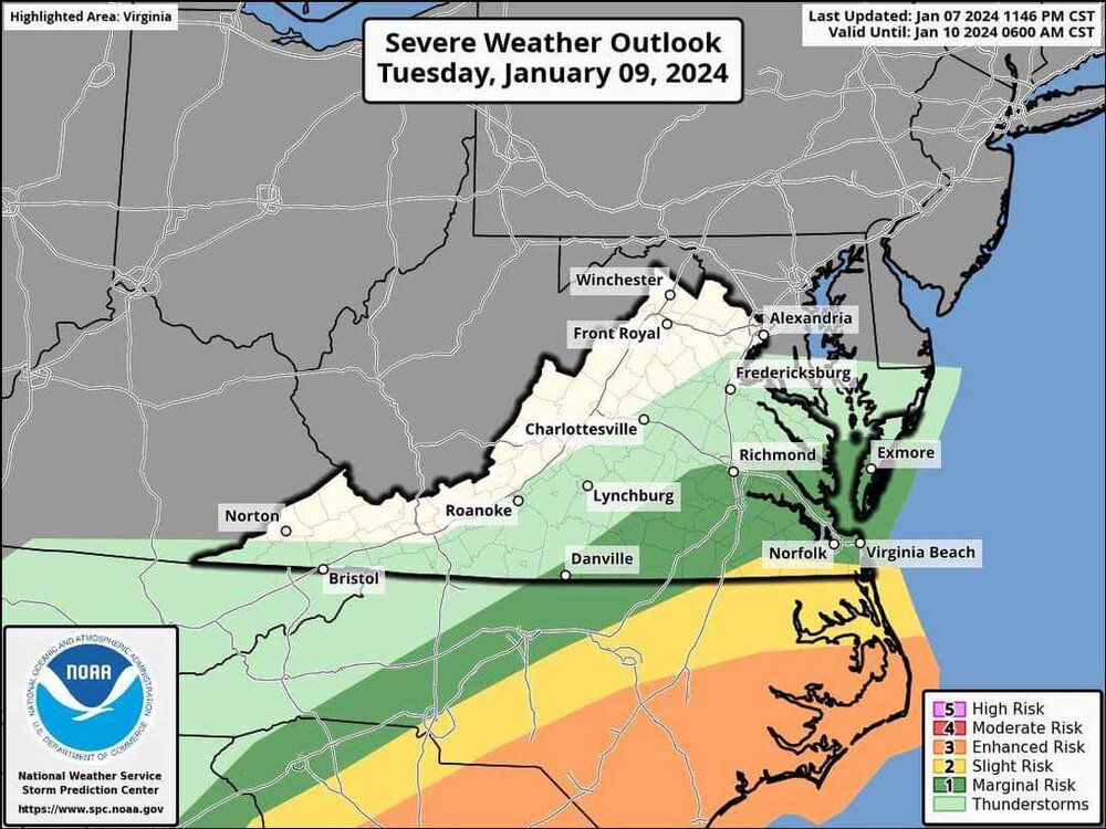
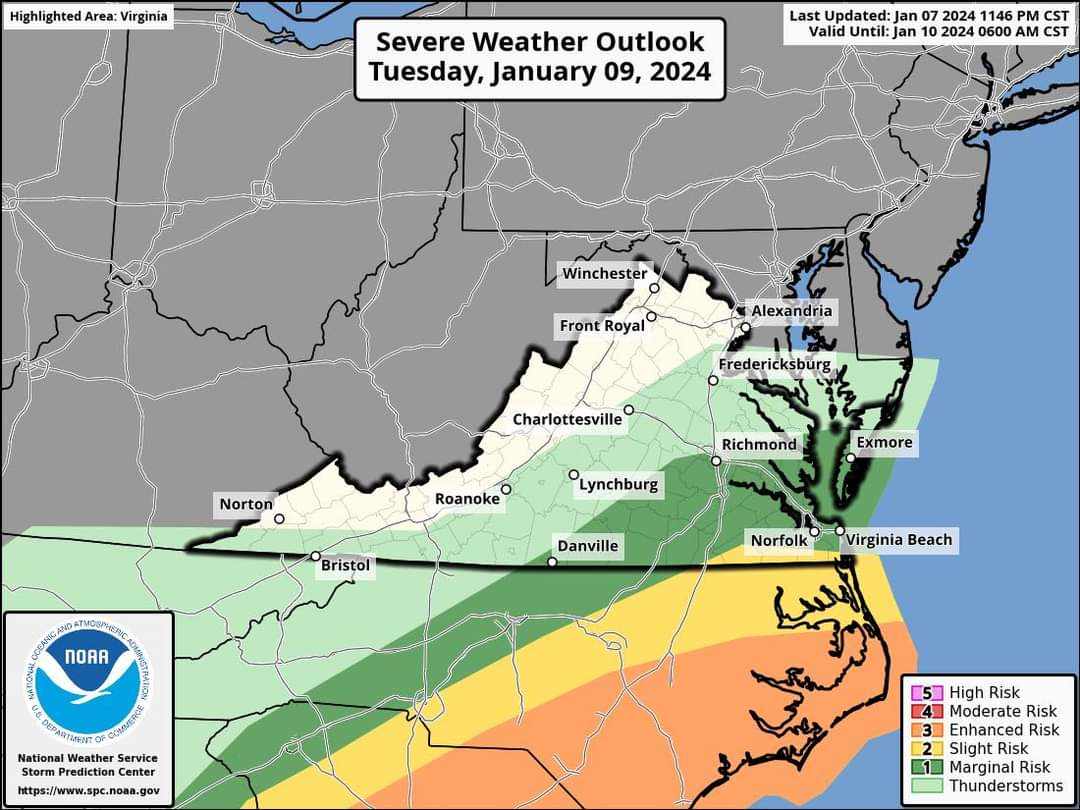
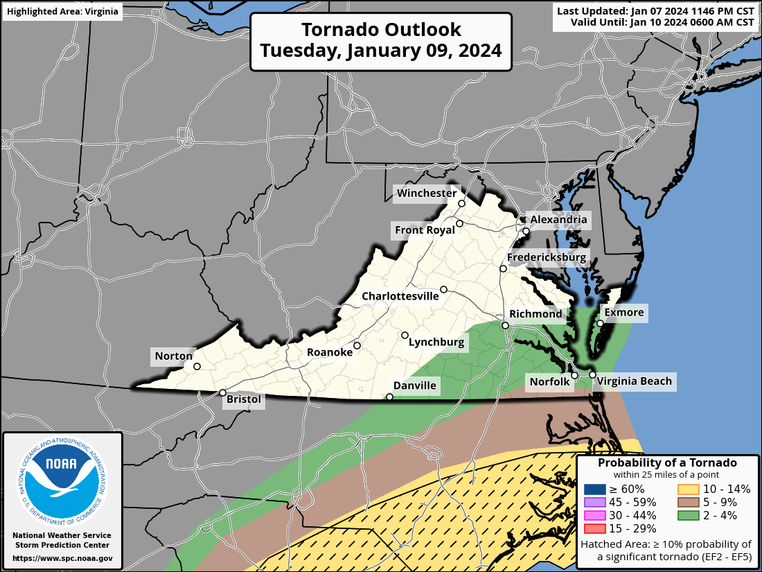
With respect to severe, SPC has a marginal risk up to about RIC. Although the risk of tornadoes isn't 0% for east-central and SE VA, the highest risk for tornadoes looks to be interior Eastern NC along and east of I-95. That is where I am seeing the highest surface CAPE (> 500 J/kg) and SCI values on the NAM. Unfortunately, I am not versed on tracking severe so I will defer to others to bail me out. I am more of a winter guy.


-
1
-
1
-
-
24 minutes ago, wasnow215 said:
GFS now showing a lack of cold air now for that system. Do you think we still have a chance to get the needed cold air? What has to happen? Or maybe the better question is what should I be looking for? @RIC Airport
I'm no pro, but I like the ridge out west and the -NAO block.
But, the cold delivery will depend on the placement of the polar vortex lobe that trails next weekend's cutter. We need that in the area where the Euro shows, even more south and east for an even colder outcome, as it could be a 50/50 feature to keep cold entrenched east of the mountains as the storm approaches. We don't want it too far south because it'll end up surpressing the storm south of us. There has been a lot of flexibility in the models on where each feature ends up, which is frustrating.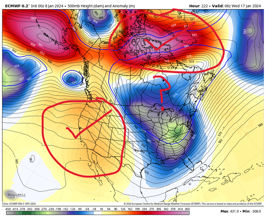
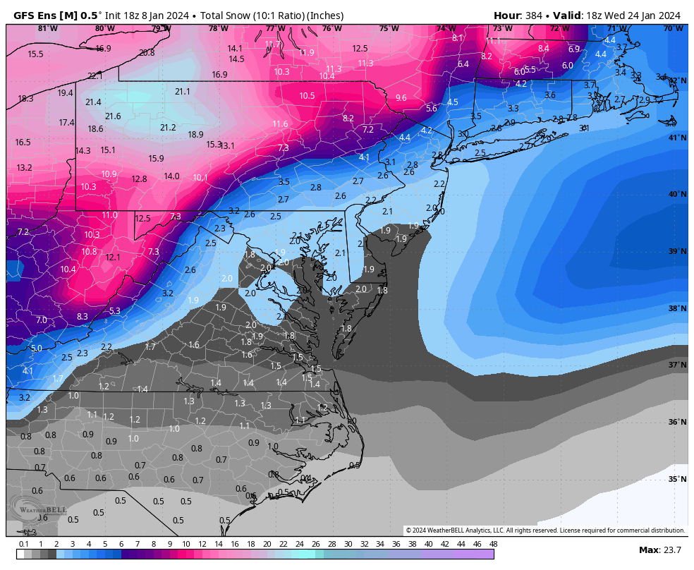
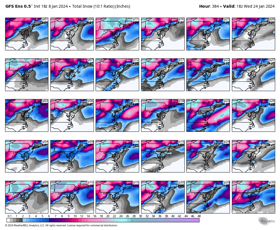
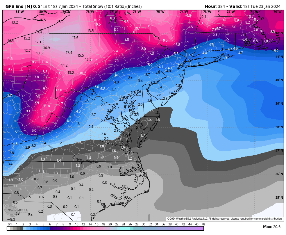
More southern solutions are a possibility. Looking at the EPS charts I posted earlier, these two members gave Norfolk 15" and 10", respectively. You can see how far south these are and how NC even gets a lot of snow.
-
4
-
1
-
-
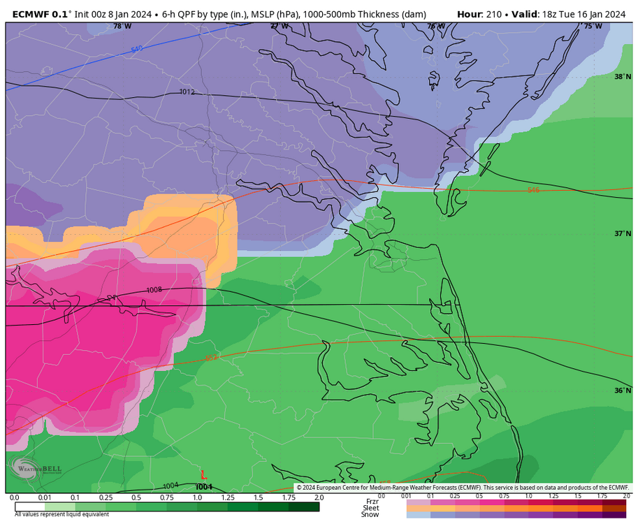
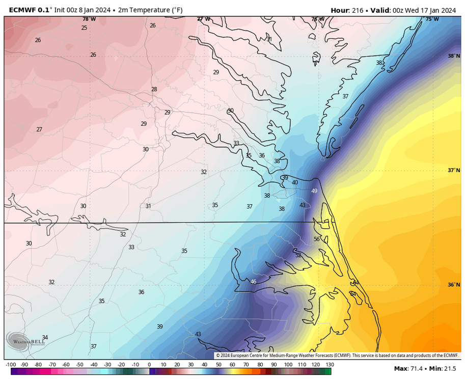
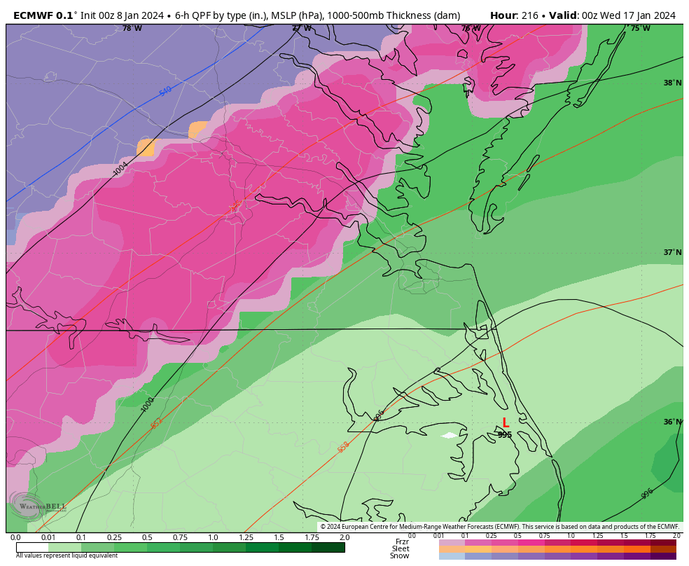
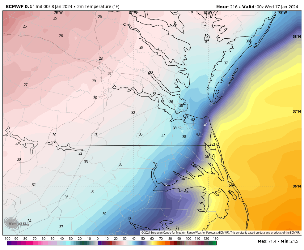
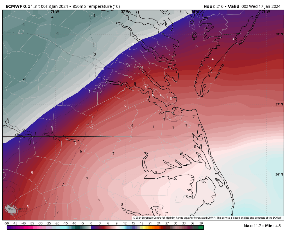
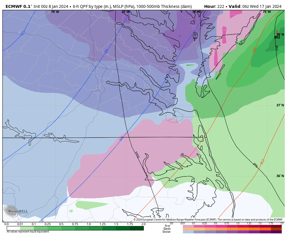
9 hours ago, Conway7305 said:
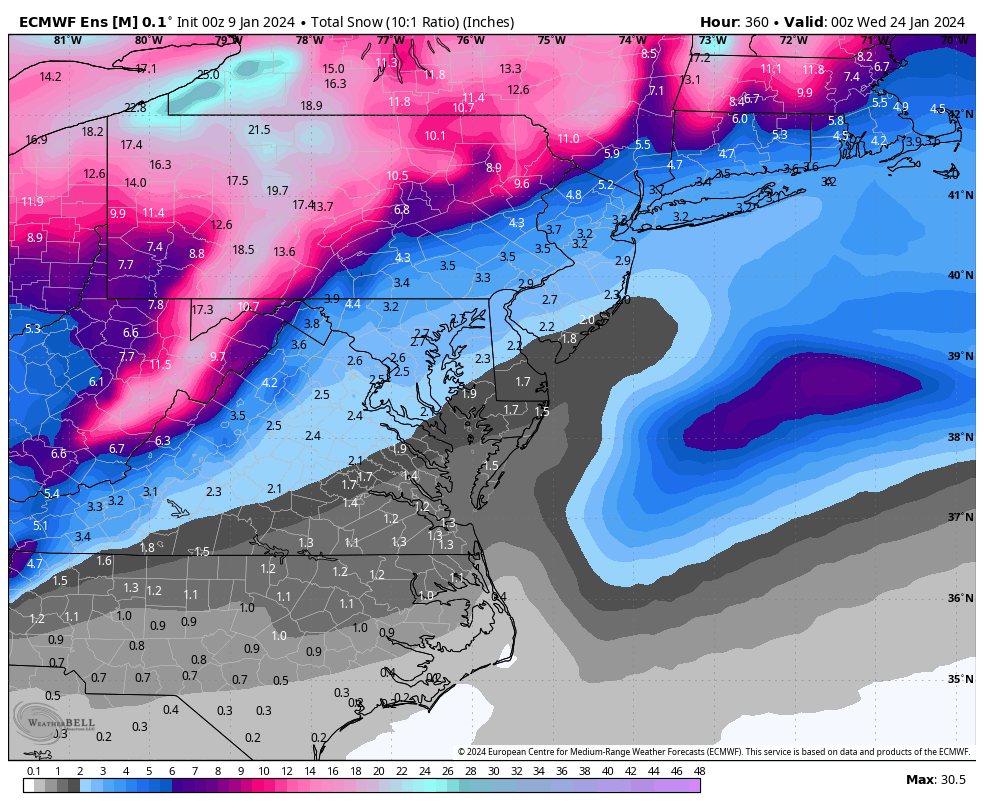
18z ECMWF Ensembles are a big improvement with trough placement further east on 13th leading up to event on 17th.
00z Euro was a nice hit. It's too bad it was at the end of the run, and we know there will be fluctuations in the days ahead. Heck, 12Z could have it back west again.
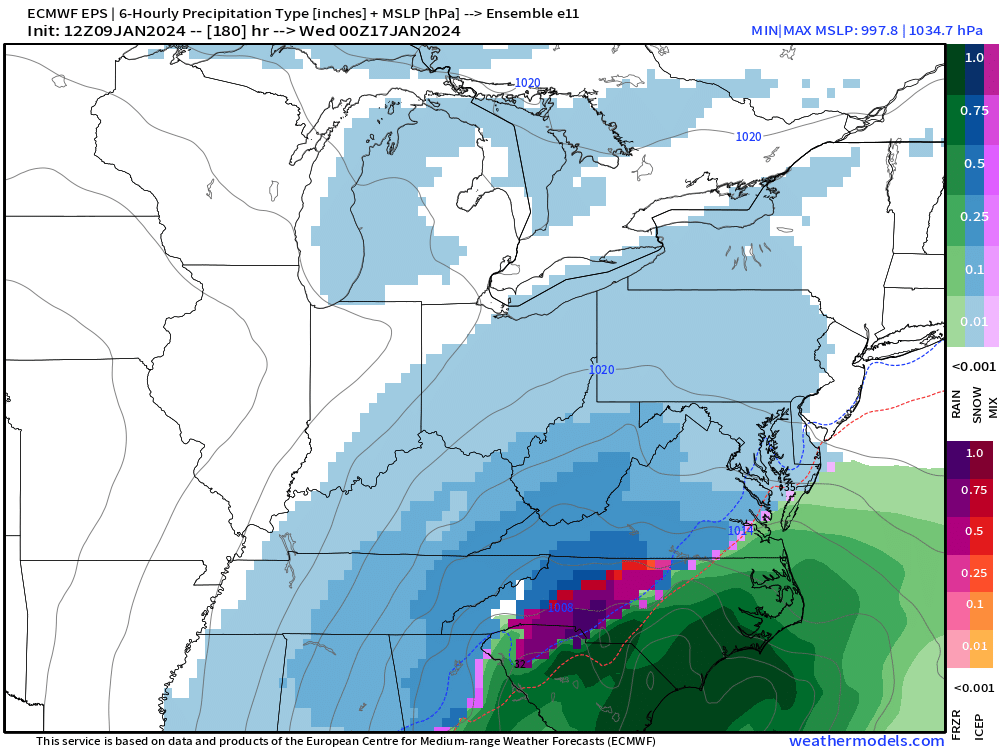
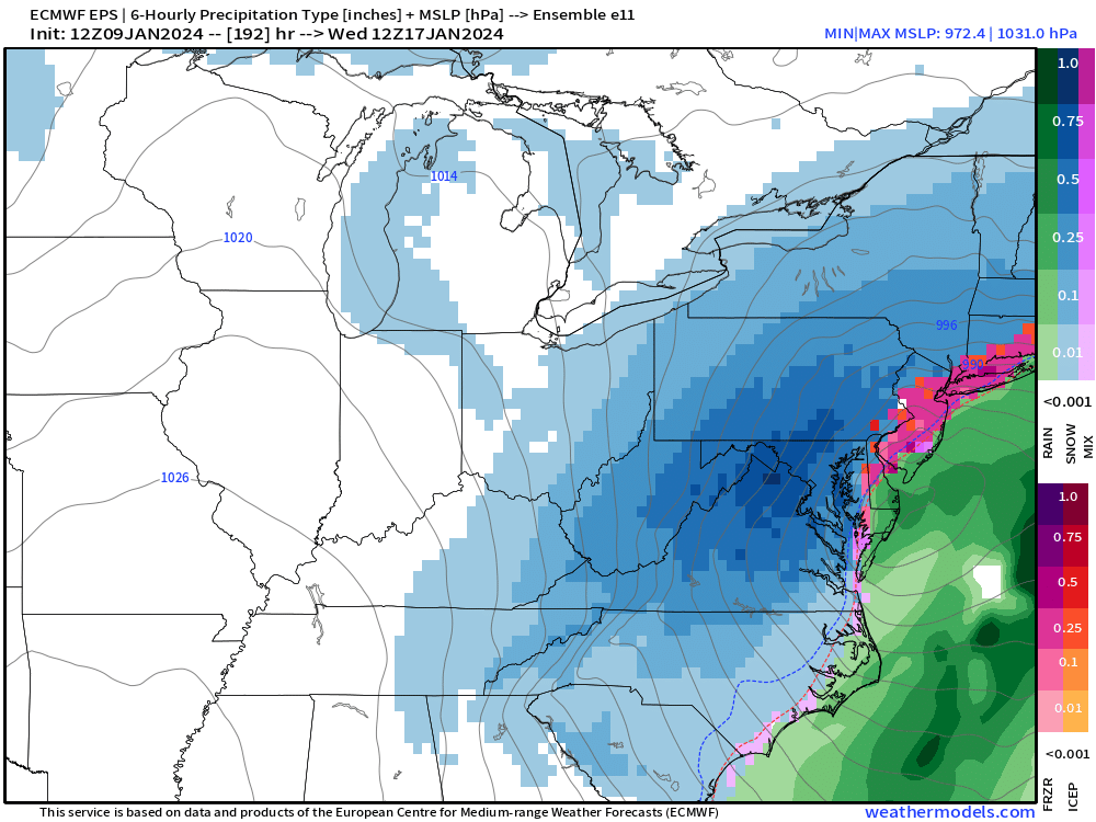
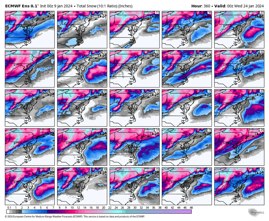
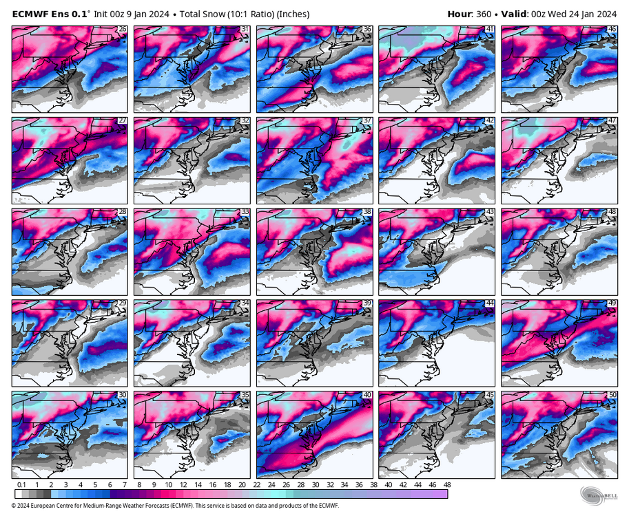
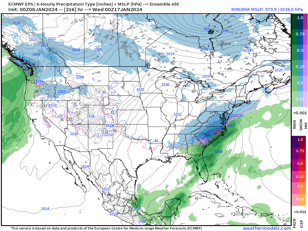
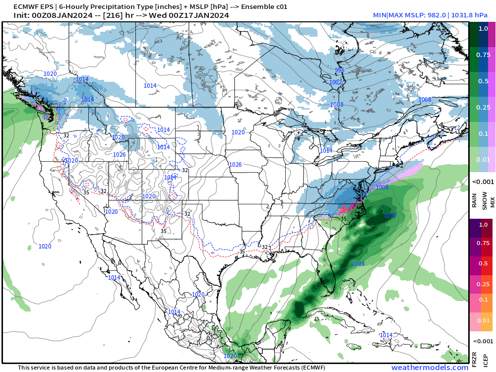
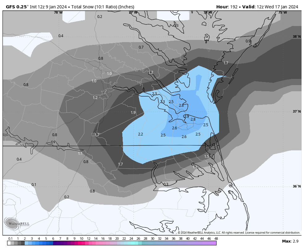
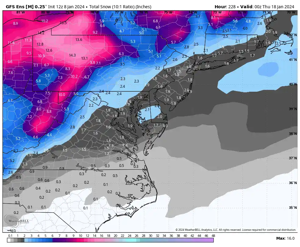
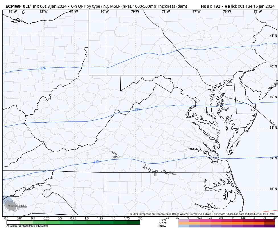
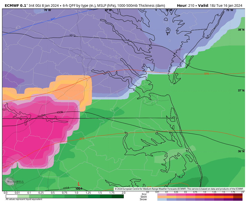
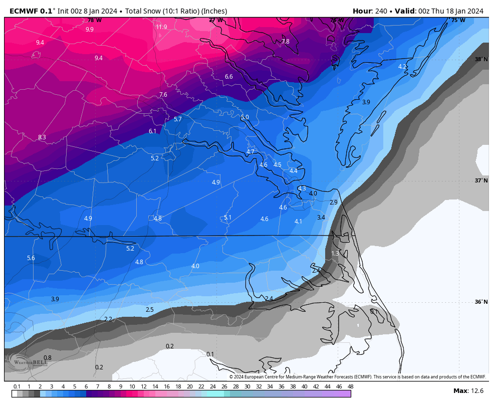
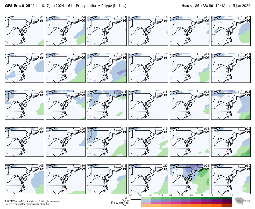
Verbatim, surface temperatures remain below freezing at Richmond for the entire event. Starts as +SN, but as you can see by hour 216, the model shows a mix as the 850mb temps begin to rise and probably get above 0C for a time from about Farmville to about Tappahannock, which are the typical areas that tend to mix in the height of the bigger storms. Afterwards, there is a return to snow on the back side of the storm including coastal areas.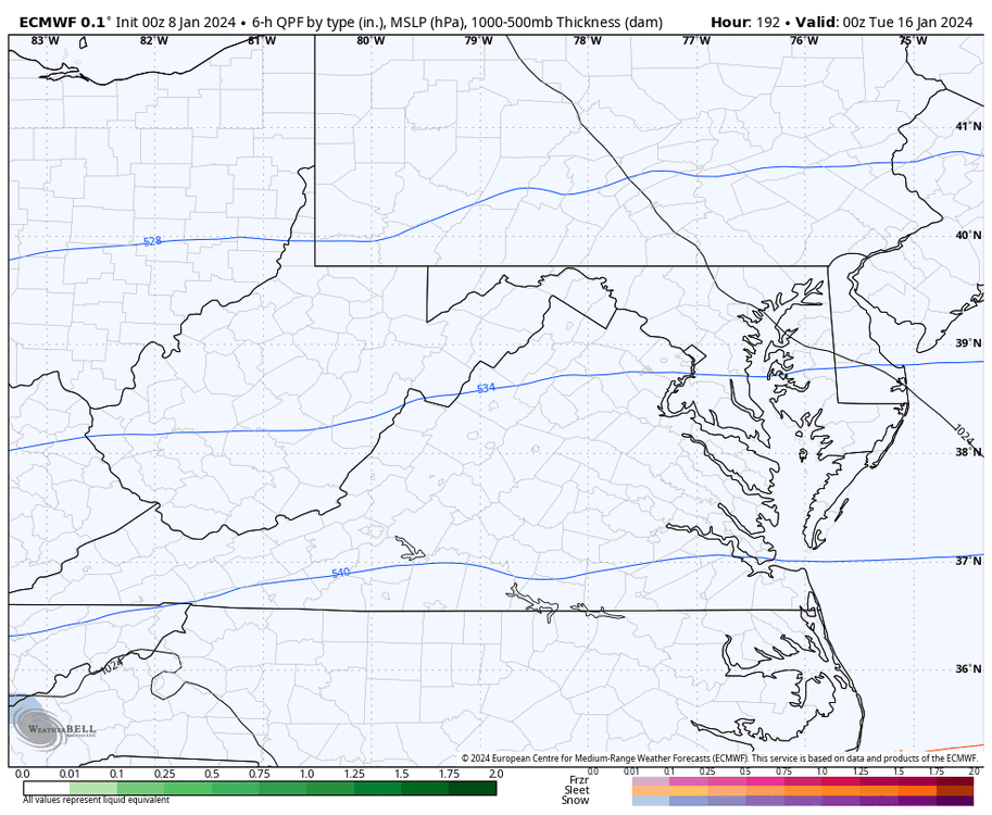


EPS overall wasn't that impressive, but there are a couple members with more southern solutions that crushed Norfolk. There were only 4 members that gave Richmond over 6" of snow.

-
1
-
-
49 minutes ago, Conway7305 said:
18z ECMWF Ensembles are a big improvement with trough placement further east on 13th leading up to event on 17th.
Hopefully, they are on to something and other runs follow suit. Still not losing hope on the ladder part of the month.
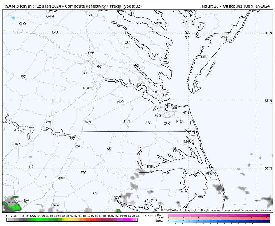
Meanwhile, the 00z 3K NAM still shows a good-looking squall line swinging through our region Tuesday between about 6pm and 1am. It'll be a windy day and probably can't rule out some thunder in spots as that line approaches.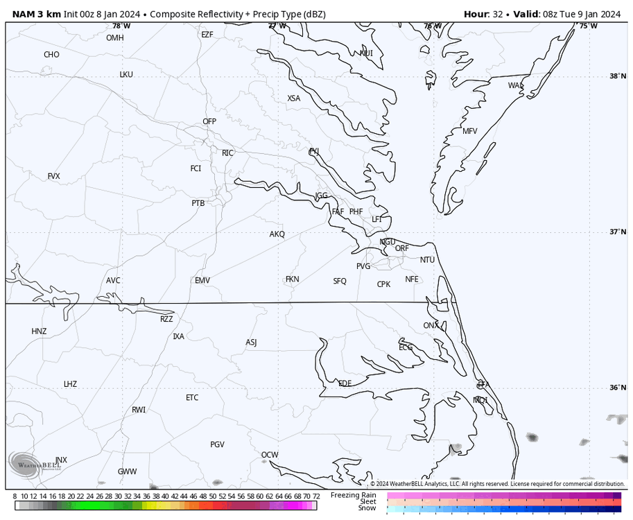
-
1
-
-
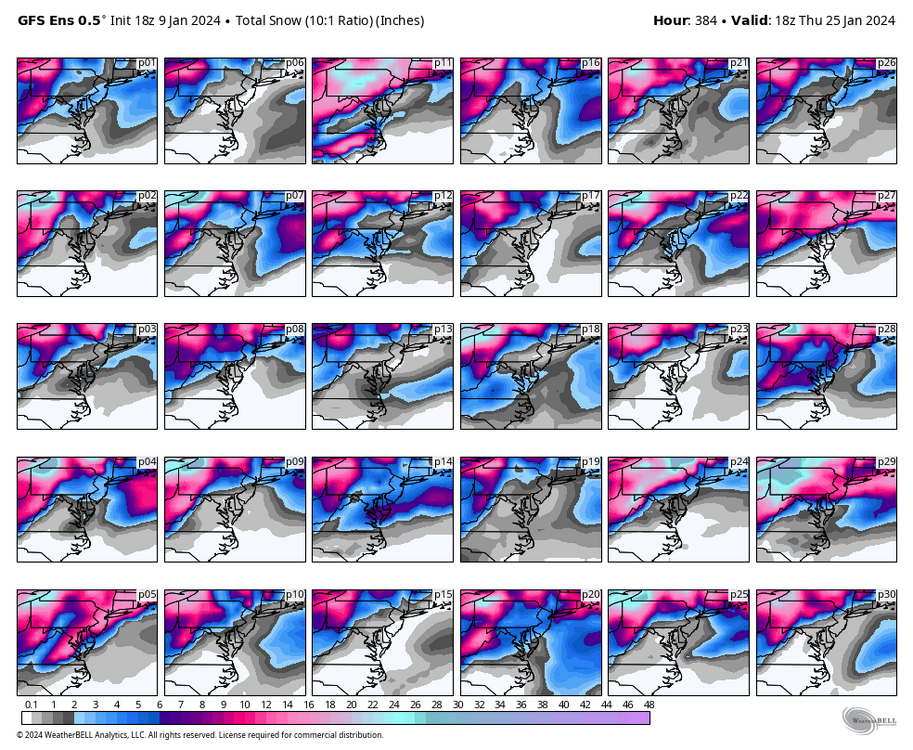
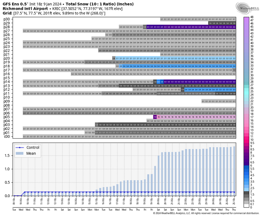
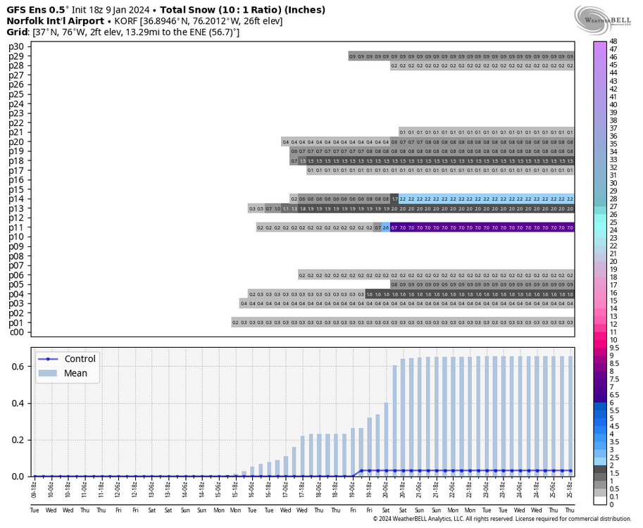
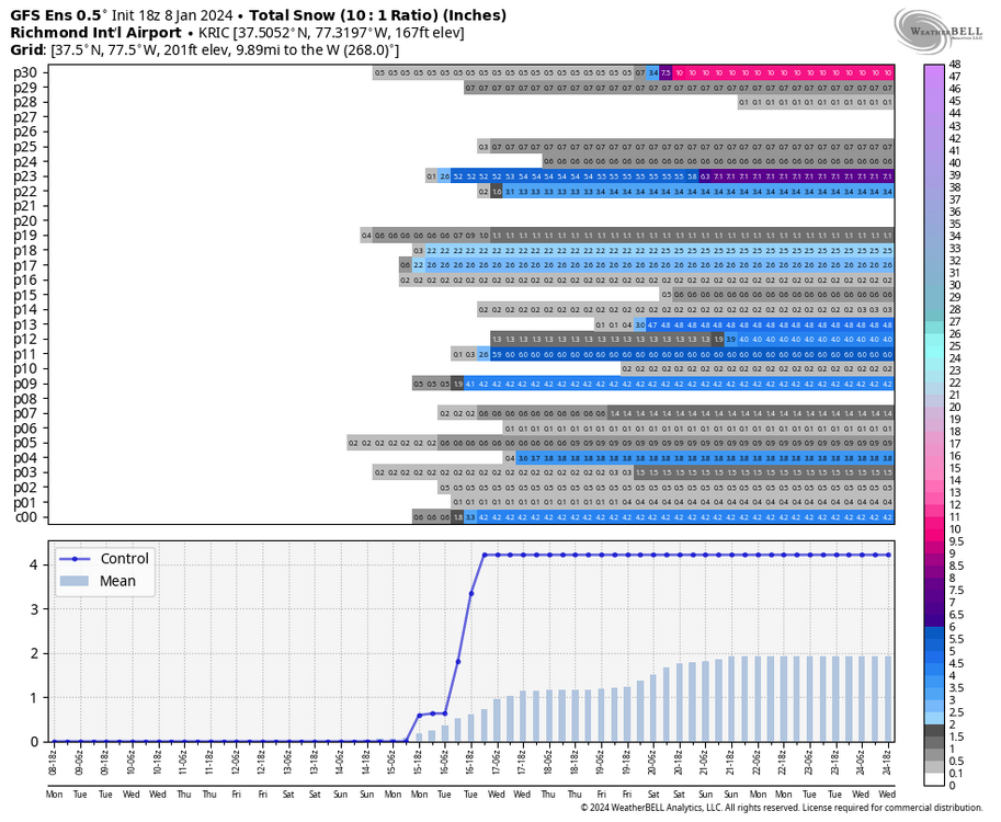
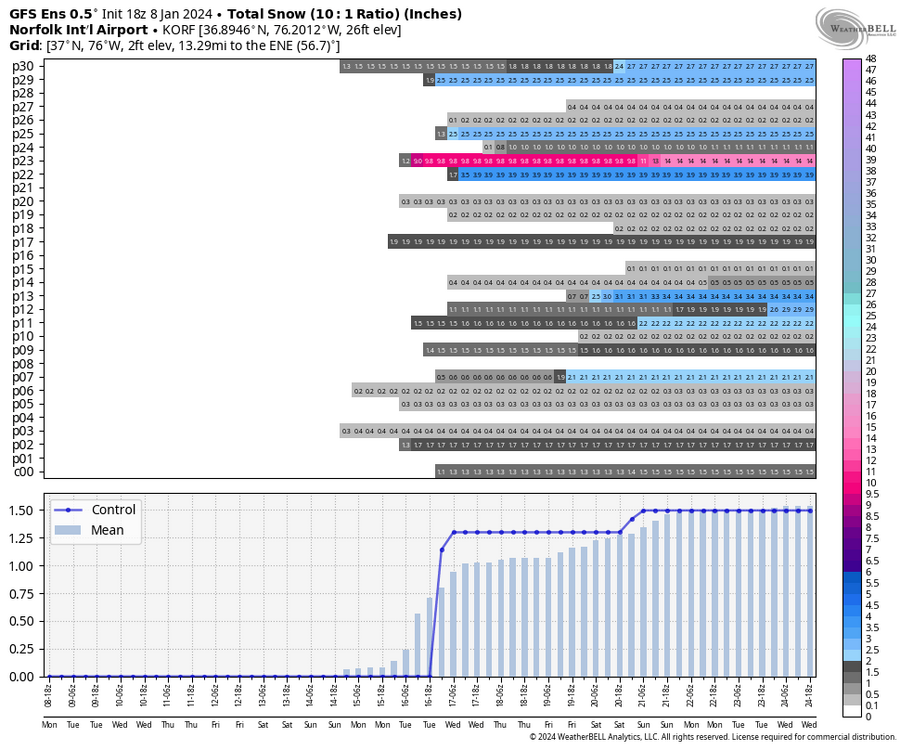
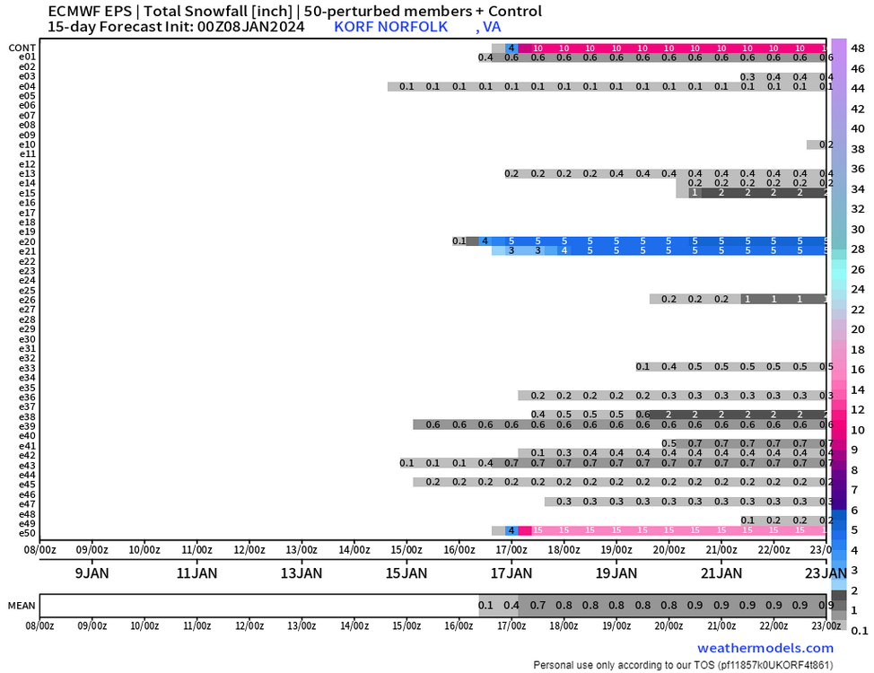
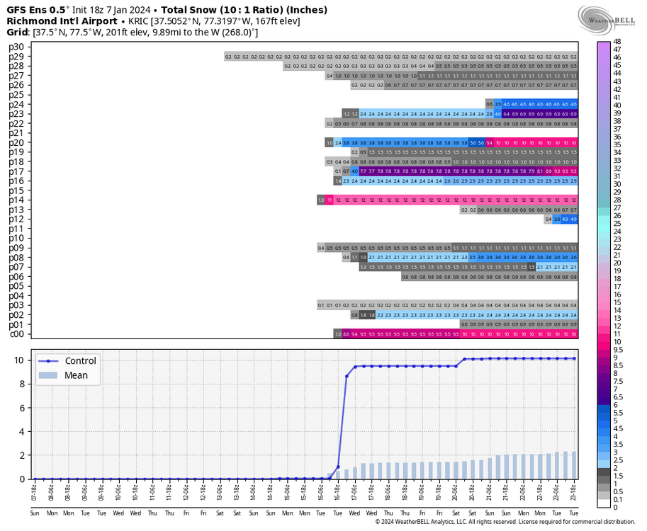
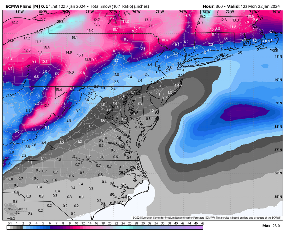
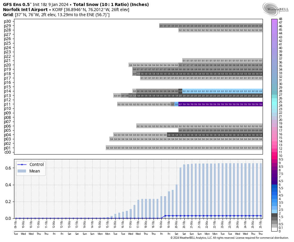
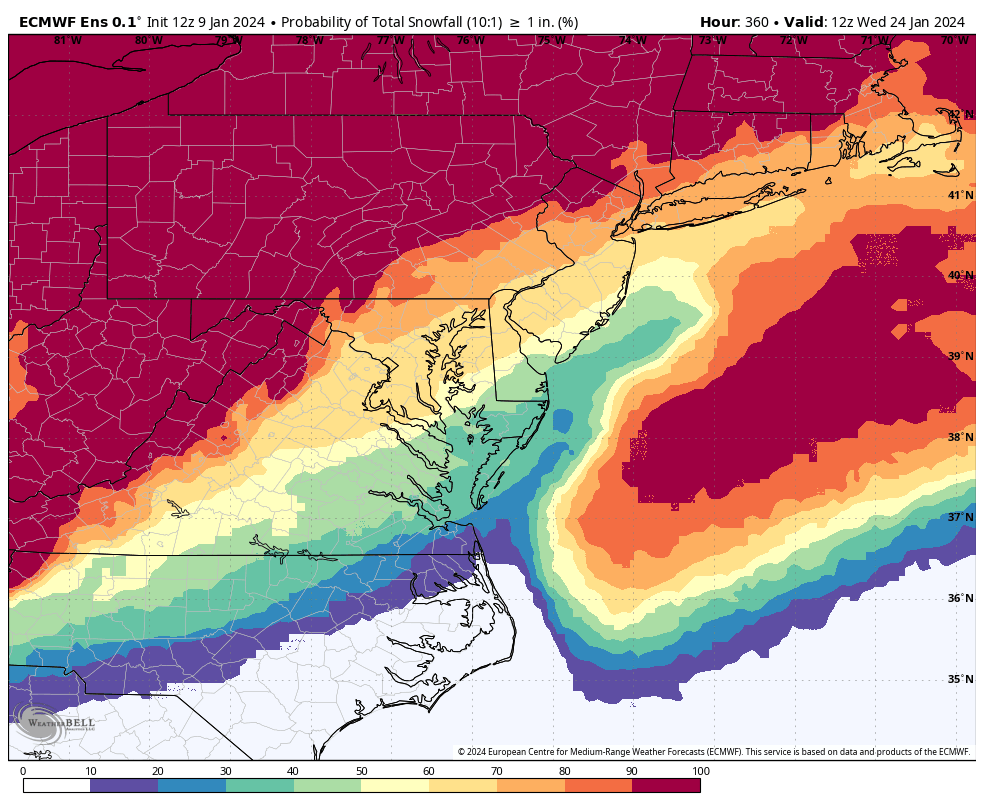
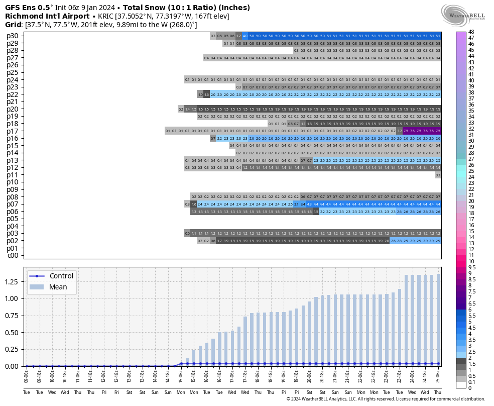
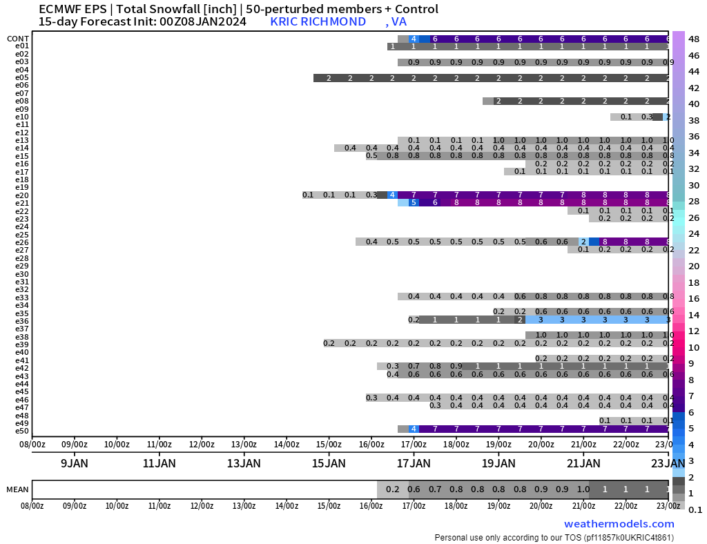
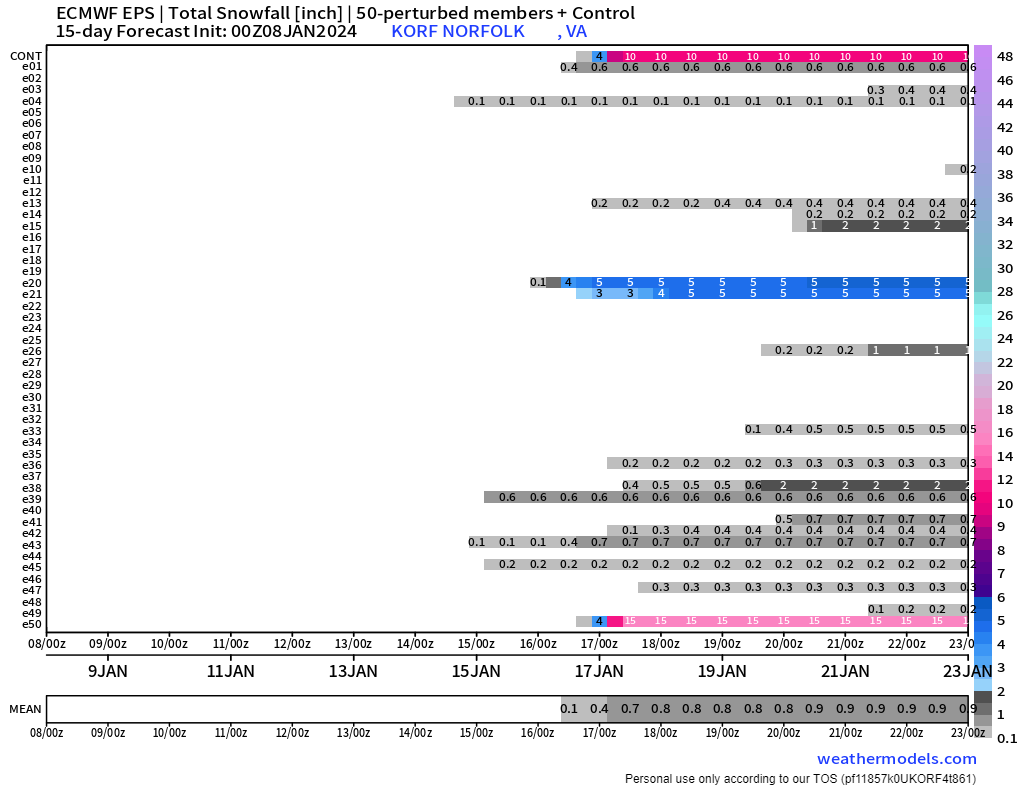
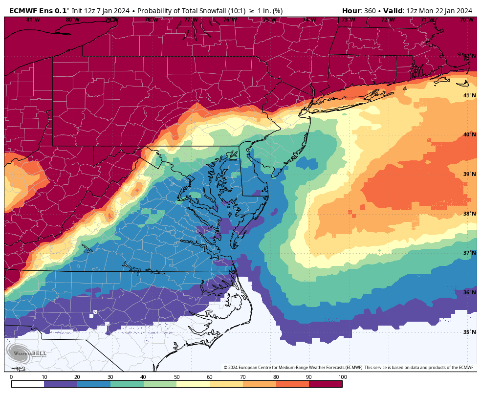
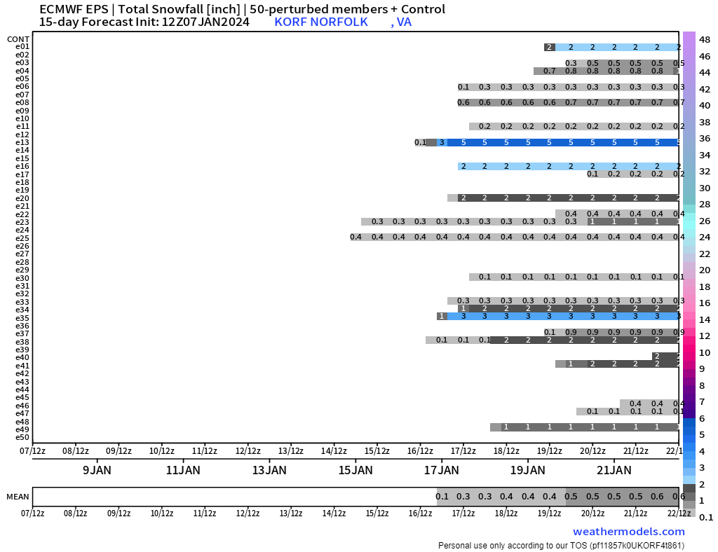
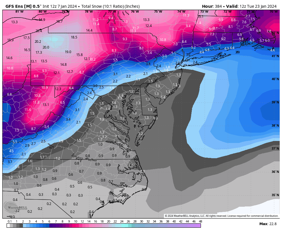
@Rhino16, @Conway7305the 18Z GEFS was encouraging as it had several events, with the largest still appearing from the 16th to the 17th, while another shows up toward the 21st. The snowfall mean for the entire run was the highest I've seen in days, and the probability of getting 1 inch of snow, particularly for areas east of the mountains, is the highest I've seen all winter.


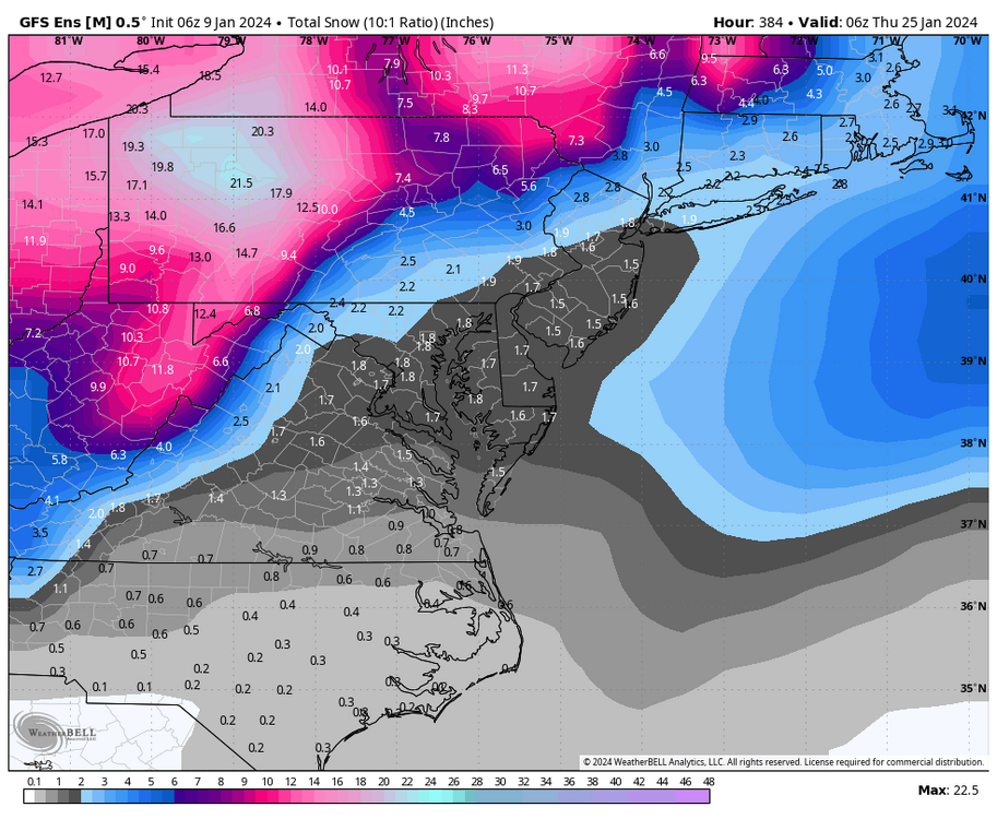
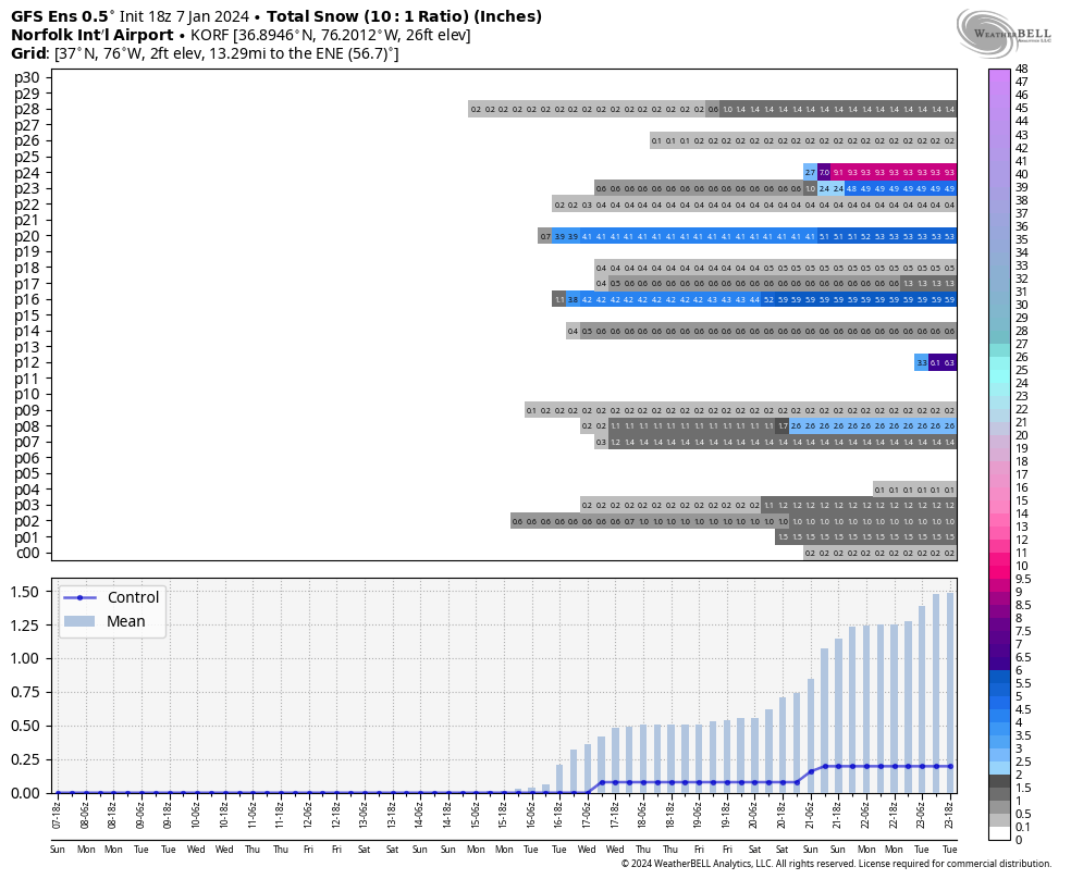
Regarding the 16-17th storm, the 18z GFS operational run was rainy for our area, with RIC reaching the low 50s (60s ORF), but many of its ensembles painted a colder scenario. In fact, there were several members that gave RIC at least 6" of snow. You can watch the hits below and see the charts for Richmond and Norfolk showing the member totals for the entire run.


-
4
-
-
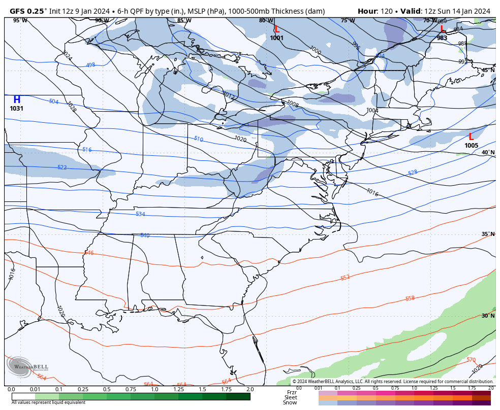
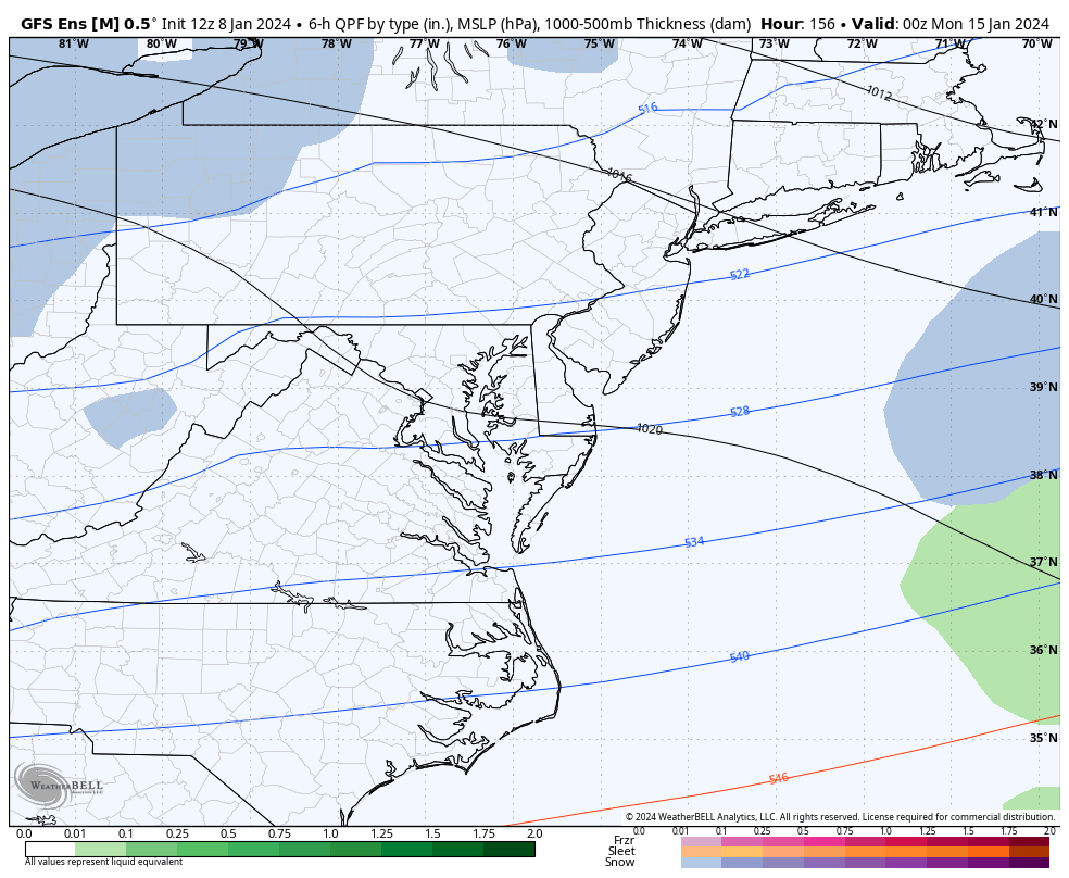
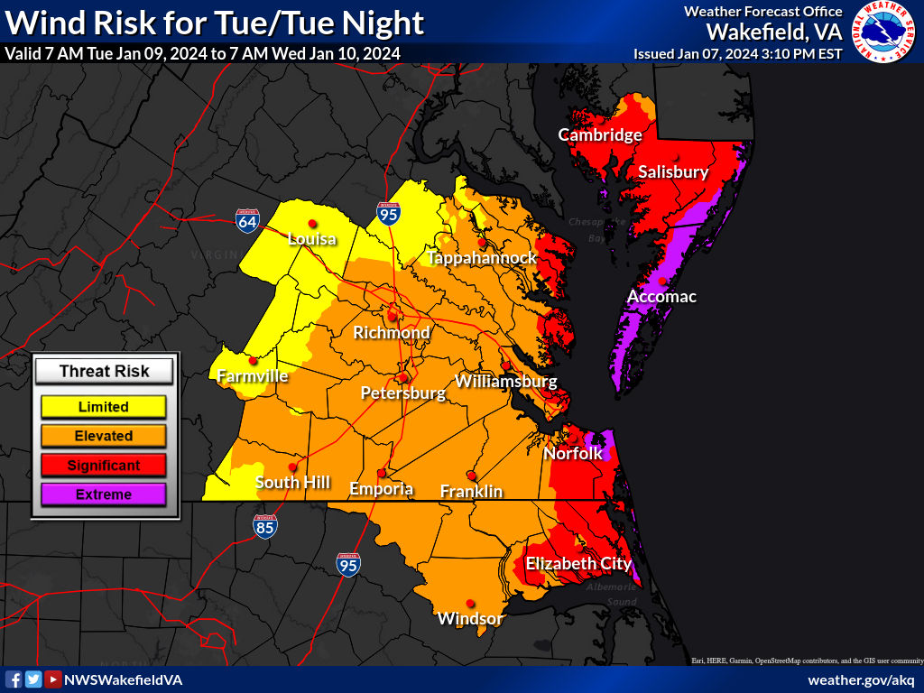
Concerning Tuesday's storm, temperatures started in the mid-upper 30s that morning, and there could be some snow or ice for the far western and northern parts of the state. But, temperatures will rise into the 60s, possibly upper 60s in spots as the main storm tracks west of the state. It will be very windy for everyone ahead of it. Wakefield has issued a High Wind Watch for the immediate coastal areas.
The 3K NAM also brings a squall line through the area between about 7pm and 1am and another widespread 1-2" of rain. Yay!


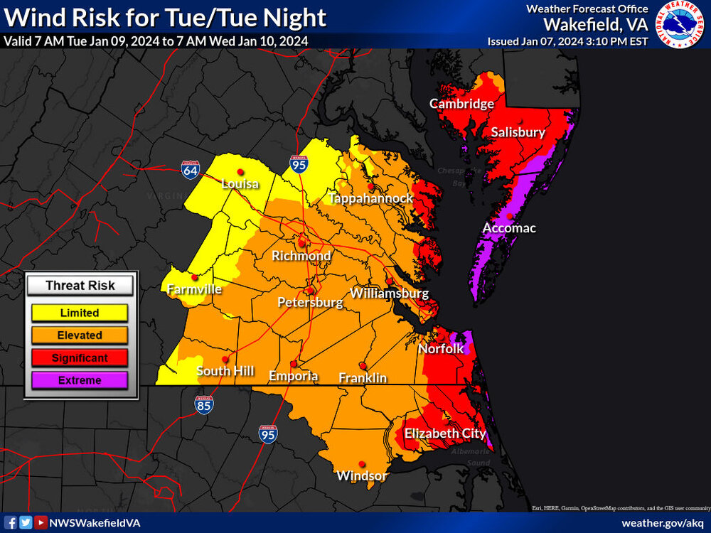
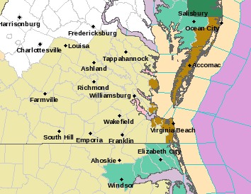
URGENT - WEATHER MESSAGE
National Weather Service Wakefield VA
249 PM EST Sun Jan 7 2024

NCZ017-102-VAZ095-098-525-080400-
/O.NEW.KAKQ.HW.A.0001.240109T1800Z-240110T0600Z/
Western Currituck-Eastern Currituck-Norfolk/Portsmouth-
Virginia Beach-Hampton/Poquoson-
Including the cities of Knotts Island, Corolla, Downtown Norfolk,
Ghent, Norfolk International Arpt, Norfolk NAS, Norview,
Ocean View, Wards Corner, Back Bay, Bayside, Cape Henry,
Dam Neck, Gallups Corner, Kempsville, London Bridge,
Buckroe Beach, Fort Monroe, Fox Hill, Grand View, Hallwood,
Hampton, and Langley AFB
249 PM EST Sun Jan 7 2024

...HIGH WIND WATCH IN EFFECT FROM TUESDAY AFTERNOON THROUGH LATE
TUESDAY NIGHT...

* WHAT...South to southeast winds 30 to 40 mph with gusts up to
  60 mph possible.

* WHERE...In North Carolina, Western Currituck and Eastern
  Currituck Counties. In Virginia, Norfolk, Portsmouth, Hampton,
  Poquoson, and Virginia Beach.

* WHEN...From Tuesday afternoon through late Tuesday night.

* IMPACTS...Damaging winds could blow down trees and power
  lines. Widespread power outages are possible. Travel could be
  difficult, especially for high profile vehicles.

PRECAUTIONARY/PREPAREDNESS ACTIONS...

Monitor the latest forecasts and warnings for updates on this
situation. Fasten loose objects or shelter objects in a safe
location prior to the onset of winds.
-
1 hour ago, Rhino16 said:
I think western storm track could be this winter’s top story.
Yeah, we've been wasting so much time tracking with no results, just cutter after cutter, which seems to always verify even when they show up on the models 10 days out.

Meanwhile, the EPS did seem to favor a more of a southern solution for the 16th-17th wave that follows next weekend's cutter, but the snow mean wasn't that great. There was one member that did gave RIC 5" of snow from it. I don't think we are gonna really know how this pattern is going to shape until we get a little closer, there are still a lot of inconsistencies on the PV and where it drops into the CONUS.

-
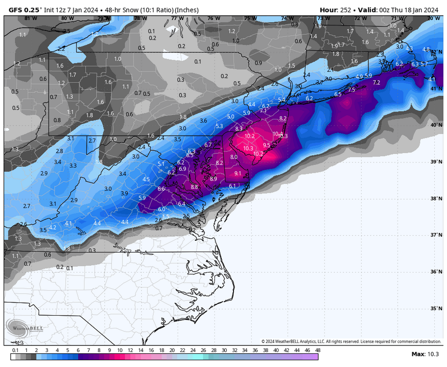
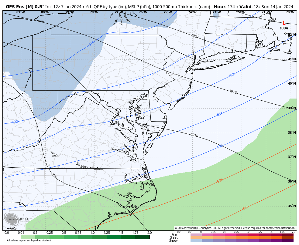
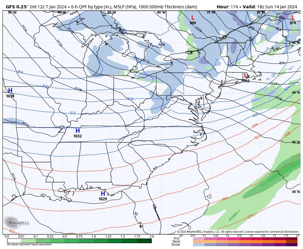
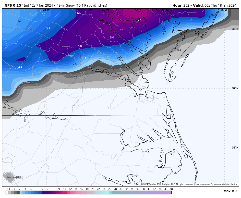
1 hour ago, RIC Airport said:
Here is the 12Z GFS
There is still some ensemble support for the 16th to 18th period, but certainly no slam dunks, @Conway7305.


-
Here is the 12Z GFS


-
3
-


Richmond Metro/Hampton Roads Area Discussion
in Mid Atlantic
Posted
Wow, that's impressive. I hope you find that you didn't undergo any structural damage. I probably hit 50-55mph a few hours ago, but I wasn't monitoring too much. I live in a newer neighborhood next to a large commercial area with few tall trees in my immediate area, so I only hear the higher gusts hit the house.
Friday into Saturday's storm is looking like another doozy, too.
I do not see that as an option on the sites I use. That may require a higher-paid subscription, I am not sure.
Adding the median would be helpful for the reasons you stated. I assume that is why the charts are available. And while I will occasionally post the snowiest member or two, I hope everyone knows that’s only for fun as frequently there are just as many, if not more, complete shuts. It's always interesting to see the evolution of the snowiest ensemble and how the storms evolved. As I’ve pointed out a couple of times, some of them don’t make sense and are laughable, but I think overall they can be helpful as long as people don’t take them verbatim.
Yeah, I actually noticed that, too! The highest gust at RIC came just as the rain was ending. I hope you don't lose power; I know a lot already did.
Many schools are closing due to excess runoff from streams rising. Wakefield has issued a flood warning for most of the CWA until 7am due to rising water. Plus, we have had like 15" of rain in about 7 weeks, just crazy! Especially since many of us were coming out of a drought.
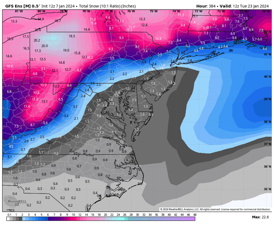
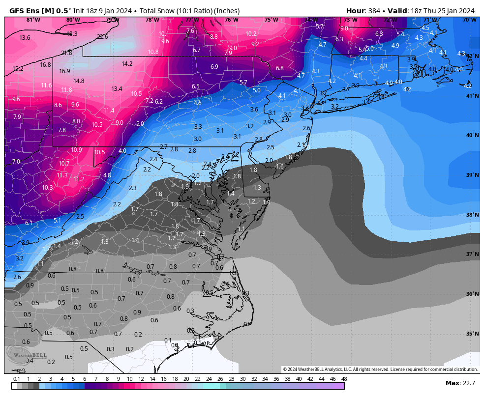
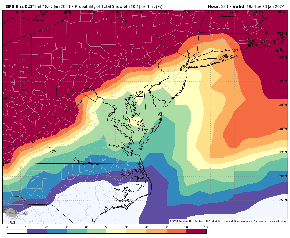
The 00z GFS did not deliver for the 15-16th, hopefully, the next one around the 20th- 21st will gain further traction.