burgertime
-
Posts
11,171 -
Joined
-
Last visited
Content Type
Profiles
Blogs
Forums
American Weather
Media Demo
Store
Gallery
Everything posted by burgertime
-
I give that .000000000001% of verifying.
-
You really should haha. Only +30 from upstate to GSO
-
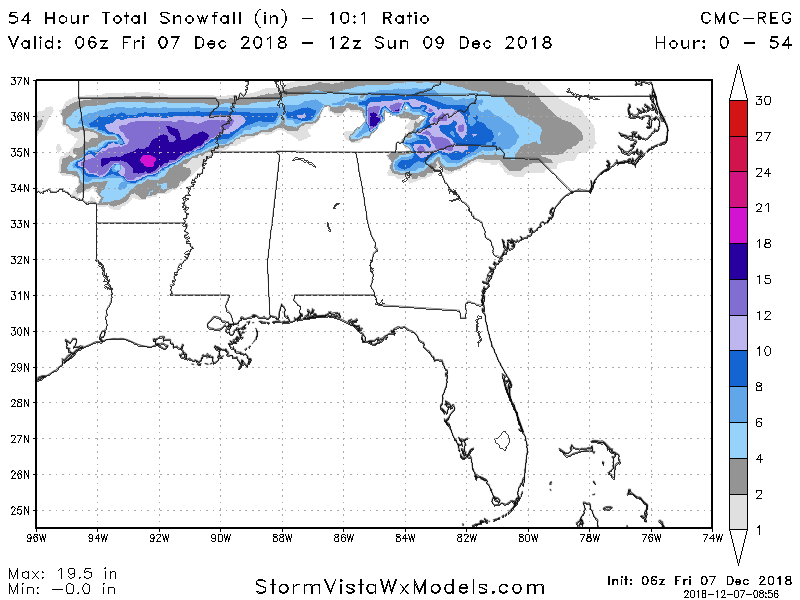
By the way here is the 6z RGEM snowfall map out to hour 54
-
Thanks. Just trying to figure out if that's the map I'm looking at in SV. I'll assume it is.
-
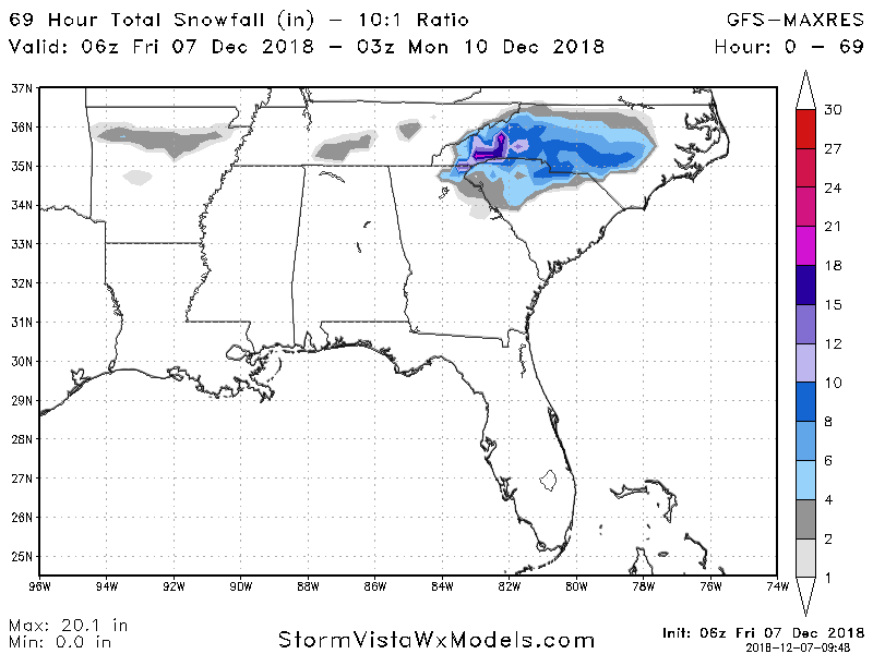
Quick question James. Is this just the new PARA run of the GFS? I don't see it on stormvista but they do have a parallel GFS map.
-
Because it's driven by easterly winds the warm nose won't be as big of a factor according to WPC. So this really could paste you guys for once.
-
Don't worry, average temp here during the winter is around 40 degrees with rain almost every day and when it does get cold and there's moisture it's usually 33 and rain. I've seen one good snow here and it only stayed on the ground for like 1 day. Got so cold the canals froze over and couldn't get any moisture. Every winter I get triggered with flashbacks
-
From WPC
-
Wow. Everyone should read this.
-
This is gonna be one of those "one city over" heartbreakers where you'll see a big dividing line between like 2 inches of compacted sleet snow and a foot of snow that next city over. I'm really interested to see if the NAM trends colder. I have a feeling it's picking up that cold air press in Canada. We're starting to get into good sampling range. RGEM should really be paid attention for that reason.
-
6z GFS is a touch colder than 12z also not as wet. This storm can turn either way for folks east of I-40.
-
Actually looking at P-type CLT gets 2 inches QPF of sleet. Areas around GSP get massive ZR and GSO cashes in outside of the mountains.
-
Hi-res NAM has WNC all snow during the heart of the storm.
-
This is gonna be a good run. By 60 CLT gets in on the heavy snow action.
-
I-40 WNC special...
-
Better CAD signature showing up on this run as well.
-
@54 NC is getting hammered with.....something? Looks like a massive sleet fest in Concord with heavy snow in GSO. Looks a lot better this run.
-
Not as good @51 because the high slides out....again though looks better to our north to my eyes for the general setup.
-
@48 most of NC has just cold enough temps at 850....could be a sleet fest or snow it's close.
-
4hrs of sleep after an epic Christmas party...I'm barely making it haha. Also this run looks better to me. If that arctic air can keep pressing and this becomes a trend there will be some fun clown maps again.
-
This run is colder...not gonna be cold enough for people but this run of the NAM is pressing that cold Canadian air down a little more. We need to watch this trend. @45 I-40 north is the 0c line. On the 00z it was along the VA border.
-
Should see snow breaking out along I-85 and parts of 74 by 00z Sunday.
-
Colder on the NAM @42 for NC.
-
Yea just got to see the maps from the 00z runs. This was my first worry was that it's still early December. Anyone south and east of 40 always gets the warm nose. I still feel like the models are kind of doing weird things. Also this will be the storm that trends warm than somehow over delivers just to make even more people confused here.
-
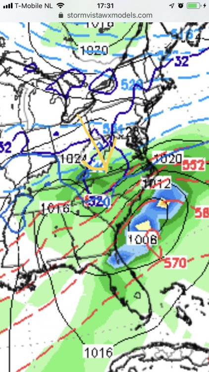
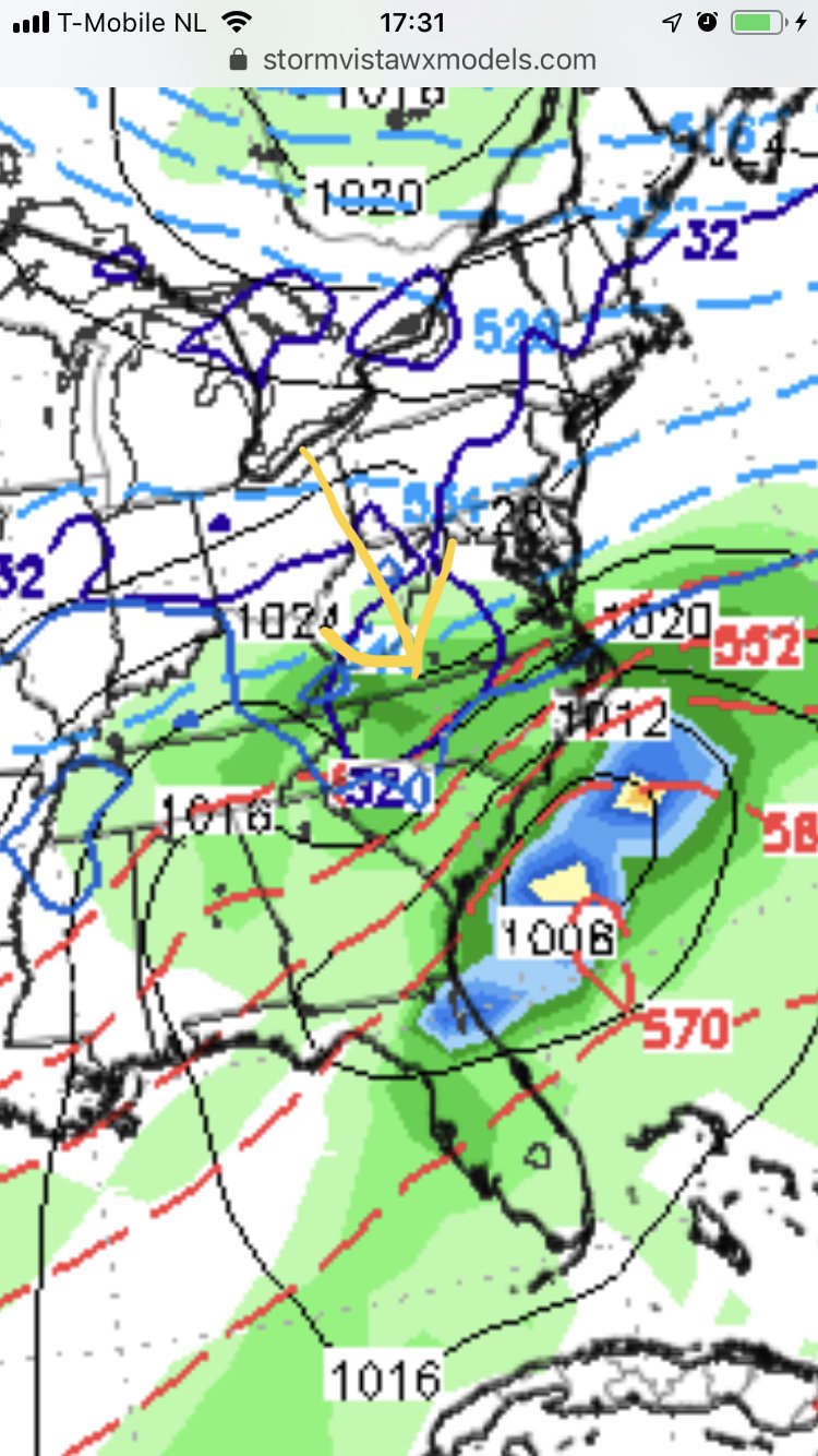
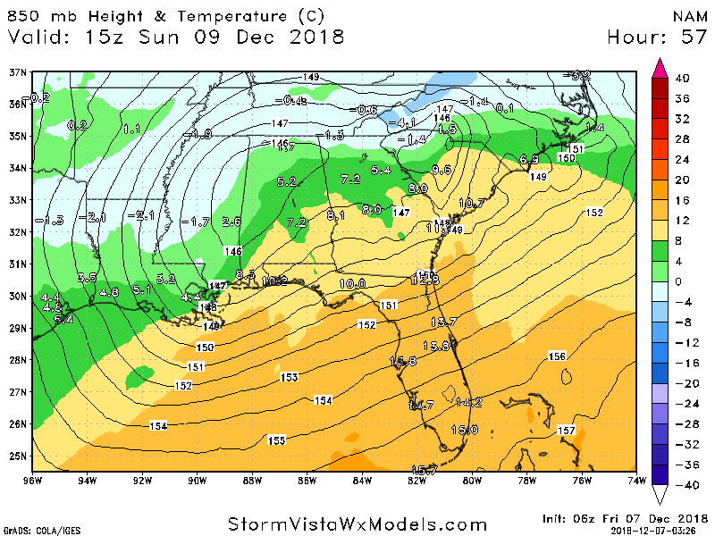
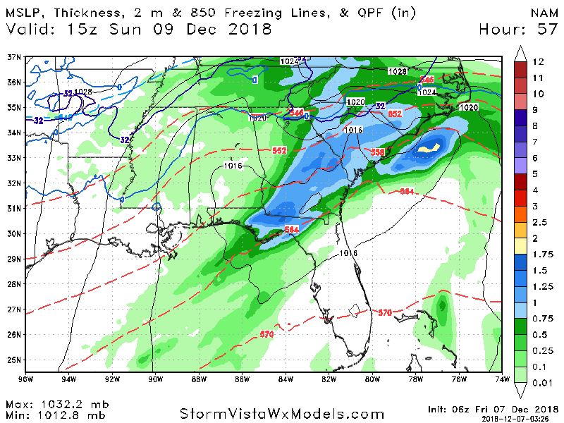
Yep and you can see this on the models. I've found that thickness is a good way to spot ice/rain. You want to be above the 540 line or between it and the 546 because as it cools the column you get sub 540. What you don't want are those red lines stacking on you. It'll be ZR every time and if you're at 546 it's usually sleet. In this case CLT is on the line but with that 850 line well south I'd take my chances that mother nature does the rest of the work. Sorry for the crude drawing. On my phone right now.