burgertime
-
Posts
11,171 -
Joined
-
Last visited
Content Type
Profiles
Blogs
Forums
American Weather
Media Demo
Store
Gallery
Everything posted by burgertime
-

Southeast Sanitarium - A Place to Vent
burgertime replied to Jonathan's topic in Southeastern States
If you have a few hours def. let me know! Can't say I'll join you in the RLD but coffeeshops and and bars are welcome haha -
Southeast Sanitarium - A Place to Vent
burgertime replied to Jonathan's topic in Southeastern States
Meh, I ride a bike everywhere and live in one of the greatest international cities in the world. It's not that bad -
Southeast Sanitarium - A Place to Vent
burgertime replied to Jonathan's topic in Southeastern States
Well believe it. Maybe one, some late night for 2 minutes. Temps have stayed in the 35 - 40f range all winter. I think we've had a handful of mornings where the low was below freezing. Maybe one day with a high at freezing for the day? Lots of rain. I was in the Pyrenees Mountains over Christmas and conditions were abysmal for the ski slopes. It's been a horrible winter for most of Europe in general if you're a snow lover. -
Southeast Sanitarium - A Place to Vent
burgertime replied to Jonathan's topic in Southeastern States
Rooting for you guys in NC/SC on this one! Haven't even seen a flurry here in Amsterdam this winter so just remember.....it can always be worse! -
Have to agree....given how the system looks currently and the setup I have a hard time believing it's that extreme.
-
That setup would make sense. I believe Goose said something about this happening all the time in OK and was never picked up by models. Also has it in that Feb of 14 storm which is where the bulk of snow came from in a setup a little like this one as well I believe.
-
GFS brings a second round on Monday. I don't think I've ever seen a clown map for NC on a global that looked like this, this close to an event. Unreal.
-
18z GFS is a big hit of snow for WNC/CNC. Much wetter and temps crash as the low gets out to coast. Again probably not worth anything right now.
-
Not that it matters but 18z GFS looks better than 00z. Looks more in line with short range models with regards to QPF.
-
Good catch. I wish all sites had the same map types.
-
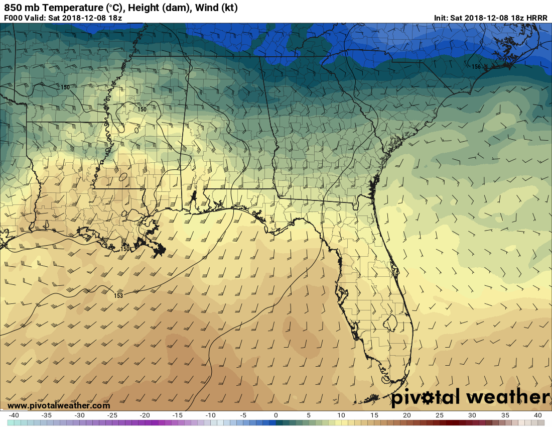
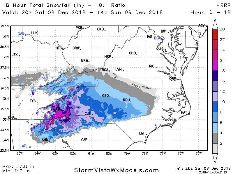
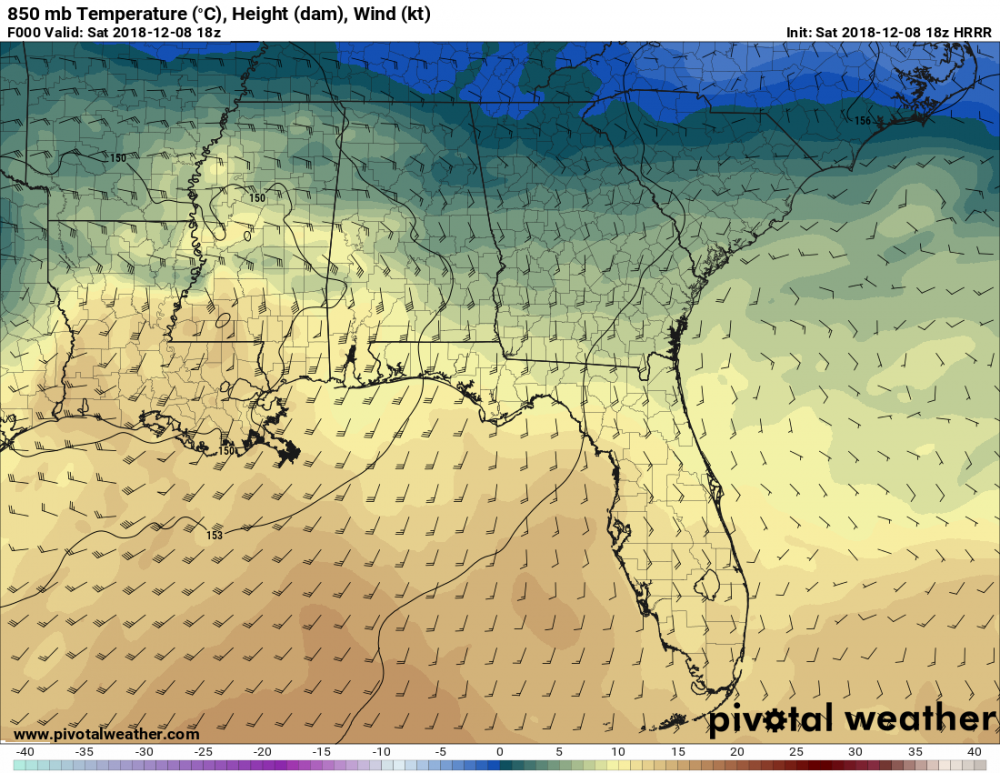
Don't have 850 temps but still shows 8 - 12 for GSP to CLT. Insane totals still.
-
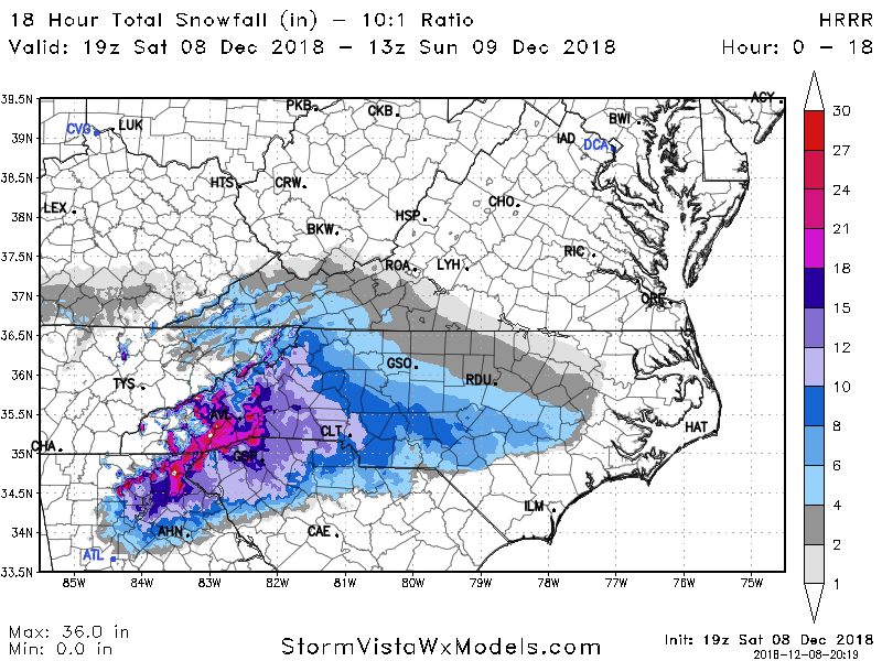
Latest HRR has less snow totals but that's because QPF isn't as far north as the last run.
-
Like I said in the post, I was just basing this off of p-type maps and QPF totals between the hours P-type was snow. On those maps RDU gets an inch of QPF while P-type is snow.
-
Thanks as always Phil! Not a bad place to be either in Monterey when it's rain and cold everyone will want to be living vicariously through you.
-
Here is the HRR snow map...
.thumb.png.080789d75eb7b9d9a4079f50d30e8ac1.png)
-
I think that map looks pretty good Jeremy
-
Have a feeling you'll be breaking out the yard stick Mark!
-
They don't have hi-res snow maps on SV...just making a guess based on precip totals and p-type.
-
Yep, and this thing is so juiced. You look to be in prime position hopefully that precip shield really spreads north well.
-
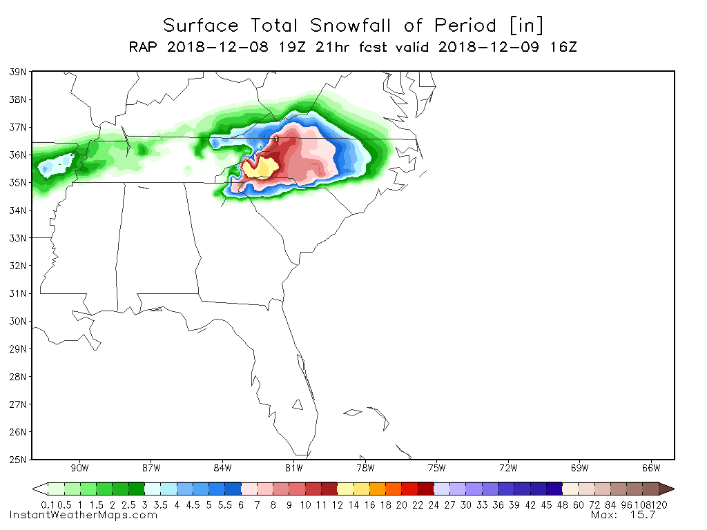
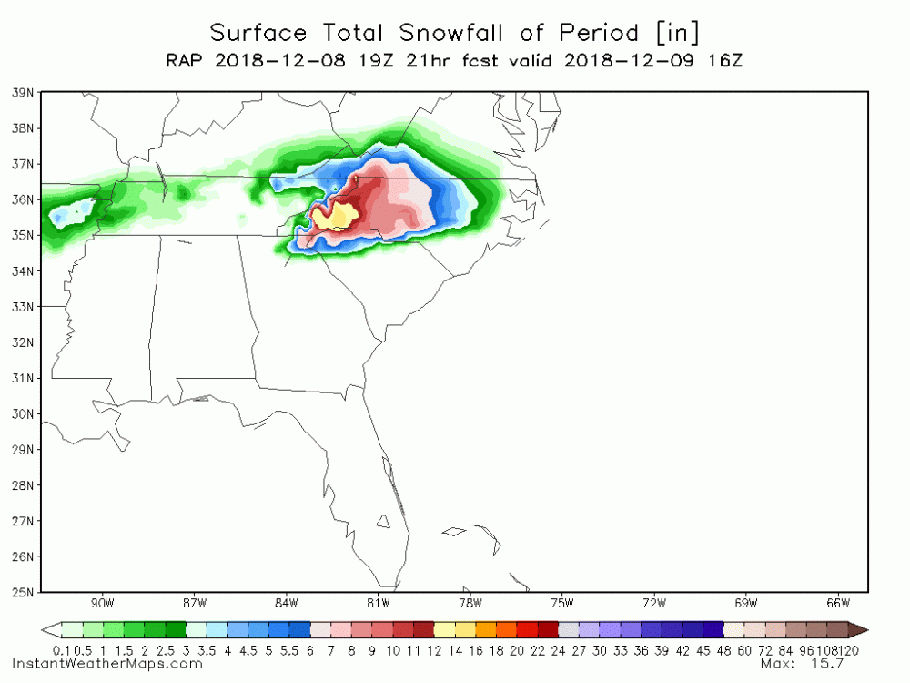
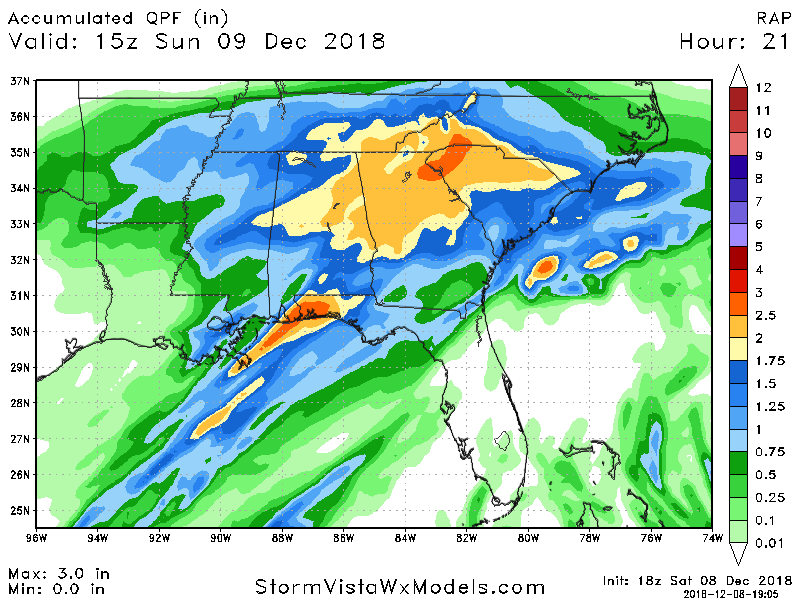
Here is the RAP
-
RAP say this is pretty much all snow for all of NC. Someone is either gonna get an epic sleet storm or a once in a life-time snow storm.
-
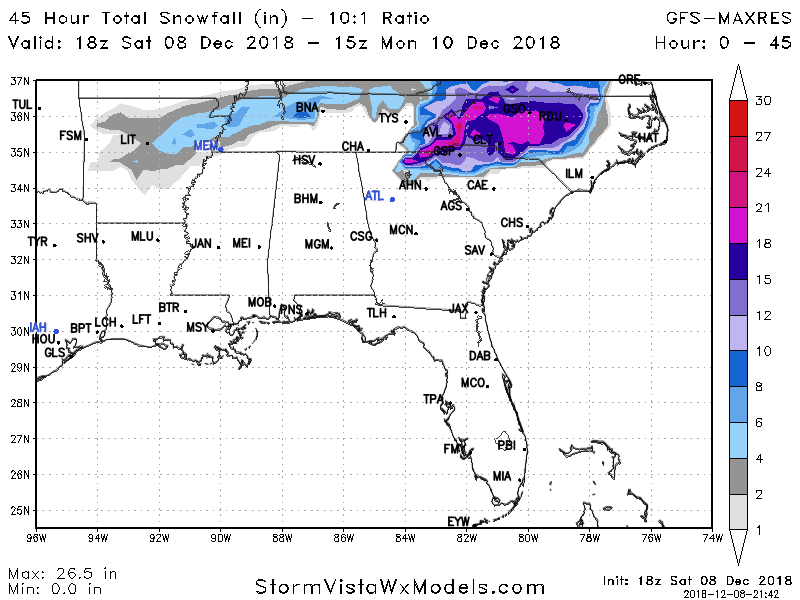
These HRR totals are crazy. On the lates run AVL has almost 15 inches by hour 15.
-
RDU per the Hi-Res NAM would get around a foot of snow before changing over to sleet just based on QPF and p-type maps.
-
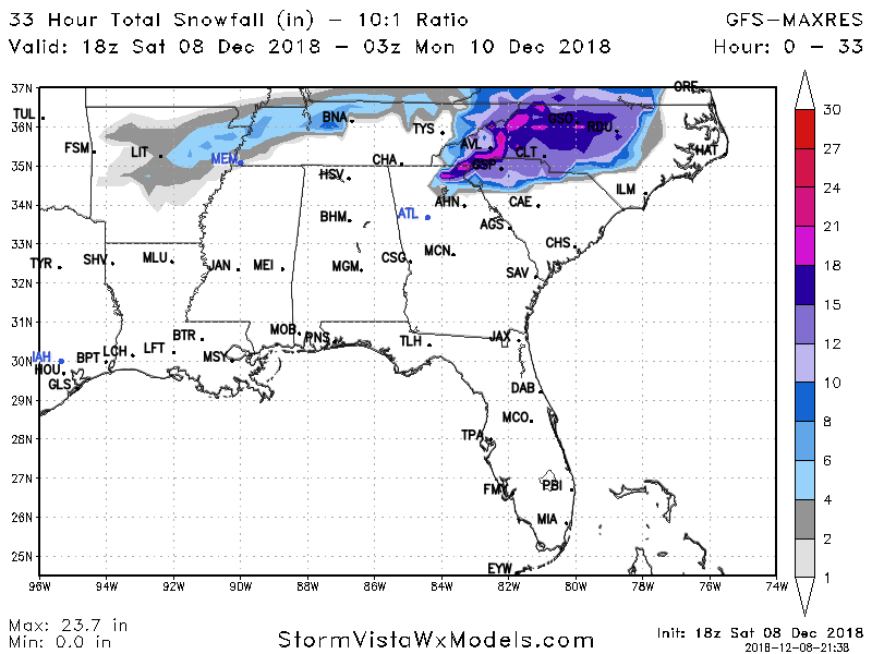
If Hi-res NAM is correct verbatim it drops almost 6 inches of snow on CLT before the switch over to sleet. Those would be some seriously heavy rates.
-
Hi-res NAM has all snow for RDU. Battle line for ice is right at CLT and along I-85.


.png.a5ca87bce0368bfa07f221ef71c783c7.png)