alex
-
Posts
4,402 -
Joined
-
Last visited
Content Type
Profiles
Blogs
Forums
American Weather
Media Demo
Store
Gallery
Everything posted by alex
-
GYX seems to have heard us: In the mountains, the air mass will initially be cold enough for wintry precipitation through perhaps half of the event. Using a blend of column temperatures to derive precip type and amounts, the potential exists for a plowable amount of snow/sleet in the White mountains northeastward to Rangeley and Jackman. These areas will likely mix with sleet and perhaps a few pockets of freezing rain before eventually going over to a cold rain before ending. Winter weather advisories may be needed for these areas. Winds may be an issue as well, mainly on the coast. Much of the model suite has converged on a stronger southeasterly LLJ on the immediate coast Saturday, with values up to 65 knots at 950 MB. Inverted low levels will keep these highest winds aloft, however forecast soundings are showing some degree of steep lapse rates below 950mb which will be capable of mixing down 30-35 knot gusts on the coast Saturday. Not completely out of the question that we`ll need a wind advisory there which is generally issued for 26 kt sustained winds and/or 40 knot gusts. Most of the steady, heavy precipitation shuts off as the afternoon progresses on Saturday. Thereafter, we`ll have strong NW flow in place along with upslope snow showers in the mountains through Sunday night. Could get several inches of snow in favored areas such as W/NW facing slopes. Thereafter, fair weather is expected through Tuesday night.
-
Even the NAM solution would mean (if that) bare ground for a few hours followed by upslope. It’s not like we have that much to lose. A 5” snowpack would be very easy to make up in an upslope area. But if course, it’s the NAM at 84 hrs so I wouldn’t expect much reliability (nor at 60, for that matter)
-
I have to admit, that’s all I look at which may explain my positive thinking. Also, if you ignore the AFD and just look at the P&C you get this which is nothing like the AFD lol
-
Hard to imagine that much QPF (either way) from a low passing so close to us if not over our head. I would think snow > drizzle/dry slot > upslope would be more likely. But maybe I’m wrong?
-
I think we see a net gain. And that's usually the case with most cutters anyways, unless they really flood us with warm air. It seems that the most likely scenario is snow to a mix/dryslot to backend upslope -> net result, we gain. That's based on my abysmal knowledge of weather and about 37 seconds spent looking at models; should really go a long way to make you feel better.
-
Lol. We are on the same boat on that river they want us rafting down
-
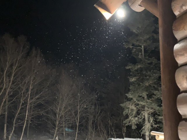
They're happening again... But lighter. But at least there's something in the spot lights, ha. What's the point of having spotlights otherwise?
-
The snowy P&C warms the heart but doesn't open glades unless it actually materializes. So if you could keep the grids as is and make sure it's in fact all snow, that'd be great! Jokes aside, it's not really meant as a criticism even though it sounds like it. I can't imagine how hard it is to capture the uncertainty and all the variables inherent to forecasting over such a long period and wide area. One day that you're bored I'd love to hear how the system actually works... It seems fascinating!
-
It's a bit strange though that with such a high probability of rain in the AFD there is not even a mention in the P&C. The two seem completely disconnected
-
1.5" overnight... Better than expected
-
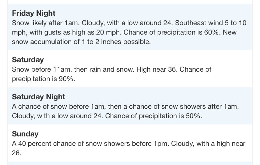
Gyx doesn't make one very optimistic... Of course my P&C has no mention of rain at all but consistency is optional (sorry OceanSt) On Friday evening a developing area of low pressure will be moving over the Great Lakes region before moving into eastern Ontario or Quebec by Saturday morning. There remains significant disagreement in the ensemble low tracks with this system as a fair number of the ECWMF individual ensembles have two main clusters, one is located over the Great Lakes region whereas the other is further to the southeast offshore of the Mid-Atlantic and southern New England at 12Z Saturday. These two separate solutions then eventually converge with a mean low track almost directly over our area. The CMC ensembles generally are in decent agreement with the ECMWF in terms of timing but on average they are a little further east. Finally, the GEFS ensemble mean low locations are somewhere in between those of the ECMWF and CMC. The ultimate track of this system will have large implications on precipitation type for our area as a more westward track would favor mostly rain whereas an eastward track would favor more in the way of winter precipitation. Generally favored the more westward solution in this forecast package due to the location of the 500 mb trough which will be located across the center of the country on saturday morning and the 500 mb ridge over the Pacific northwest. This keeps the majority of the precipitation liquid, even across the north. In terms of total QPF from this system, the ECMWF ensemble mean by 06Z Sunday has a swath of around 1" of precipitation across central NH and ME with between 0.50-0.75" further to the north and south. The GEFS ensemble mean by this same time is in overall good agreement with again locally 1" or greater of QPF across central regions. Finally, the NBM is overall somewhere in the middle but still indicated the potential for locally up to around 1" of liquid equivalent precipitation for some locations. This amount of rain combined with dew points up to around 40F will likely melt much if not all of the remaining snow and ice that is on the ground in many locations.
-
Also I’m an idiot and I always call it angel instead of diamond dust. But being northern New Hampshire, neither would surprise me
-
I think GYX should issue a Severe Angeldusting Warning. Surprised how noticeable it is at 5/-4, usually it’s when it’s below 0
-
Tonight could be the first subzero night in a while if the clouds don’t roll back in. Down to 5 already
-
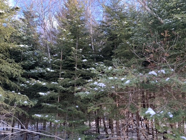
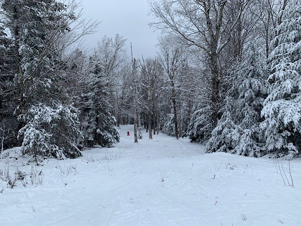
Finally getting some sun. The cool thing is that we've managed to hold on to some snow on the trees through this whole crappy period. Not much left on the trees at lower elevations though.
-
One of the wider glades opened yesterday. Rough conditions but fun
-
Increasingly large portions of bread and butter?
-
Our daily light snow has started again. Such a weird stretch
-
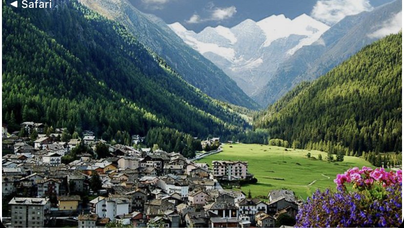
I was born in Torino, near the Alps. There are some breathtaking towns there. Courmayeur and the village of Cogne are some of my favorites. Chamonix is also really nice, on the other side. Cogne at about 5000 ft is just idyllic, surrounded by glaciers and enormous waterfalls towering over the town. Just breathtaking
-
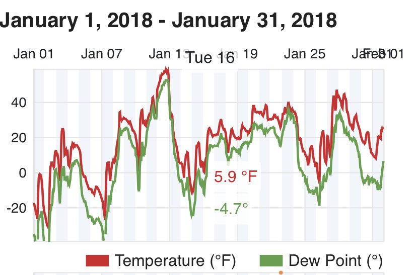
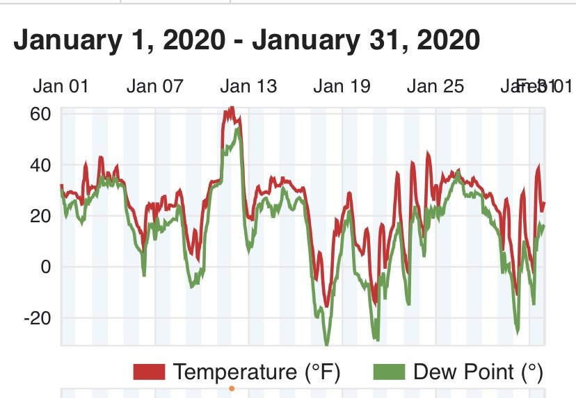
And 2018 for good measure
-
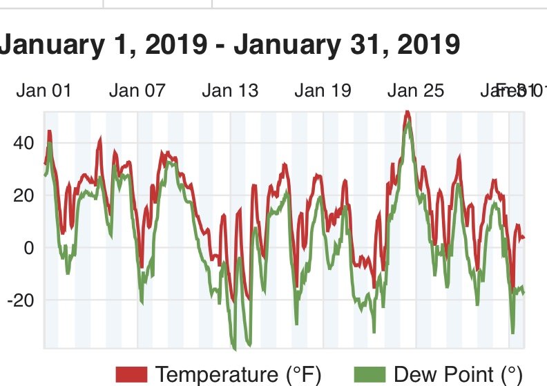
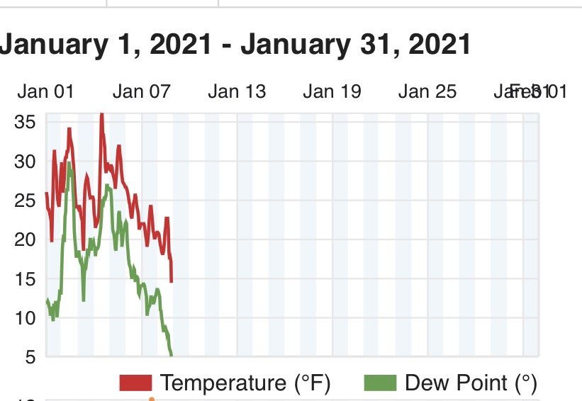
These are graphs of my PWS temperature for this year and the last 2
-
I've had some serious gripes with Cannon ski Ops before. Never in person of course, but I remember one time when it was 40 degrees at closing with a sharp cold front coming in, and they started grooming right away before the pack had a chance to freeze. They might as well have used a Zamboni, the next day was unskiable. The groomers at Bretton Woods seem much more careful.
-
What's funny is that it's actually been in my opinion perfect winter temperatures here. Below freezing for the past 4 days, no torches, snow still hanging on the trees, daily flurries and yet no uncomfortable mornings when you wonder why you live in this tundra. Although today's high of 22 did feel strangely chilly skiing.
-
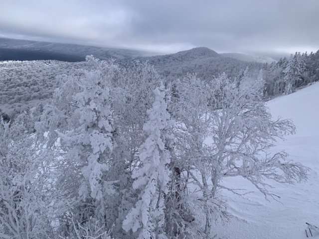
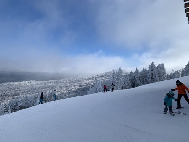
It's from the top of the gondola!
-
No it looks like it's always been in the clouds. There's a good 3-4" of rime