Chinook
-
Posts
10,081 -
Joined
-
Last visited
Content Type
Profiles
Blogs
Forums
American Weather
Media Demo
Store
Gallery
Everything posted by Chinook
-
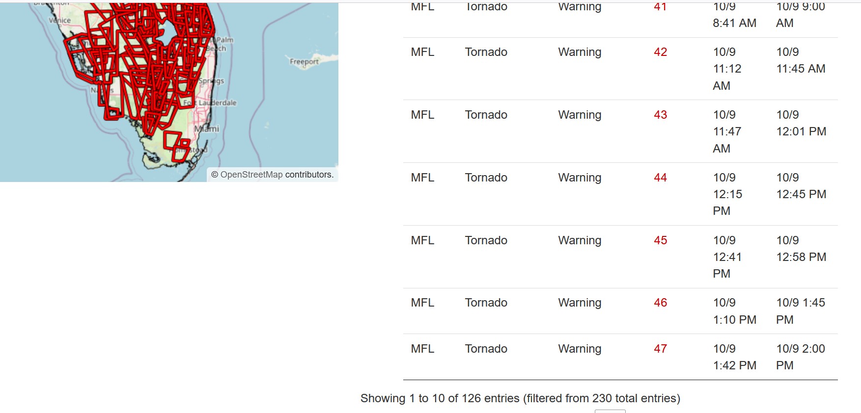
Here is the summary and (partial) map of the 126 tornado warnings from 5:00am Wednesday to 5:00am Thursday

-
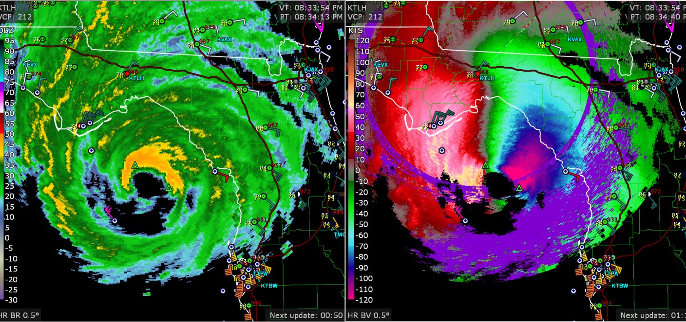
radar still says 120 knots in the lower clouds
-
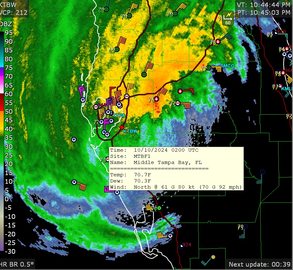
92mph down the bay

-
Sarasota airport: now max wind gusts of 96mph from the east
-
49mph gusting to 74mph at Venice FL
-
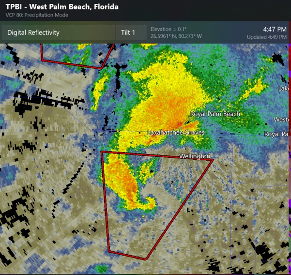
small supercell with tornado warning by West Palm Beach area
-
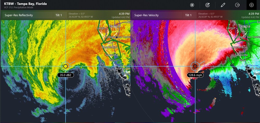
radar seeing 128mph at a few thousand feet
-
tornado on the ground, near Kenansville
-
another possible large tornado by Yeehaw Junction

-
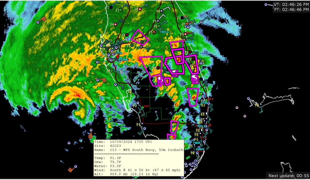
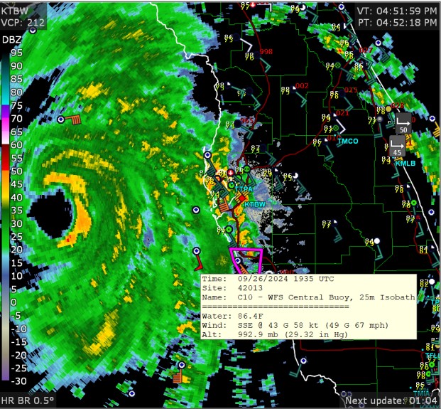
buoy now has wind gusts up to 65mph. Also, 5 tornado reports shown on this radar view
-
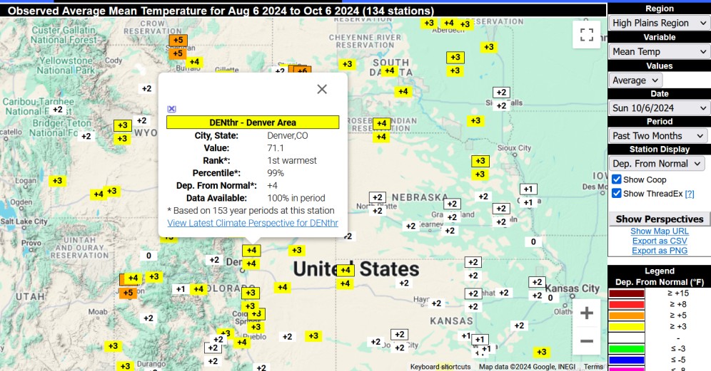
you didn't want to see this warmest for Denver in this 60 day period 700mb temp was 1.75C to 2C (3.15F to 3.6F) above normal
-
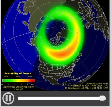
maybe some people could see the auroras from Michigan, Wisconsin tonight
-
Broncos 34 Raiders 18 they were great in their 80's uniforms
-
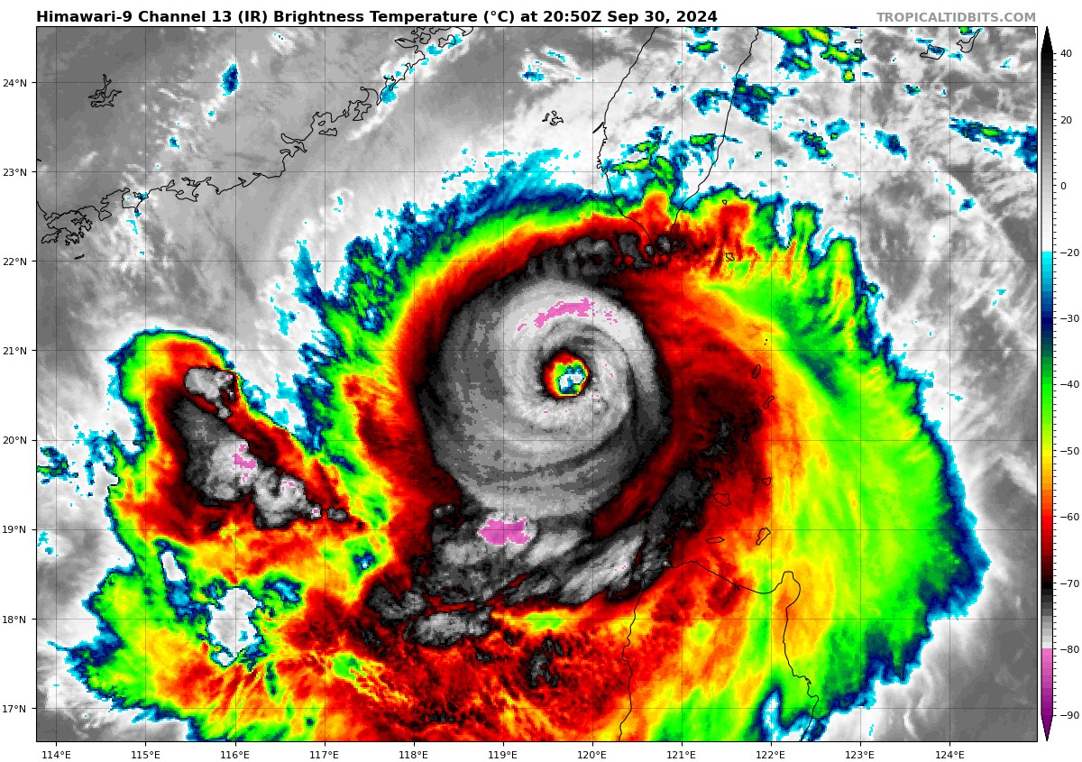
 Typhoon Krathon topped out at Category-4 equivalent (JTWC) and is now at 110 kt (just under category 4) on October 1st
-
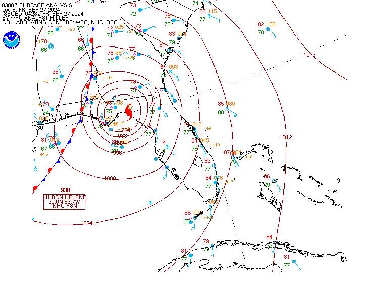
when you have 938 stamped on a surface map
-
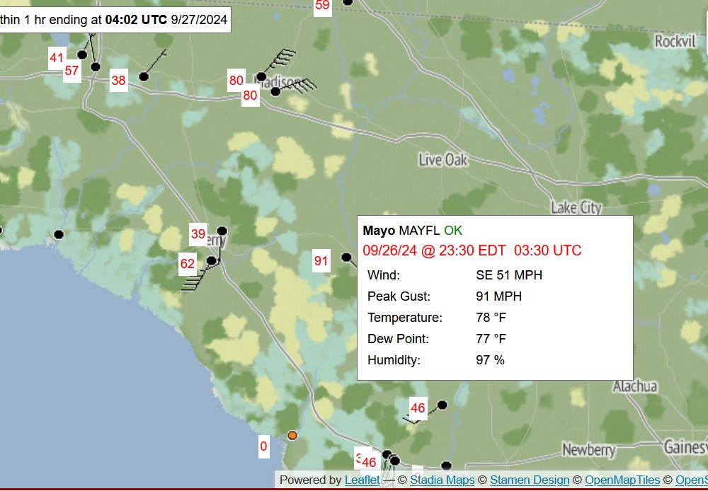
max values I saw were 99 and 91
-
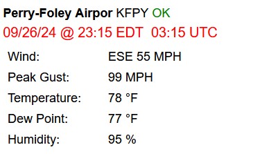
55mph gusting 99mph

-
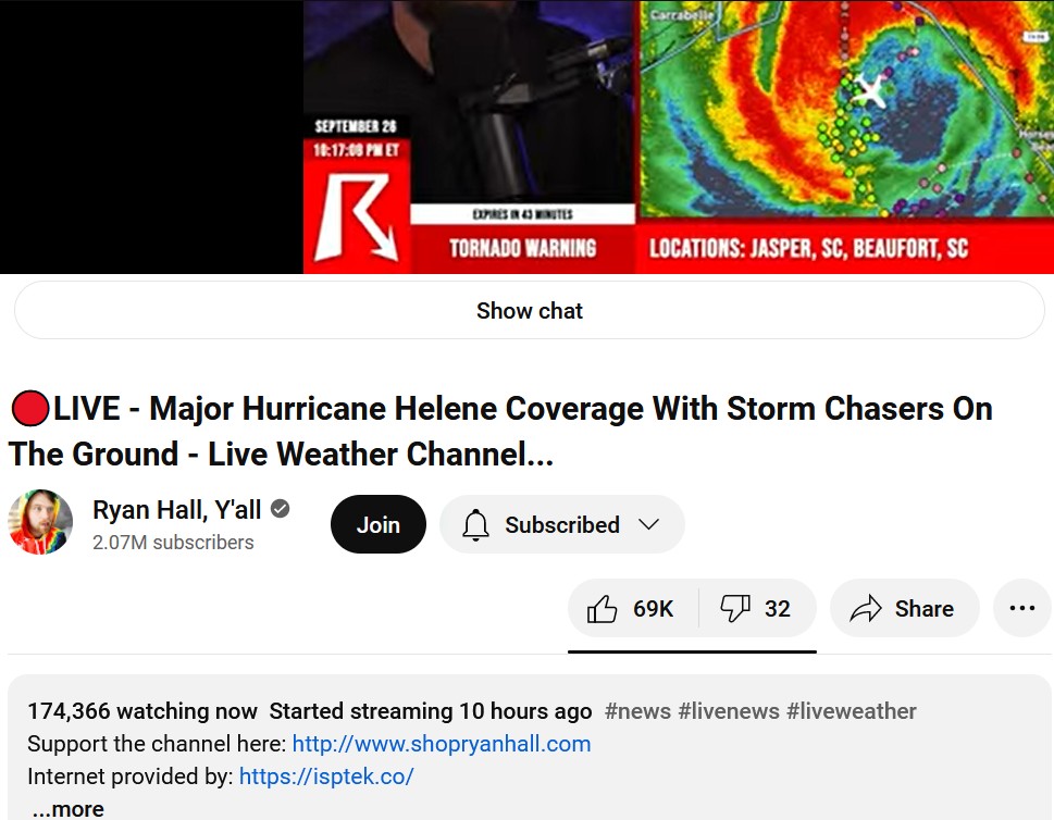
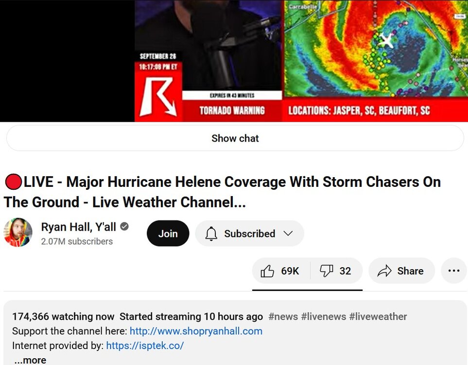
It seems like a lot of people are watching
-
Ryan Hall stream said that the Hurricane Hunters kind of got stuck in the eye earlier (not sure if this is old news, but I haven't heard of such a thing.)
-
these http://placefiles.redteamwx.com/buoyobs.php http://placefiles.redteamwx.com/loop_fullobs.php (for those who don't know, these have to be pasted into the correct entry field in GRLevel2/GRLevel3 program)
-
radar now picking up 130 knots in the clouds

-
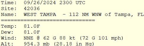
update for the buoy in the storm with over 100 mph gusts
-
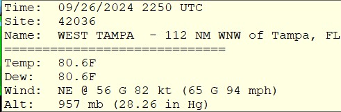
new buoy measurement in the eyewall
-
67mph wind gust at a buoy that is far from the storm
-
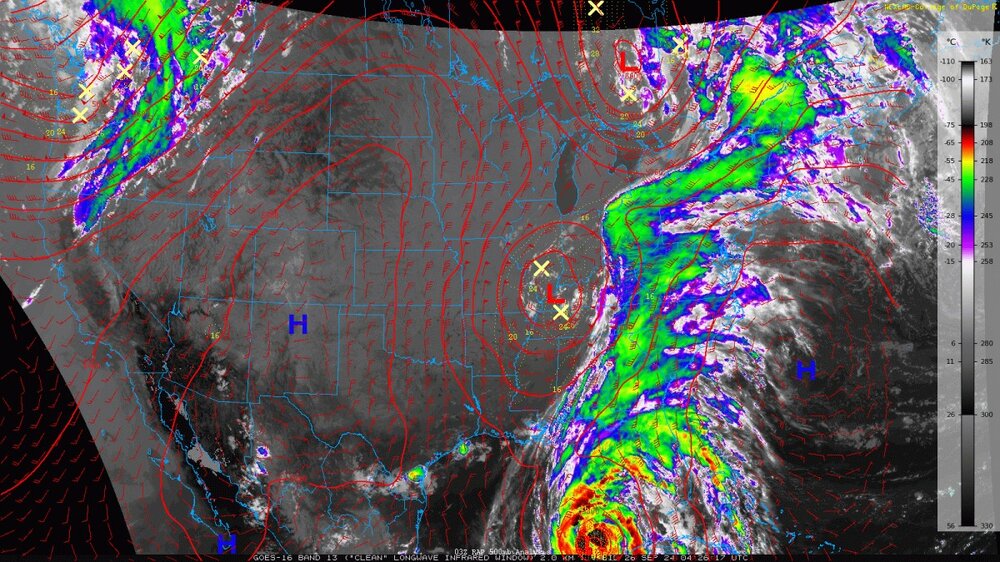
The connection of the hurricane with the USA weather system makes it look like the hurricane has a million fingers