Chinook
-
Posts
10,080 -
Joined
-
Last visited
Content Type
Profiles
Blogs
Forums
American Weather
Media Demo
Store
Gallery
Everything posted by Chinook
-
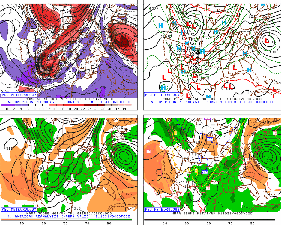
I'm not sure what will happen with the storm at about 120 hours from now. New models have a really low pressure near Detroit, with snow in Ohio. The models have been changing rapidly. Guess what? I made a new loop! The Great Lakes Storm of 1913 (20th Century Reanalysis) https://great-lakes-salsite.web.app/Great_Storm_of_1913_loop.html
-
 Typhoon Man Yi is expected to peak at 115 kt (low-end category 4) soon, also it is close to the Philippines. It is going to be 115kt down to 90kt just offshore from the Philippines and make landfall.
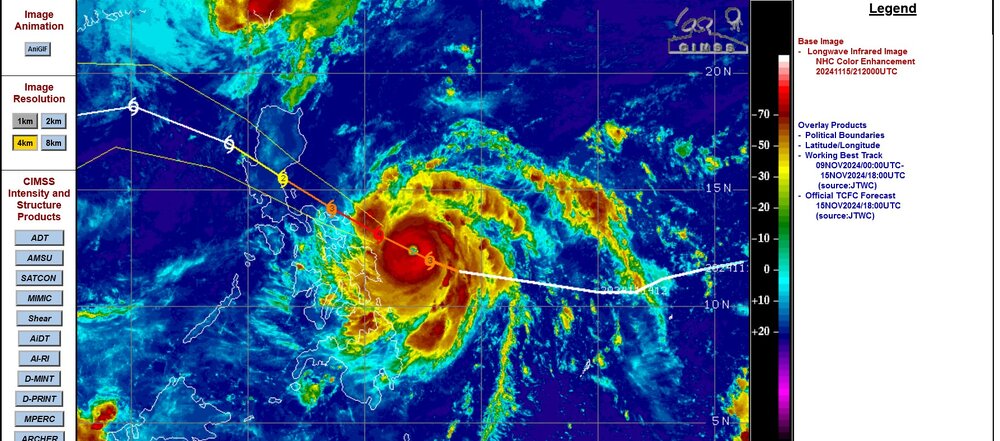
-
this is neat
-
College of Dupage now has the ECMWF to 360 hours
-
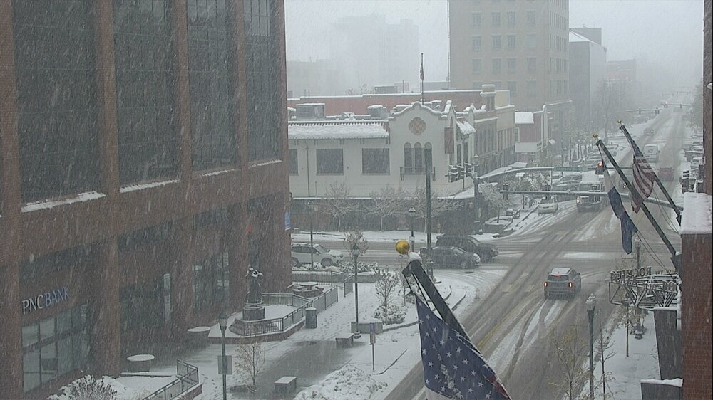
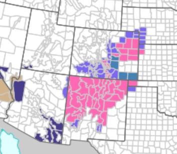
new loops for the huge storm, as I now will call it, the Denver double snowstorm https://great-lakes-salsite.web.app/Nov_5_2024_surface_loop.html https://great-lakes-salsite.web.app/Nov_5_2024_500mb_loop.html https://great-lakes-salsite.web.app/Nov_5_2024_radar_loop.html
-
hey, I just found this interesting video about a terrible tornado in New England edit SPC's reanalysis view of helicity for this isolated tornado
-
I kind of wonder if Toledo just was simply colder, for some reason I can't explain, that is, not due to consistently rainy conditions (obviously.) Fort Wayne had +3.6F.
-
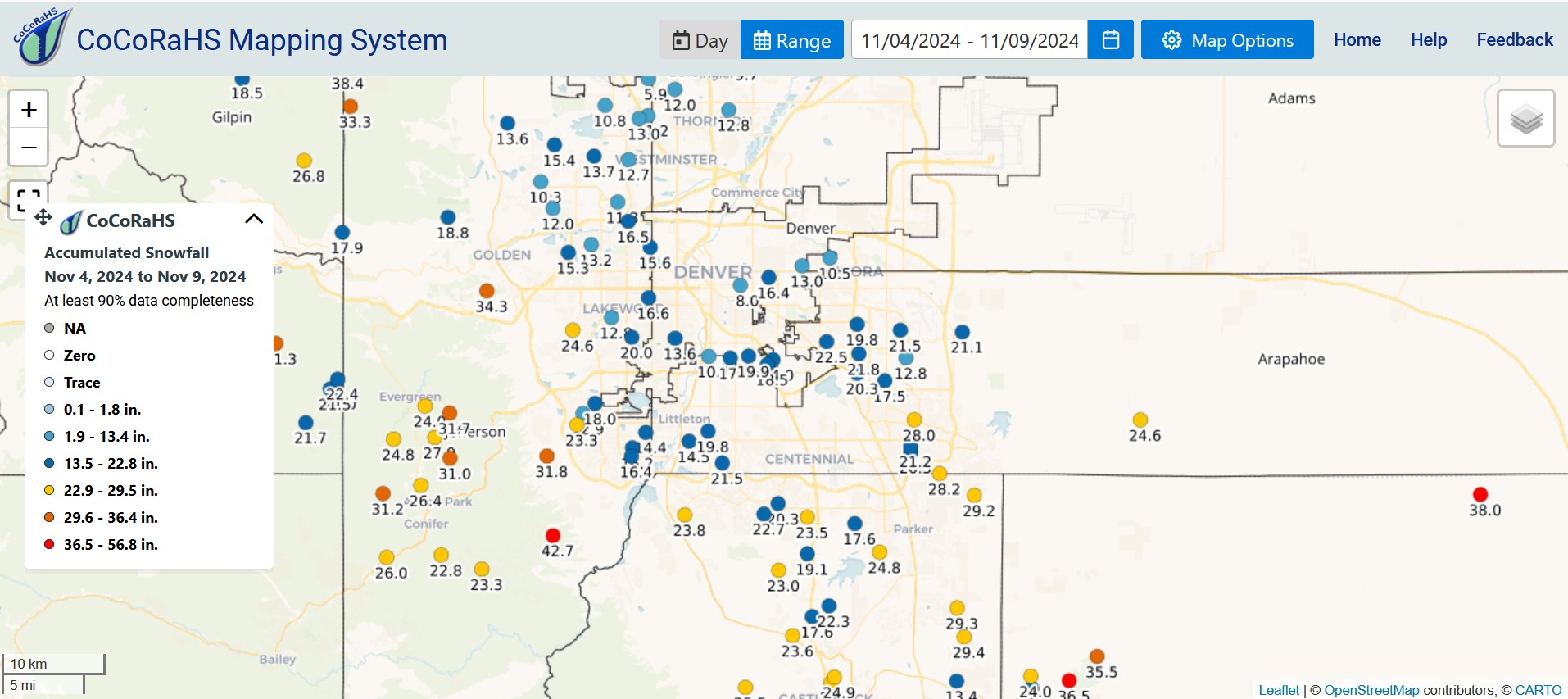
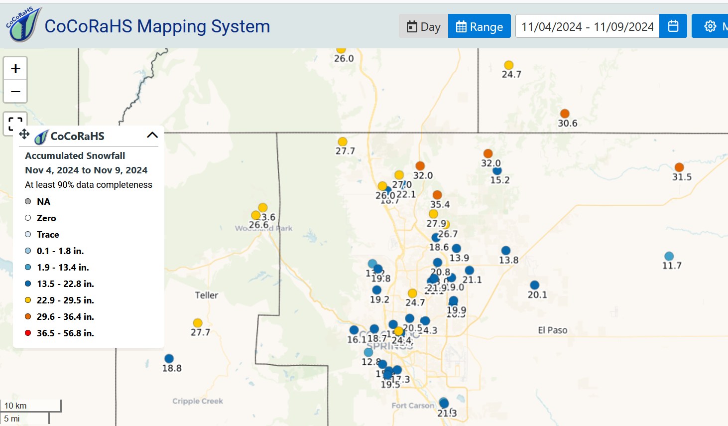
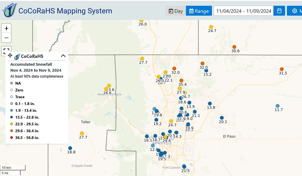
This is epic. The great storm of December 1st-5th 1913 had over 40" in Denver and this says 38" east of Denver. By the way I did a quick check of the biggest snowstorm in Colorado Springs (Airport) in modern times and it was something like 19.5 in October 1997. (1997-1998 El Nino)

-
Detroit was +3.5F for October, Toledo was +1.6. Detroit had a warmer average temperature, Detroit had 56.5, Toledo had 56.2.
-
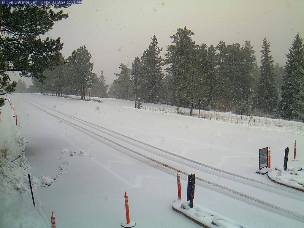
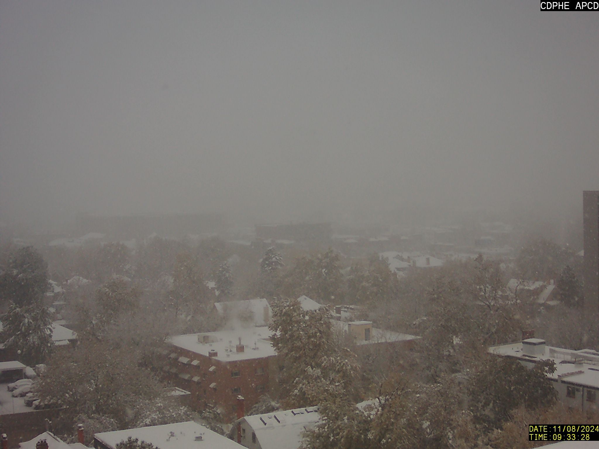
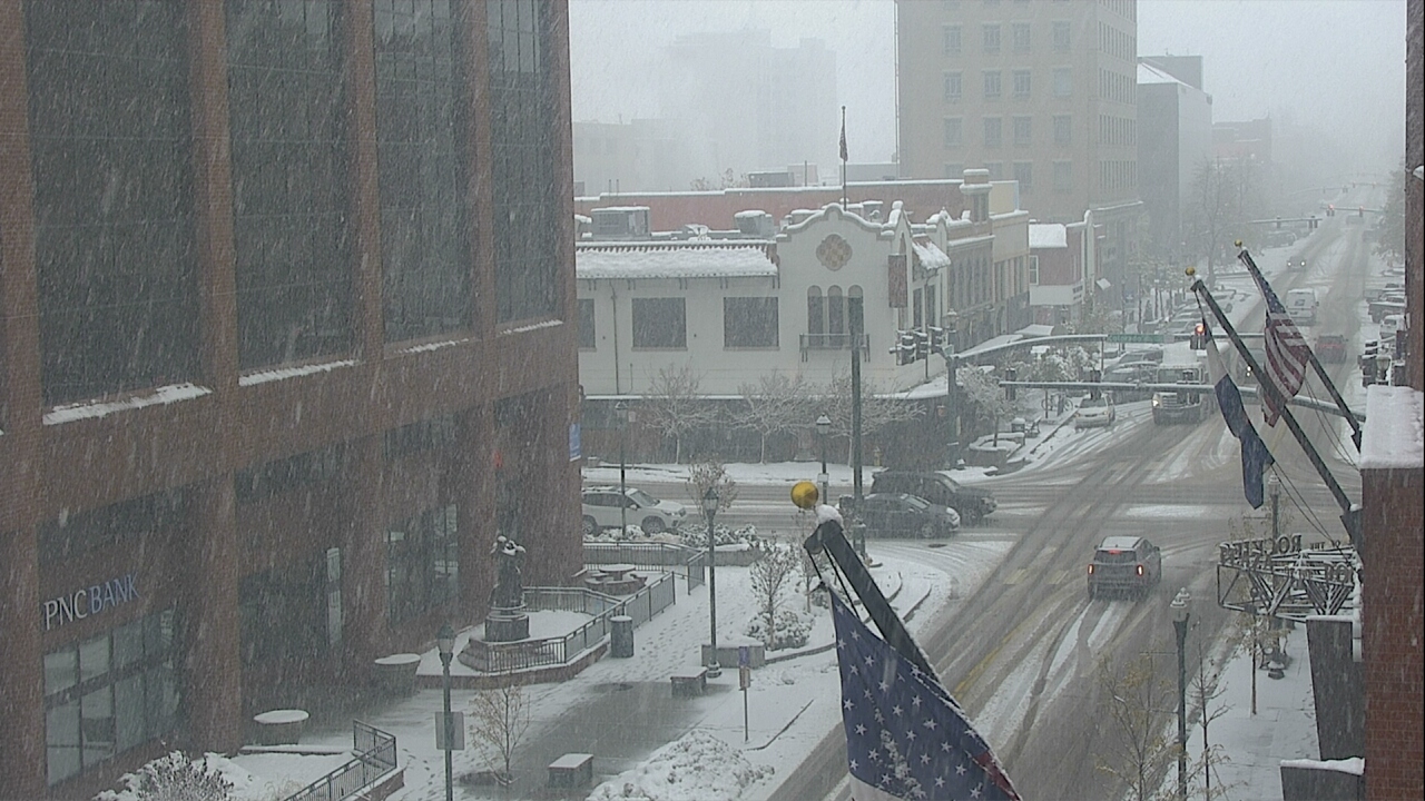
downtown Denver and Colorado Springs and Fall River Road/RMNP


-
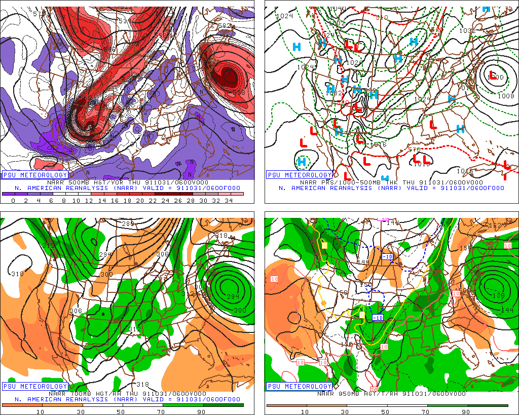
Interesting coincidence at this time of year, early November. It's not exactly an analog, well, not 100% match by any means. There was a deep trough in AZ/NM that created a heavy snow storm for the Plains in 1991. It was coincident to the Perfect Storm. It's partially because the Perfect Storm blocked up the ridge in the east. There was 10"-20" by Pueblo and Trinidad. The snow continued up the Plains with, I believe, 15-30" by Duluth, Minnesota. Maybe Mayjawintastawm actually was in Massachusetts for the Perfect Storm's waves. Maybe you saw George Clooney sail out on the Andrea Gail.
-
so I guess this is happening
-
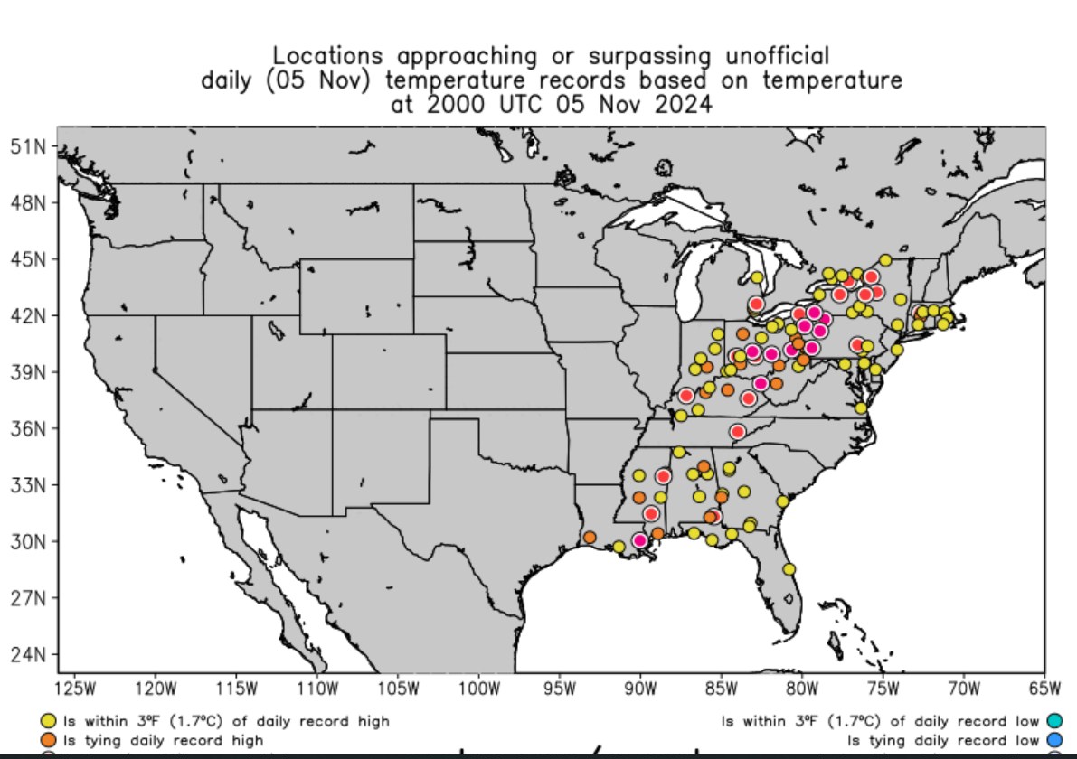
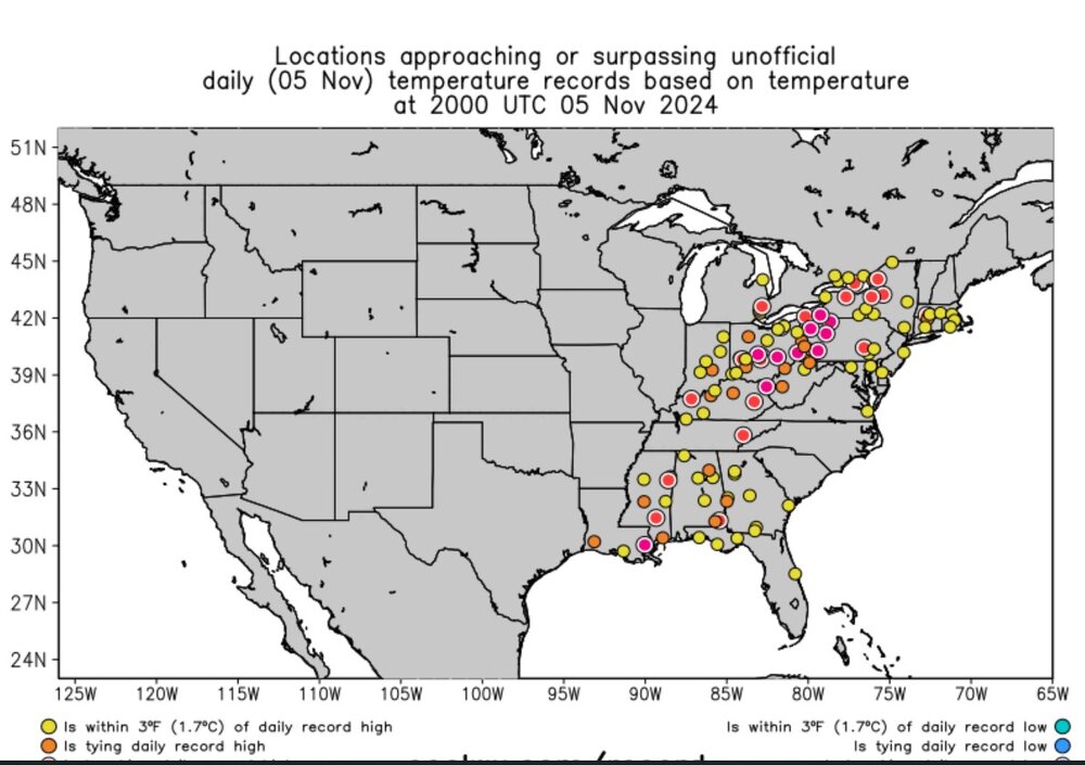
Here is a snapshot of hour-to-hour record breakers
-
Plains States Observations and Discussion Thread
Chinook replied to lookingnorth's topic in Central/Western States
new confirmed tornado north of that one where I showed the funnel cloud icon -
Plains States Observations and Discussion Thread
Chinook replied to lookingnorth's topic in Central/Western States
small squall-line tornado at Crane MO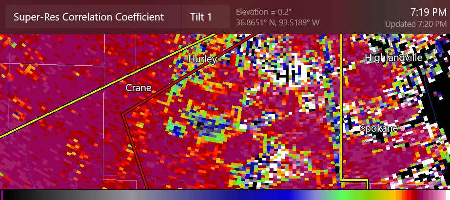
-
Plains States Observations and Discussion Thread
Chinook replied to lookingnorth's topic in Central/Western States
This report icon is actually a funnel cloud, by Branson Missouri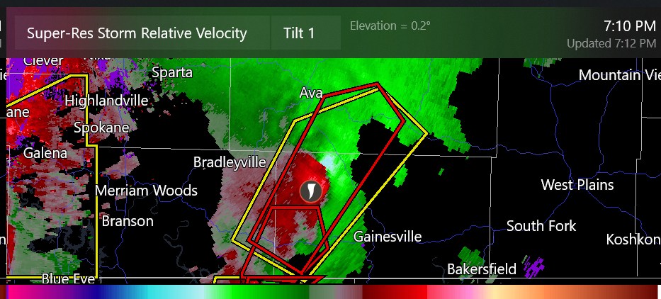
-
Plains States Observations and Discussion Thread
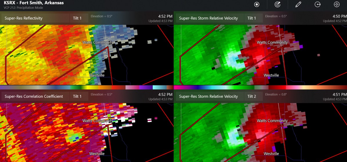
Chinook replied to lookingnorth's topic in Central/Western States
now this is showing a large debris, with easy to see 70-80mph storm relative winds on the west side
-
Plains States Observations and Discussion Thread
Chinook replied to lookingnorth's topic in Central/Western States
this tornado has tracked maybe 10 miles in eastern Oklahoma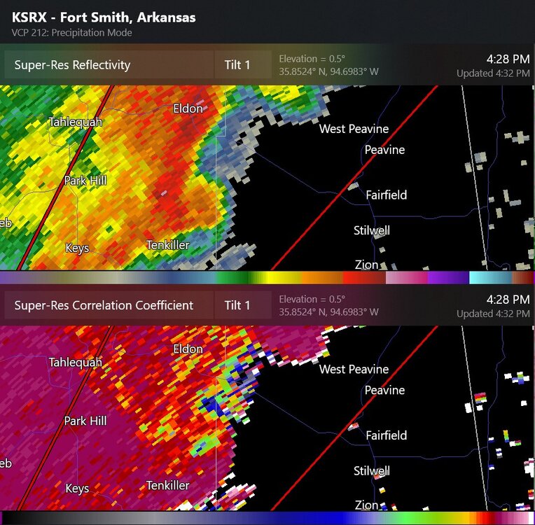
-
with all apologies to Phil Collins of Genesis... here's the next DenverBoulder forecast dicussion. Note NWS-WPC has 1"-3" total QPF in the next week from Denver to the southeastern portion of Colorado
-
Plains States Observations and Discussion Thread
Chinook replied to lookingnorth's topic in Central/Western States
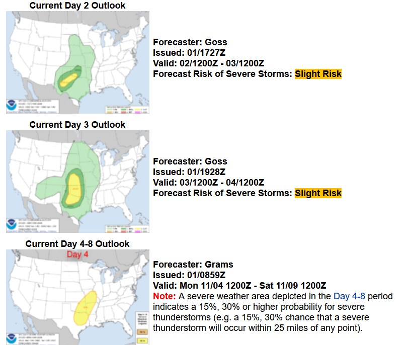
Dallas Fort Worth on the boundary of the 5% tornado outlook (slight risk)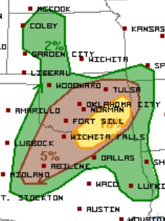
-
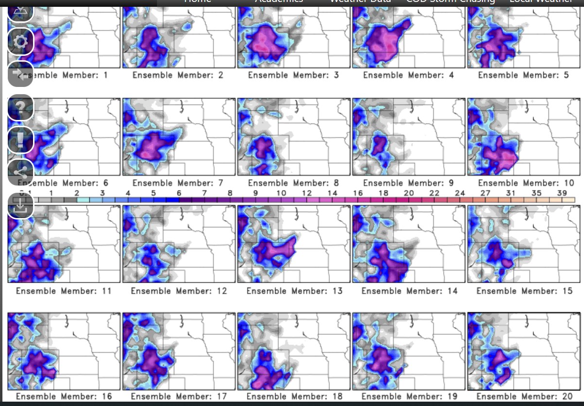
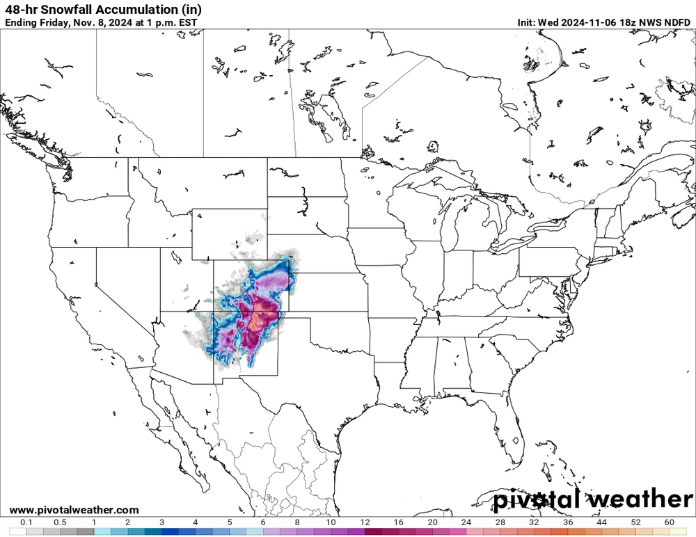
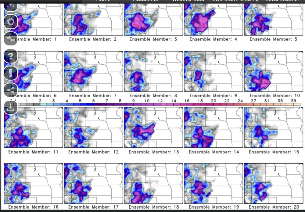
multiple models have a 500mb low at the Four Corners. Here is the new GEFS individual models showing significant total snow accumulations for the mountains (and maybe more) from generally 48hr-120hr (2days-5days)
-
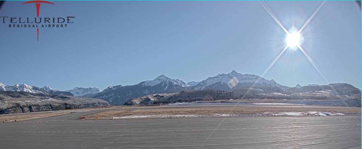
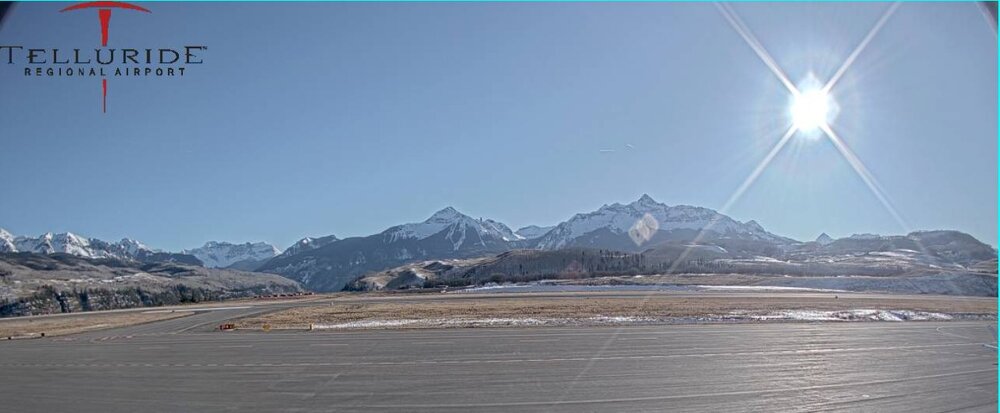
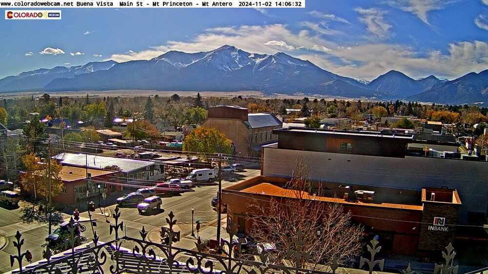
a few days ago this web cam had much more yellows on the trees, much like my yard here in Ohio. You wouldn't tend to think that the peak colors at 7000 ft would be at the same time as some of the Midwest... but it must have been warm.. you know like 8 deg above normal.
-
Plains States Observations and Discussion Thread
Chinook replied to lookingnorth's topic in Central/Western States
Sunday night. The convective allowing models have, perhaps a mess of a squall line, perhaps a number of supercells. There should be with higher storm-relative helicity available with a chance of significant tornadoes.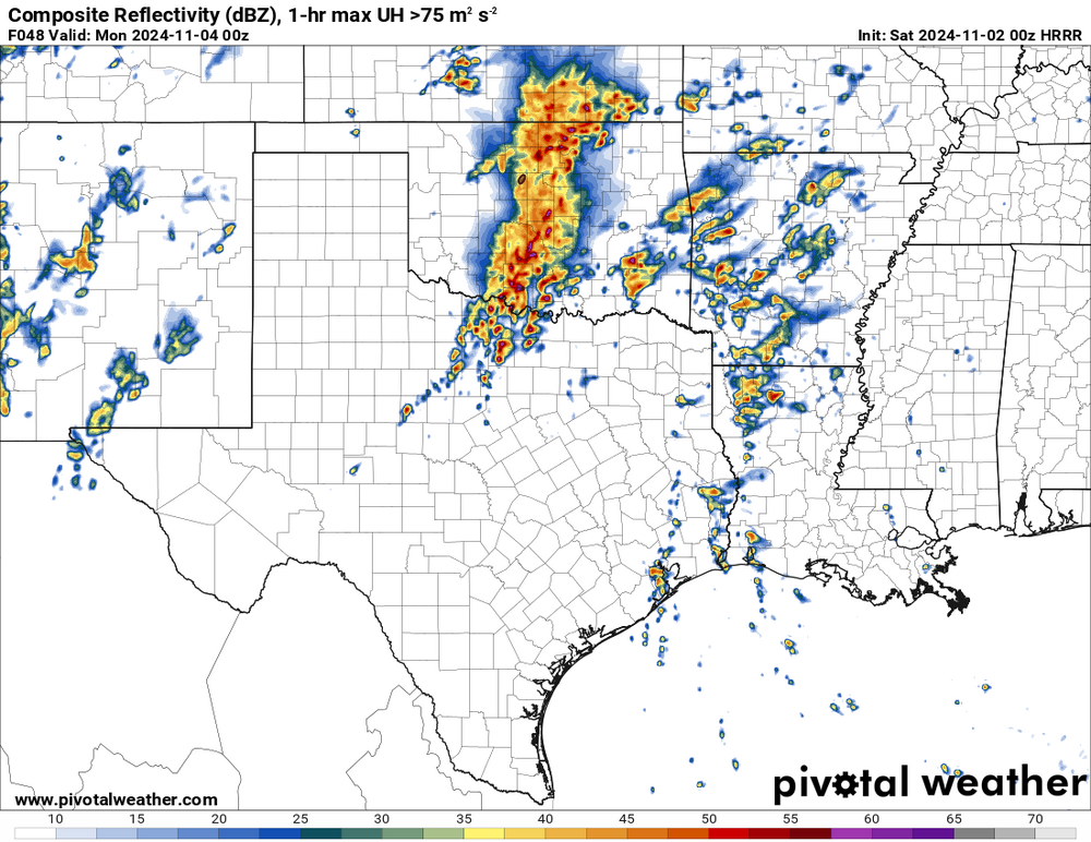
-
Plains States Observations and Discussion Thread
Chinook replied to lookingnorth's topic in Central/Western States
three slight risk effective outlooks