Chinook
-
Posts
10,080 -
Joined
-
Last visited
Content Type
Profiles
Blogs
Forums
American Weather
Media Demo
Store
Gallery
Everything posted by Chinook
-
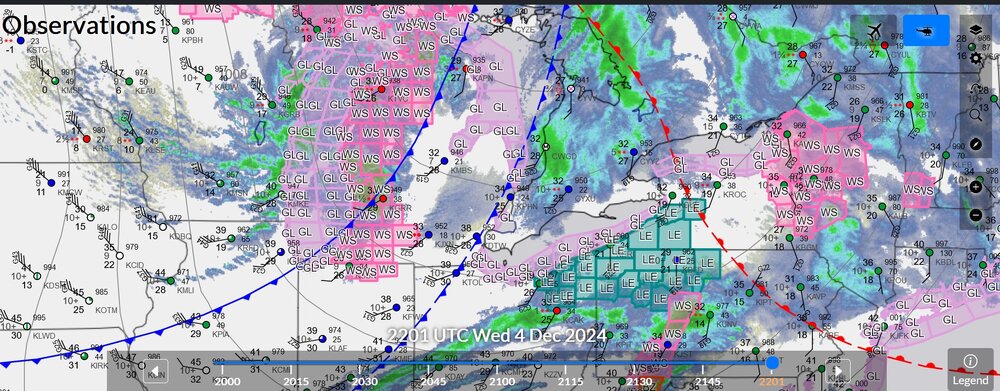
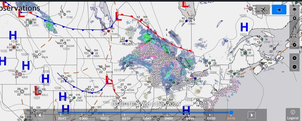
Lots happening
-
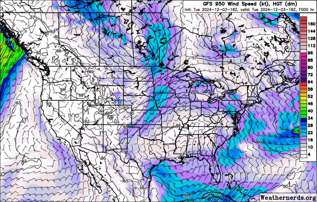
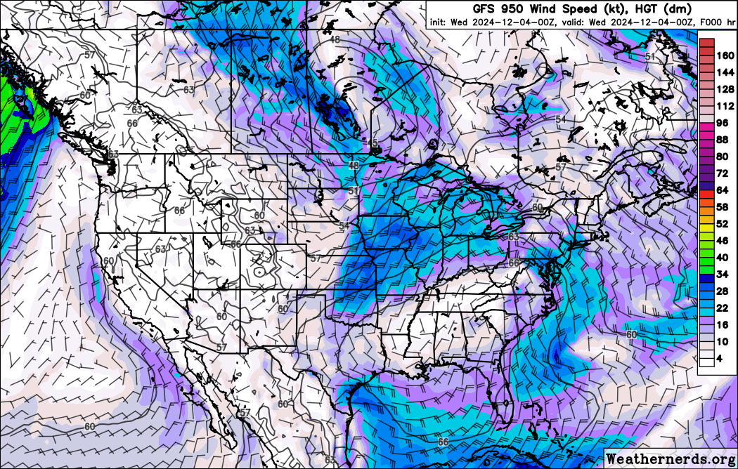
The clipper has really ramped up the NW winds in Manitoba, with up to 35kt winds at 900mb tonight in Manitoba and Saskatchewan. The cold air avoided us for so long, it's hard to believe the arctic blast is going to slide right in here. (Already measured 34kt, gale force, wind gusts at Brandon Manitoba)


-
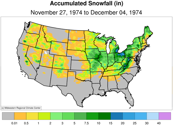
I made this map of a storm that happened 50 years ago, with marginal temps, and a cut off low, perfect for pulling some Atlantic moisture back to Detroit
-
that's excellent. I think that's from ice clouds in the lower atmosphere, right? (no water droplets)
-
flying a direct route from the North Pole to Chicago, it's Santa Claus, wait, no, just air.
-
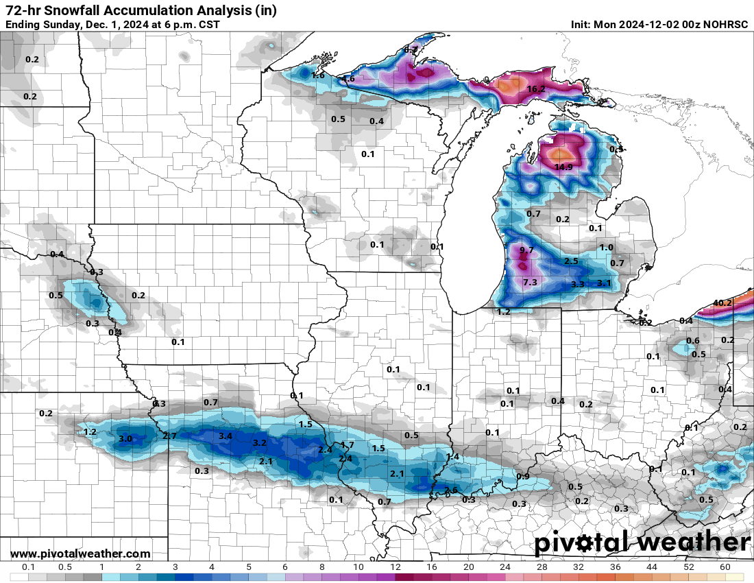
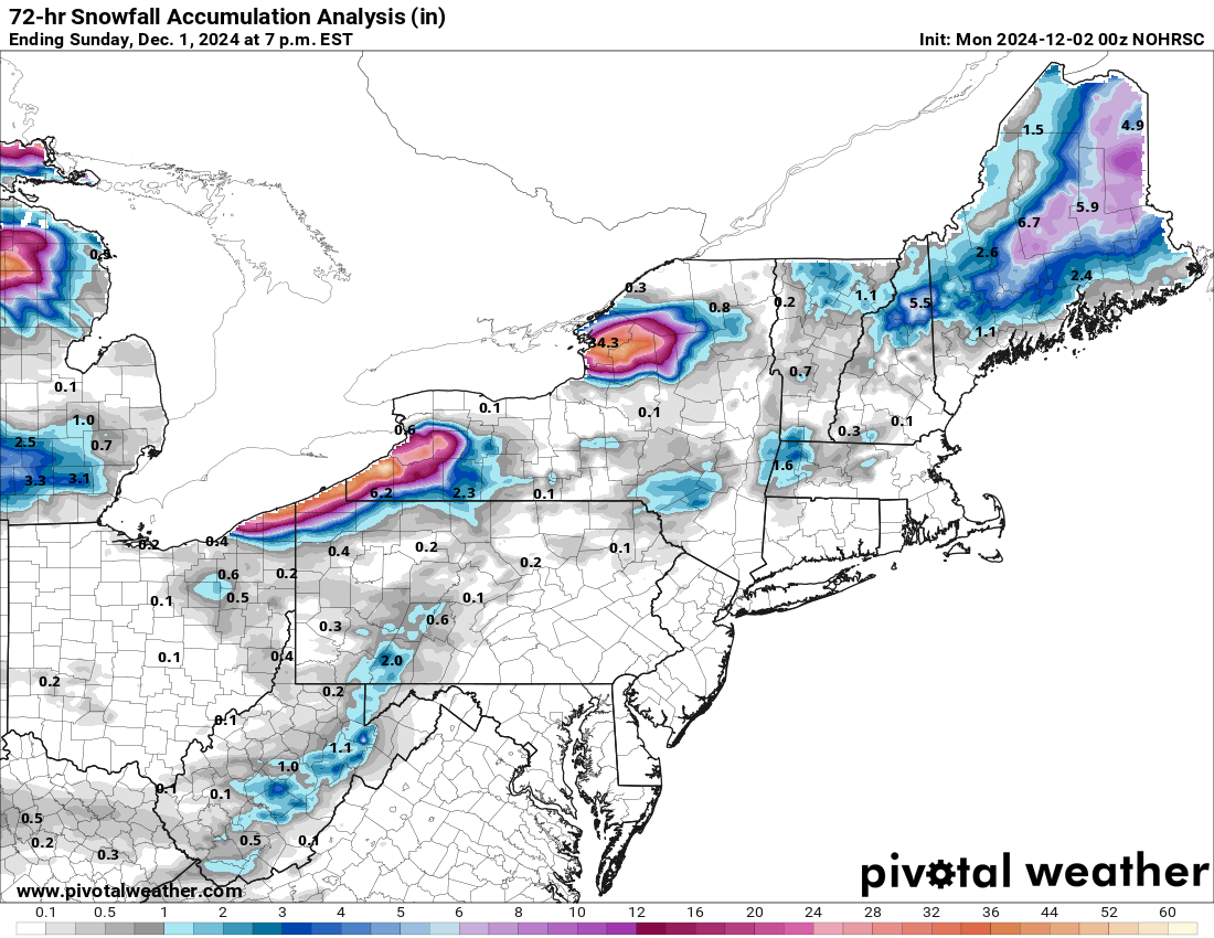
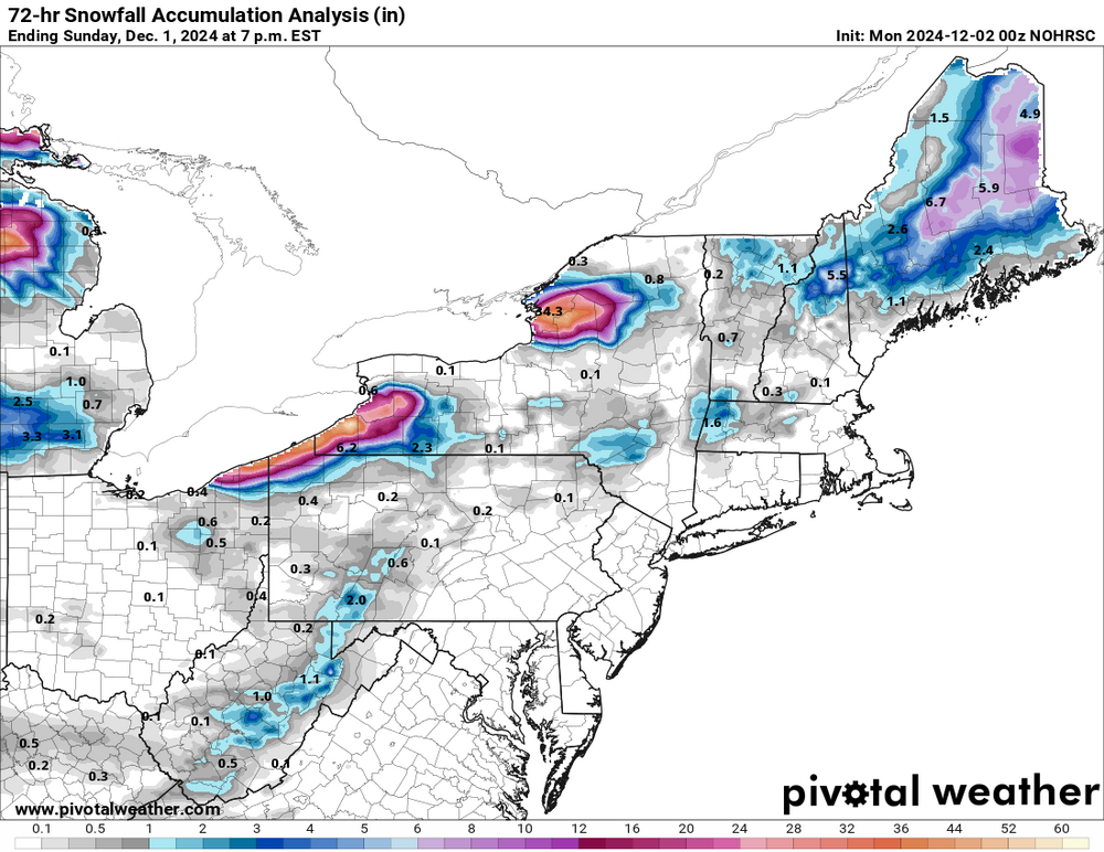
snowfall analysis, apparently updated at 00z, (and 12z) which I totally forgot about

-
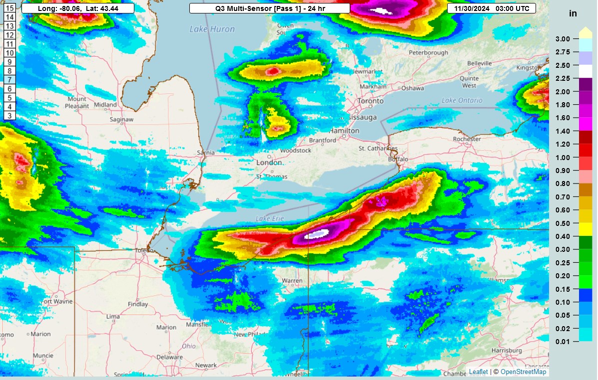
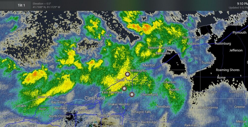
new precip since the LES started. I've seen local storm reports of 17"-22" at Erie PA, and nearby. (not sure if there's any more updates)

-
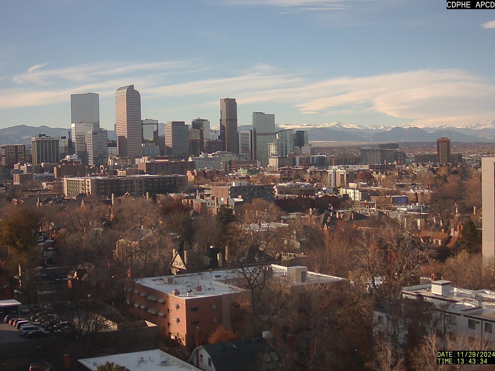
Got a bit of luck today on checking the web cams: lenticular north of Denver
-
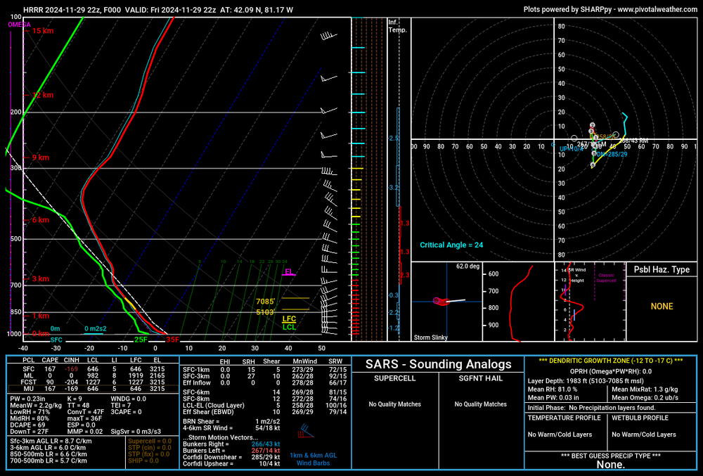
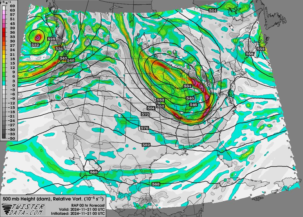
you don't always see a reasonable value of CAPE when the LES is going
-
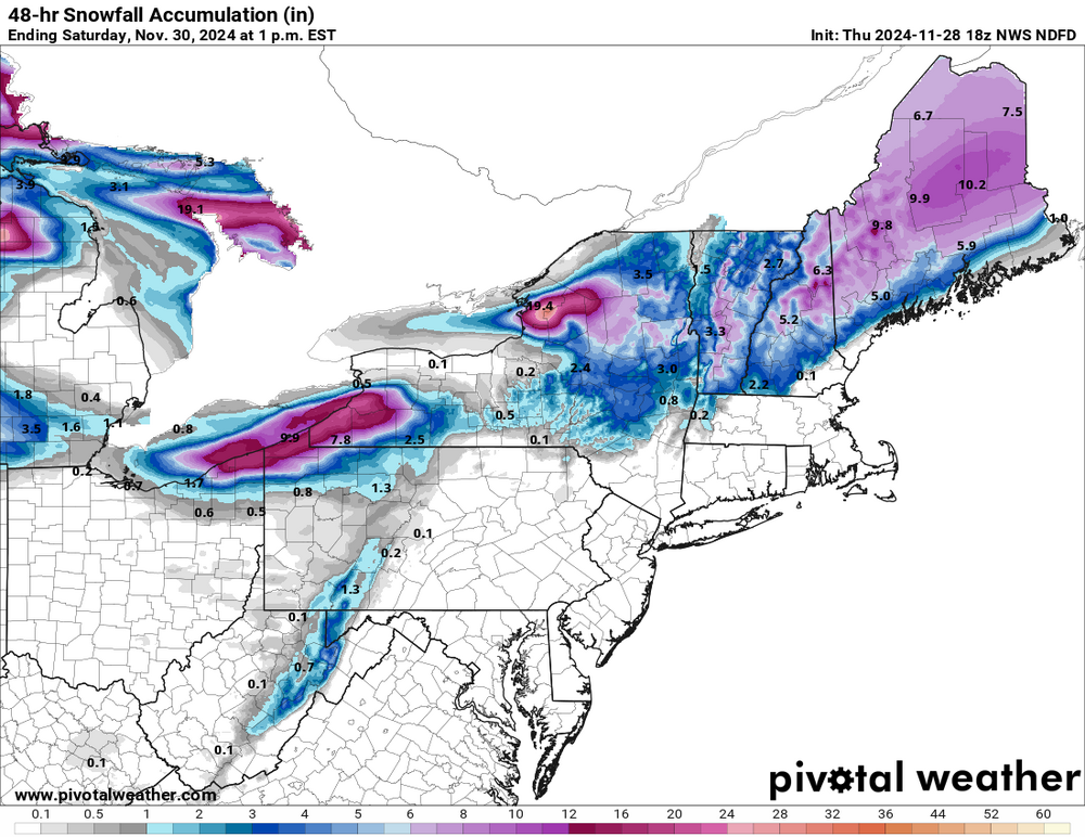
NWS official snowfall forecast (48hr)
-

Winter 2024-25 Medium/Long Range Discussion
Chinook replied to michsnowfreak's topic in Lakes/Ohio Valley
Looks like the high 500mb heights and warm 850mb temperatures in Russia and the Bering Sea are bumping the upper level features to be cold in North America.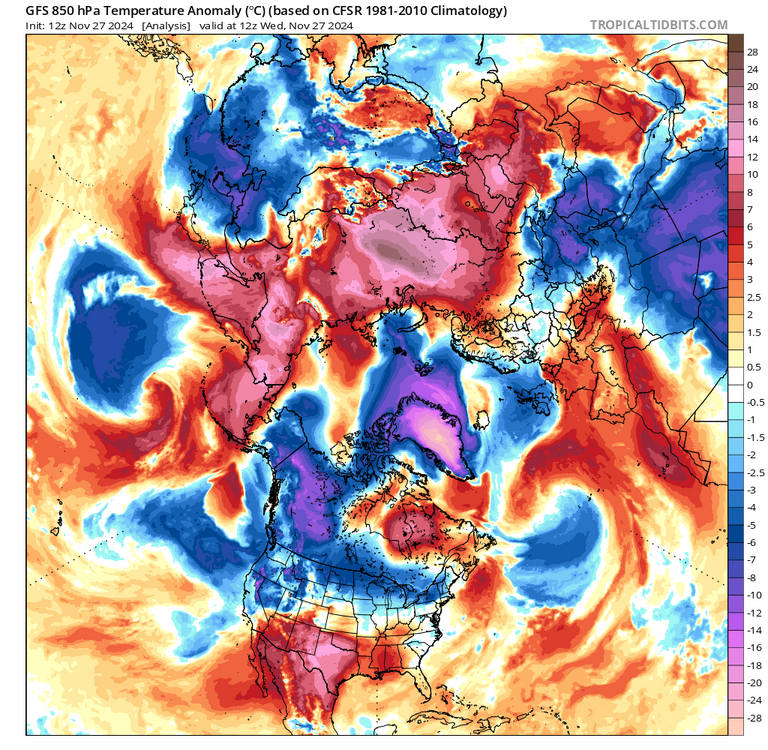
-
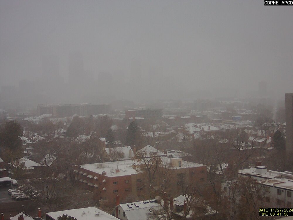
moderate snow at Denver International Airport right now
-
here are some rouge waves for Roguewaves

-
New winter storm warning above 9000 ft, also, winter storm watch and also an advisory for the Palmer Divide NAM/GFS have 40" for Crested Butte with over 3" of QPF
-
Winter 2024-25 Medium/Long Range Discussion
Chinook replied to michsnowfreak's topic in Lakes/Ohio Valley
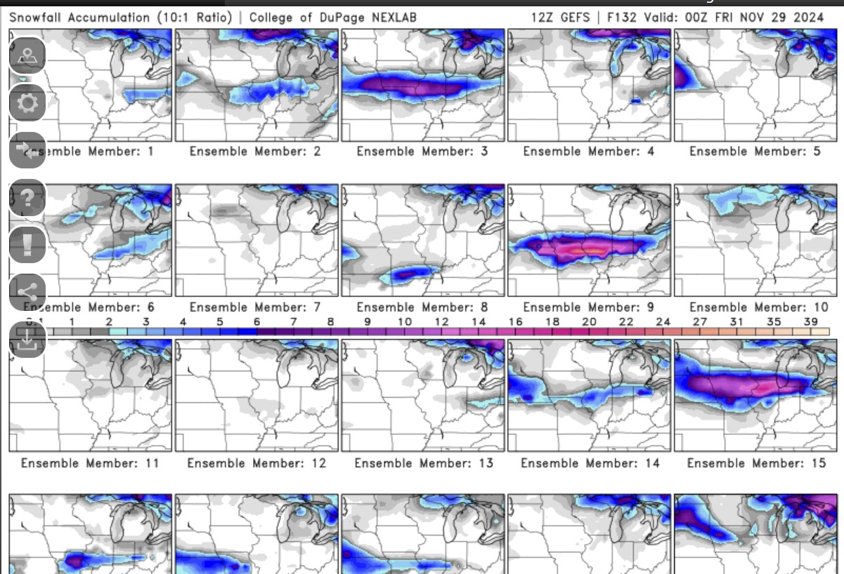
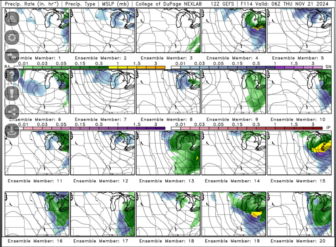
some crazy ensembles with some ensembles with heavy snow at Chicago, Indianapolis, almost St. Louis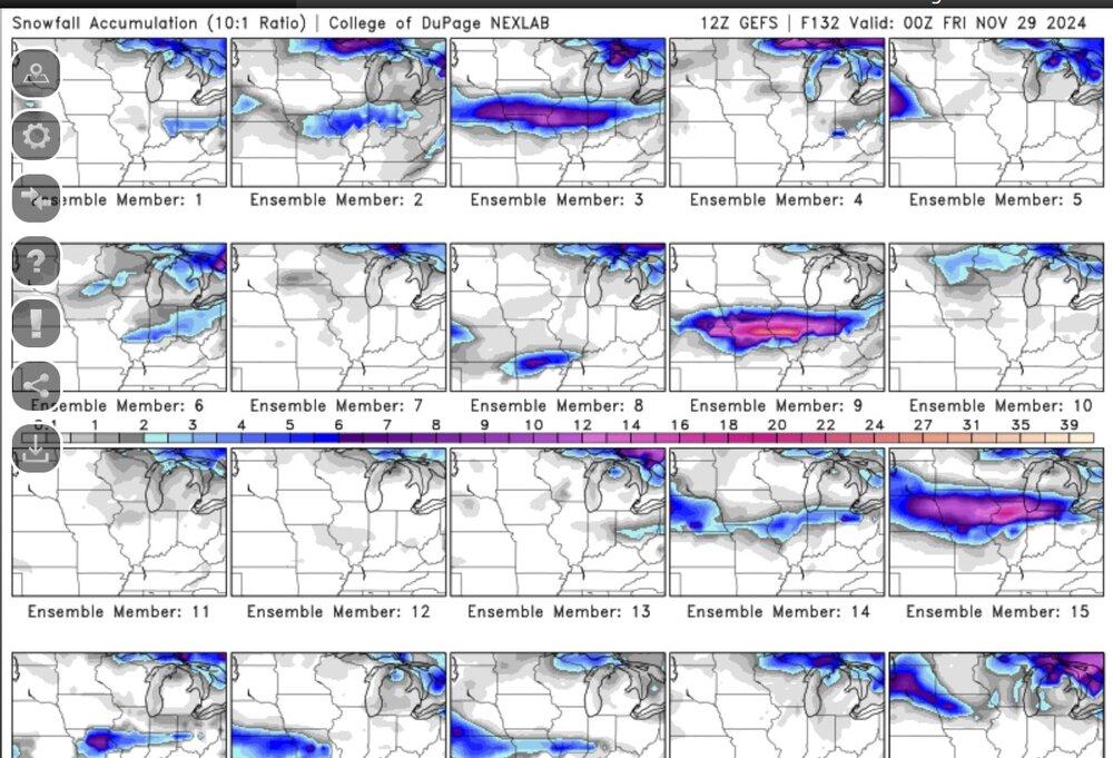
-
the football game is nothing but white!
-
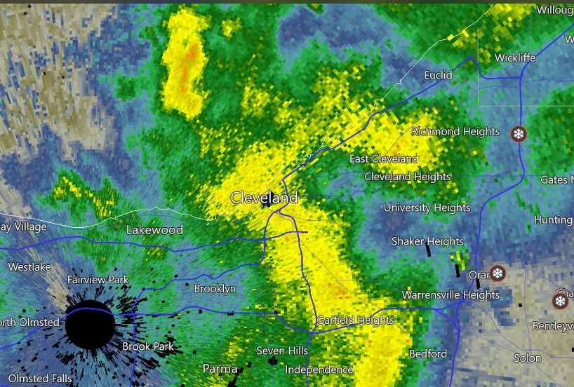
heavy snow bands near the football game tonight
-
This is a rapidly changing jet stream disturbance that's going to get the new low pressure going in Ontario, going backwards, as the rest of the trough goes forwards.

-
Let’s talk winter!! Ohio and surrounding states!! 24'-25'
Chinook replied to buckeye's topic in Lakes/Ohio Valley
I believe the 1864 storm is covered in "Thunder in the Heartland," by Thomas Schmidlin, weather historian. When I read that book, I didn't make any specific notes, as it was almost impossible to find a weather observation that I could have included on my web site. If you look at the Daily Weather Map archive from the government (back then it was the US Weather Bureau) you can only see back to 1871 (amazingly). -
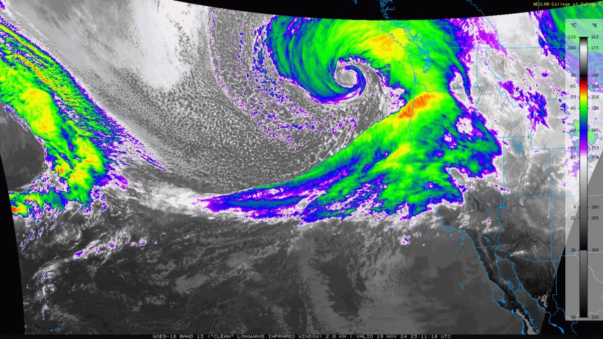
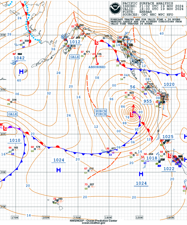
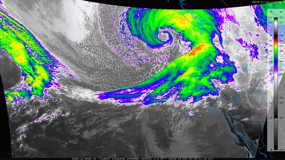
Sea-Tac had 55mph wind gusts from the ESE, and I have heard 500000 are without power around Seattle with similar circumstances with some easterly downslope winds. I've never seen a low pressure get down to 945mb so quickly unless it was a hurricane, I think.
-
blizzard warnings, hurricane force wind warning offshore, high wind warnings

-
this low was 1000mb at 06z
-
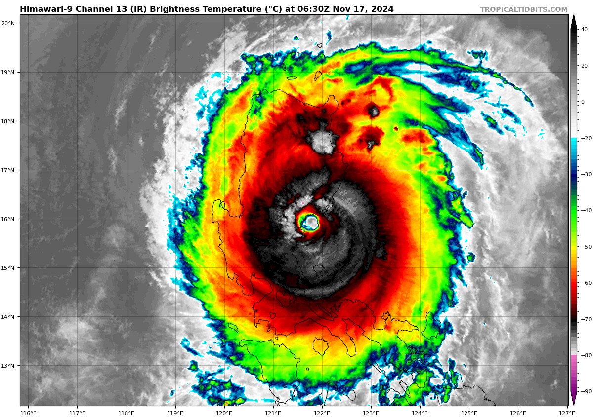
Typhoon Man-Yi: JTWC said 130 kts before landfall and 90 kts after landfall, with news reports saying 121mph(105 kts) at landfall. Here is the image at landfall.

-
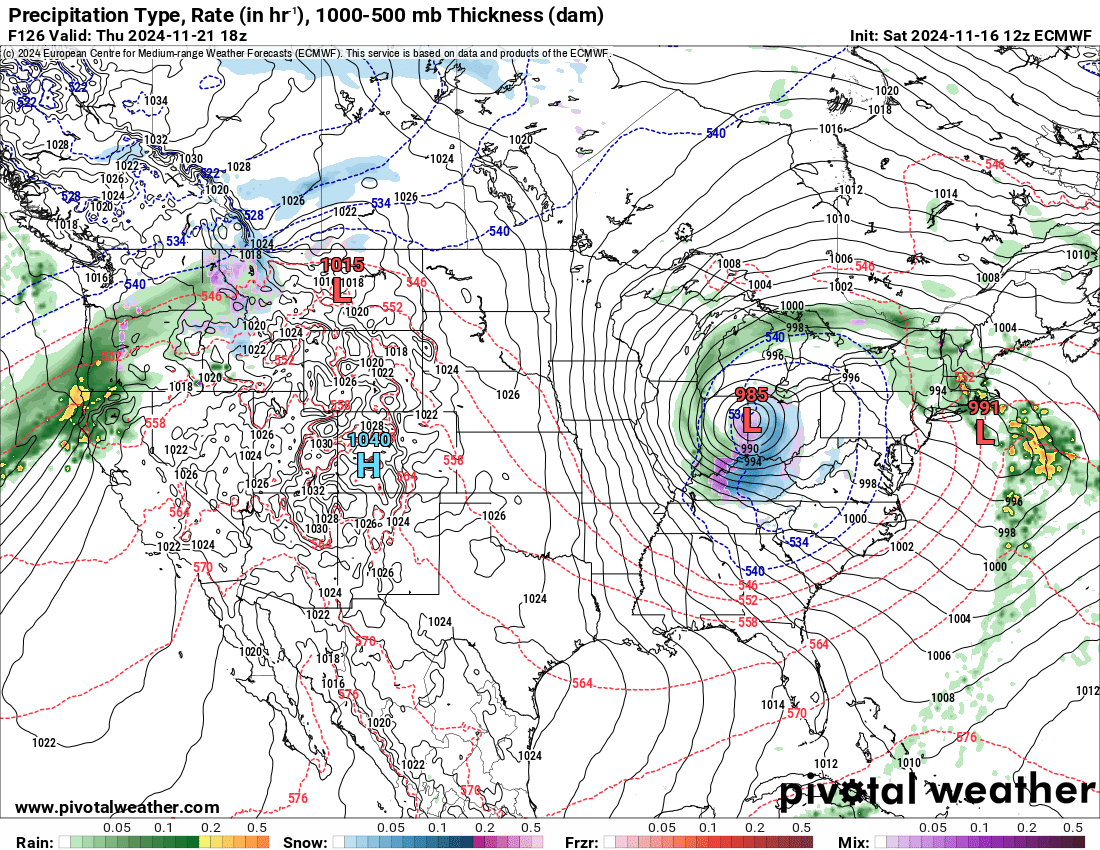
Some GEFS ensemble members and the ECMWF have a low pressure near Toledo or Detroit with snow to the south. I expect that models will take a few days to come to agreement on this dynamic system


-
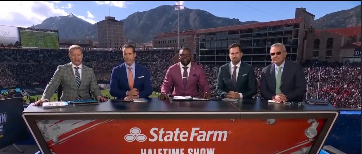
maybe it warmed up a bit at Boulder for these guys