Chinook
-
Posts
10,084 -
Joined
-
Last visited
Content Type
Profiles
Blogs
Forums
American Weather
Media Demo
Store
Gallery
Everything posted by Chinook
-
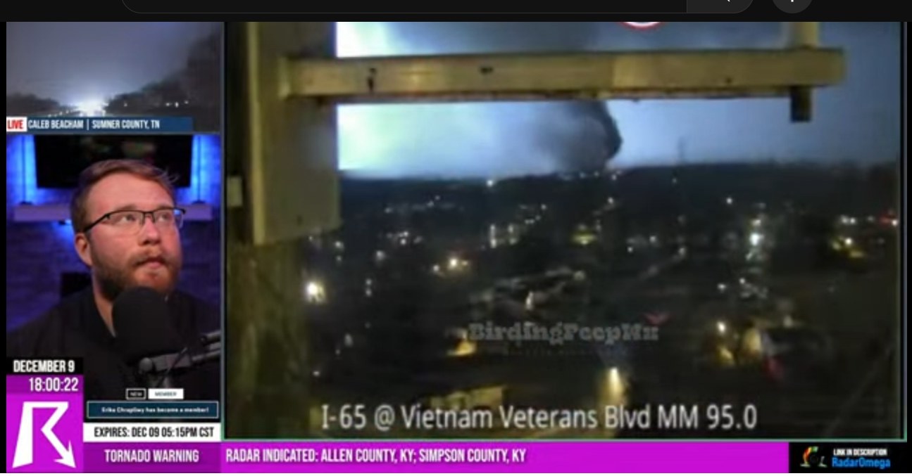
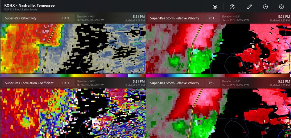
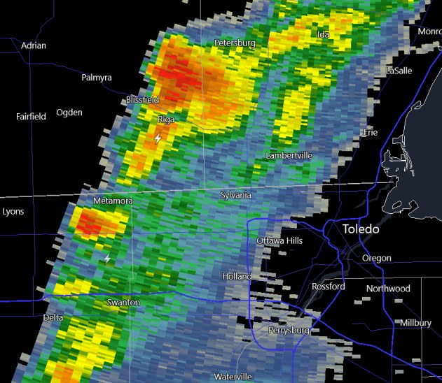
tornado video from Hendersonville

-
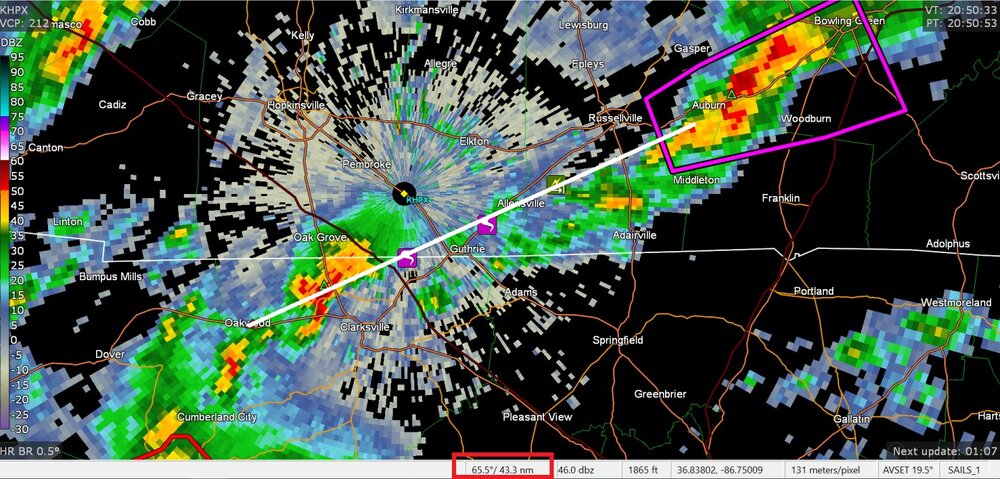
I think we have big debris at Hendersonville
-
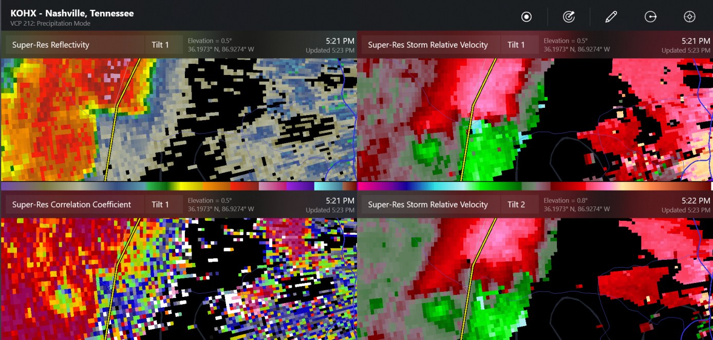
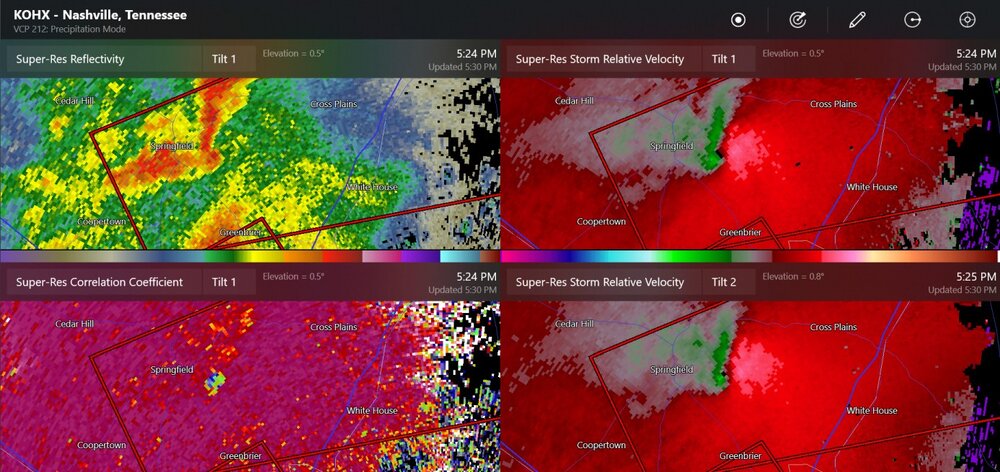
significant debris shown south and east of Springfield Tennessee
-
double rotation
-
tornado reported near Springfield, Tennessee
-
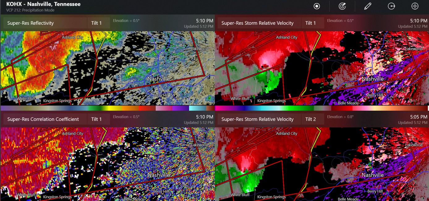
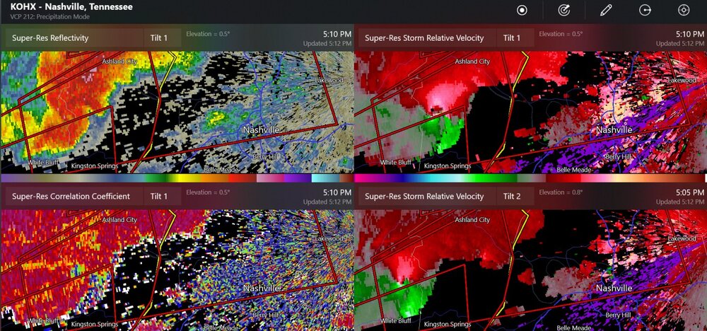
tornado debris for sure south of Ashland City now
-
new confirmed tornado here, about 24 miles west of Nashville
-
50 mile mesocylone track - how long was the tornado?
-
The debris signature isn't showing up anymore
-
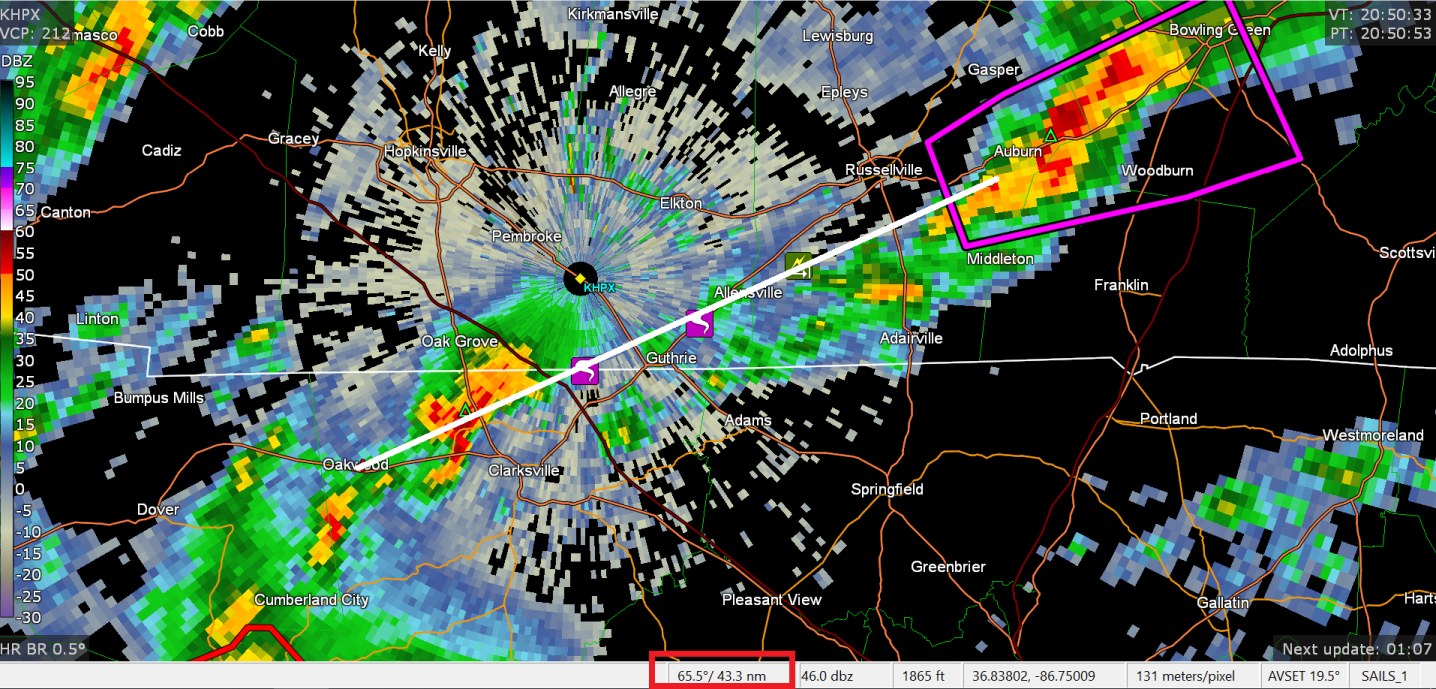
I have made some posts in Central/Western subforum. The tornadic storm has likely gone from Oakwood Tennessee to Auburn Kentucky almost.
-
it keeps going
-
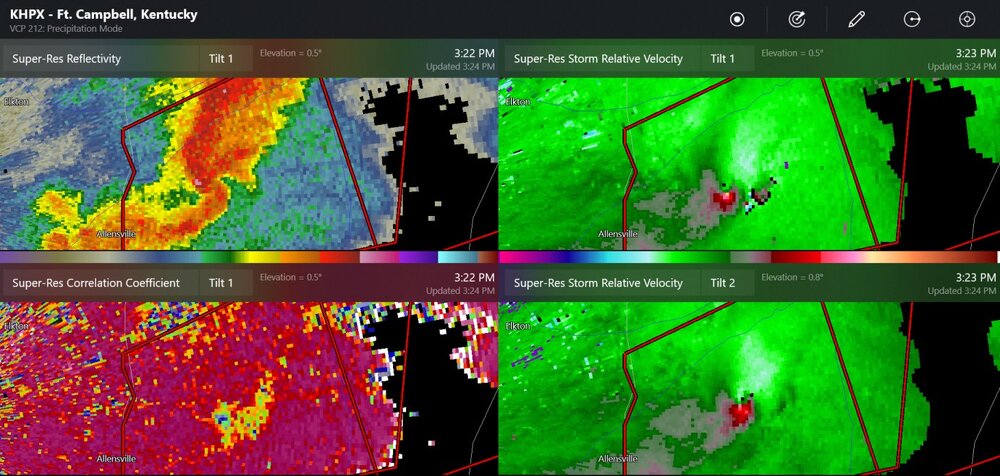
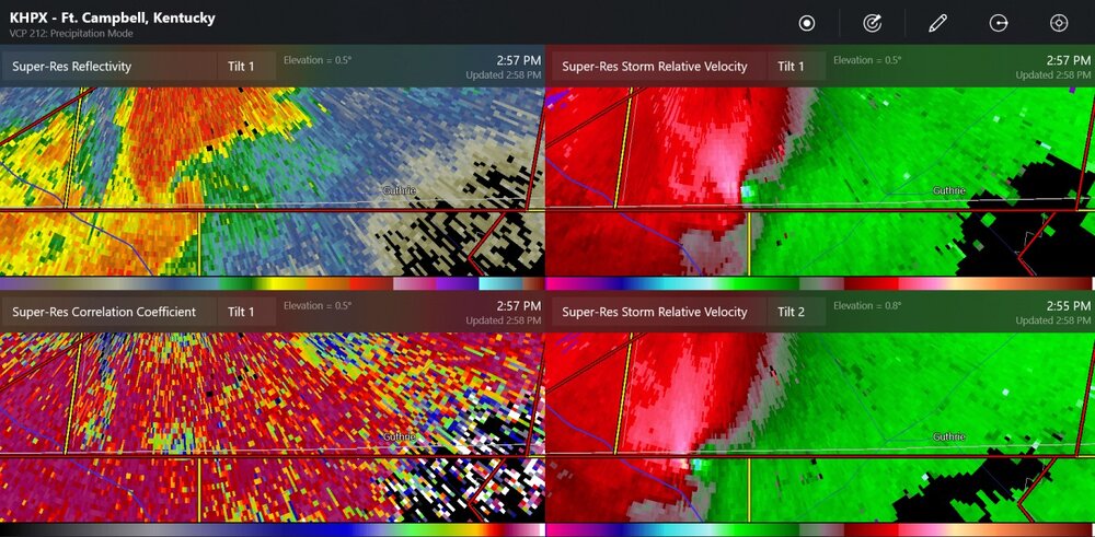
large debris signature near Guthrie Kentucky, probably in a rural area right now
-
possible tornado path is 12 miles already
-
ongoing tornado
-
tornadoes reported close to the Hopkinsville Kentucky radar site
-
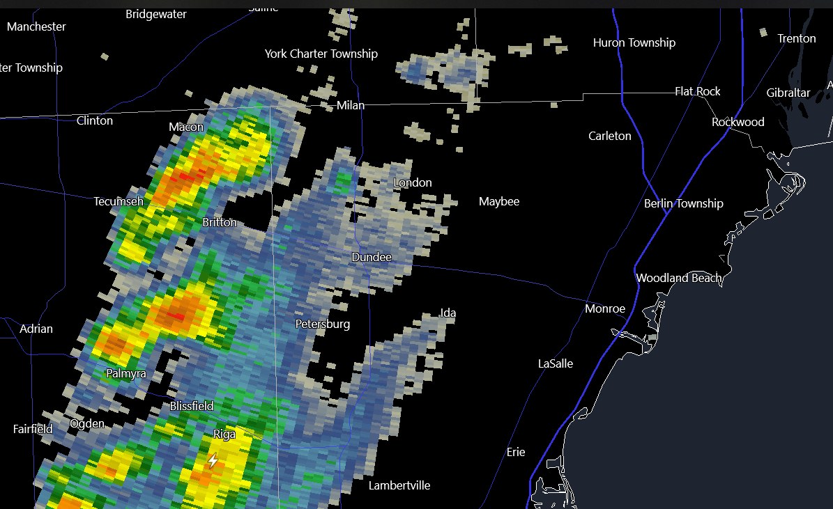
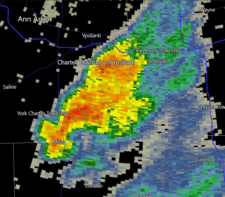
50dbz coming in towards Detroit Metro Airport
-
It's like it's trying to be a supercell. Oh well, not that much CAPE. Some c-g lightning in Ohio!
-
It's 60 degrees in December, before noon. Of course the cold front will be coming soon, but we may be still in the 50's up to 7:00PM. Models say winds are 47kt at 925mb. Toledo has measured max wind gusts to 33knots/38mph
-

Mountain West Discussion- cool season '23-24
Chinook replied to mayjawintastawm's topic in Central/Western States
I think there are just a few buildings and the weather station on Colorado Mines Peak, which might be 500ft above the Berthoud Pass parking lot and a few hundred feet east of it. It seems like this would be difficult to see from all angles. And how do they shovel snow at these things?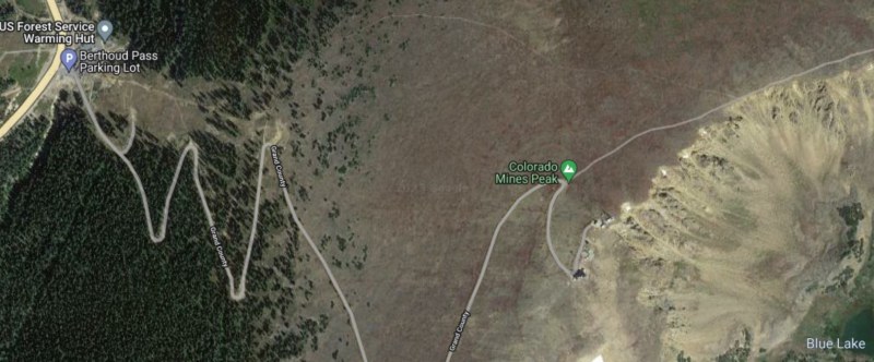
-
Mountain West Discussion- cool season '23-24
Chinook replied to mayjawintastawm's topic in Central/Western States
this what I posted on Great Lakes/Ohio Valley a couple of days ago. It's after I was explaining how I made a snowball in June 2022 at Cameron Pass before I left. -
Mountain West Discussion- cool season '23-24
Chinook replied to mayjawintastawm's topic in Central/Western States
This is not a way to transport in the cold air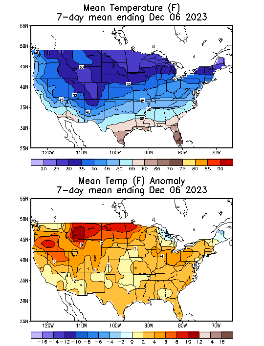
-
The models kind of suck. Look back at the 18z GFS from Monday, hour 126-132, high snow rates near Chicago.. then.. now. Even the ECMWF from 00z Tuesday (almost the same data) had snow for Chicago at 132hr.
-
Mountain West Discussion- cool season '23-24
Chinook replied to mayjawintastawm's topic in Central/Western States
It looks like it was in the 50's to even the 70's on the mid to northern plains. -
You know, this is just past the 49-year anniversary of the slow-moving storm that brought Detroit its snowiest snowstorm (Dec 1-2 1974). Key factor: pulling in moisture from the Atlantic.
-
Cameron is at 10276 and accumulates a lot of snow since it's in the north. I've seen two moose there and have heard others tell me they've seen moose. Some of the highest passes are 12000 like Independence. Monarch is 11300, Rocky Mountain Natl Park has 12108 but that's not a high-volume US highway for shipping and commerce. Berthoud pass is at 11300 on US 40, a main commerce road. If you've got a well-built SUV, and a lot of experience, you can drive an old mining road nearly all the way to Mt. Antero where the road stops at 13800. Then I-70 and US-6 almost go in the same spot but I-70 tunnels through Loveland Mountain (not to be confused with Loveland city.) If you like weather observations from METARS, K0CO (yes, that's right, mixed numbers and letters) is above Berthoud pass and pretty much just has a freezing blizzard all the time.