Chinook
-
Posts
10,084 -
Joined
-
Last visited
Content Type
Profiles
Blogs
Forums
American Weather
Media Demo
Store
Gallery
Everything posted by Chinook
-

Mountain West Discussion- cool season '23-24
Chinook replied to mayjawintastawm's topic in Central/Western States
This is the storm that will lend its energy to the Western USA storm. And the models may or may not have read the upper air information from the Pacific really well. We will see what happens.
-
Mountain West Discussion- cool season '23-24
Chinook replied to mayjawintastawm's topic in Central/Western States
Model ensembles/NWS-WPC definitely have a lot of QPF for the West, including the Front Range -
Mountain West Discussion- cool season '23-24
Chinook replied to mayjawintastawm's topic in Central/Western States
The Euro and Canadian both have the big storm next week. It's probably way too early to discuss details, but both of these models have temperatures at just freezing. -
Toledo is up to 4.22" perhaps on the top-10 list but I'm not sure. On the positive side of things, there's no D1 drought category here anymore. Still hoping for some drought to be busted by El Nino systems in the Southwest, which could be upcoming
-
Mountain West Discussion- cool season '23-24
Chinook replied to mayjawintastawm's topic in Central/Western States
This is a strange weather pattern. There will be some version of an omega-block. Who knows how the snow/rain will happen in the Southwest.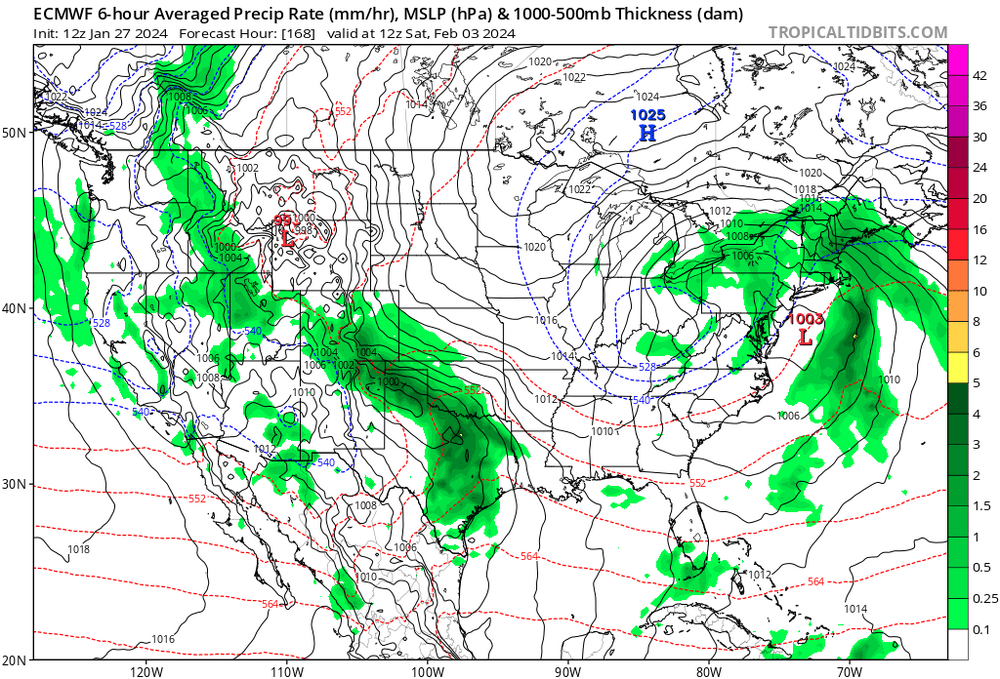
-
It is certainly this is an interesting question. Another thing related to this: As of recent years, I heard advisories are going to be phased out of the NWS entirely 2024. But it's 2024 now. I wonder if somebody can comment on that Toledo had pea-soup fog with rain or drizzle in a lot of hours today
-
Hope you guys survived the storm.
-
January 22-23 Potential Ice Event
Chinook replied to HillsdaleMIWeather's topic in Lakes/Ohio Valley
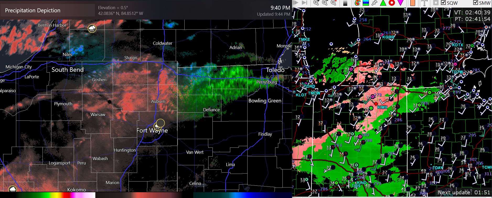
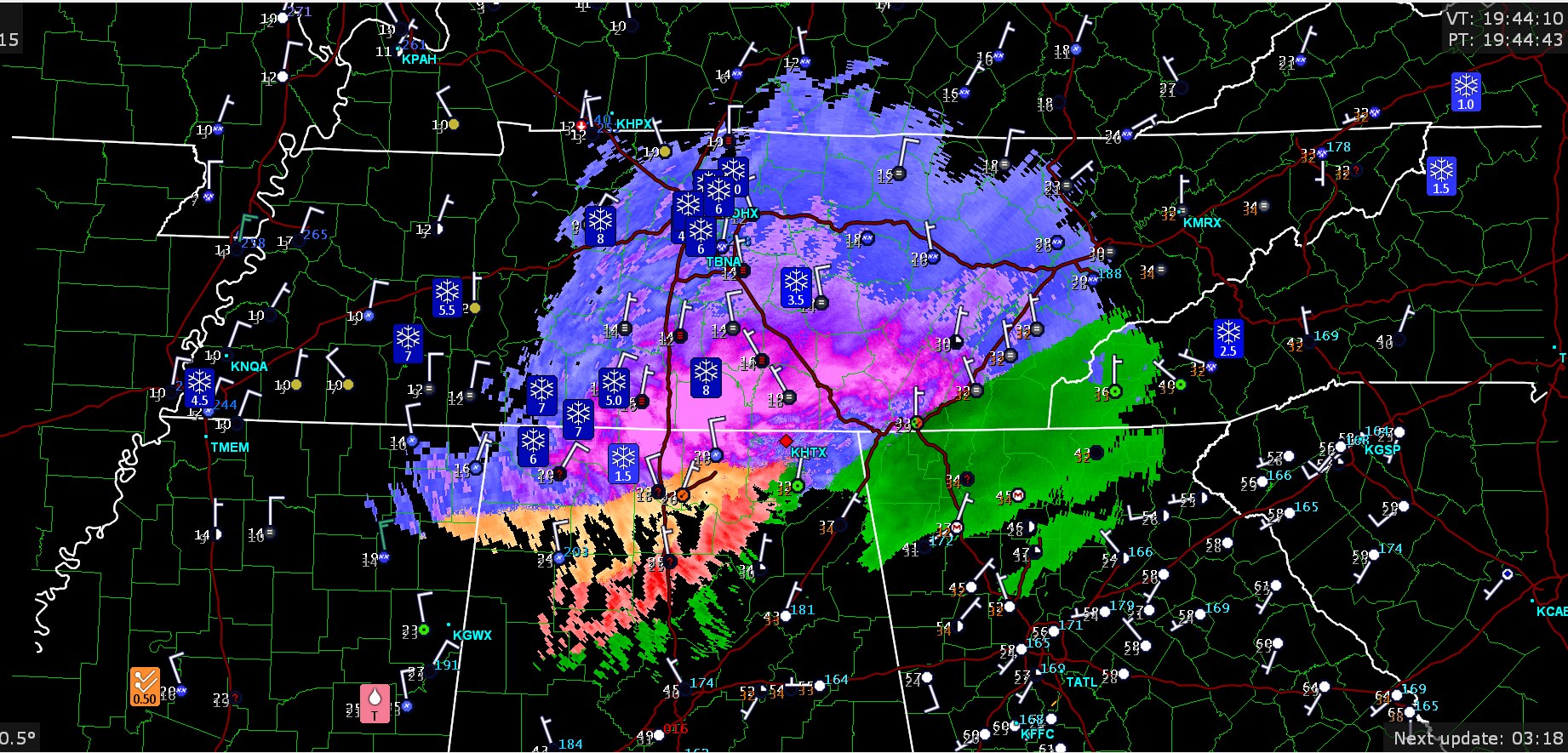
here's a comparison of the precipitation type on Radarscope and GRLevel3. one Mping report says icy sidewalks at Fort Wayne
-
January 22-23 Potential Ice Event
Chinook replied to HillsdaleMIWeather's topic in Lakes/Ohio Valley
The newest HRRR says 0 to 0.15" freezing rain for Toledo and up into the 0.30" range north of town. -
Mountain West Discussion- cool season '23-24
Chinook replied to mayjawintastawm's topic in Central/Western States
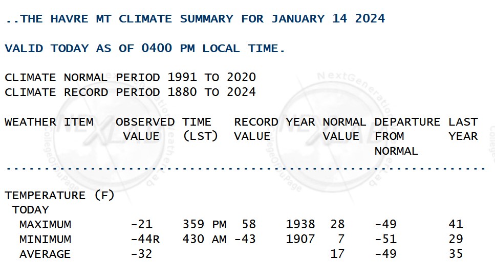
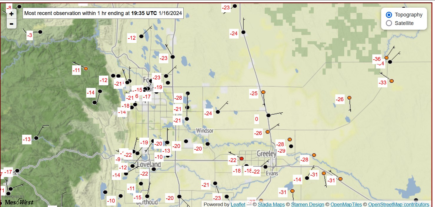
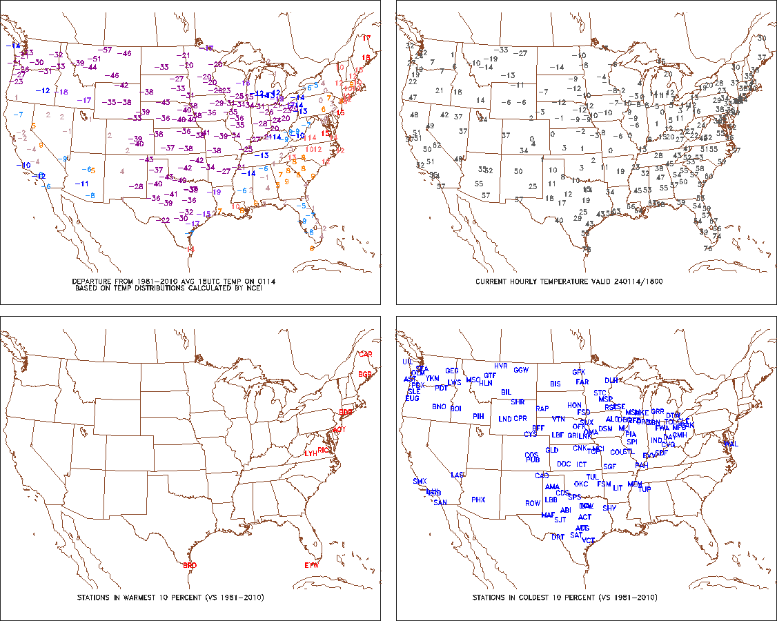
By the way I found this the other day. I don't believe I saw any observation of a -36 on the Platte River area in the entire time I lived there.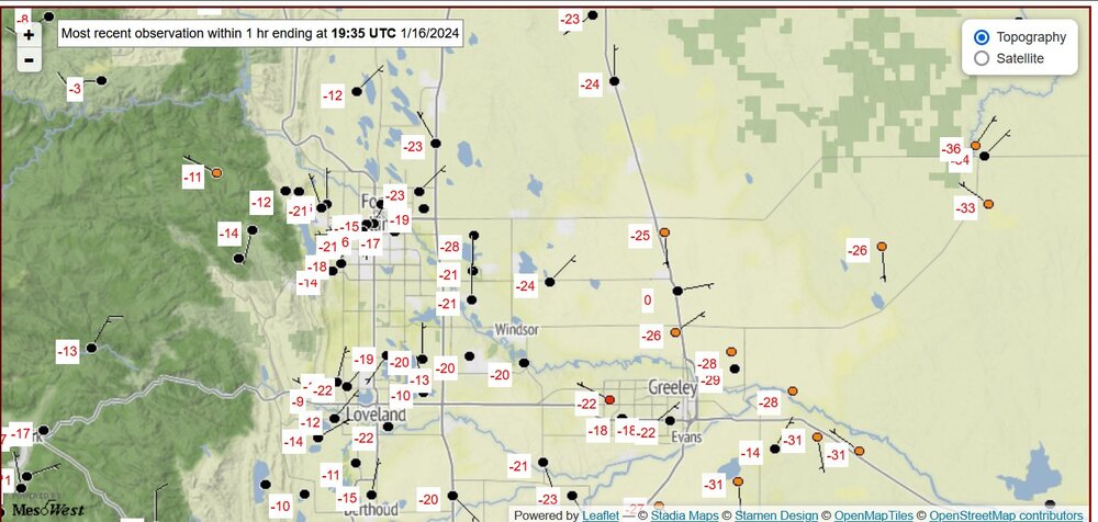
-
I think that areas that are already 6F or more below normal from Jan 1-21 don't have a big chance to turn it into a positive for the month, because it would take something like a +12F for Jan 22-31 to undo it.
-
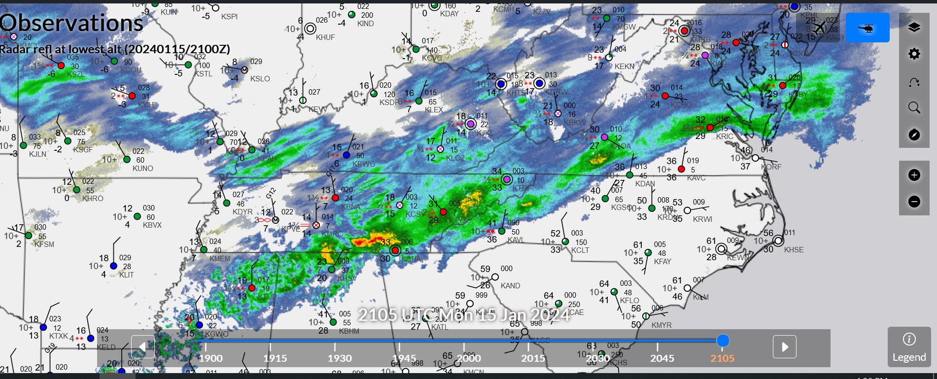
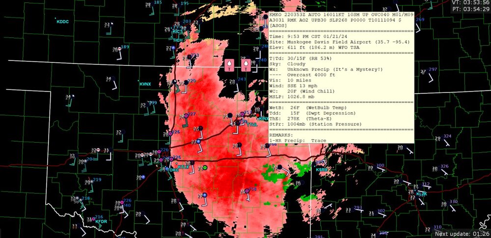
freezing rain or "unknown precipitation" (possibly sleet) hitting the area
-
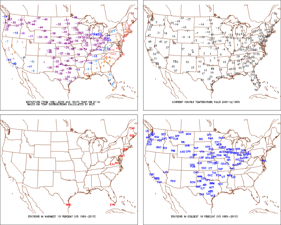
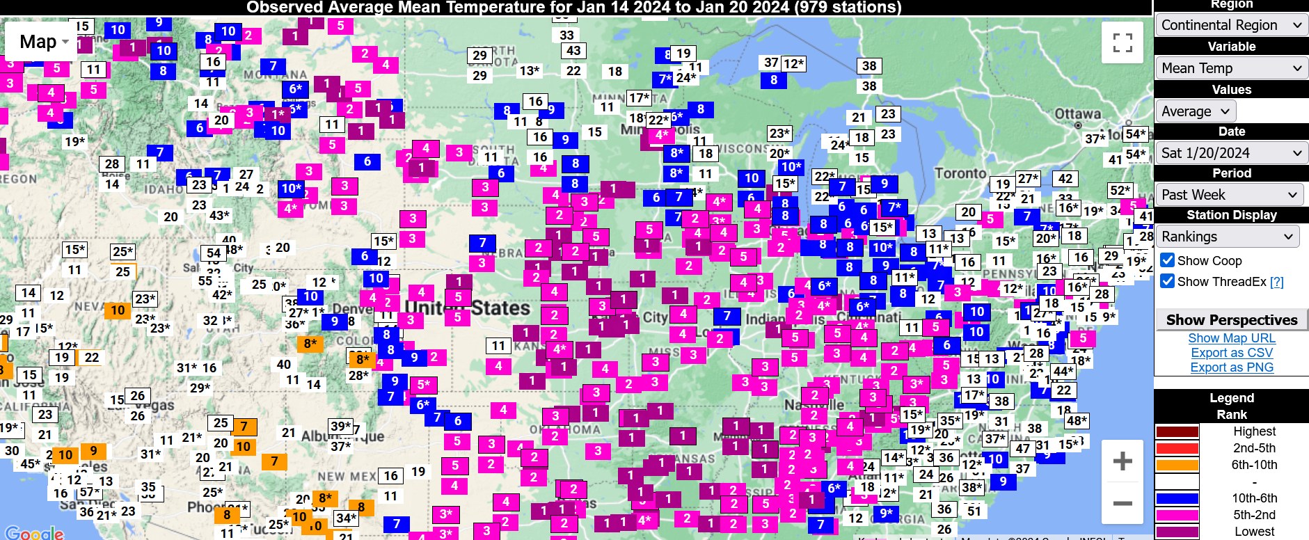
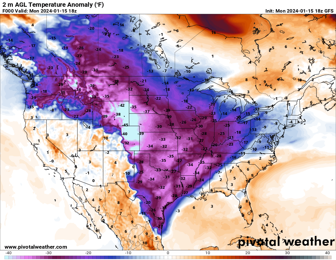
Highly varied areas had their lowest Jan 14-20 7-day average temperature

-
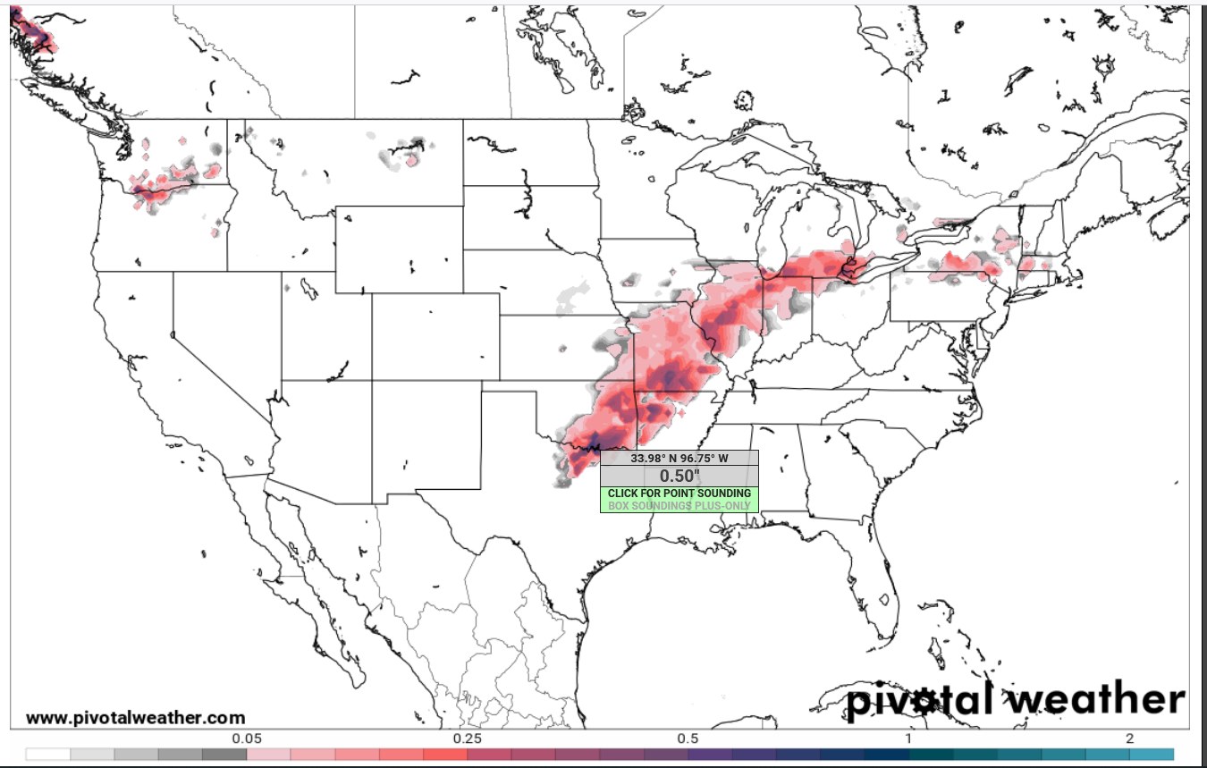
Freezing rain and sleet starting in Oklahoma, with maybe a bit of drizzle/32 in Texas

-
It's usually bad news if the GFS forecasts a lot of freezing rain. The NAM usually likes to overdo freezing rain QPF and/or freezing rain accumulation on ground.

-
Did Someone Say Clipper(Hybrid)!?! 1/18-1/19
Chinook replied to Frog Town's topic in Lakes/Ohio Valley
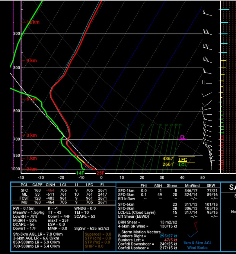
This was HRRR sounding with the max CAPE for Lake Michigan today. This is significant, for wintertime, sfc-700mb CAPE. In the old days, it was difficult to get the NAM soundings to show this realistically. Hmm the values displayed on here are 53 J/kg for 3CAPE but 163 J/kg for MUCAPE, so that doesn't really match up. I don't really know how that happened.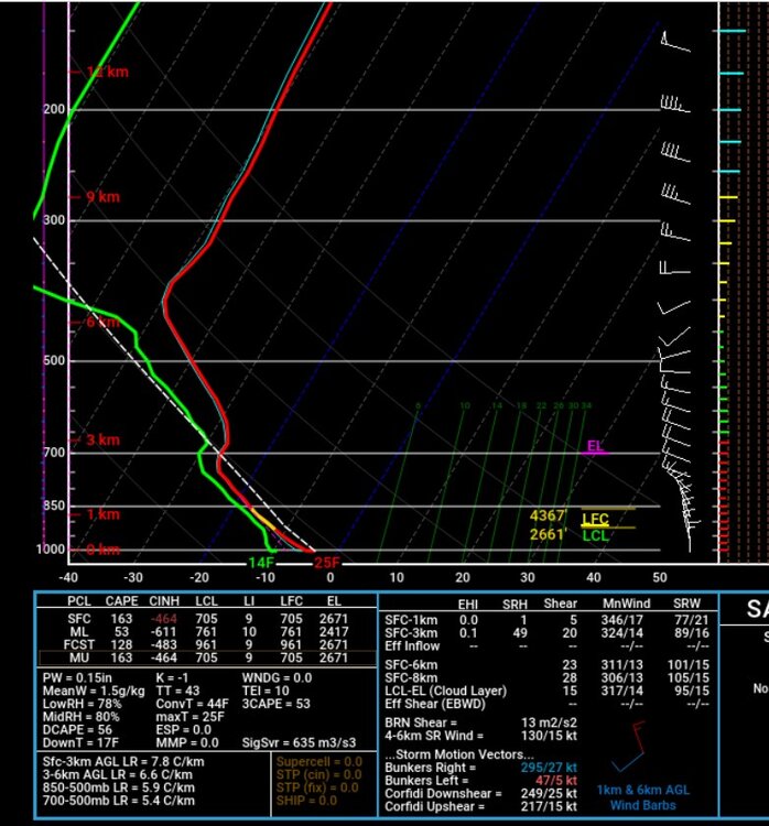
-
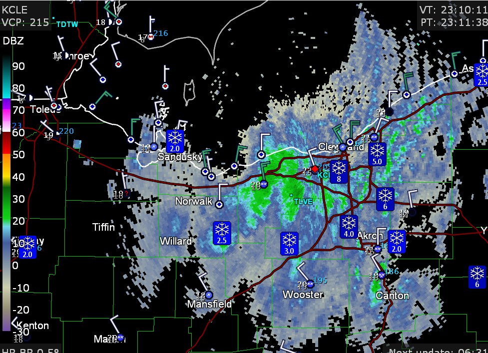
My area got 1.5-2.0" with maybe a few bits of enhancement from Lake Huron, as the clouds and the light snow stuck around. Here's the radar with some storm reports around snowy Cleveland tonight.
-
A lot has happened this month. Here are my loops of the previous couple of weeks. I didn't save quite as many 500mb maps, since the initial Nor'easter of the month actually wasn't that interesting at 500mb. https://great-lakes-salsite.web.app/Jan_1_17_2024_250mb_loop.html https://great-lakes-salsite.web.app/Jan_6_17_2024_surface_loop.html https://great-lakes-salsite.web.app/Jan_8_17_2024_500mb_loop.html
-
Did Someone Say Clipper(Hybrid)!?! 1/18-1/19
Chinook replied to Frog Town's topic in Lakes/Ohio Valley
The GFS has about 0.1" QPF by 18z or 1:00PM, but the NAM 12km/3km have less, like 0.01" to 0.03" QPF by that time, but the HRRR gets snowier by 18z. So I guess it's a bit of a battle of NAM vs everybody. It's been kind of a long time since I actually went down to the 0.01" values of QPF to actually care about something, because, you know, rain doesn't make a sheet of ice. -
Did Someone Say Clipper(Hybrid)!?! 1/18-1/19
Chinook replied to Frog Town's topic in Lakes/Ohio Valley
Here's the newest NWS snow map, which is sort of non-continuous around Toledo. It's much higher than the approximately 1" that last night's models were saying.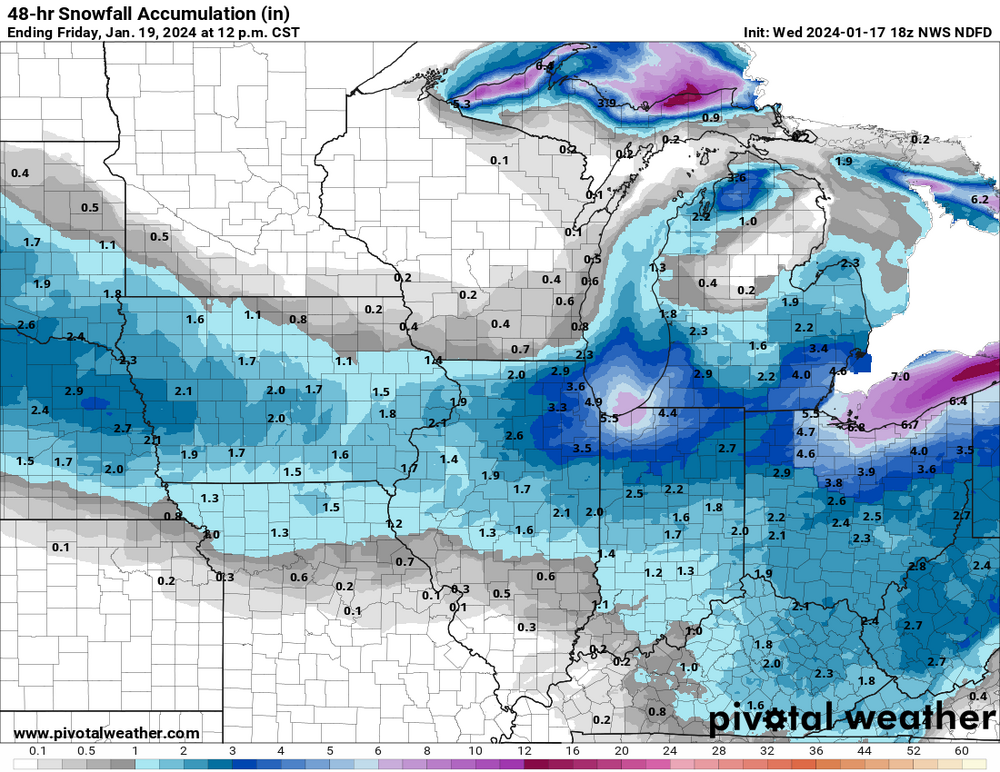
-
Mountain West Discussion- cool season '23-24
Chinook replied to mayjawintastawm's topic in Central/Western States
you guys were off the bottom end of the color-bar in January.
-
January 15th-17th 2024 Arctic Blast/Snow Event
Chinook replied to John1122's topic in Tennessee Valley
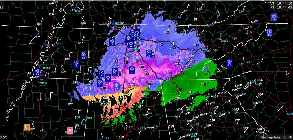
impressive amount of snow in the south
-
Mountain West Discussion- cool season '23-24
Chinook replied to mayjawintastawm's topic in Central/Western States
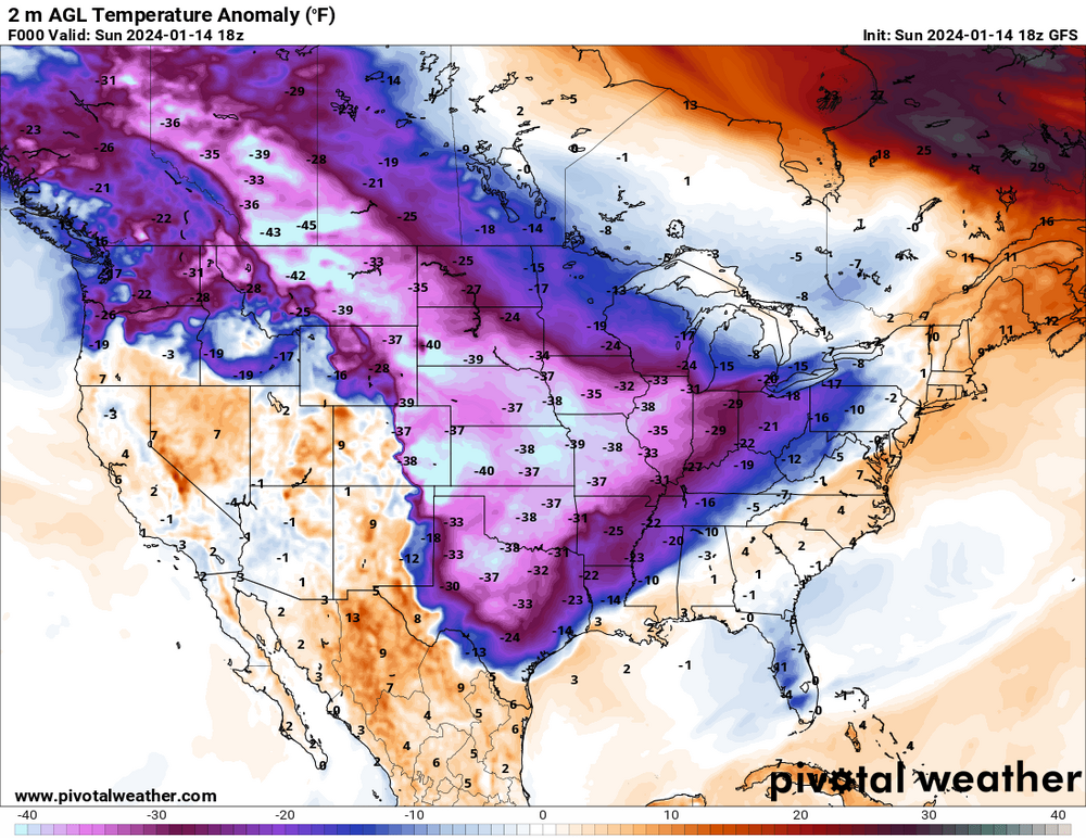
when -57 is a number that's not in Siberia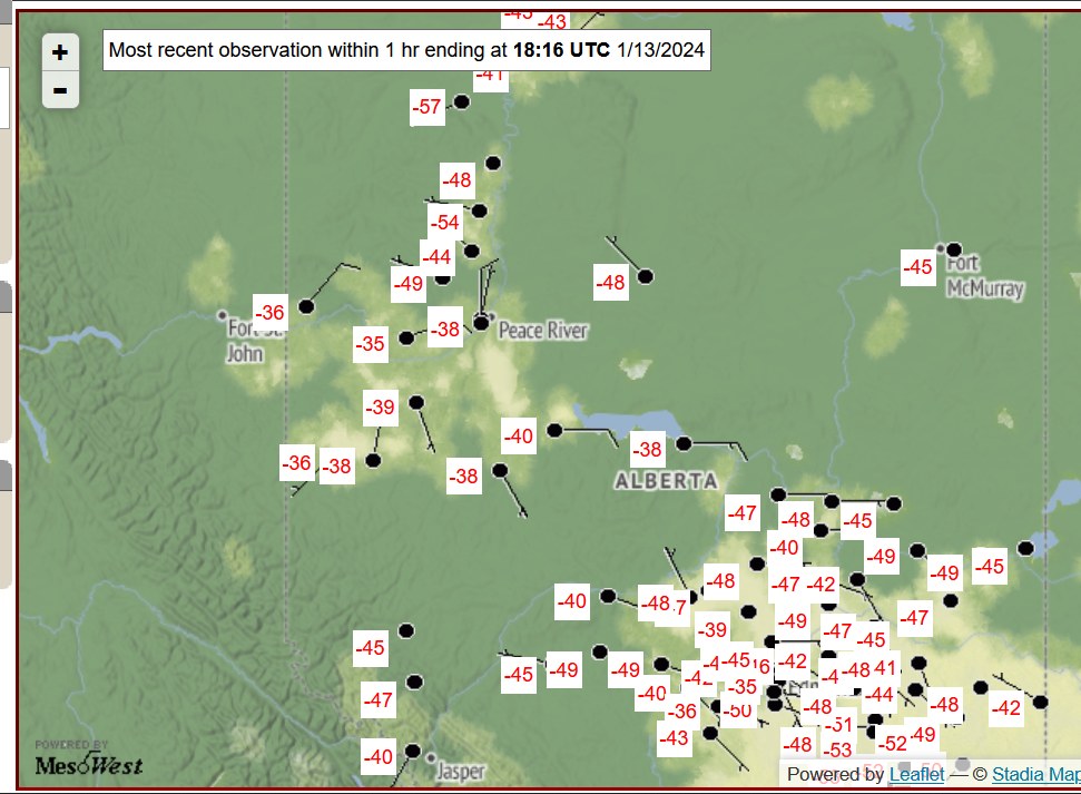
-
Mountain West Discussion- cool season '23-24
Chinook replied to mayjawintastawm's topic in Central/Western States
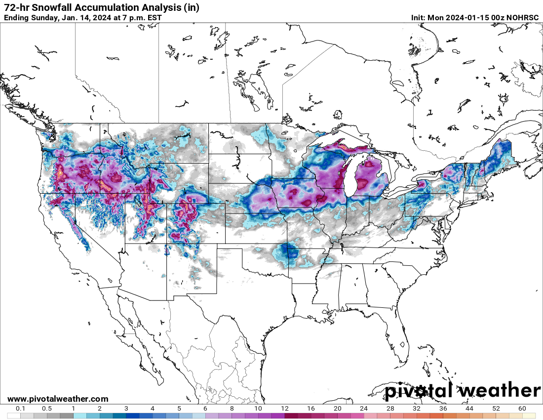
Here is what I was talking about with the Portland area, intermountain area snow, up to and including RMNP
-
This has been pretty historic in the sense that you don't see a lot of -40F to -50F in North America, outside of Alaska. Also some large snowfall values from Oregon (also freezing rain there) to Idaho, Utah, and Colorado (in addition to what we've been discussing here)