Chinook
-
Posts
10,081 -
Joined
-
Last visited
Content Type
Profiles
Blogs
Forums
American Weather
Media Demo
Store
Gallery
Everything posted by Chinook
-

Mountain West Discussion- cool season '23-24
Chinook replied to mayjawintastawm's topic in Central/Western States
5 years ago: (mar 13 2019) was NOT the big one (that is 2021), but a plains blizzard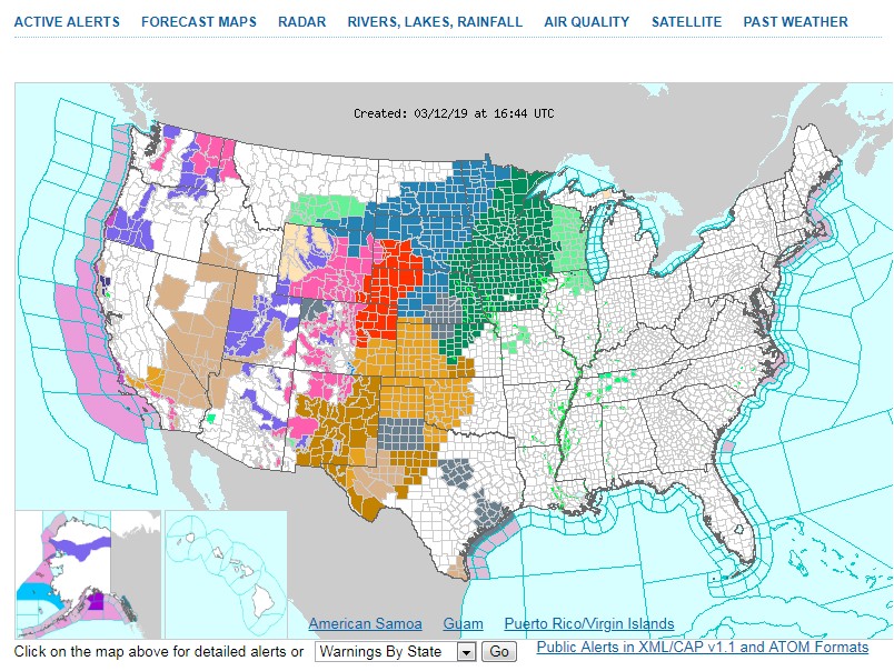
-
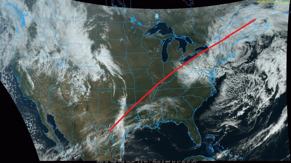
if the eclipse were right now
-
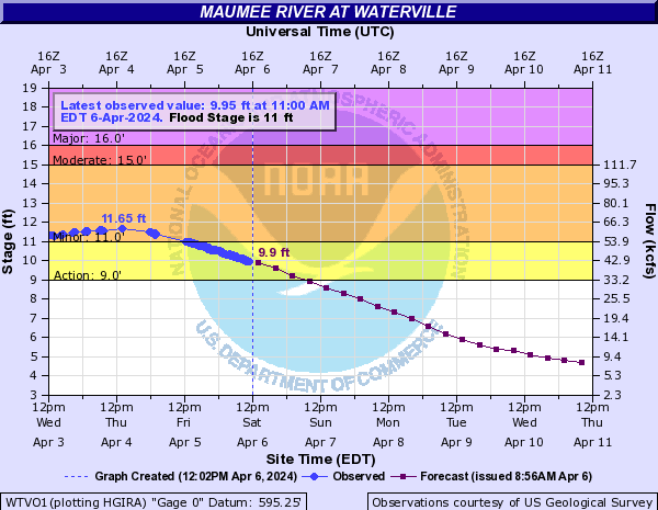
I haven't seen a flood for a while. apparently we got 0.5ft over minor flood stage
-
Mountain West Discussion- cool season '23-24
Chinook replied to mayjawintastawm's topic in Central/Western States
this is more of a cold upper-air event, which might be called a "bora," which is one of two downslope wind types (katabatic and adiabatic, Foehn and Bora, from the Alps in Europe.) NW wind gusts of 41 kt next to SE wind gusts of 38 kt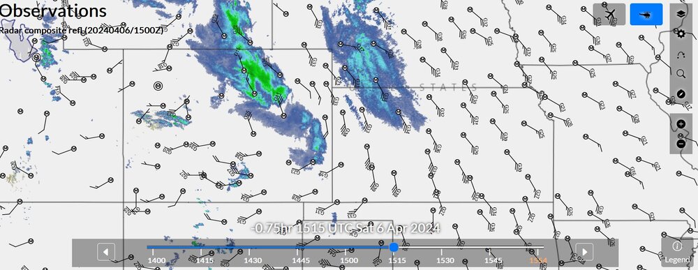
-
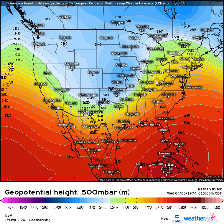
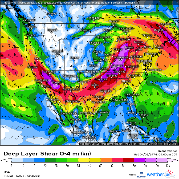
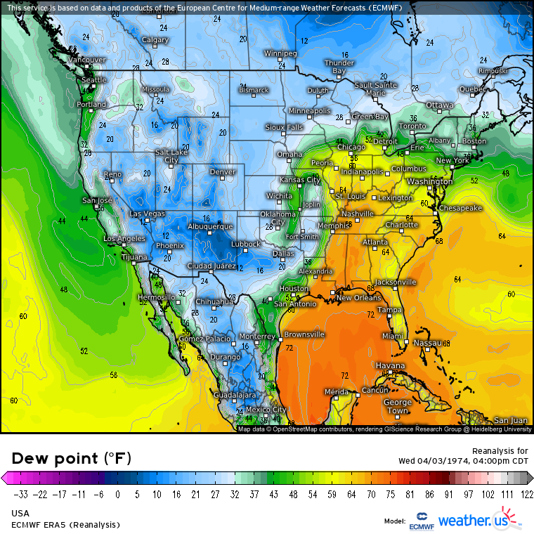
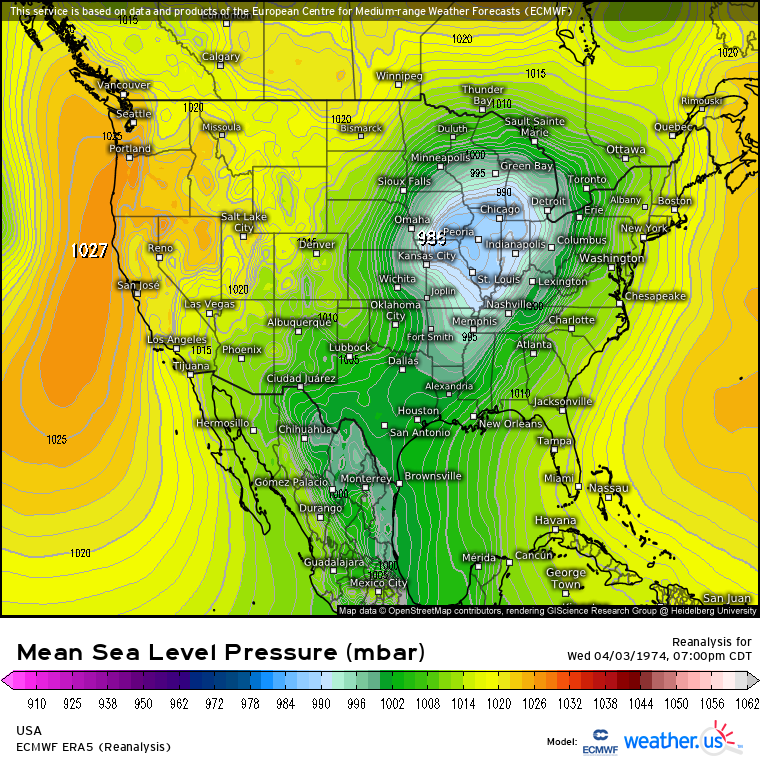
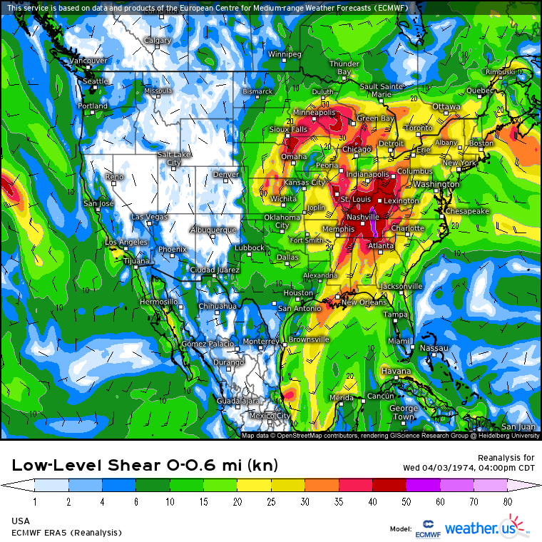
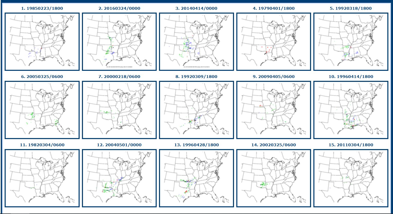
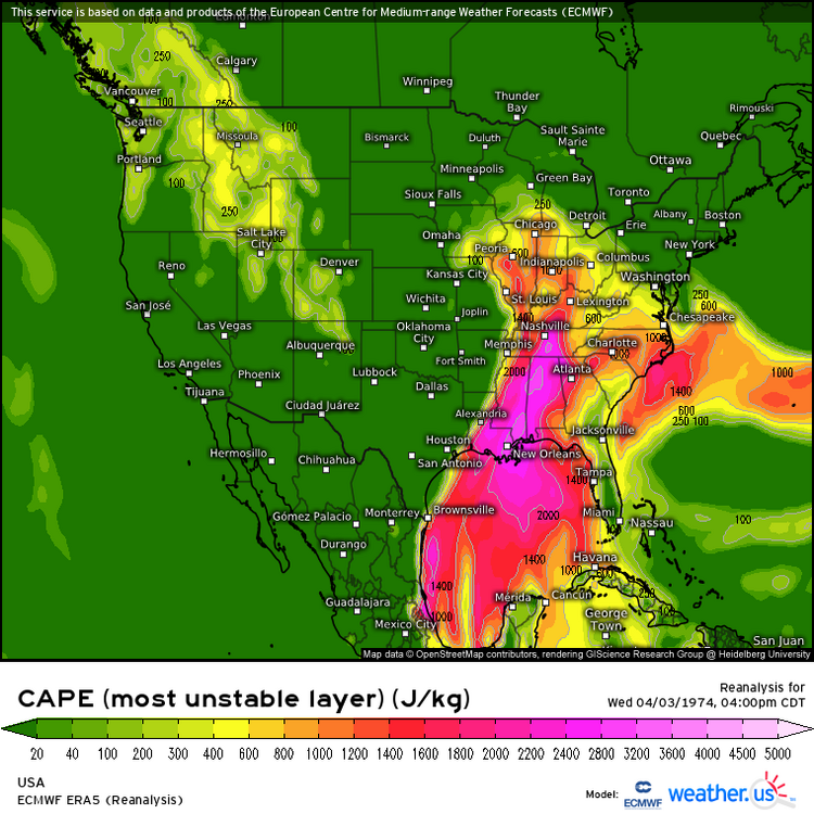
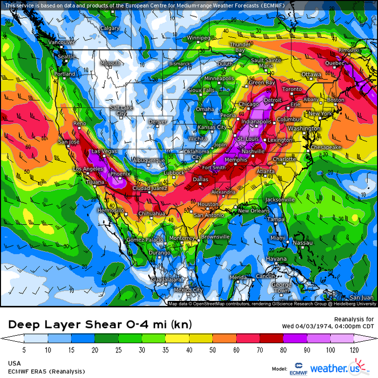
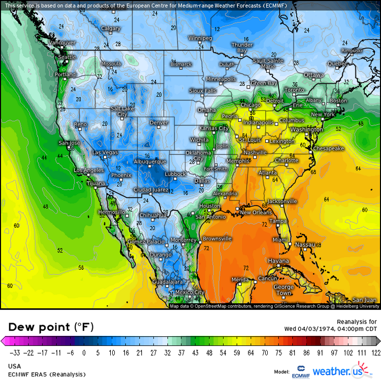
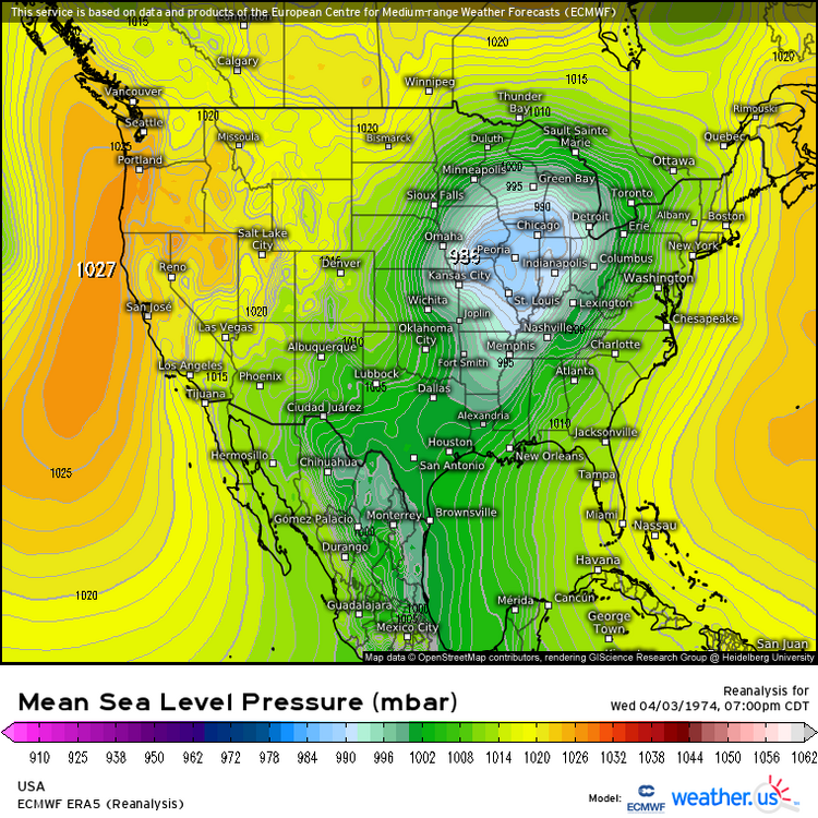
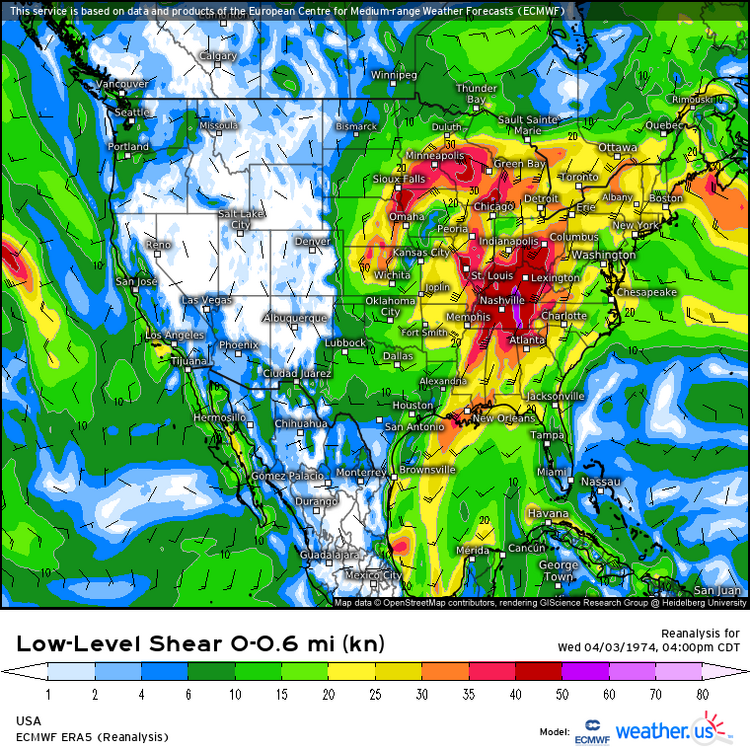
A while ago, I downloaded these ECMWF-ERA reanalysis charts of 4/3/74. 500mb heights show a strong closed low in Kansas, with high wind flow (18z) There was CAPE up to 2400 J/kg in the South, but less CAPE in the north Ohio Valley, but still enough for severe weather. Normally NCEP reanalysis doesn't show high CAPE values as much as actually happened locally on warm days (this is the ECMWF, so I'm not sure how that performs on this, though) 0-6km of 50 kt to 100kt, as such strong 500mb winds rotated around the trough There were dew points of the low 60's to low 70's, with a dryline or cold front type feature, out in front of some 40's dew points in Kansas very low pressure in Iowa, with high low-level winds 0-1km shear values of 30kt to 50kt are a huge component in 0-1km storm relative helicity, highly linked to tornadoes. (large area of 40kt values)

- 1 reply
-
- 3
-

-

-
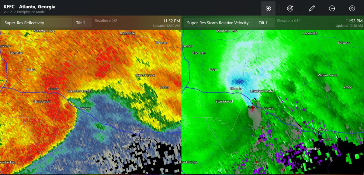
4/1-4/2 severe threat (southern portion of subforum)
Chinook replied to largetornado's topic in Lakes/Ohio Valley
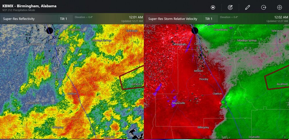
tornado at Conyers Georgia, by Atlanta. Also, tornado by Clanton Alabama (0403z). Thankfully I don't believe there's been a lot of storm reports down south. But these could be as dangerous as any night time tornado!
-
4/1-4/2 severe threat (southern portion of subforum)
Chinook replied to largetornado's topic in Lakes/Ohio Valley
I'm glad this wasn't a major disaster. Models/SPC also had quite a few chances for big storms down to Mississippi, but that didn't work out much. -
4/1-4/2 severe threat (southern portion of subforum)
Chinook replied to largetornado's topic in Lakes/Ohio Valley
Possible tornado Buckeye Lake- Gratiot Ohio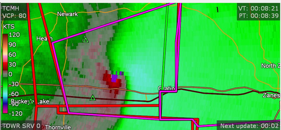
-
4/1-4/2 severe threat (southern portion of subforum)
Chinook replied to largetornado's topic in Lakes/Ohio Valley
confirmed tornado at the Ohio River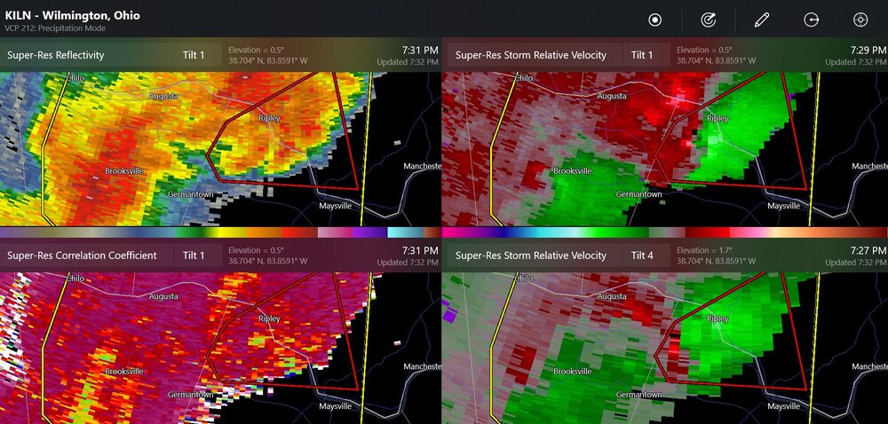
-
4/1-4/2 severe threat (southern portion of subforum)
Chinook replied to largetornado's topic in Lakes/Ohio Valley
Funnel cloud at Covington -
4/1-4/2 severe threat (southern portion of subforum)
Chinook replied to largetornado's topic in Lakes/Ohio Valley
Ryan Hall showed pictures of damage in eastern West Virginia -
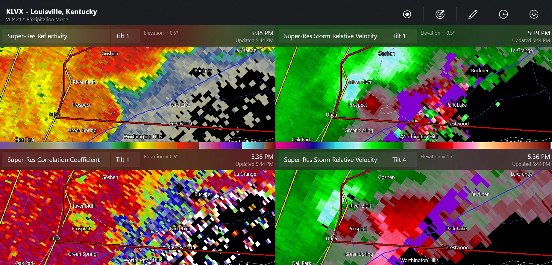
4/1-4/2 severe threat (southern portion of subforum)
Chinook replied to largetornado's topic in Lakes/Ohio Valley
confirmed tornado near Louisville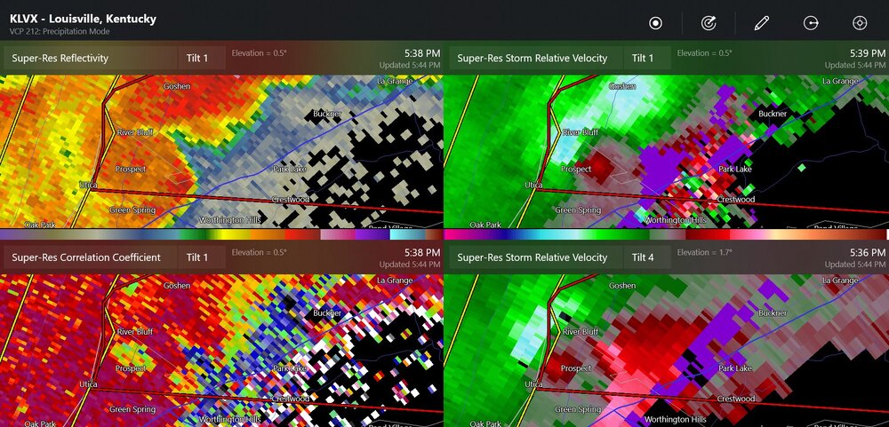
-
4/1-4/2 severe threat (southern portion of subforum)
Chinook replied to largetornado's topic in Lakes/Ohio Valley
four severe warnings getting going in Indiana -
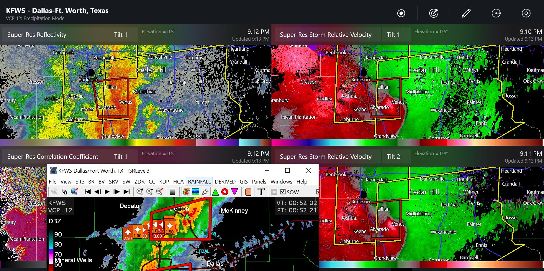
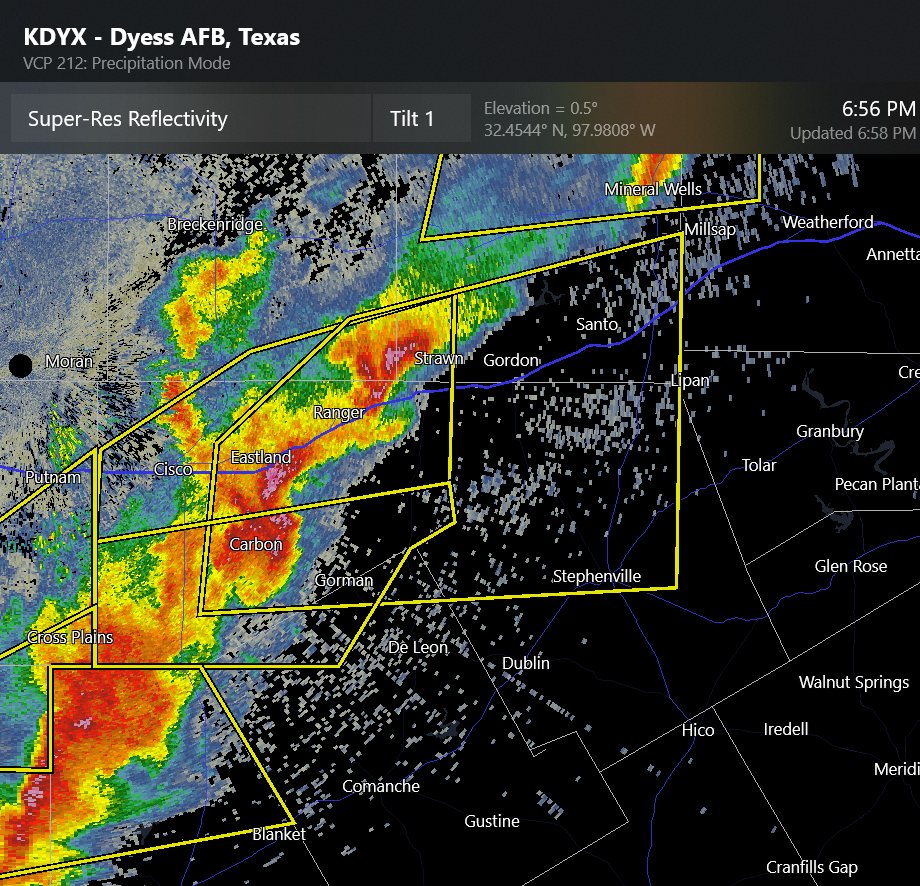
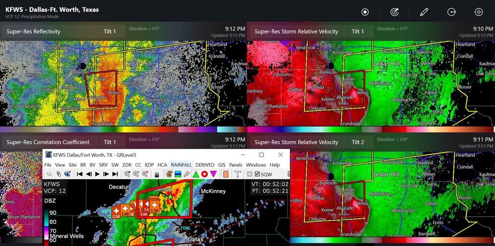
possible tornado near Dallas Fort Worth, also, hail reports from other storms shown
-
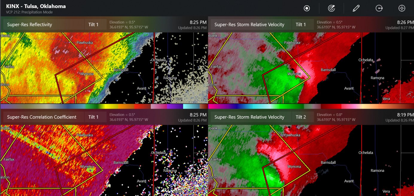
this is a confirmed tornado outside of Tulsa

-
4/1-4/2 severe threat (southern portion of subforum)
Chinook replied to largetornado's topic in Lakes/Ohio Valley
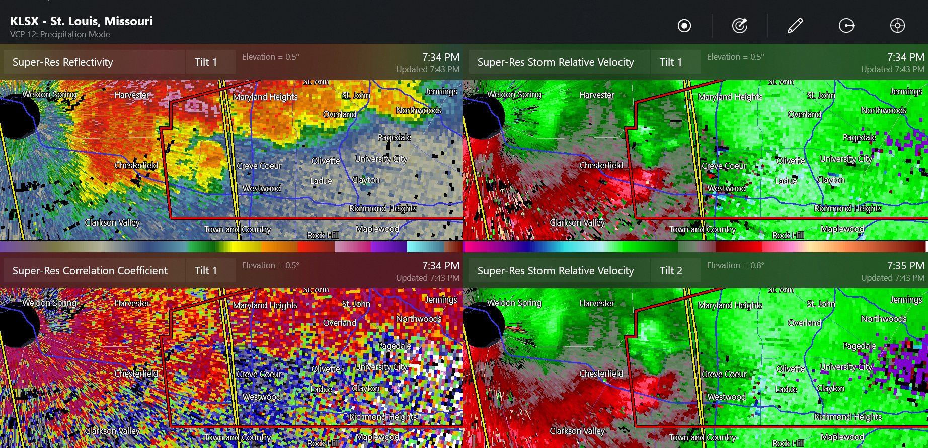
this is a confirmed tornado at or near Chesterfield Missouri, near St Louis
-
storms with weak rotation have put out 2" hail and one 88mph wind gust this afternoon

-
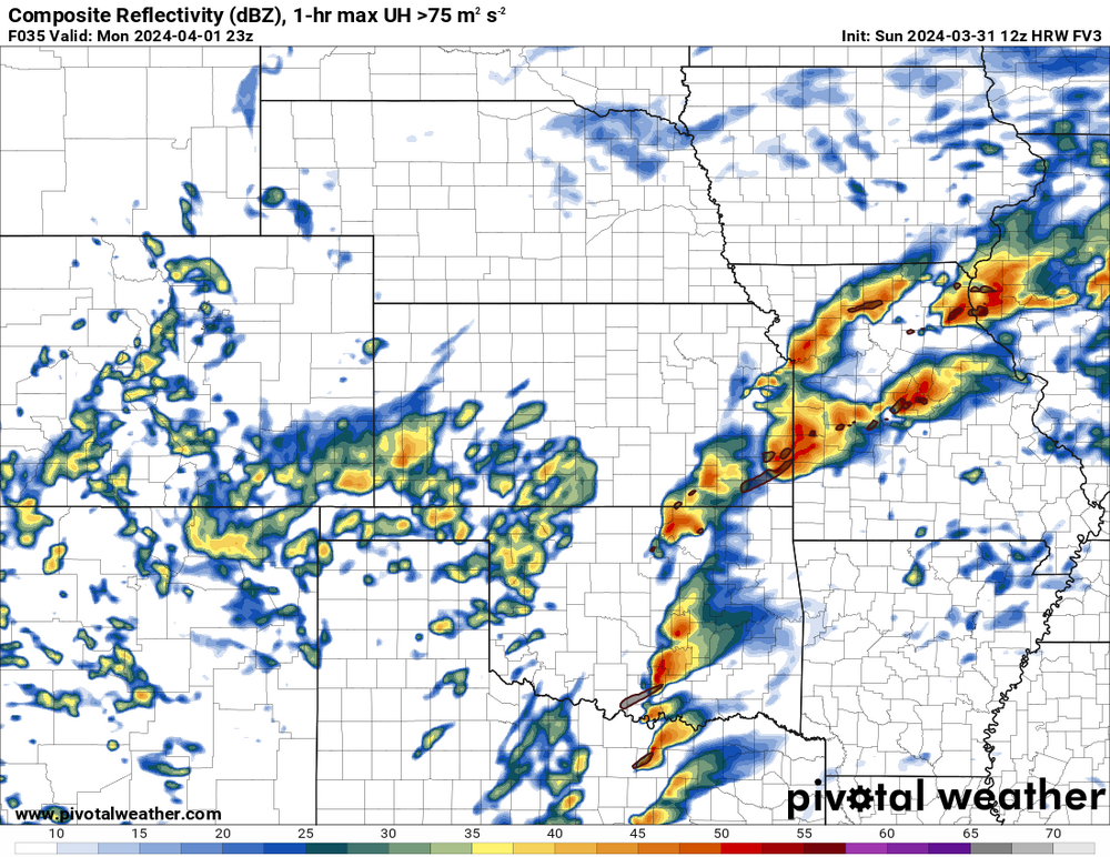
2024 Short/Medium Range Severe Weather Discussion
Chinook replied to Chicago Storm's topic in Lakes/Ohio Valley
This isolated storm has left a swath of hail reports in Illinois.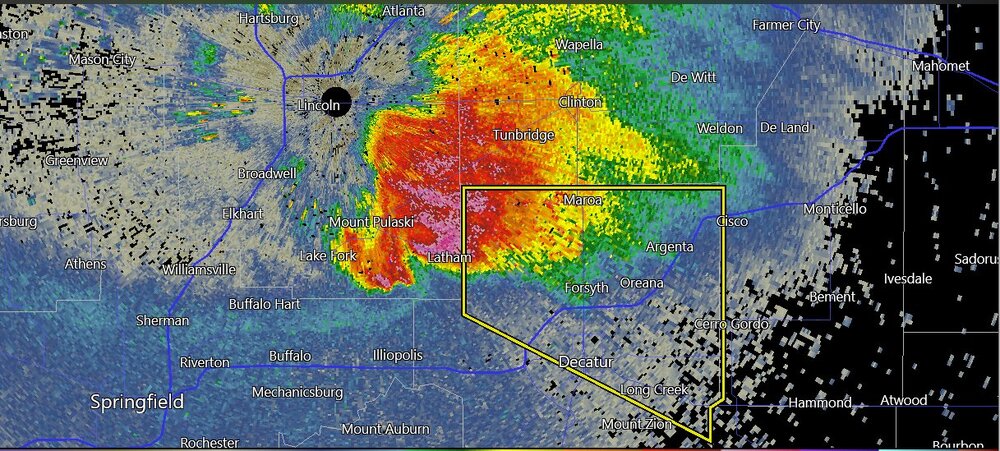
-
According to a couple of models, the southernmost supercells could be by Dallas (possibly without the higher storm-relative helicity values)
-
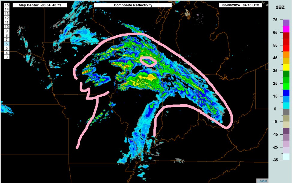
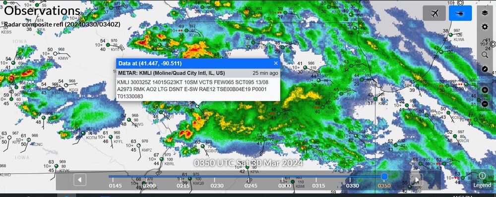
this is last night's radar with my picture of a bird head
-
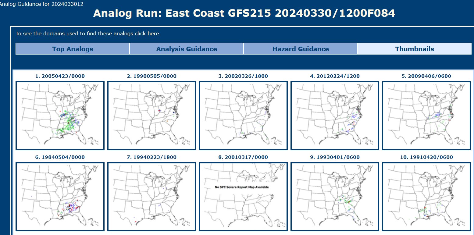
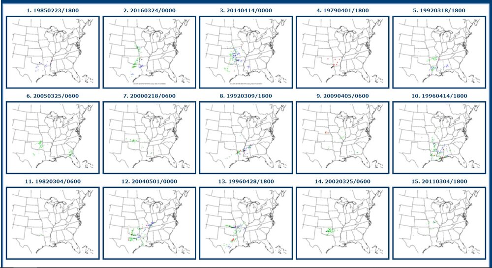
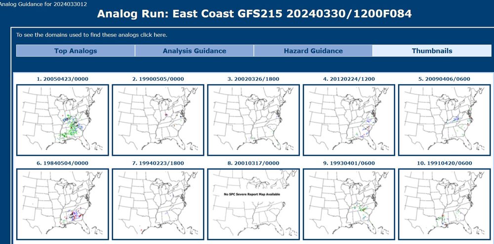
Top synoptic analogs vary greatly in severe weather coverage. Most analogs here have some severe weather reports in Arkansas. There are not necessarily a lot of tornado analogs. As for now, I am not sure what I might want to post with the models. Instability seems a bit low. 84-hours
-
scattered thunderstorms in various areas near this warm front
-
thumbs down to this post
-
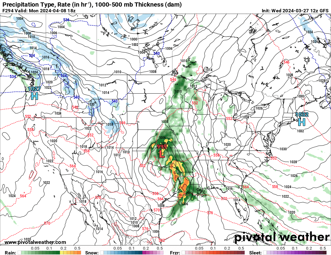
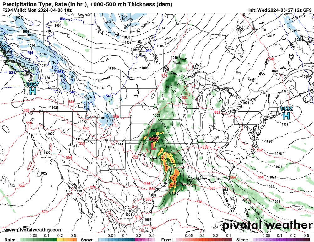
This is surely the 100% correct forecast for Monday, April 8th, the eclipse day. There seems to be a high chance of sunshine for the East, but a heavy storm for Texas and Arkansas. And when I say "surely," I mean the cloudiness forecast is absolutely uncertain at this point.
-
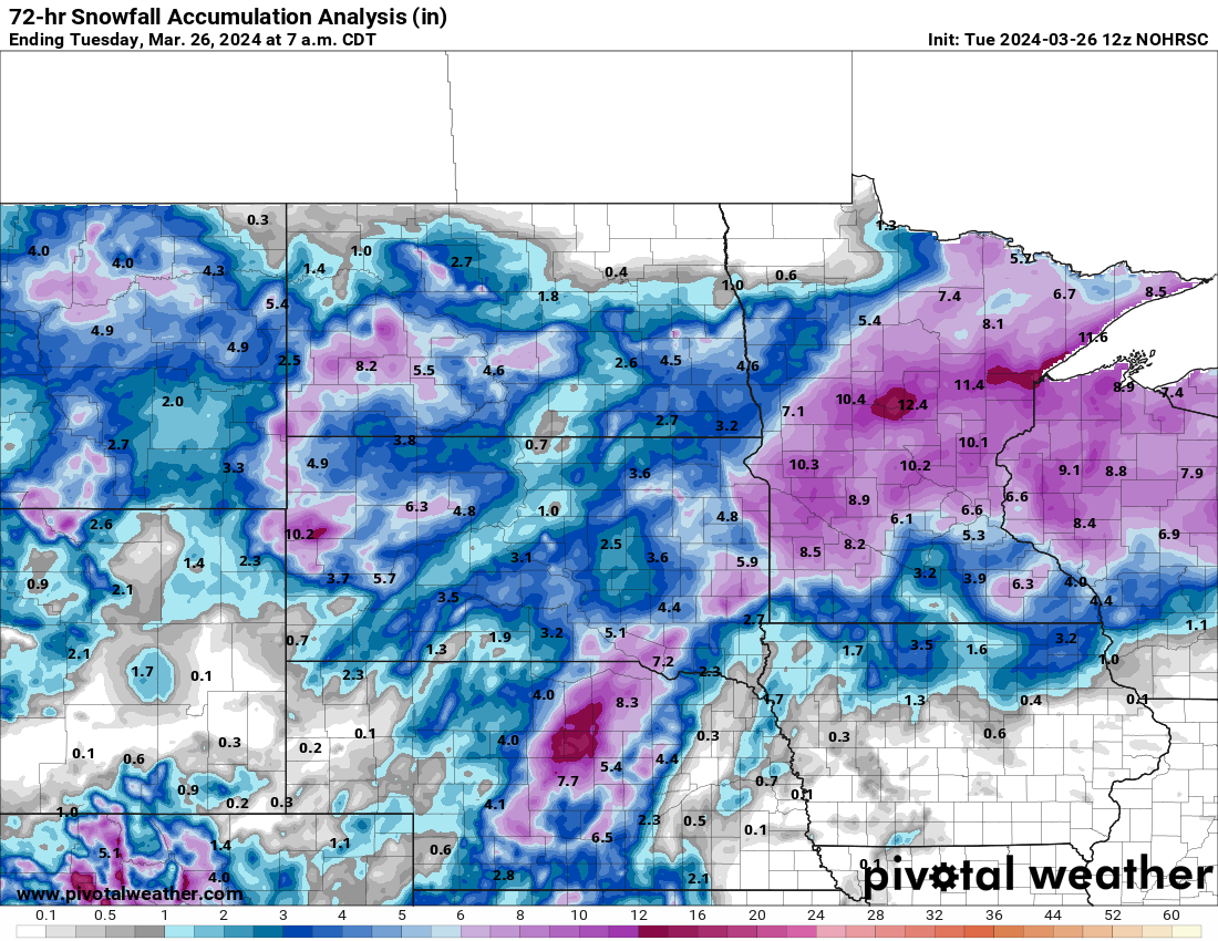
wasn't this supposed to be pretty insane for South Dakota into Minnesota? I absolutely remember a NWS graphic from Aberdeen that said 16"-23" for a border twn