Chinook
-
Posts
10,081 -
Joined
-
Last visited
Content Type
Profiles
Blogs
Forums
American Weather
Media Demo
Store
Gallery
Everything posted by Chinook
-
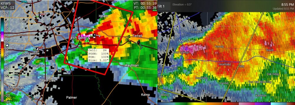
this is once again, close to my family (sort of)
-
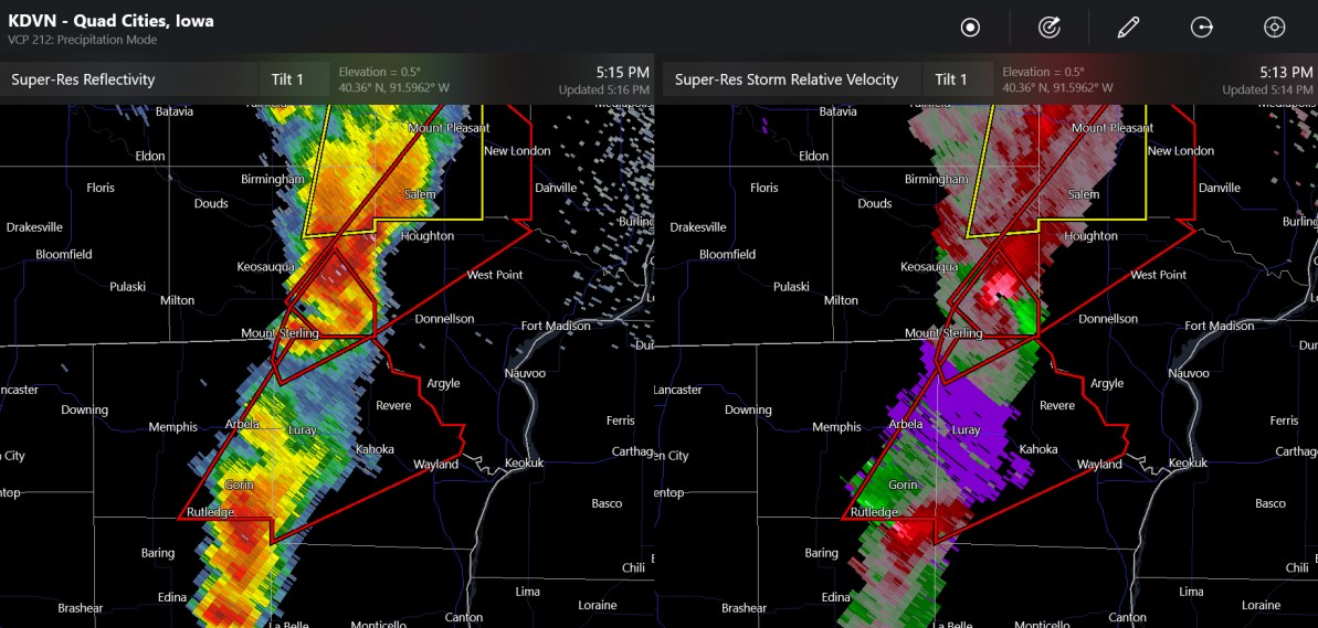
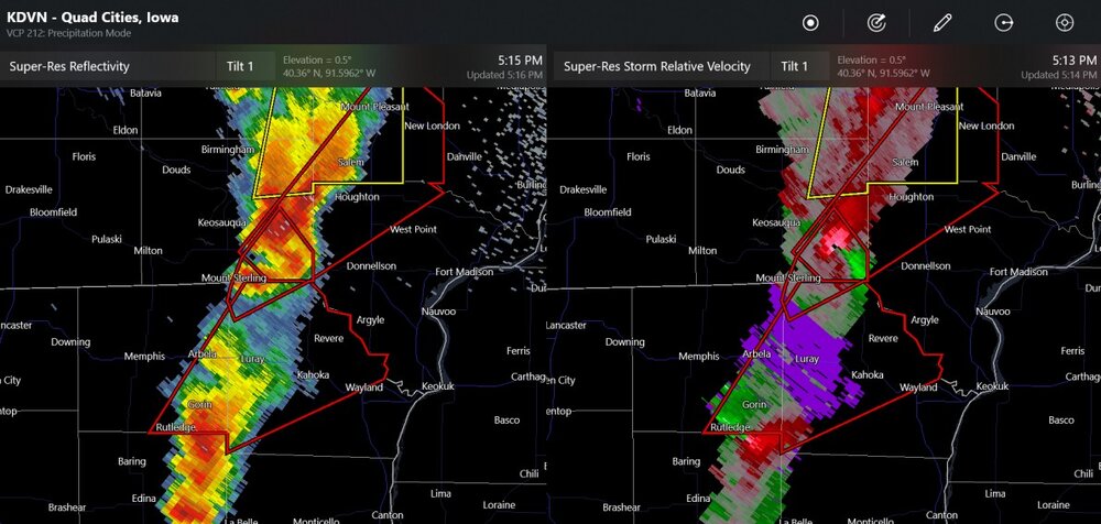
The storm chasers have seen the tornado lift, I believe, by New London Iowa but could produce a new one.
-
It's by Houghton and Salem Iowa
-
Iowa city tornado warning
-
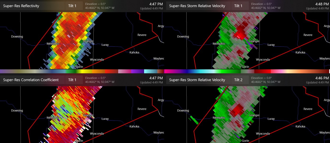
two non-confirmed tornado warnings in Iowa/Missouri (note: both storms are far from the radar)
-
this is kind of in the radar hole

-

2024 Short/Medium Range Severe Weather Discussion
Chinook replied to Chicago Storm's topic in Lakes/Ohio Valley
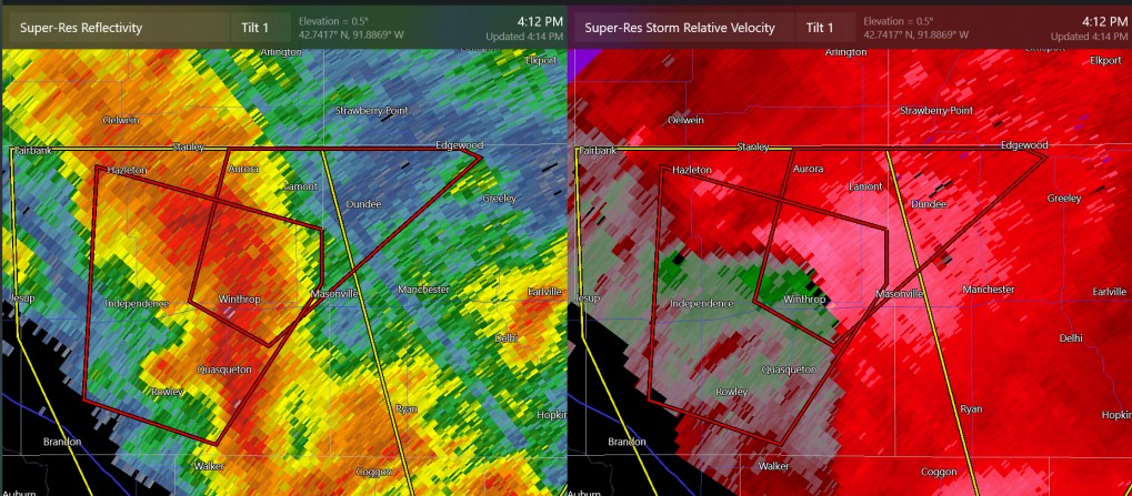
continuing tornado warning at Winthrop, Iowa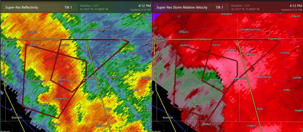
-
2024 Short/Medium Range Severe Weather Discussion
Chinook replied to Chicago Storm's topic in Lakes/Ohio Valley
We'll have to closely watch both convective lines for supercells and tornadoes, and wind gusts.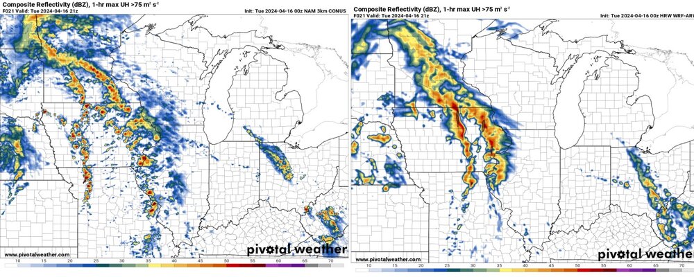
-
Sometimes the 2nd day of an expected 2-day tornado outbreak is much more interesting. Obviously we'll have storms going off in the Midwest tomorrow.
-
It's too capped in TX/OK.
-
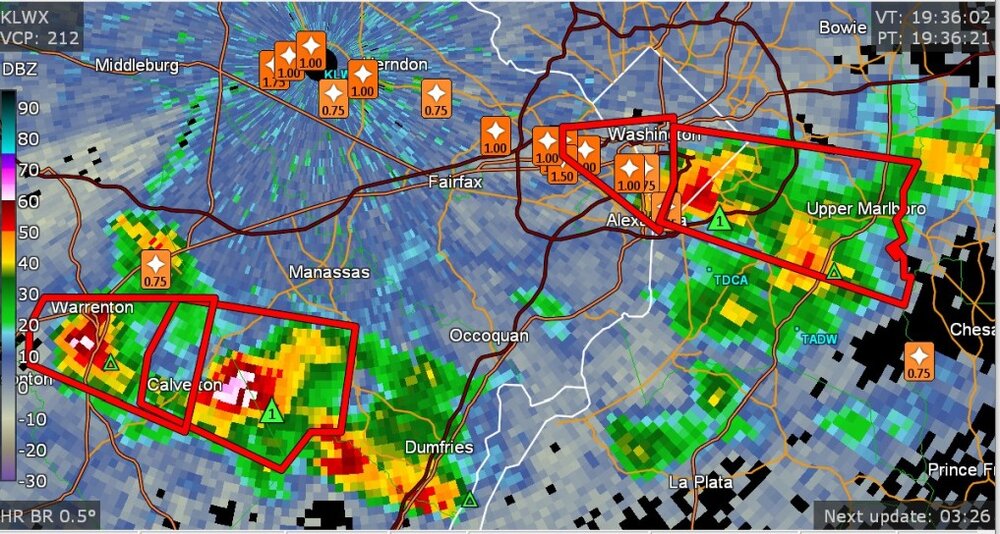
zoom in on severe (and sub-severe,) storm reports near Washington DC
- 1,696 replies
-
- 2
-

-
- severe
- thunderstorms
- (and 5 more)
-
4/14/12 was 12 years ago. I'd say that was one of the biggest outbreaks since 2011.
-
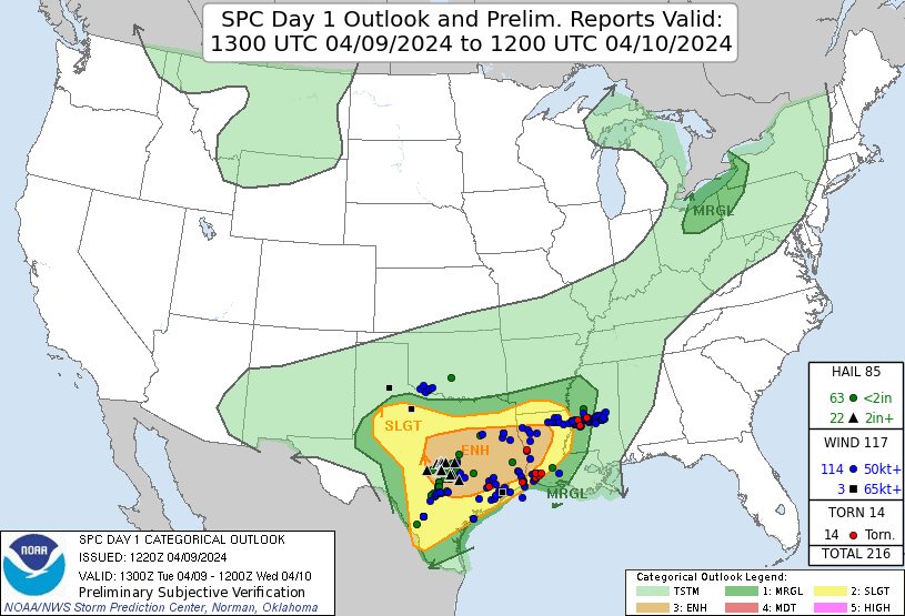
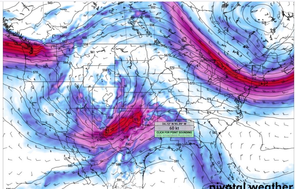
by the way: day-2 non-Midwest I didn't post much about the last few days because it was a messy system in Texas. Also note: nobody seems to care. Guess what. I'm not going to believe in a tornado outbreak until I see one. The SPC is overcooking everything. It looks like the GFS and ECMWF have a storm near Wichita Falls, Texas on Monday. 60 kt+ winds aloft where things could get going in Oklahoma on Monday night (03z)
-
dangerous tornado at Tampa
-
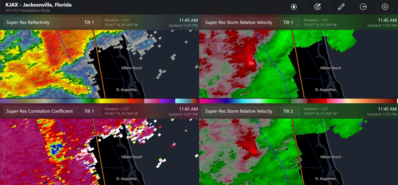
a tornado hit near the St. John's River and World Golf Village in northeast Florida

-
Non-confirmed tornado warning at the LA/TX border. It's next to Toledo Bend Reservoir, so it's near me, right?
-
There is a confirmed tornado warning near Jackson, MS. This area might be the middle of the tornado action tomorrow (Louisiana to Mississippi)
-
here it was
-
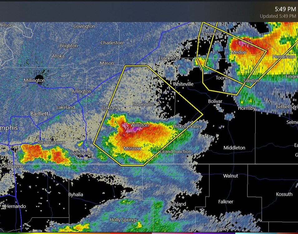
radar says this could be 4" hail near Memphis TN
-
The temperature dropped from 78 to 72 in northern Arkansas due to the lack of light, also, 82 to 77 at Little Rock
-
It worked out nicely here. I figured that I could not really avoid the cirrus clouds by driving a short distance or even a possibly long distance, so I stayed in town. The weird part is that the cirrus clouds were generally fine, but looked like dark storm clouds during totality.
-
Mountain West Discussion- cool season '23-24
Chinook replied to mayjawintastawm's topic in Central/Western States
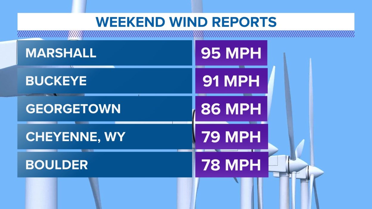
Akron CO got to 72mph wind gusts, Sterling CO got to 70mph wind gusts
-
HRRR says the temperature will decrease from 66 to 63 for me during the eclipse.
-
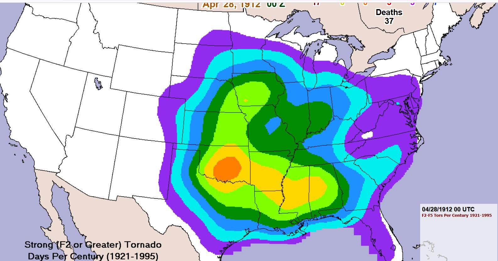
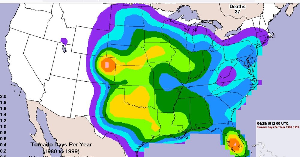
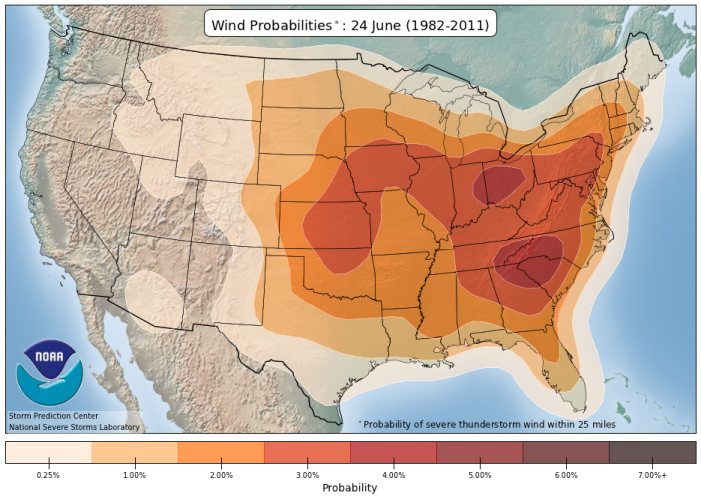
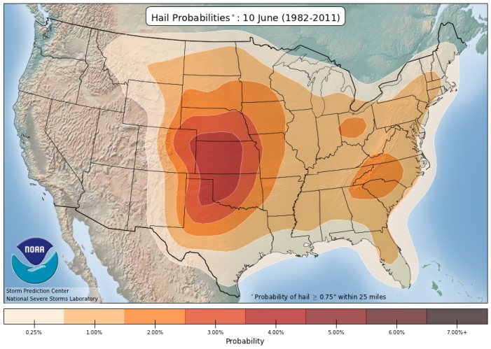
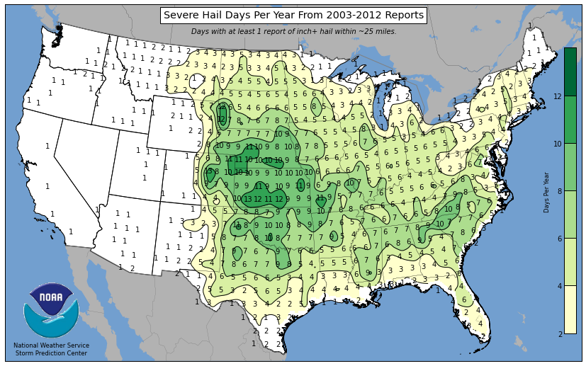
Here's something intereting. There's a relative minimum of EF2+ tornadoes and total tornadoes in Missouri. On the third chart shown, I have chosen the wind probability climatology for June 24th. It is well known that June has the maximum number of wind reports of any month across the US. This chart shows the wind damage reports maximize at Kansas, also, what I'll call "Derecho Alley," from Iowa to Ohio. Also, the southern Appalachians have a maximum of wind reports. Thunderstorms are numerous in the southern Appalachians but sometimes there is not high deep-layer shear in summer. On the fourth chart you can see the hail over 1" maximizes in the central Plains, pretty much lines up with traditional tornado alley. The area with the maximum number of hail-days (of any hail size) is at Cheyenne, Wyoming to the Nebraska high plains and over to Goodland, Kansas (Not shown) Final map: total number of days of severe hail of over 1"

-
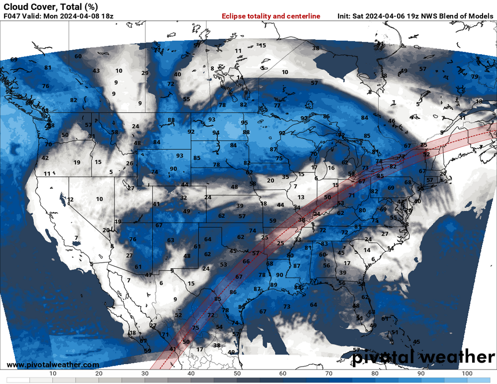
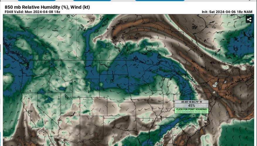
this might be getting worse for north central OH, better for Toledo. Last couple of NAM runs have varying cloud cover for NW Ohio. It's possible there could be a decrease in surface-based clouds(cumulus clouds) closer to totality due to lack of heating. I think this could make a difference for Indiana/Ohio and down to Arkansas but not for thicker cloud areas. 45 % humidity at the lower levels (OH/IN border) may help some cumulus clouds to form. The models have some upper level moisture, so that could be some cirrus clouds