Chinook
-
Posts
10,080 -
Joined
-
Last visited
Content Type
Profiles
Blogs
Forums
American Weather
Media Demo
Store
Gallery
Everything posted by Chinook
-
-
My area already has some slippery sidewalks with drizzle, and there's nothing on the radar.
-
I guess I'll be rooting for this. Or more.
-
-
low wind chills with (almost) advisory-level snow

-
So interesting to see that two storms are going to take different tracks and the second one will be more north
-
sleet or snow clumps

-
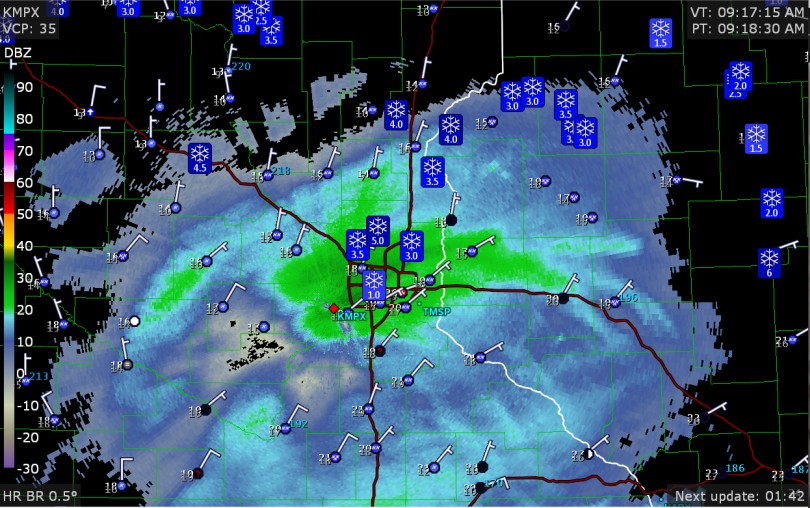
3.5" and more has fallen near Minneapolis. Impressive on the radar right now
-
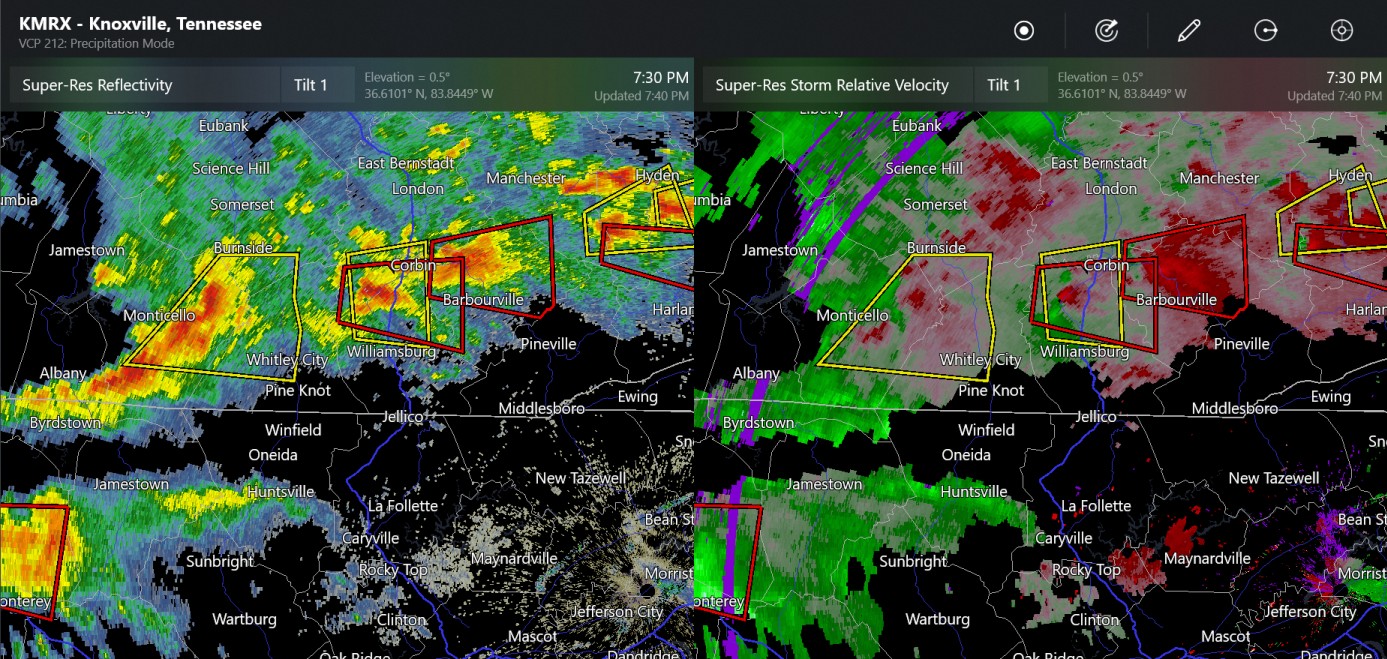
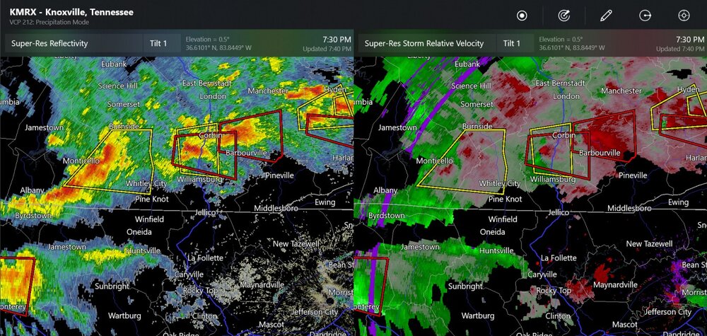
There was one confirmed tornado warning way earlier today in Kentucky, but it doesn't show up on storm reports. Here are four more non-confirmed tornado warnings now (730pm)
-
My car is completely coated with 0.1" of ice. The salt I put on the driveway did almost nothing. All because of this, during the ice thunderstorm.

-
Ice thunderstorm
-
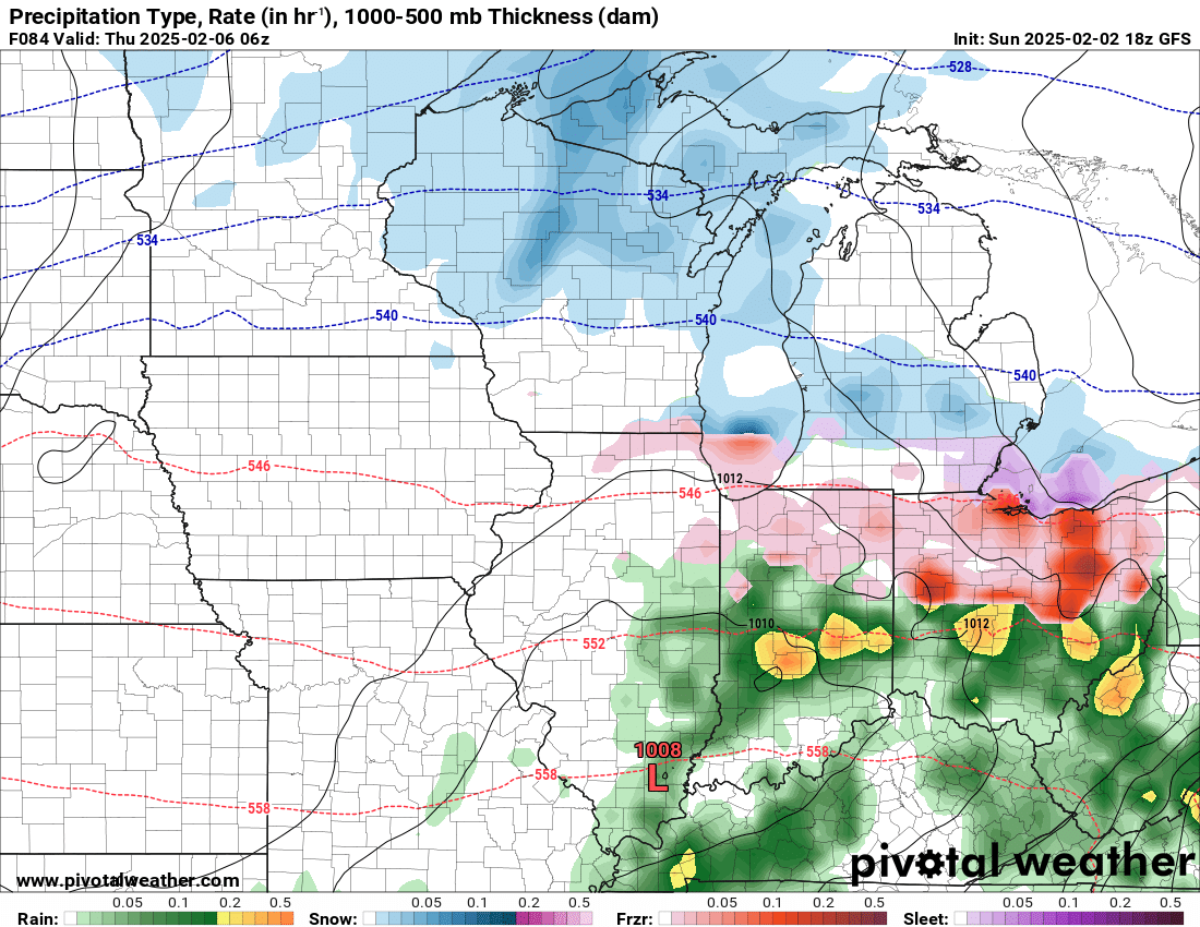
A few places are getting freezing rain around Cincinnati right now, also Indianapolis. Ice Storm Warning for a few areas of the Mid-Atlantic

-
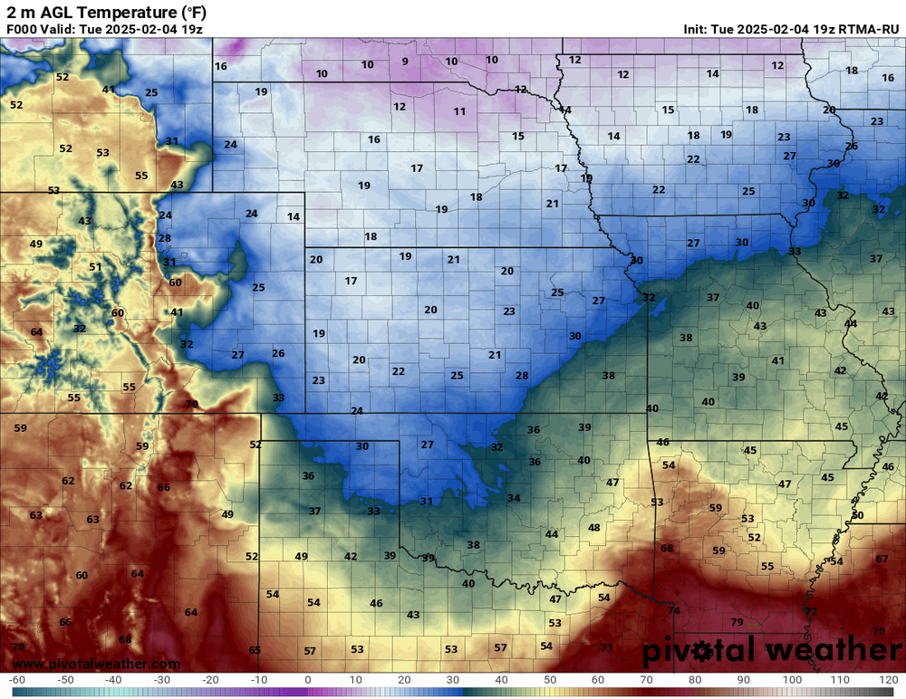
There are some 30 degree temperature difference between the cities and the foothills. Leadville is 46, Fort Collins is 26.
-
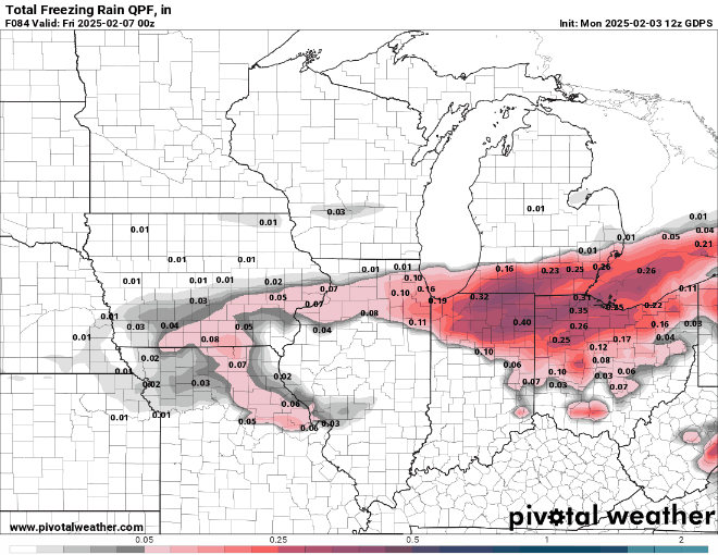
I don't want 0.38" of ice
-
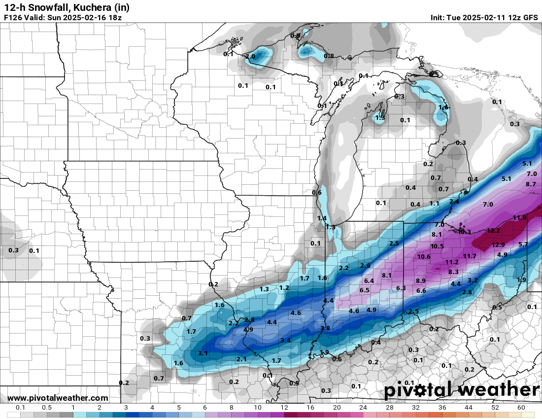
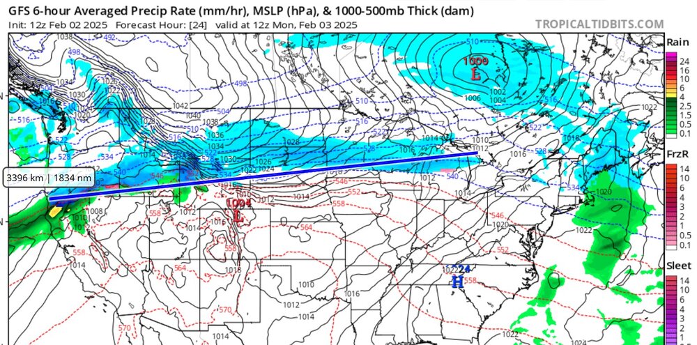
1834 continuous nautical miles worth of snow tomorrow
-
This is starting to be greatly concerning to me.

-

Let’s talk winter!! Ohio and surrounding states!! 24'-25'
Chinook replied to buckeye's topic in Lakes/Ohio Valley
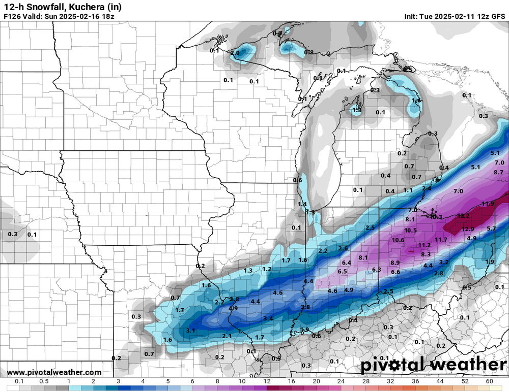
Similarly, the Pivotalweather web site, with Kuchera ratios, has 42" in Ohio, with no lake effect. This continues into lower Illinois with 34.7". It's pretty rare. You'd have to cherry-pick model runs over several years to see something better. -
Winter 2024-25 Medium/Long Range Discussion
Chinook replied to michsnowfreak's topic in Lakes/Ohio Valley
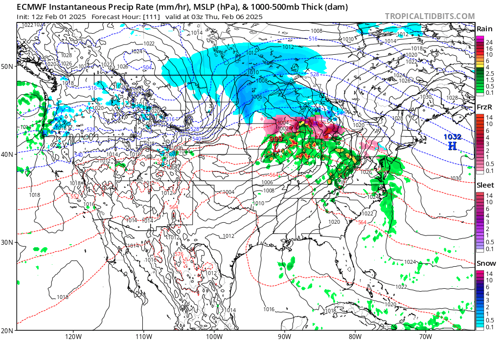
This one is kind of crazy. The ECMWF tends to have moments when it tries to resolve convection but it can't. Nevertheless, chances for rain/freezing rain are there in a few days.
-
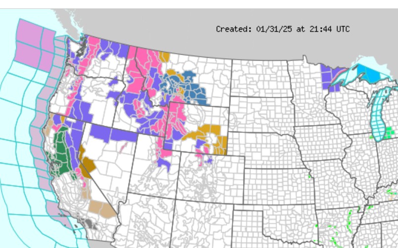
seems like some people in the NW are going to be getting 37.7"... tomorrow.
-
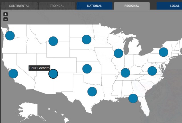
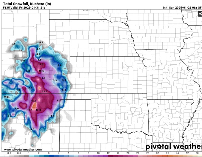
Things got a little snowy down south in Colorado, but not too crazy Pivotalweather changed the zoom areas to include Four Corners and N. Rockies.
-
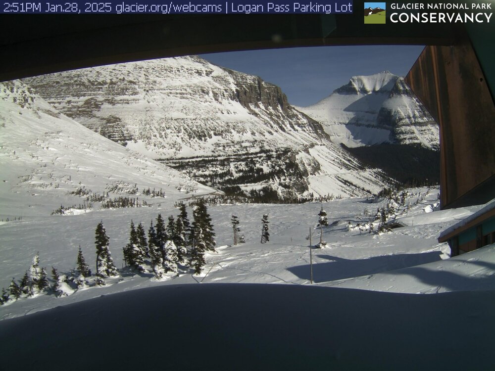
Up in Montana
-
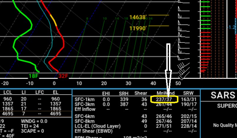
Sometimes this 0-1km mean wind, intended for severe weather, can help predict surface winds/wind gusts. In this case, 37 knots is almost exactly Toledo (TDZ) max gust at this time in the afternoon.
-
For the moment, several ensemble members show heavy snow possible in New Mexico and southern Colorado with the next upper level low late in the week.
-
up to 5.8" right around Denver
-
New winter weather advisory (most snow just west of I-25) I guess Mayjawintastawm finally got his CPC-predicted cold wave from the end of December, predicted from Jan. 1 to 7. And then shared it with everybody.