roardog
Members-
Posts
1,619 -
Joined
-
Last visited
About roardog

Profile Information
-
Gender
Not Telling
-
Location:
Cass City,Michigan
Recent Profile Visitors
The recent visitors block is disabled and is not being shown to other users.
-
I never really compared those winters so I don't know without looking into it.
-
In the end, the 500mb height anomalies in 72-73 were very similar to 23-24 when you adjust for the current climate.
-
Yeah. The dewpoints usually aren’t real high and the longer nights allow it to start cooling down fairly early even if it does get really warm during the afternoon.
-
Mid 30s here this morning. I looked for frost on the rooftops this morning but didn't see any.
-
Is that even possible?
-
Yeah. There’s a couple areas around here where there’s some groups of trees that have a decent amount of color. There’s always some trees with color at this time of year but I feel like it’s been awhile since there’s been this much color already in early September.
-
If that happens this winter, I expect if someone working in an Antarctic research station posts a tweet about it, you’ll find it and post it here. lol
-
I’ll take Nina over Nino every time around here in the winter. Hopefully we do have a “warm” October. It feels like a lot of times a cold October turns into a mild December. Although, that’s probably due to a cold October being more common in a Nino. A cold October is kind of useless anyway except for chasing the first flakes of the season or some sloppy early season slush accumulation that melts in a few hours.
-
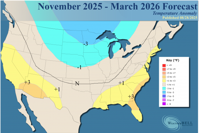
I’m pretty sure the model was forecasting all of that below average snow because it had a country wide blowtorch. So it was right for the wrong reason pretty much.
-
-
August started cool and obviously ended very cool with just “heat” in the middle of the month which was more like very warm with obnoxious dewpoints. July was certainly hot overall but June was fairly cool until the last week to 10 days of the month. For all the talk of record setting ridges and all that stuff, it wasn’t even anything special for heat.
-
I gotta say. This cool airmass is impressive not only in strength but in duration. I mean, the sun has been set for about an hour and a half here and the temperature is already down into the 40s. That’s impressive for August even if it is at the end of the month.
-
Yeah. I’m seeing that too. I remember a lot of early color in 2017 after that cool August and early September. Then it of course turned hot in late September as you know. lol.
-
Through yesterday, we are now at .4 above average for the month around here. Tomorrow will be well below average and the lows around here for sure will be below average the rest of the month. The highs might be too but Sunday might be close. I think we’re going to end the month slightly below average with the low temperatures leading the way which has become quite unusual in recent times.
-
I still think that all of the extra water vapor/moisture around the globe(compared to a few decades ago)helps keep the summers cloudier and cooler there while keeping the other seasons warmer. Every year when October rolls around these days, the temp anomaly maps go from light blue to dark red. It just can’t cool down as fast as it used to with so much more moisture in the air. Having more open water than decades ago probably just adds to the moisture.


