dryslot
-
Posts
60,469 -
Joined
-
Last visited
Content Type
Profiles
Blogs
Forums
American Weather
Media Demo
Store
Gallery
Everything posted by dryslot
-
Temp dropped -20°F down to 71°F with this shower.
-
Incoming
-
Warning hoisted. Severe Thunderstorm Warning MEC001-005-017-062015- /O.NEW.KGYX.SV.W.0019.190706T1919Z-190706T2015Z/ BULLETIN - IMMEDIATE BROADCAST REQUESTED Severe Thunderstorm Warning National Weather Service Gray ME 319 PM EDT Sat Jul 6 2019 The National Weather Service in Gray Maine has issued a * Severe Thunderstorm Warning for... Southeastern Oxford County in western Maine... Androscoggin County in southwestern Maine... North central Cumberland County in southwestern Maine... * Until 415 PM EDT. * At 318 PM EDT, a severe thunderstorm was located 9 miles northwest of Mechanic Falls, moving east at 30 mph. HAZARD...60 mph wind gusts. SOURCE...Radar indicated. IMPACT...Expect damage to roofs, siding, and trees. * Locations impacted include... Lewiston, Mechanic Falls, Turner, Waterford, Lisbon, Greene, Durham, Harrison, Leeds, Livermore, Buckfield, Hebron, Hartford, Greenwood, West Paris, Wales, Otisfield, Sabattus, Poland and Oxford. This includes Interstate 95 between mile markers 73 and 86. This also includes... Crocker Hill, Streaked Mountain, and Singepole Ridge. PRECAUTIONARY/PREPAREDNESS ACTIONS... For your protection move to an interior room on the lowest floor of a building. Torrential rainfall is occurring with this storm, and may lead to flash flooding. Do not drive your vehicle through flooded roadways.
-
90/73°F, Clouds are starting to build.
-
SEL4 URGENT - IMMEDIATE BROADCAST REQUESTED Severe Thunderstorm Watch Number 494 NWS Storm Prediction Center Norman OK 105 PM EDT Sat Jul 6 2019 The NWS Storm Prediction Center has issued a * Severe Thunderstorm Watch for portions of Maine New Hampshire Coastal Waters * Effective this Saturday afternoon and evening from 105 PM until 800 PM EDT. * Primary threats include... Scattered damaging wind gusts to 70 mph possible SUMMARY...Scattered strong-severe thunderstorms will form this afternoon along and ahead of a cold front, and the storms will spread east-southeastward through this evening. A few damaging wind gusts will be the main threat. The severe thunderstorm watch area is approximately along and 50 statute miles north and south of a line from 85 miles northeast of Bangor ME to 40 miles west northwest of Concord NH. For a complete depiction of the watch see the associated watch outline update (WOUS64 KWNS WOU4). PRECAUTIONARY/PREPAREDNESS ACTIONS... REMEMBER...A Severe Thunderstorm Watch means conditions are favorable for severe thunderstorms in and close to the watch area. Persons in these areas should be on the lookout for threatening weather conditions and listen for later statements and possible warnings. Severe thunderstorms can and occasionally do produce tornadoes. && AVIATION...A few severe thunderstorms with hail surface and aloft to 0.5 inches. Extreme turbulence and surface wind gusts to 60 knots. A few cumulonimbi with maximum tops to 500. Mean storm motion vector 29025. ...Thompson
-
This is how we “Dew” it.
-
80/70, This is what we call swamp ass weather, Should be noticeably better once the CF comes thru later with some storms.
-
Ah, Ok, I had a very nice rock maple that was a 12 yr old tree that I had lost, The 2 years before it died the leaves were real small which I found odd, Then the next year the top of the trees had died but the rest of the tree had small leaves, Then the last year, it started to leaf out and stopped and that was it, Come to find out my neighbor had rototilled for a garden and severed one of the main roots to my tree.....
-
I have a red maple here but its not a vibrant color in the fall, My neighbor has some rock maples and those have some vibrant color to them.
-
84/61°F, Going to be a hot one out there today.
-

-
Love Bocce.
-
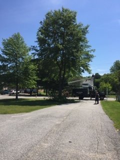
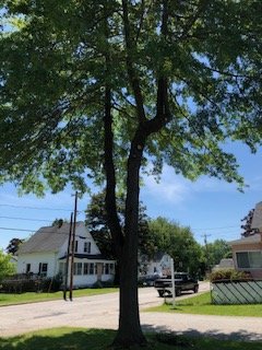
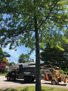
Thanks, Both trees were planted at the same time 30+ yrs ago, The one on the left got hit by lightning and for 10 yrs or so, Only half the tree had leaves and the other half didn't, The bark was split wide open the full length of the tree facing the street, But it has finally healed back over and has just started to thrive so it was set back a few years compared to the one near the driveway, I know one thing, Over the last 5+yrs or so, Its been quite the PITA trying to keep those lower branches trimmed so they were not hitting the tops of vehicles pulling into the driveway. I was about as far as i could go with trimming them with a pole saw standing in the back of my PU, The main problem was the further up into the canopy i was getting i could only cut off half the branch so there was a lot of dead branches still attached to the trunk that I'm sure was not contributing to the health of both trees, They came in and cut them off flush to the trunks plus removed the next two rows that were hanging back down into the driveway, Should be good for another 5yrs or so now hopefully.
-
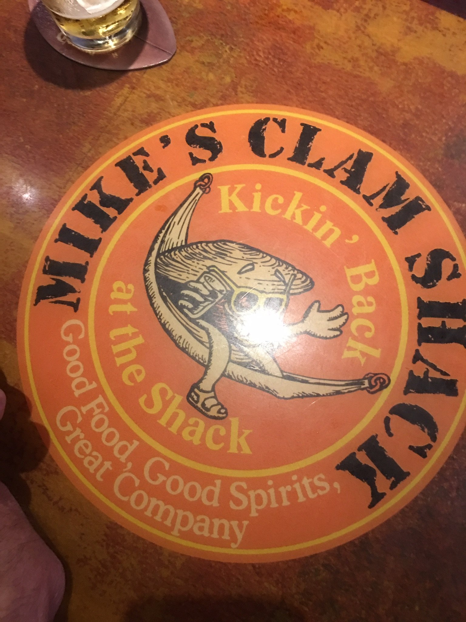
Head over to Mike's Clam Shack for some brews and a meal.

-
Facing west i presume............
-
We roasted them around the holidays, Its too bad we lost that species, In other news, I had a buddy of mine who is an arborist come give my pin oaks a good trimming last week, That should keep the branches off the vehicles for a few years...............
-
Radar estimates are anywhere from .25-2.00".
-
I would say there is some very large hail embedded in this cell around Milinocket/Lincoln...............
-
Cracking open the outer spiny shell to actually get at the chestnut was quite a challenge..............
-
I remember Chestnuts were still around back in the 60's up here
-
SST temps at OOB today is a refreshing 59°F.
-
Same here.
-
Its peak pollen season here, Pea soup.
-
Terrible, I'm a Mosquito farm, May have to make a dragonfly purchase, Or build some bat houses.
-
Very few "congrats" over the last 6 mos for you.