dryslot
-
Posts
62,800 -
Joined
-
Last visited
Content Type
Profiles
Blogs
Forums
American Weather
Media Demo
Store
Gallery
Everything posted by dryslot
-
To bad we blew the convective load in April.
-
Back to hibernation.
-
A few rumbles and some lighting here earlier this morning with a couple passing showers around 6am.
-
So you have a Dunlap, Stomach Dunlap over your belt...............................
-
The frost heaves are enormous this year.
-
Sounds like you got the ins company to pony up some, This sucks though overall.
-
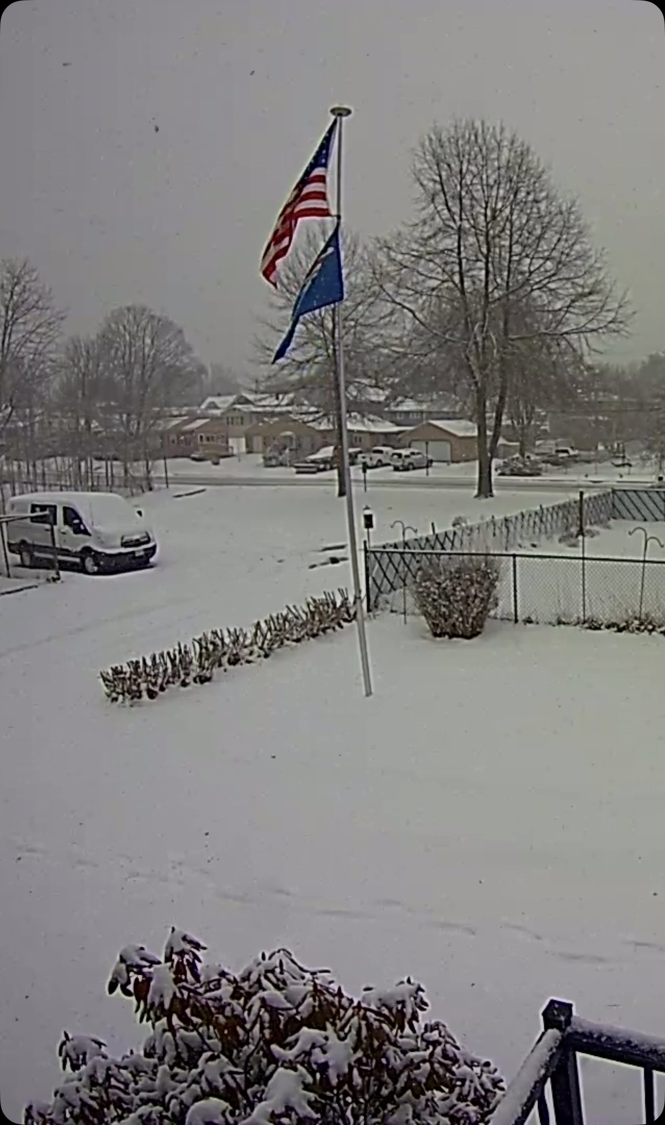
Another 1" late yesterday afternoon into the overnight so we finished at 6" total.
-
86.23" on the season, Outside shot at 90"
-
-SN, 31/28F
-
Congrats Dendrite!
-
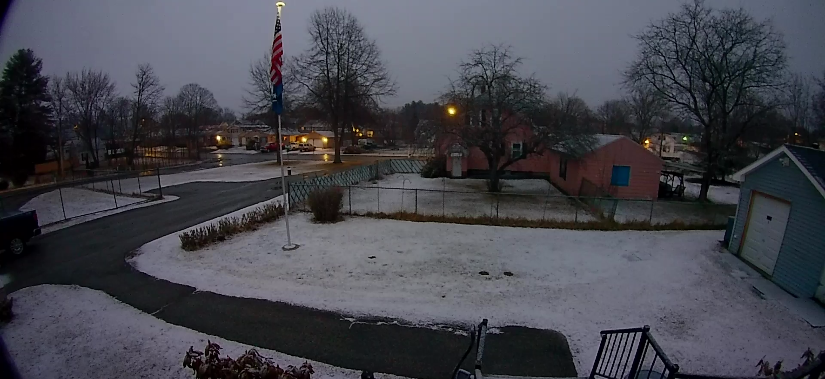
Just some snizzle out now,31/31F
-
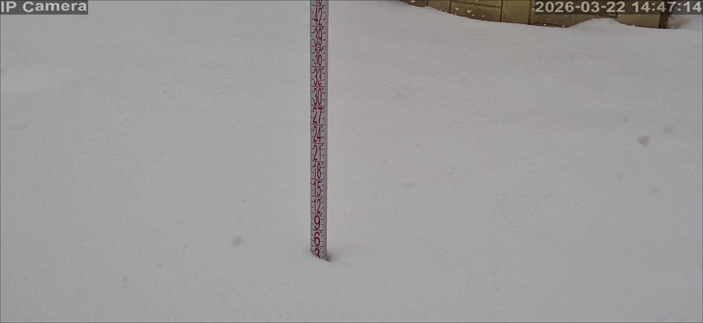
5.0” so far.
-
Eyeballing a bit over 4” now
-
Coming down at some of the heaviest rates thus far, +SN, 30F

-
Its on orange street in Lew.
-
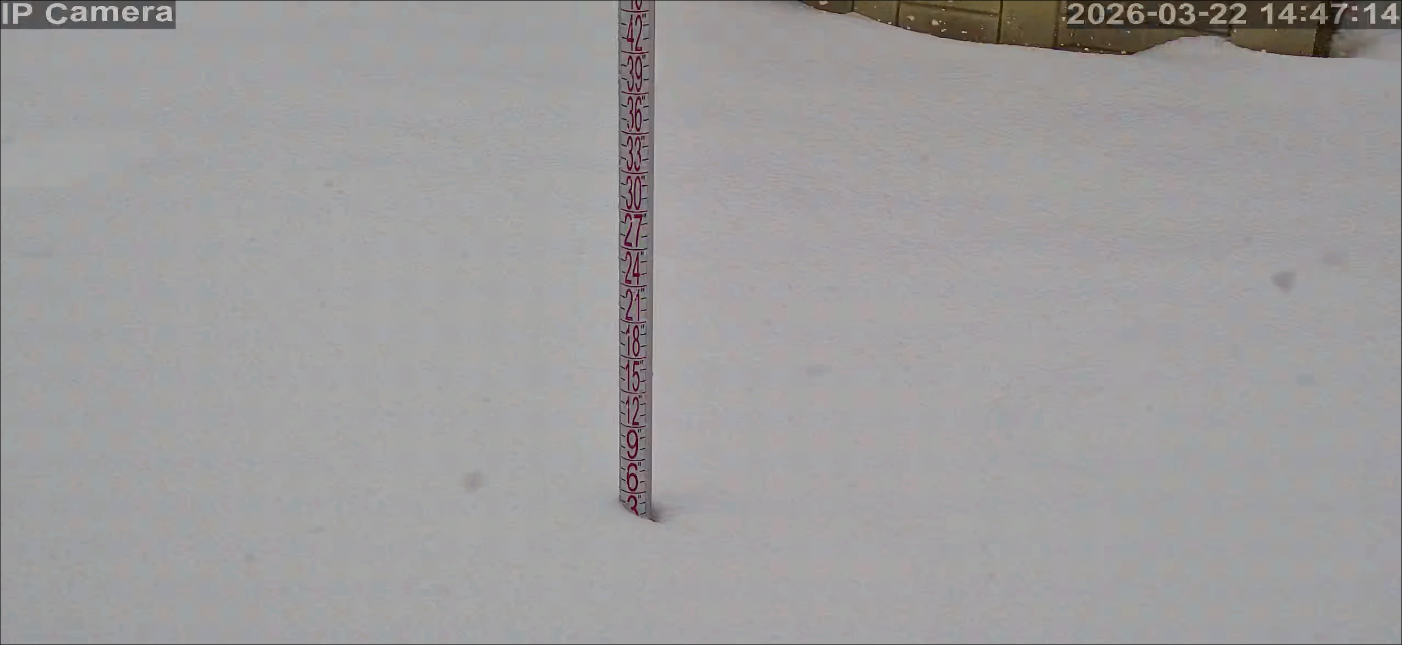
SN, 29/28°F, 2" so far. SPECI KLEW 221551Z AUTO 09007KT 1/2SM SN FG SCT006 OVC010 00/M02 A2990 RMK AO2 PRESFR P0000 FZRANO

-
No choice in the matter.
-
Hoisted
-
I will soon, Usually April, Already cancelled my weathermodels one.
-
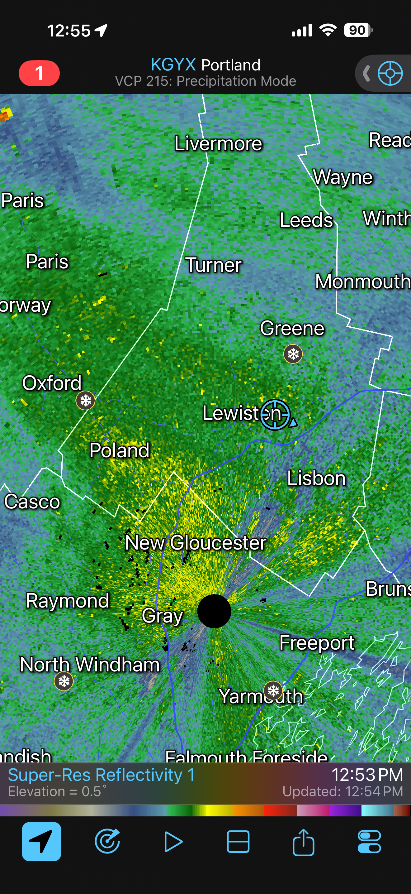
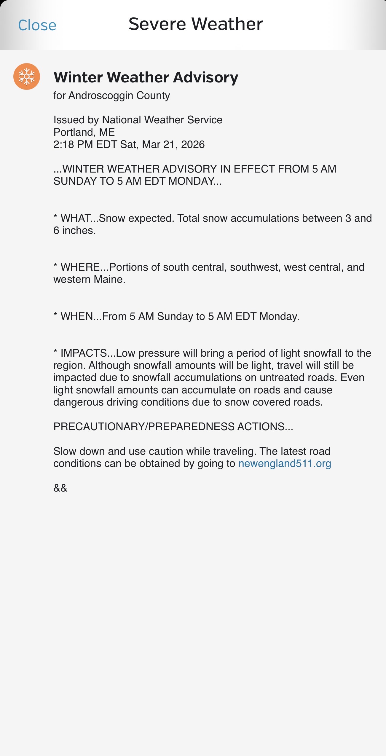
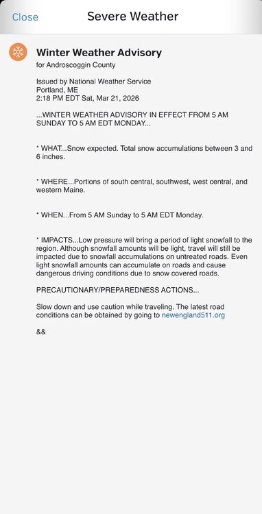
I'm thinking advisories and warning coming for some here soon in CNE/NNE.
-
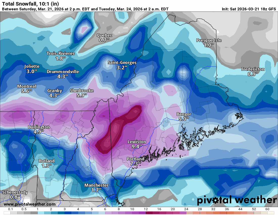
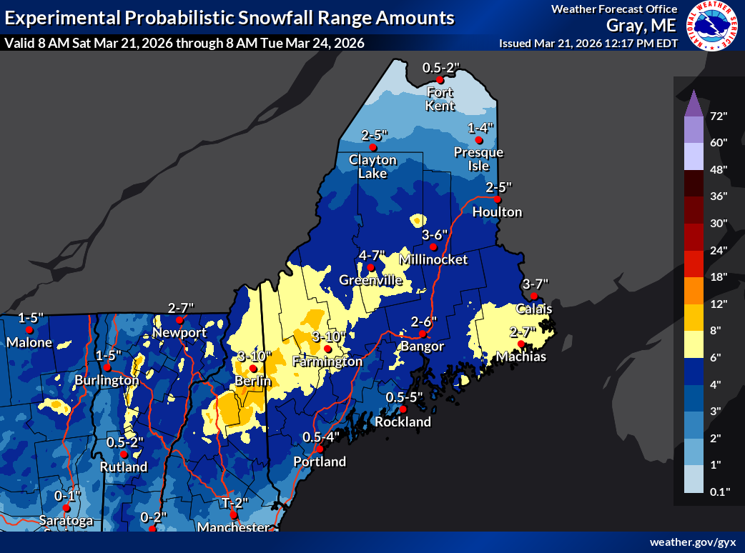
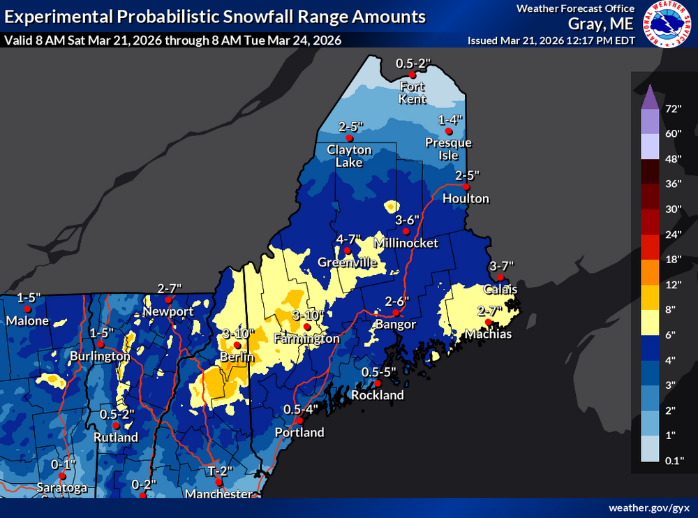
Looks like 4-6" here tomorrow, A bit more on Thurs next week, And a bigger system possibly around April fools day on modeling.
-
38/28°F under PC skies, Bit breezy with a brisk wind out of the NW
-
GWDTLT