

Stormlover74
-
Posts
24,323 -
Joined
-
Last visited
Content Type
Profiles
Blogs
Forums
American Weather
Media Demo
Store
Gallery
Everything posted by Stormlover74
-
Looks like no change on the Spc midday update
-
Sun trying to come out..73
-
We'll probably get a watch anyway
-
Nams agree. We don't even see any rain tonight
-
Time to take a drive
-
 Worse seems impossible.
 -
He likes snow but enjoys our misery more
-
Spc has a 45% severe wind risk for DC not as impressive for our area
-
Much of the day is dry
-
I think we might be caught in between. Where monday the threat is further west and then Tuesday it shifts to new England, but we should at least have rain chances
-
Euro is quite wet Monday morning. Not sure how that will impact our severe chances later in the day
-
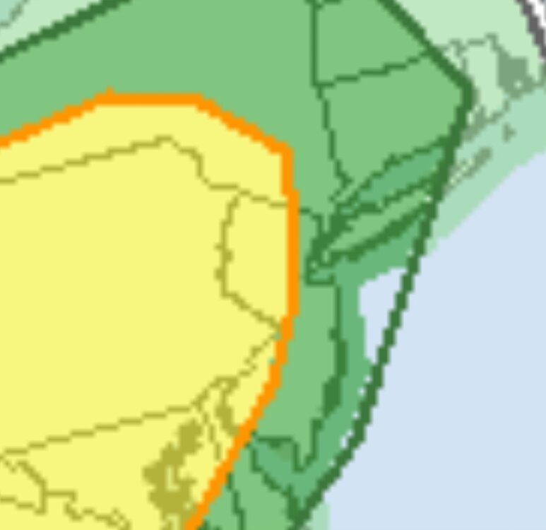
SPC Day 3
-
We're now getting back to needing some rain after a dry week
-
Refreshing onshore breeze at the moment. Should kill any storm chances
-
Yeah I agree. Hrrr has been inconsistent and it doesn't feel like an active day but I suppose things could change by late this evening
-
Hrrr has a line moving southeast between 9 and 11 tonight
.thumb.png.d5d294263f3caa04a077e29bd5b5d84e.png)
-
Euro brings back heavy rain tomorrow afternoon and evening. Models keep waffling
-
Pretty much
-
-
Hot off the presses. Frosty flakey and slushy. Our winter will be a breakfast cereal or something from Rita's
-
Some parts of the country go back next week
-
Euro is quite wet thursday night and Friday but we look to salvage the weekend
-
Now the gfs went dry, euro is very wet Friday and Friday night
-
Rain could return as soon as Thursday afternoon and last on and off thru Saturday but I'm sure that will change 20 times


.png.9e18f63ef87b4b1e1ea305a43354a04f.png)