Stormlover74
-
Posts
24,277 -
Joined
-
Last visited
Content Type
Profiles
Blogs
Forums
American Weather
Media Demo
Store
Gallery
Everything posted by Stormlover74
-
60s at 9pm on July 25th. I'll take it
-
Looks quite wet next week. Especially northern areas
-
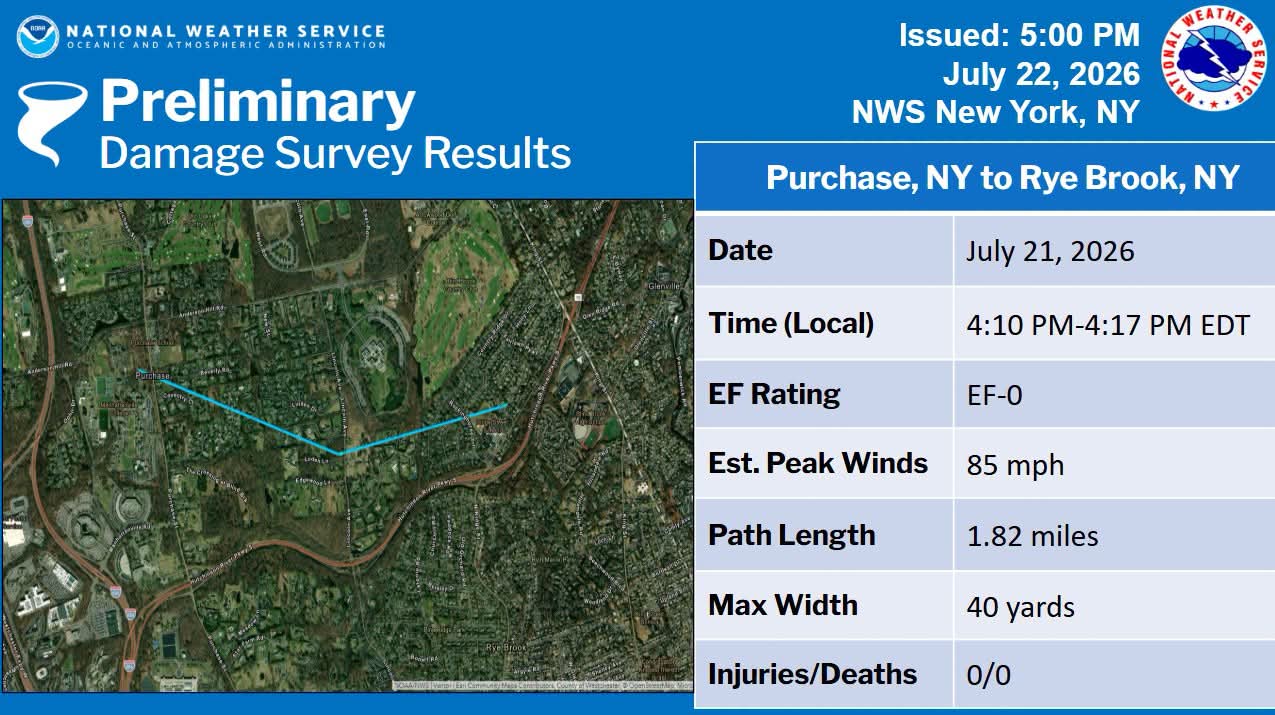
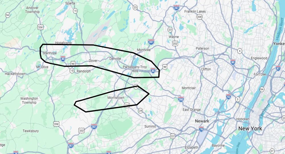
Tornado survey areas for tomorrow
-
Yeah I think the threat is over for us
-
Seems to be weakening except for the southern part
-
Looks like
-
Friend in montclair says its very dark and sky looks scary. Another is in IKEA (paramus) and they moved everyone to the basement.
-
Yes we had that during Ida
-
They are really going crazy with this. County parks are closing as of noon as a precaution
-
Now it shifted to tomorrow
-
Because most of the models are showing anywhere from a quarter inch to half a foot. high bust potential
-
I think its time for Mr. G to hang it up
-
And nam is mostly Wednesday morning
-
Models all over with regards to timing. Some have heavy rain tomorrow morning, tomorrow night or Wednesday
-
Down to 56. Feels chilly out
-
Lots of 50s for lows tomorrow morning
-
Very refreshing breeze this morning
-
July is now the wettest month since May 2025 at ewr
-
Kdix radar was hit by lightning
-
Not the friends we made along the way?
-
Already canceled
-
Cell in Mercer is warned for Middlesex and southern somerset
-
Looks a couple cells in west central nj moving northeast
-
Lol RADAR OUTAGE: The National Weather Service says its KDIX radar is currently down for an unknown reason. Technicians have been notified, but there is no estimated return-to-service time. You can still monitor the NWS national radar mosaic, which incorporates surrounding radars, but local low-level coverage may be less precise. Keep Wireless Emergency Alerts enabled, follow NWS Mount Holly and trusted local media, and use a reliable weather app for warnings. We’ll continue monitoring updates and public reports here.