Stormlover74
-
Posts
24,318 -
Joined
-
Last visited
1 Follower

About Stormlover74

- Currently Viewing Topic: Interior NW & NE Burbs 2026
- Birthday 12/02/1974
Recent Profile Visitors
20,876 profile views


-
Yeah we have to be careful what we wish for if this pattern continues
-
Yeah looks like we're mostly done
-
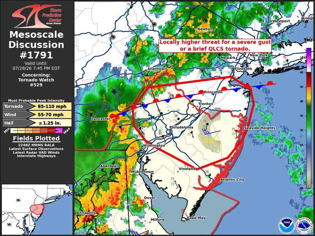
There's no severe threat for tomorrow according to the SPC
-

-
West orange heading towards south mountain reservation
-
kinda looks like it wants to split but hopefully not
-
Lots of mud and rocks and the golf course across the road was washed out
-
Roads closed all over essex county. Saw a mudslide
-
Nam seems to think there will be more activity to the south but hrrr keeps it over Delaware
-
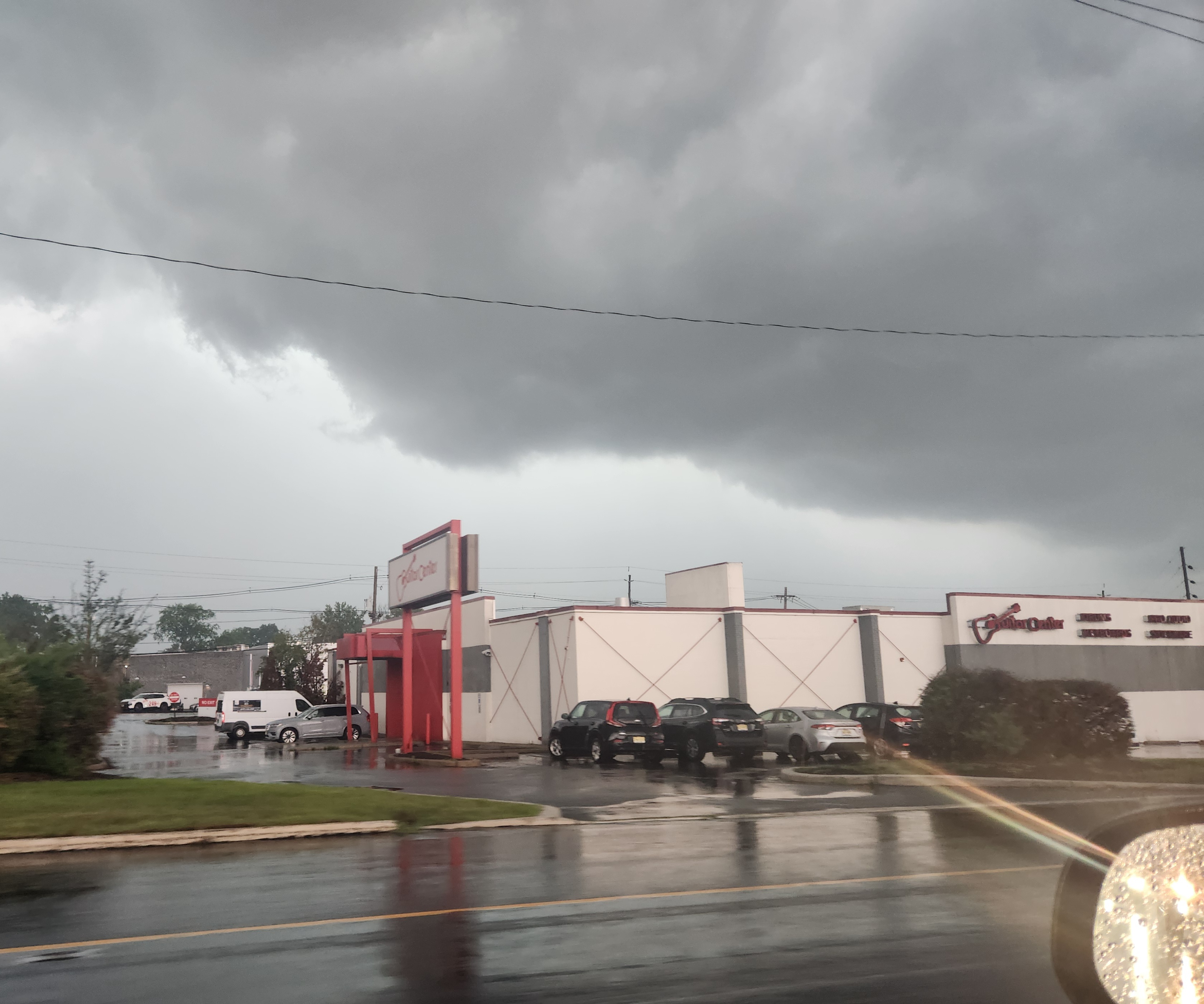
Its nuts. I'm in West Orange and deluge continues with ctg strikes every few seconds.
-
280 west practically a white out
-
On the parkway , north now about to get wild
-
Picture doesn't do it justice. super dark looking north
-
Yeah and visibility down near 0. No wind though