ROOSTA
-
Posts
3,009 -
Joined
-
Last visited
Content Type
Profiles
Blogs
Forums
American Weather
Media Demo
Store
Gallery
Everything posted by ROOSTA
-

Monitoring a potential important TV to East Coastal storm: Jan 17
ROOSTA replied to Typhoon Tip's topic in New England
"We have all been here before." "Move along, there's nothing to see here." _____________________ The solution has yet to be revealed. I'd go snow to rain coastal plain. Snow to mix to rain out to Rt128. Snow to mix back to snow outside 495. SAFE BET...ATT -
Monitoring a potential important TV to East Coastal storm: Jan 17
ROOSTA replied to Typhoon Tip's topic in New England
It's easier to accept when you don't have a dog in the fight. Emotions will always dictate some of the responses. Imagine for one moment the region gets back-to-back KU's, MBY has 3' of snow on the ground and still not satisfied. Still a long way to go before critiquing an outcome that is least wrong in the end. Analysis of reason is lacking. Just a personal observation. -
Monitoring a potential important TV to East Coastal storm: Jan 17
ROOSTA replied to Typhoon Tip's topic in New England
Overall (model consensus) ensembles have a snowstorm, dependent on the member to choose but trending 70/30% wise to a white solution. The OP's on the otherhand are literally all over the map, LOL. Something big as in deep, I mean deep this way cometh. Big model runs forthcoming. -
Ocean Bomb storms are my favorite to track. The unpredictablity of going from a clear and cold forecast to a 2' blizz is on a razors edge. They tend to be slow movers and back in at the 11th hour. Something to watch. Big model runs upcoming, there's a big one in there somewhere
-
LA-LA-LAND on steroids, piqued my interest. It's there no doubt, something BIG is going to pop. Please send me a bone...freeze, frost, I'd buy a flake if I could.
-
I'll post a grid map for snow depth in that timeframe if you insist, but for what reason I have no idea? Heck even MSLP is way "off" (wrong) in the LA-LA land of modelling. Potential is there, support from ensembles, some model agreement. Further runs needed to validate threat... something to watch. I think something else is going to pop in the interim.
-
I'm extremely jealous. One of these days, maybe in my old-age I'm going to move back somewhere in VT., NH., or ME. Pass-away with a smile on my face. NEXT?
-
KUDO'S to those who stuck to their guns in predictions. GUESS IT PRODUCED(ING). Congrats weenies...it's snowing. Ratios FTW.
-
Development off the Delmarva

-
Someone earlier was asking. What to use for latest obs: MesoWest Data (utah.edu) Change Network, Map and overlays.
-
Observations (next 2hrs) in this thread will telltale the outcome. A nowcast of nowcasts. I don't like the meso models for double digit accumulations. The slide-east for dynamics is a redflag, we shall see.
-
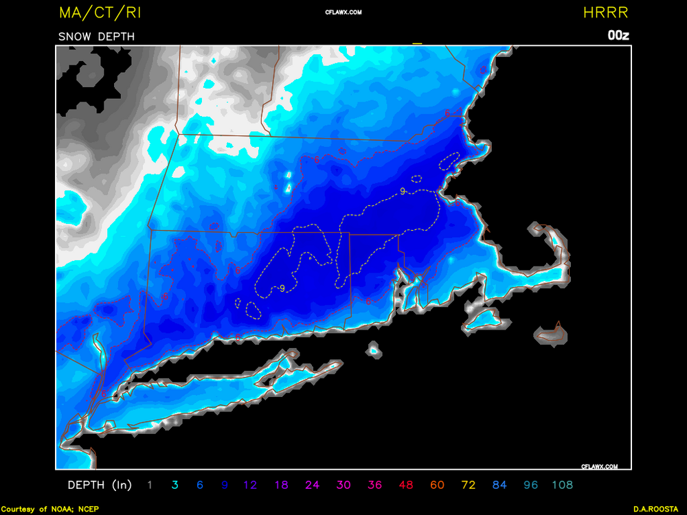
Let the grids do the talking... ANOTHER WEENIE SNOWMAP! HRRR from 00z to 12z. Cutback bigtime with not as much W expansion. (rgem too) Expect ML fronto magic with amounts higher than modeled Only question left IMHO is where it sets-up.
-
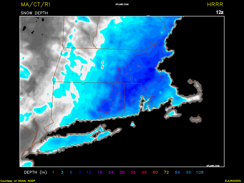
A weenie map to feast upon! 00z HRRR L Looks pretty

-
Zeus is in the house. Becoming clearer that a moderate event will unfold. Where? how much? minor details. Come March or in the prolific snow years of yesteryear this type event would likely only garner a dozen posts or so. First one is big regradless of amounts.
-
The potential is there! Compared to where the pattern was to where it is going forth, dollar to dime bet it's an improvement. Any snow is good snow! As the models turn (should be a mid-day soap on TV) THIS IS NOT THE EVENT TO BASE WINTER ON.
-
I second the concept. Red Tag only based on science thread. Many times one gets lost (Atleast I do) in the quagmire of frivilous posts.
-
Easy to state as it is NOWCAST. But the little bugger always had the potentail to overachive. It snowed as far S as Pensicola FL. When all is said and done the hills of VA. WV. will find a jack.
-
NEXT 48hrs HRRR is shifting a bit further N. A butterfly fart "could, might, possibly" bring accumulating snow into coastal CT most of RI and E. MA.
-
It's a step to "normal" and something to track. Record High temps down here...snooze. Expect changes run to run, I refuse to fall into the trap of predicting on a meso scale until it's actually snowing up there with greater model agreement.
-
Happy New Year to all. Looking into the crystal ball. Baby steps I say baby steps, I'll be looking at the slow lowering of HGTS to the SE Ridge. Get that "modelled" cutter or crapper to pass open the gates to the cold thus a reallign to the overall wave pattern. Looks like a volitale pattern that the OP models have yet to sniff out. A patern change looks to be in the making.
-
It's amazing to watch the emotional response(s) on the run to run model output. Just my 2 cents, forget about the OP and follow the ENS. The pattern will flip the question is "when" and for "how long" ? Winter could and probably will be determined by a stretch of 2 or 3 weeks throw in a KU during that timeframe and everyone is satisfied. Living in the northern clims atleast most of you have a chance of experiencing snow, below zero temps, admittedly what else is there to live for...LOL. Just hang in there cause you get what you get it's not controlled and it will change. A volitile, unpredictable atmosphere with an extreme event not out of the realm of the possible
-
Extreme events, huge swings in temp and precip. Piece the dynamic together perfectly not far fetched to experience 80F one given day and a 3ft snowbomb the next. We've already seen it, and will become more severe into the future. I miss New England, but I moved planning on having beachfront property surrounded by water! LOL
-
No complaining. It was 85F here today
-
Many members go way back, back before forums. Newsfeed, I think under the title ne.weather that goes back to the 90's. "Time waits for no-one! No-one waits for me." The Rolling Stones.