high risk
-
Posts
2,801 -
Joined
-
Last visited
Content Type
Profiles
Blogs
Forums
American Weather
Media Demo
Store
Gallery
Everything posted by high risk
-
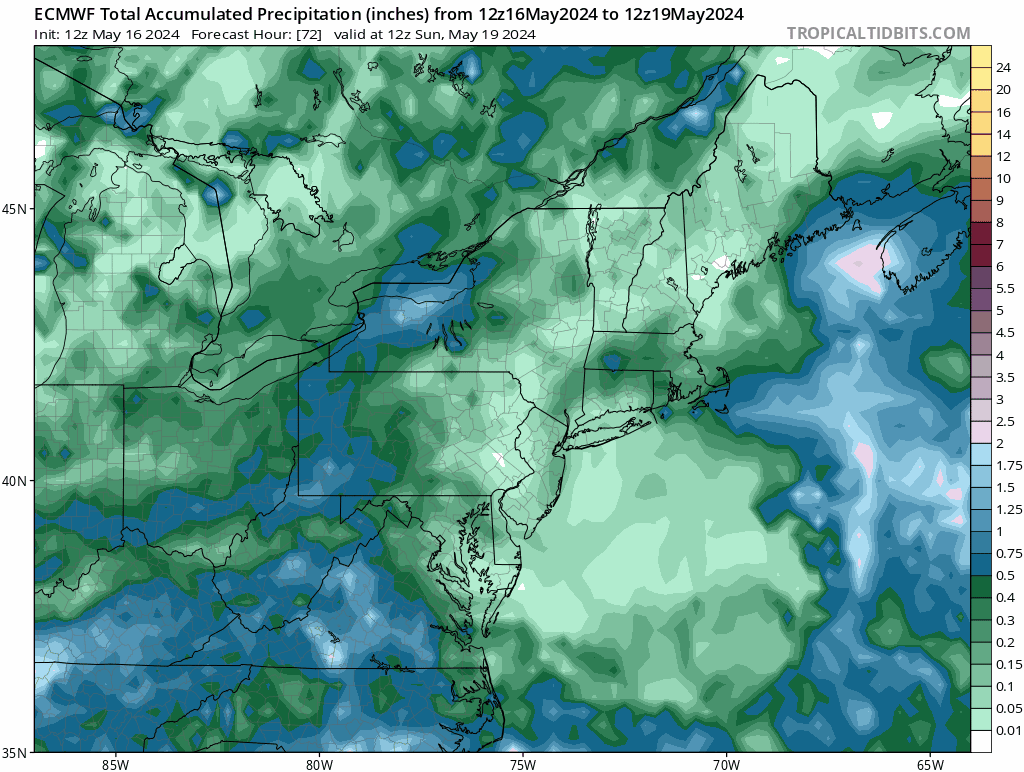
That's a very bullish forecast. It certainly seems like the best chances of heavy weekend rain are in the western and southwestern parts of the area, but depending on model of choice, heavy rain is far from a lock even there:

-
Right, but northern stream events here early in the season often struggle with instability, as it's tough to get good low-level moisture north at this time of year without some help.
- 1,696 replies
-
- 3
-

-
- severe
- thunderstorms
- (and 5 more)
-
Not only were there a couple of confirmed tornadoes in Garrett County Saturday, but the SPC storm reports list effectively shows a regional mini-outbreak. Quite remarkable for an event without a watch box.
- 1,696 replies
-
- 3
-
-
- severe
- thunderstorms
- (and 5 more)
-
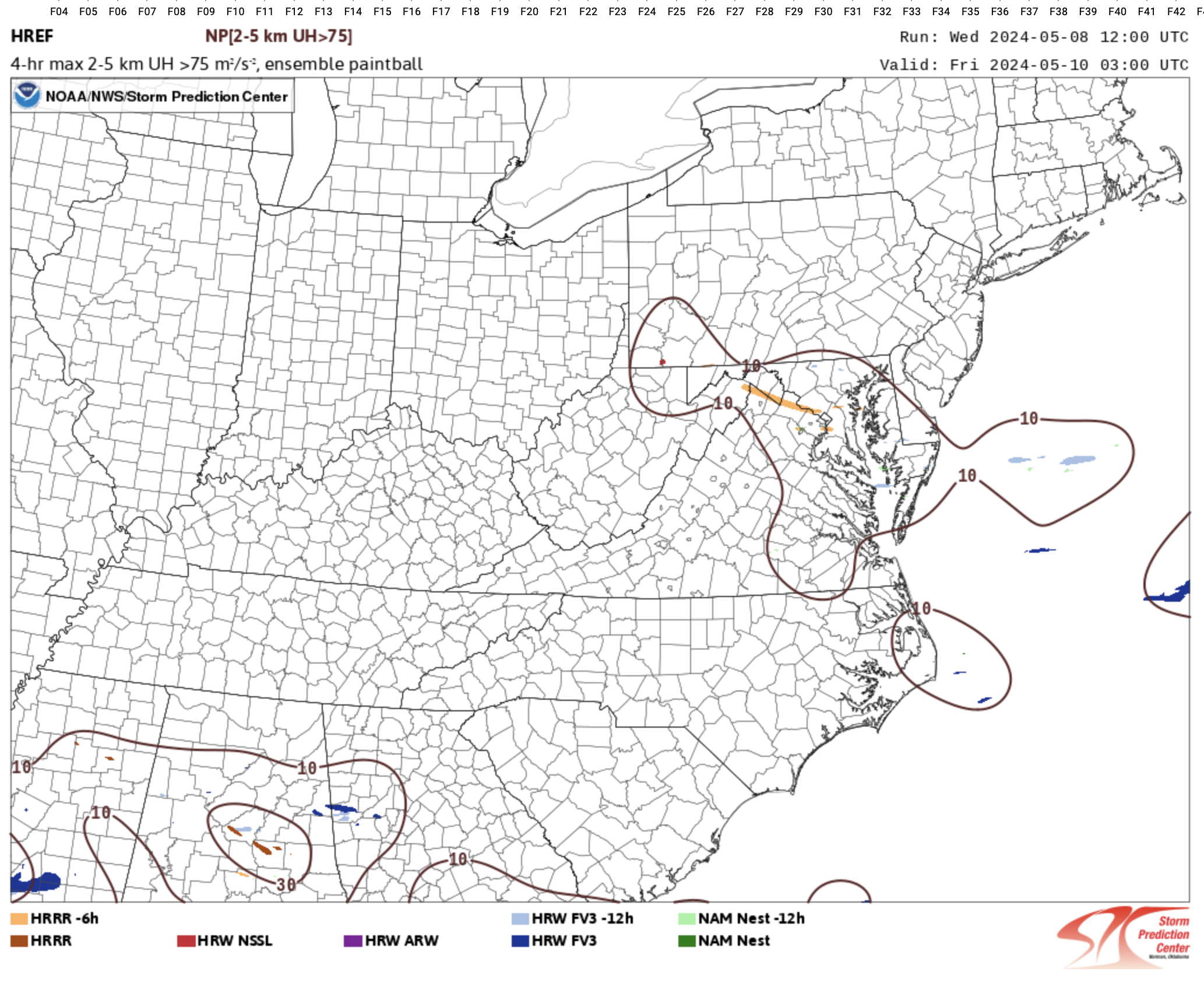
models are very emphatic that the warm air is going to be confined to areas well south and west of DC. The trends in the HREF to eliminate the SVR risk in the DC area are quite clear: 12Z yesterday: 00Z today:

-
The HRRR was really the only model that ever went all in on this scenario, but it really backed off yesterday evening.
- 1,696 replies
-
- 1
-
-
- severe
- thunderstorms
- (and 5 more)
-
I think there is some clear potential for higher end events like that in the LWX CWA, but it's going to be limited to the extreme southern part of their area unless the models start moving the warm sector back further north
-
The afternoon NAM Nest and HRRR both suggest that SVR potential Thursday will be confined to south of a line from CHO to NYG. LWX basically agrees in their afternoon discussion.
-
I thought that the 12Z CAMs took a step back in the threat for tomorrow, with most showing much cooler temps locally, at least partially driven by early morning rain/clouds.
-
The 12Z NAM Nest now looks very much like that Euro run and has an explicit forecast of organized convection here Thursday in a fairly good environment.
- 1,696 replies
-
- 5
-
-
- severe
- thunderstorms
- (and 5 more)
-
That would favor severe for sure, but the problem is that the ECMWF for now is alone in depicting southerly winds over the Mid-Atlantic.
- 1,696 replies
-
- 1
-
-
- severe
- thunderstorms
- (and 5 more)
-
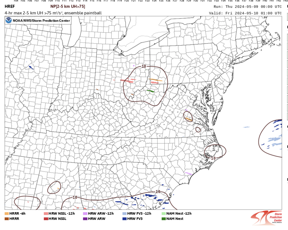
The HRRR has been fairly consistent in bringing storms through the OKC Metro during that period; the question is whether they will be discrete or some sort of QLCS thing. There are UH tracks in the HRRR output associated with those storms, but they're overall not super impressive. That suggests that despite the excellent parameter space, the mode may not be favorable for a high-end threat. It of course bears close watching, however.
-
I've actually been encouraged by how many thunder events I've already had this year. We've had some years in which I haven't heard thunder by May 1. Ultimately, our peak severe season here is roughly May 10 - June 20. There is the occasional cold core April hail event or some strongly forced early-season wind/tor event in some years, but the norm is to not really get cranking here until after the first week of May.
- 1,696 replies
-
- 4
-
-
- severe
- thunderstorms
- (and 5 more)
-
No doubt, but the problem is that the CAMs seem in pretty good agreement that the timing is just really bad for us. Those storms won't approach the PA/MD border until just after dark at the earliest, and temps will be cooling fast. For the record, it's complete bullsh*t that central PA gets a legit early season threat before we do.
- 1,696 replies
-
- 5
-
-

-
- severe
- thunderstorms
- (and 5 more)
-
You might get it in 15 minutes with this line rolling through now.... But yeah, the models really backed off leading up to the event.
-
Hard not to be interested with a red box now up for areas just to the southwest, and the latest guidance showing a surge of instability ahead of the line segment. Overall, the CAMs show a weakening trend, and the hodographs aren't all that impressive, but I'll definitely be watching for a while longer.
- 1,696 replies
-
- 1
-
-
- severe
- thunderstorms
- (and 5 more)
-
The environment certainly does look a bit more favorable later tonight than it had been, but I'm not seeing any decent UH tracks in any of the CAMs.
- 1,696 replies
-
- 3
-
-
- severe
- thunderstorms
- (and 5 more)
-
You have a VERY generous definition of "central".
- 1,696 replies
-
- 1
-

-
- severe
- thunderstorms
- (and 5 more)
-
definitely the best solution, but somewhat on its own. Our best hope for SVR is focus in the early evening, as the potential for something if we have to wait later in the night is still fairly low, IMHO, despite some good wind fields
- 1,696 replies
-
- 1
-
-
- severe
- thunderstorms
- (and 5 more)
-
No surprise that the tornado watch is for areas well south of DC.
- 1,696 replies
-
- 3
-
-
- severe
- thunderstorms
- (and 5 more)
-
While I'm modestly interested in Wednesday for areas south of DC, I'm actually intrigued a bit more (at least for those of us from DC to north) for Thursday. Cold temps aloft will allow for some surface-based instability to be present, and with very low freezing levels, I think that some hail/graupel is likely with the stronger cells. Downdraft CAPE is also present, meaning that some stronger gusts are possible too. All of the CAMs have a good convective signal. Maybe it won't quite require a MRGL, but it sure looks like an interesting afternoon.
- 1,696 replies
-
- 5
-
-
- severe
- thunderstorms
- (and 5 more)
-
The surface warm front is the leading edge of that warmer air head trying to return to the north.
- 1,696 replies
-
- 3
-
-
-
- severe
- thunderstorms
- (and 5 more)
-
Wednesday is pretty interesting. The shear will be off of the charts, and wind damage and tornadoes seem possible in any sustained surfaced-based storms. But how far north will the low-level warm air get? Pretty good agreement it makes it into southern MD and also pretty good agreement that it doesn't make it north of the DC Beltway. The in-between zone (including DC) has a fair amount of uncertainty.
- 1,696 replies
-
- 5
-
-
-
- severe
- thunderstorms
- (and 5 more)
-
Returned from a vacation and saw that we're going to be wedged on Tuesday with the front well south of here, so I was shocked to see that we're in a Day 3 SLGT. All of the skepticism is of course warranted, as we don't do SVR here with elevated convection well at all. That said, though, the lapse rates look shockingly impressive above the stable surface layer Tuesday evening or night, so maybe this is one of those super rare instances where we can get some decent hail even when temps at the ground are in the 40s. Again, this type of setup is so difficult to make work in the Mid-Atlantic, but we don't often see 1500 of elevated CAPE. .

- 1,696 replies
-
- 6
-
-
- severe
- thunderstorms
- (and 5 more)
-
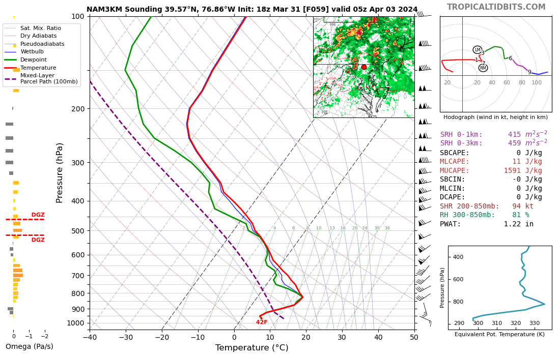
This is what I was saying, based on the forecasted soundings. If you start a parcel around 700 mb (710, to be precise, per the diagnostics), you do have some actual CAPE. It's just rare here to get convection based that high. The April 2011 comparison you made is likely a really good one.
-
I remember that event. The lightning was incredible.