das
-
Posts
2,299 -
Joined
-
Last visited
Content Type
Profiles
Blogs
Forums
American Weather
Media Demo
Store
Gallery
Everything posted by das
-
-5°F / -11°F here just south of Burlington. Probably not much mixing with the storm here. :^P Virga is now only 3 counties to the south away. It’s going to be a long day of radar hallucinations waiting. For those of you struggling with the NWS “upgrade” of the radar page, here’s my favorite mosaic from Univ of Washington. Change the number of frames there in the link for longer or shorter loops and to auto if you want it to auto refresh every 6 minutes: https://a.atmos.washington.edu/~ovens/wxloop.cgi?radar_us_full+30+-noauto And, if any of you want to pass the virga watching time and read up on Froude numbers for blocked flow, here’s an excellent primer from the team at NWS Burlington: https://www.weather.gov/btv/froude
-
-1°F / -5°F here in the Champlain Valley. Looking forward to 4-6 hours of WCB tomorrow night with the ~700 frontogenic max pushing thru then all eyes are on the froude number as blocked flow commences.
-
1.1" here in the Champlain Valley. Just enough to pretty up the 3" of crusty snow that's been sitting around for the last 3 weeks.
-
Significant upper middle Atlantic S/CNE mix/snow potential Jan 3+
das replied to Typhoon Tip's topic in New England
.25” waaaaaay out west here in the Champlain Valley. In the pre-dawn hours. Maybe we’ll squeeze another quarter inch tonight for a whopping 0.5” storm total. The freezing fog is fun tho. -
Significant upper middle Atlantic S/CNE mix/snow potential Jan 3+
das replied to Typhoon Tip's topic in New England
Truth. 0.7” was the grand total in Charlotte last night. At least it all came in a 1.5 hour period so it looked nice whitening up the snow from the 2nd. -
Topped out at 31°F yesterday with minimal sun only as it was setting. It’s all still here in the Champlain Valley.
-
3.8” was the storm total in Charlotte. It feels like a central Maryland snow. Dense, high water content. Might have to make a snowman.
-
3.1” here in Charlotte with 32dBZ returns overhead and more incoming from the WSW. Looking at correlation coefficient, the mix line stalled just south of Middlebury and recently shunted east as winds veered. Nice morning so far. Edited to add: 30.9°F here at the house. Going out for a run!
-
Column has finally saturated and light snow has commenced. 1/4” in the first hour. 28.1°F here in the northern Champlain Valley.
-
26.1°F and a passing snow shower in Clarksburg. It’s 61°F and raining here in Vermont. Merry Christmas, everyone!
-
Totally unrelated but I had a crash course in this. In the 72 hours ending at 3am this morning, there were 52 hourly obs of snow here in Charlotte and a temp that ranged from 24F to 29F. For a whopping 3.6" of snow. And, a max of 2.9" OTG.
-
There could be three tropical storms (or stronger) in the Atlantic basin at the same time in the middle of November. Incredible.
-
Here you go:
-
(sorry for the banter)
-
The 11am update still has Zeta as a tropical storm as it enters SW Virginia. Is it really still warm-core at this point?
-
I gotta be honest, I am most interested in the potential, eventual interaction between what’s left of Zeta and the upper level low that will eject east out of that phased trough in the west. Whopper Halloween storms are fun.
-
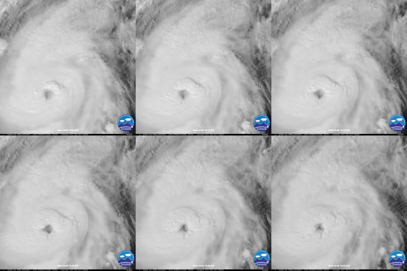
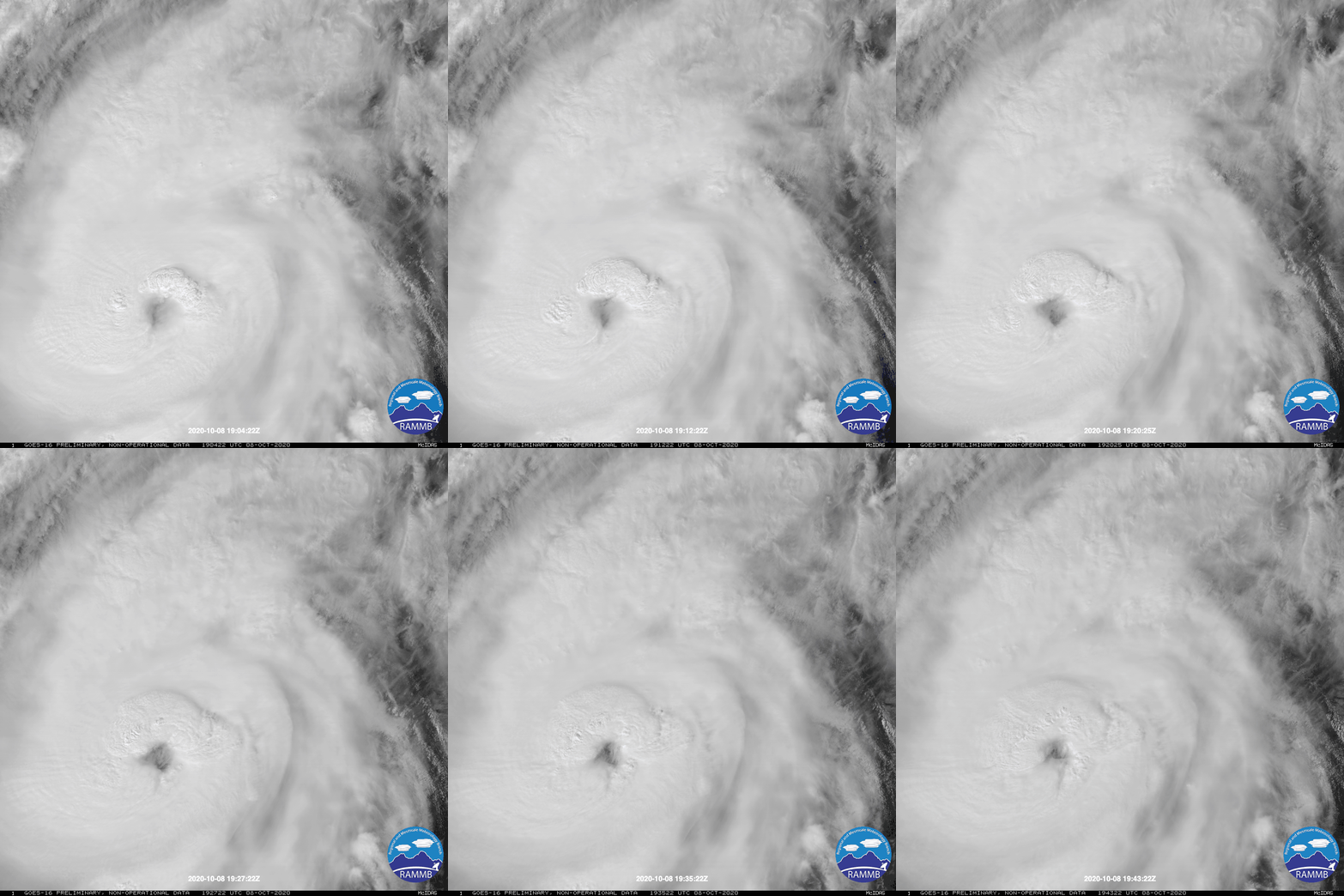
Just saving this here. Organizing storms at 1min intervals and 0.5km resolution are a thing of beauty:
-
May 8-9 mid-spring rain, snow, cold, wind obs
das replied to CT Valley Snowman's topic in New England
Steady snow just south of Burlington. Temp down to 35.7°F. Woo! -
I may have told this story back in the EasternUSWX days but just in case I didn't, here goes. I was hosting the Winnipeg Police Service for a 3 day conference over the holiday weekend here in the DC area right before PDII. They thought it was funny how excited the locals were as the storm approached and how the town seemed to be preparing for a disaster. Once the snow started to fall, they could not believe what they were seeing. They will have a long duration snow like PDII was every once in a while but never with the intensity they saw here. The conference degraded into a discussion on the synoptic setups that create major east coast storms and why places like Winnipeg never receive that much snow. Their largest single snowfall is 18". I have to admit that I was impressed with the general meteorological knowledge that the vast majority of the officers had. I wonder if their education system puts a greater emphasis on their weather education modules in school than here in the States. The CoP called me on 11 Feb 2010 incredulous that we had just had our third storm of the year that exceeded their greatest snowfall. He was a big snow weenie.
-
Reconsider majoring in meteorology!
das replied to stormguy80's topic in Weather Forecasting and Discussion
Concur. The College of the Environment at Univ of Washington is excellent as is specifically the Department of Atmospheric Sciences. They have undergrad (BS in Atmospheric Sciences) and graduate programs. They also understand the matrixed nature of the modern atmospheric scientist and offer minors in climatology and meteorology as well as a dual major of a BS in Applied & Computer Math Science. They are heavy on research with long-standing colloborative programs with NOAA, JPL and JISAO. I am not an alum but worked with the Department for years. Very good. -
Devastating tornado strikes Joplin, Missouri
das replied to Hoosier's topic in Weather Forecasting and Discussion
Excellent photo set, thanks for posting. There's a lot to be gleaned from them about the microdynamics of a strong tornado in a densely populated area. -
Absolutely excellent read and a great memory. Did you do the same thing over there for 09-10 Feb?
-
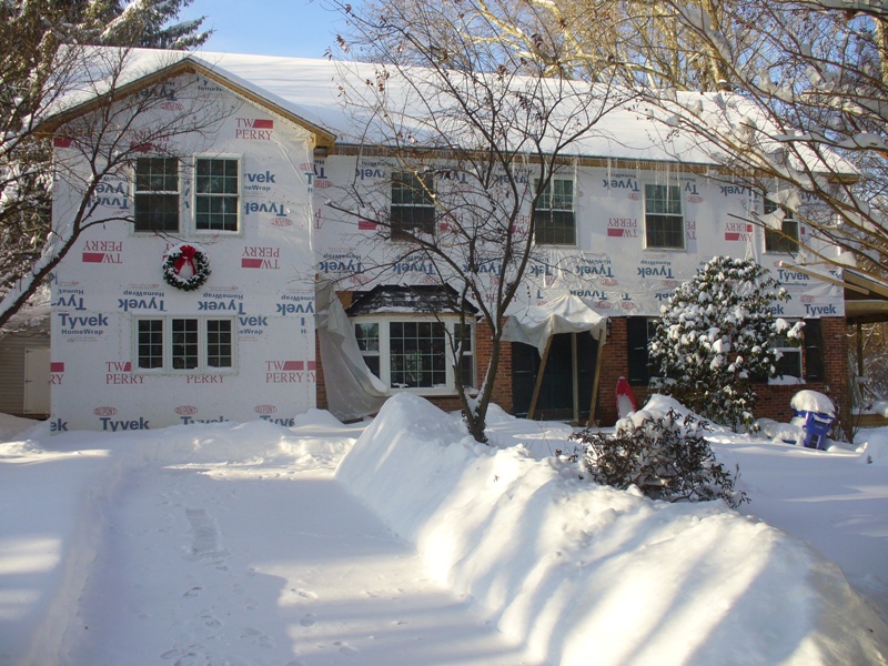
It was indeed a great storm. 20.5" in Clarksburg, right during the height of the holiday season and cold enough throughout the column that it was going to be all snow, all the time. It was great fun to see the storm modeled so well and I was giddy as more and more hitsoric storm analogs popped up as the event drew near. The two things that stick out the most for me were 1) being able to drive an AWD SUV through 20" of powder since it was so light and fluffy (technical term) and 2) taking a look at the ULL back in the midwest as the coastal bas bombing out off the VA capes and thinking, "that's going to make the pivot righ over me and give another inch or two on the wraparound 12 hours from now!!!" Here's a pic from the house on the morning of the 20th. It's safe to say construction on the remodel was at a halt...