-
Posts
3,679 -
Joined
-
Last visited
Content Type
Profiles
Blogs
Forums
American Weather
Media Demo
Store
Gallery
Posts posted by osfan24
-
-
Business is picking up in here, I see. I wish we could just skip ahead to January 20 and let it play out.
-
Woof, that's basically a non-event for the majority of the forum outside of PSU land and west. Still time but this is kinda trending where most of us thought it probably would.
-
It's whatever. Looks like two cutters set the table and then it is game on for the second half of the month.
-
 1
1
-
-
Icon is definitely a bit worse for some, for the little it matters.
-
Looks like GFS really cut back on precip after the overnight monster run. Might have to do with the shift to a slightly colder/less amped solution. Interesting to see how the storm has sped up so much in time. I feel like most of the time, our storms usually move back a bit in time, not up.
-
Alright, let's find a way to slow this thing down and stall it and bomb right over us to get a KU.
-
 2
2
-
-
Just now, WinterWxLuvr said:
Keep vigilant for carpenter bees. If they are around those woodpeckers will stop at nothing to get at them. That includes deck boards and siding.
Hate the carpenter bees. We moved into our new house a few years ago and they had put so many holes in our wood fence. I've spend the past couple of years trying to eradicate them and fill in the holes. People that lived here before us did like zero maintenance on anything.
-
 1
1
-
-
1 minute ago, Paleocene said:
I hear you, I just love seeing this solution versus the low running through Charleston WV, lol. We've got the high and low in the right place with this run... time cross fingers that it sticks to the canonical track off of the OBX/VA coast over the next two days worth of runs.
Oh yeah, I am not worried about that run. It was a perfectly fine run that keeps everyone right in the game. I do agree it looks like a pretty classic Mid-Atlantic MECS to HECS storm track. Just needed to gain a bit more lattitude.
One thing I'd like to see to pump up the totals more into HECS range is some WAA snow running through the region before we get into the CCB.
-
 2
2
-
-
1 minute ago, Paleocene said:
dude the low is due east of the NC/VA border at 144 hours... a hundred miles further NW and we rain in the 95 corridor. This thing is gonna jump around a lot in the next two days
Was not saying this is the final solution but that is definitely suppressed. I don't even think the heavy snow bands reach 95 unless the GFS is just not correctly showing how expansive precip would be on the northwest side.
-
 1
1
-
-
Looks suppressed to me.
-
 4
4
-
 3
3
-
 1
1
-
-
I am greedy. Let's start bumping those totals up a little.
-
 1
1
-
 4
4
-
-
-
-
I don't get the GEFS love. It spent all of last winter following the op. Seems like it will do the same this winter.
-
 4
4
-
-
Just now, psuhoffman said:
Gfs is going to be a disaster I think. Hope I’m wrong
Yeah, low is already way too far northwest.
-
2 minutes ago, Eskimo Joe said:
UMD has added a micronet to the Maryland Mesonet for College Park. Early results show a clear UHI.
I don't know if it is the metro or what. Obviously, it's probably even worse now than when I went there since the school and especially surrounding area has become far more built up than it was in the early and mid 2000's. But you would think with some of the green space there that it would help mitigate some of it.
-
1 minute ago, psuhoffman said:
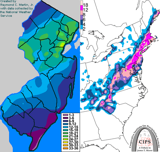
That makes more sense for Feb 2006. College Park clearly in the 8-12 and I am guessing it was much closer to 8 and possibly even a localized amount under 8. I am not sure why, but College Park always seemed to run warmer than surrounding areas. Do remember the February 2003 crushjob very well. That one hit us good down there, though again, not as hard as I got hit at home.
-
4 minutes ago, psuhoffman said:
@Ji Case in point there have been 11 snowstorms of greater than 15” here since 1980. Every one of them was also a big storm for you. We share the same big storms.
Jan 96: 36”
Feb 11 2010: 30”
Jan 2016: 28”
Feb 2003: 28”
Feb 83: 28”
Feb 5 2010: 27”
Feb 2014: 23”
Dec 2009: 18”
Feb 1987: 18”
March 93: 17”
Feb 2006: 16”
February of 2014 forever pains me. Got crushed overnight with like 10-12 inches of snow and then it was just a little too warm during the day and I had drizzle and a ton of melting. There was like four inches left on the deck by the end of it. I think it did eventually get colder late in the afternoon and we got some heavy graupel that turned back to snow for a short period. Meanwhile, it snowed pretty steadily all day back up your way and really dumped on you. I was in college at UMCP for the February 2006 storm and do not remember that one at all. I cannot imagine we got over a foot of snow down there and I don't remember it.
-
 1
1
-
-
41 minutes ago, Terpeast said:
Maybe it’s different during a nino, but last year the ensembles had tracks biased too far SE at 5-8 day leads. They eventually corrected to the op tracks.
We saw the ens move NW with the mean track already. The op is too far NW for a pure snow event along I-95, but NW of the fall line still in the game.
Let’s root for the 1/4 system to go ape off the coast for a stronger 50/50
I remember that well. The ensembles were worthless last year and oddly followed the op. Hopefully, that's not the case this year. Definitely some big hit potential with this one but could be heartbreak as well.
-
Oh baby. So close to something even bigger.
-
 1
1
-
-
Interesting that the January 10 system tries for a little front-end something. Doesn't happen but I just kinda wrote everything off after January 6/7. Maybe that will bear watching at some point.
-
 1
1
-
-
985 off of OC and hardly snowing, lol. Another way to fail I guess. At least it is a step in the right direction.
-
44 minutes ago, CAPE said:
Maybe those 'saying its ok' fully realize the advertised look is not what we ideally want to see, but also recognize that if that that's hand we are dealt we have a couple choices- find something else to do, or continue to look for chances within that pattern. We have managed to snow in non-ideal longwave patterns you don't approve of in recent winters, and many here are happy with any snow at all, and don't have your high standards of 40"+ per season and KUs in every Nino. In this area we suck at snow in general, and its likely not getting any better going forward. Maybe you need to adjust a bit.
I think his point, and one I share, is that when we finally get a Nino where things look like they should be lined up for a big season, you have to get that big season. We are coming out of an awful period for snow. I know where I live, I don't expect 96/03/09-10/14 every year. I get it. Those years are few and far between. But especially when our snow in general seems to be really decreasing in the crappy seasons, we have to hit big on the good seasons. To nickel and dime my way to 12-15 inches this year would be dreadful.
-
 1
1
-
 1
1
-
-
3 minutes ago, Ji said:
lol its 222 hours out....and it actually has made a gradual improvement over the last few runs.
Sure, it's better and certainly worth monitoring. This was always the time period/storm I thought had the best chance to produce before the mid-January relax period.


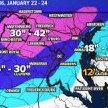
January 6-7 Storm Discussion: we’re due?
in Mid Atlantic
Posted
Rough start this morning after last night's great runs. GFS is much faster and weaker. Also looks a tad warmer as well.