-
Posts
3,676 -
Joined
-
Last visited
About osfan24

Profile Information
-
Four Letter Airport Code For Weather Obs (Such as KDCA)
BWI
-
Location:
Ellicott City
Recent Profile Visitors
7,956 profile views
-
If this was 2 months ago, especially after nearly the past decade, I’d be looking for the nearest bridge to jump off of, lol.
-
D+? One decent storm and not much else. I missed out on the epic squall day, which might have been the coolest part of winter for some. That said, there were a bunch of days with snow showers or flurries, and the decent storm timed up well with cold air behind it for almost the entire month of January, so there was snow over for almost an entire month. February was just such a disappointment, and our third snowiest month has been just really windy and now warm and there is nothing to track. The season basically ended in late February in terms of tracking anything. It was probably a B- considering expectations heading in and given recent years, but it seemed like we missed some opportunities once it actually got going.
-
Flurries. Must have come down harder for a few minutes because I have a light dusting on sidewalk and it stuck to the street in spots as well.
-
Sad to hear Richmond is getting anything.
-
I thought the NAM wasn't even developed until after the January 2000 storm specifically because of that major model miss?
-
Saw there was a ton of posts in here and was wondering what in the world was going on. Can't say the number of posts matches the models lol.
-
Unless there is another -AO/-NAO upcoming, I don’t see much to get excited about. Either way, after this latest massive fail, the de amplification trend all winter plus the Route 50 South train tracks make it hard to get interested.
-
It’s naturally bound to happen in a forum that covers so much geographically, but where the large majority of those in the forum live in a relatively small area. Also, the region covers everything from the mountains to the coast, so it’s almost impossible that the entire region ever experiences the same results from a snowstorm.
-
The lack of self awareness is really something to behold.
-
It does.
-
I’m not even sure how much I want the snow now. I just hope you have to build an ark for your flood down there.
-
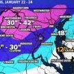
Euro still keeps the HECS scenario in play. Has there ever been a storm with this kind of result, though? A storm that destroyed that specific area? Not one that comes to mind. Usually it’s either a southern slider, a region-wide hit or it’s one of those coastal scrapers in Nina’s that hit the beaches, NYC and NE.
-
My kids were born in 2015 and after. They’ve never seen a big storm. The ingredients are there. 12 is fine, but it’s not a big storm like 1996, 2000, 2003, 2009. 2010, 2016. I want to them to get to see a big one.
-
Snow predictions at the start of the season are irrelevant at this point. The ingredients are there for a rare HECS after 9 years of mostly trash winters. Gotta convert. It’s like getting to Super Bowl and getting blown out and being happy you made it there.
-
The good runs?


