jbenedet
-
Posts
6,955 -
Joined
-
Last visited
Content Type
Profiles
Blogs
Forums
American Weather
Media Demo
Store
Gallery
Everything posted by jbenedet
-
White rain at DAW. Looks like another good round incoming. Mod+ rates in the last one, but too warm to accumulate.
-
Sun is out. We back to brown.
-
Eh. it's a combination. PSM/DAW dropped to 34/32 at coldest overnight; now back to 36... We know that won't stack unless it's ripping. It was high risk to go more than nuisance given all that needed to break right.
-
Only a coating at DAW. Wet roads. This was a big bust away from the coast in NH.
-
There’s a patchy coating on grassy surfaces only. Already melting occurring with lighter echoes and mostly rain falling…
-
PSM 40/32
-
Rain showers here. Nice night for walking the dog. Kids across the street playing basketball…
-
Already 32/20 at PSM. Looks like a setup where temp rises all day; high around midnight. Expecting a high in low 40’s today and tomorrow, before the fropa early tomorrow morning.
-
Yup. Good map. 80% of our regional landmass affected but only 10% of the population
-
Bermuda high now on the NAM. man is this thing just dog shit or what. Clowns going down in GFS flames again.
-
The NAM is warmer again. 40F isotherm now up to PSM, during the heaviest precip and dews are up in the mid 30's so wet bulbin' ain't happenin'. I have a better shot of registering AN temp than accumulating snow at this point. I'm wayyy out of this one. Enjoy far interior folks...

-
The trend is not your friend in the marginal zones of SNE, coastal maine and NH. I'm looking for rain showers and maybe ending with white rain.
-

December 2024 - Best look to an early December pattern in many a year!
jbenedet replied to FXWX's topic in New England
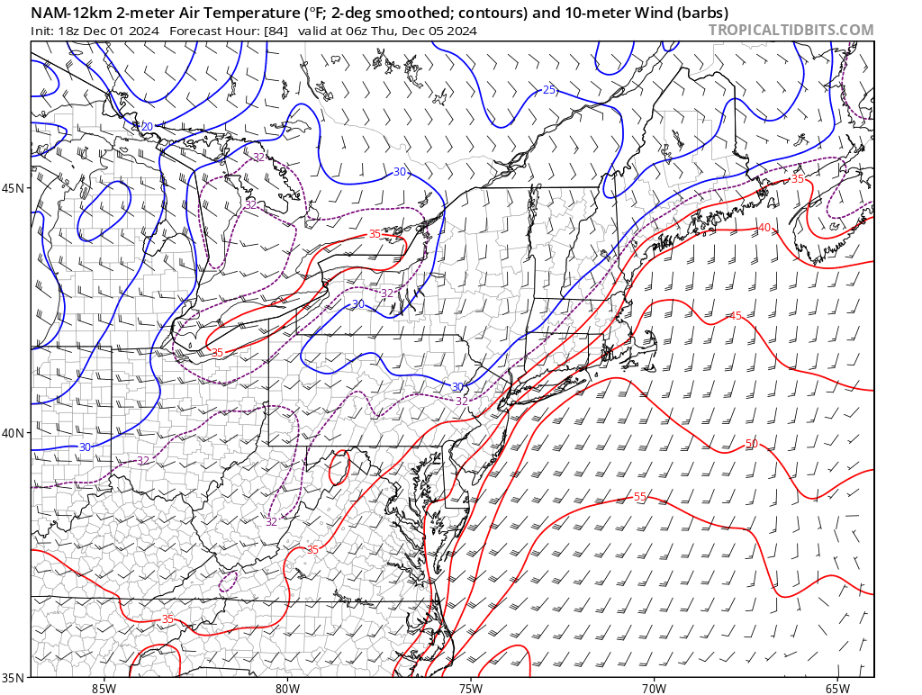
The Wednesday night clippah is looking like rain showers here. Another NNE and CNE event. -
December 2024 - Best look to an early December pattern in many a year!
jbenedet replied to FXWX's topic in New England
Coldologists are killin’ it. Now how do they get promoted to snowologists? -
December 2024 - Best look to an early December pattern in many a year!
jbenedet replied to FXWX's topic in New England
You’re changing the guidance narrative of the past 10 days to fit your opinion. Shocker. The N to BN pattern was very well advertised by guidance and most of us here didn’t bet against it. EPS, GEFS saw it weeks in advance and never lost it; in fact the signal strengthened with time. It’s the storm/snow part that you are after and you’re still missing outside of an advisory clipper. -
December 2024 - Best look to an early December pattern in many a year!
jbenedet replied to FXWX's topic in New England
The GEFS is misaligned with the modeled teleconnections. The -NAO and -AO disappear by first few days of December. The EPS is already picking up on what the GEFS isn’t with sharp shift to + AN by the 10th. I believe this gets pushed forward in time, especially along the coastal plain. -
Blowvember - and not named for wind potential
jbenedet replied to Go Kart Mozart's topic in New England
I keep hearing about BN; seacoast NH is already at its average high temp for the day. NWS forecast for the seacoast region looks like normal temps to close out November. -
December 2024 - Best look to an early December pattern in many a year!
jbenedet replied to FXWX's topic in New England
I’m talking the lakes region. -
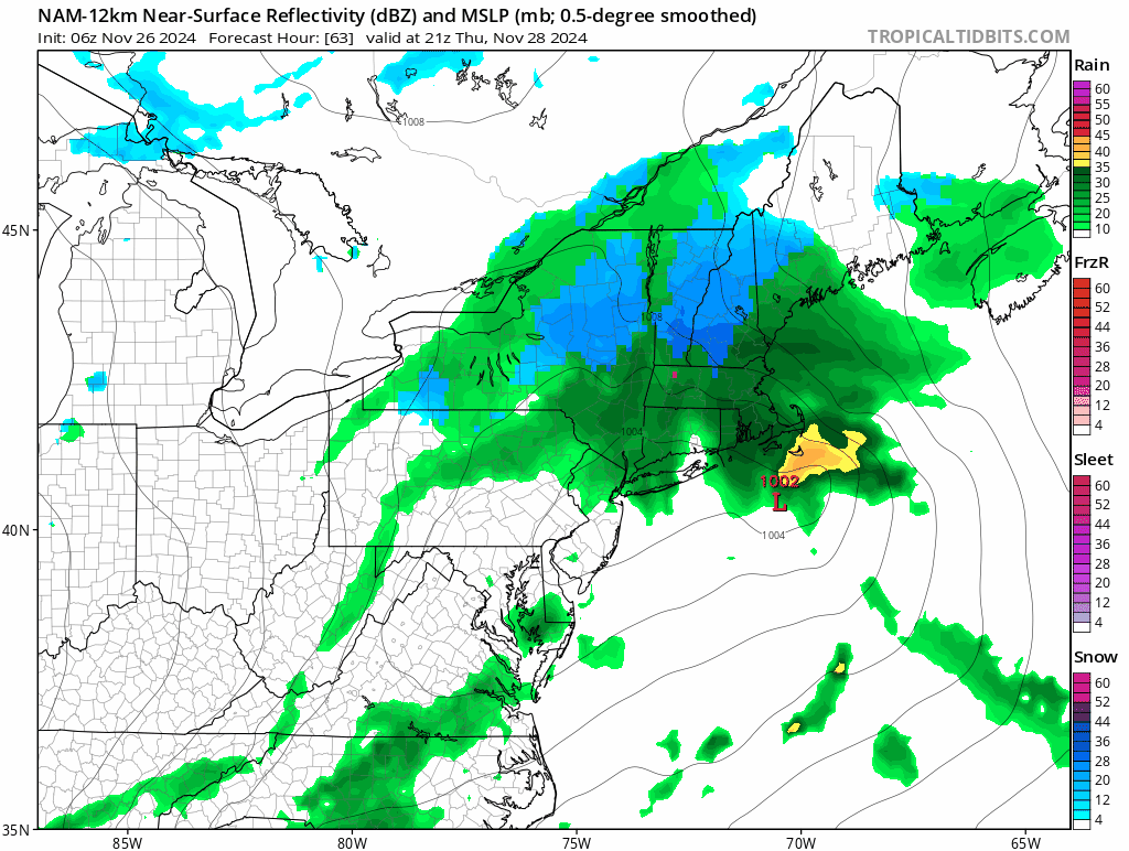
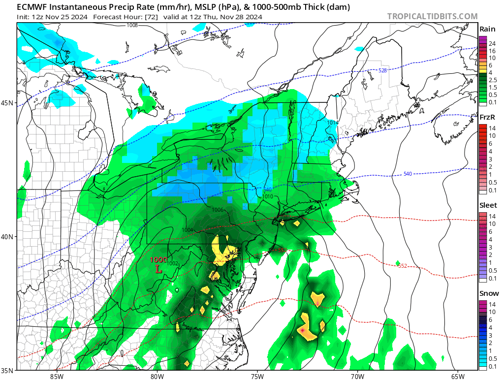
Turkey Day Birch Bender Snow Storm/Observation Thread 11/28/-11/29
jbenedet replied to dryslot's topic in New England
Pretty remarkable short term trend especially with such weak ridging in place off the east coast.
-
Turkey Day Birch Bender Snow Storm/Observation Thread 11/28/-11/29
jbenedet replied to dryslot's topic in New England
Only interest in this event locally is how warm PSM can get on ENE winds off the 50 degree gulf of Maine… -
December 2024 - Best look to an early December pattern in many a year!
jbenedet replied to FXWX's topic in New England
One of the few places where a significantly warmer regional climate translates to a lot more annual snowfall. I don’t think a lot of the people who moved to that area recently are ready for that though. Snow cover so high that blocks out your windows for weeks on end gets old. You really gotta winterize your home and mind to stay positive through that. -
December 2024 - Best look to an early December pattern in many a year!
jbenedet replied to FXWX's topic in New England
Zzzzzz -
Blowvember - and not named for wind potential
jbenedet replied to Go Kart Mozart's topic in New England
Yea, "closer". But what the hell is going on with these algorithms..? You look at the run and there's not 1 hour of modeled snowfall output for DAW...Similar for N ORH and yet somehow even the depth change shows 4" otg... SMH
-
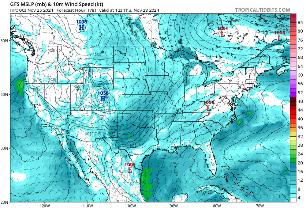
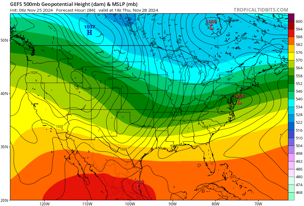
Blowvember - and not named for wind potential
jbenedet replied to Go Kart Mozart's topic in New England
The GFS op is the only model that develops a surface high in eastern canada for turkey day. Even the 6Z GEFS calls BS..
-
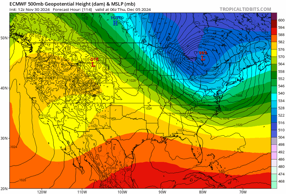
Blowvember - and not named for wind potential
jbenedet replied to Go Kart Mozart's topic in New England
I see a string of surface lows in southeastern Canada.... This is a crap setup guys...