jbenedet
-
Posts
6,955 -
Joined
-
Last visited
Content Type
Profiles
Blogs
Forums
American Weather
Media Demo
Store
Gallery
Everything posted by jbenedet
-
So much confluence seeing AN surface temps showing up in eastern NH and Maine now. Without a pack in the region it’s definitely believable. I’ll happily take that over the severe cold and dry I was looking at a few days ago….
-

December 2024 - Best look to an early December pattern in many a year!
jbenedet replied to FXWX's topic in New England
It doesn’t get better over the next two weeks— another rainer then all the confluence—-> dry What this is, is a key difference from previous years when caribou really cashed in. The biggest regional difference vs persistence of past 5 years I’d wager. My hope and expectation is this translates to an earlier start to spring. Better weather in later March and early April than in recent years. -
December 2024 - Best look to an early December pattern in many a year!
jbenedet replied to FXWX's topic in New England
Snowfall wise this December vs 2023, was worse for NNE better for SNE. In my hood this year was just as bad as last; though slightly colder. Region wide, generally less warmth but the much smaller pack in the north takes much less +AN to erode…The result is we are in same position as this time last year in terms of snow pack. Thinking many long range forecasters are losing to persistence at this point…. -
Looks like a few flakes for Boston/southeast. Radar decay look for many in eastern areas.
-
It’s a 1020 surface “low” pressure The system is also dampening as it traverses our region…. I think a coating will be max in the high population locations.
-
December 2024 - Best look to an early December pattern in many a year!
jbenedet replied to FXWX's topic in New England
Stars to align for -15. Well we did it with this. On the solstice no less… https://x.com/NWS_MountHolly/status/1870729535593050436 -
December 2024 - Best look to an early December pattern in many a year!
jbenedet replied to FXWX's topic in New England
I don’t reference DAW in winter. I can’t explain that. In summer it hasn’t been far off; it’s much better than me using PSM temps in late spring and summer. I know it still blows your mind but it’s often one of the hottest spots in the region on southwest winds. Even the guidance can pick this up, into York. So there is something else also going on that you physically haven’t been able to explain; just that the ASOS is BS. -
Yea one of these patterns where you don’t much latitude because the mid level tracks are suppressed.
-
Merry Christmas.
-
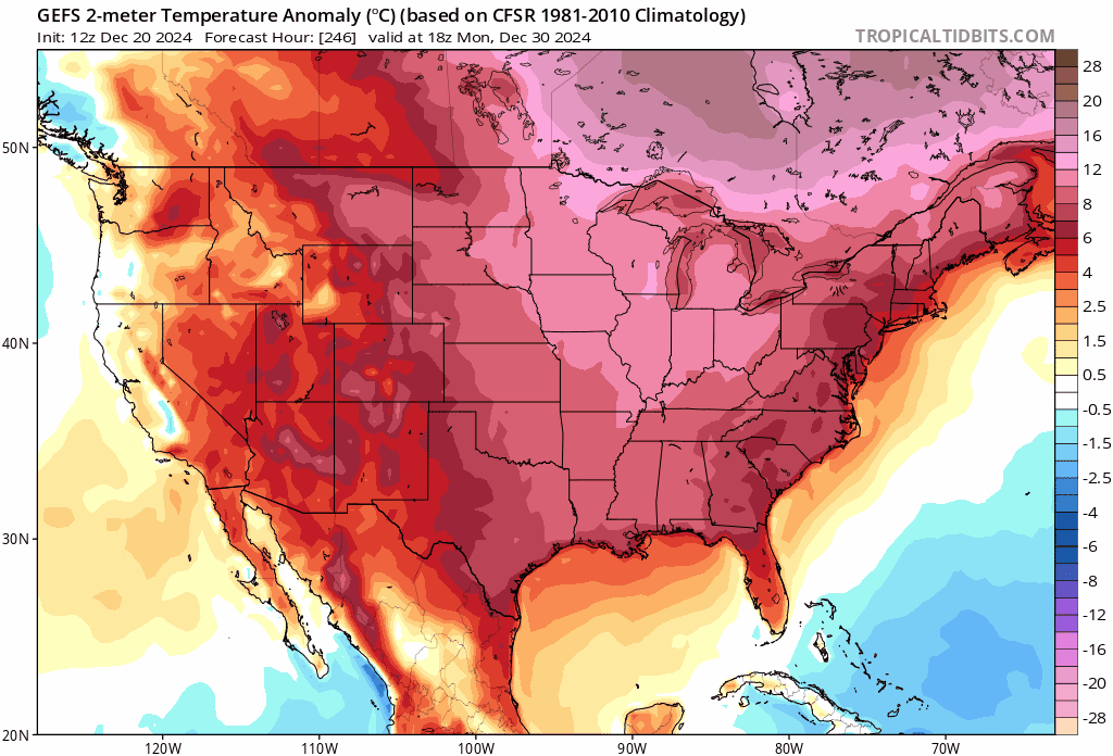
The early Jan pattern —I’m seeing a number of synoptic scale parallels to the period which produced the blizzard of 96. Weenies will of course take this and run with it…but so much still has to break right for a similar outcome. Of course timing is everything but main point here is I see SNE, and especially mid Atlantic in best spot for significant snowfalls after the late December warmup.
-
This isn't accurate. The H500 height anoms are misleading as Canada is very warm. The PNA ridge is too far west, allowing for MP air, vs CP, despite the longwave trough developing in the eastern half of the US. MP in January isn't going to translate to cold for the mid latitudes. I'd agree in march or april, however... I will give you that the torch fades (with time) on latest guidance, but that's also with the highest uncertainty some 320 hours + out.

-
Really tough forecast for BOS. I see on guidance, especially euro, by afternoon winds switching more easterly and temps jumping >35F.
-
December 2024 - Best look to an early December pattern in many a year!
jbenedet replied to FXWX's topic in New England
In terms of snowcover we are trailing behind every year since 2019, except last year. Last year in mid December there were back to back cutters that decimated the snowcover through year end. We have a hostile period incoming about 10 days behind last year's...Will be interesting to see where we are around the 1st... -
December 2024 - Best look to an early December pattern in many a year!
jbenedet replied to FXWX's topic in New England
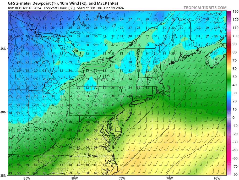
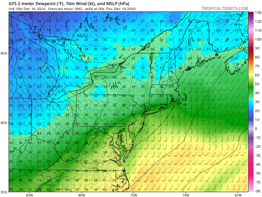
For Friday night, with the cold so close didn't really anticipate stacking issues but.... Highest pop in the areas with surface temps above freezing. Northeast winds.. but for BOS/ to SE MA, that's right off the GOM which in points northeast is still ~45F.... -
December 2024 - Best look to an early December pattern in many a year!
jbenedet replied to FXWX's topic in New England
Tonight has turned to mostly rain even in the interior of NNE.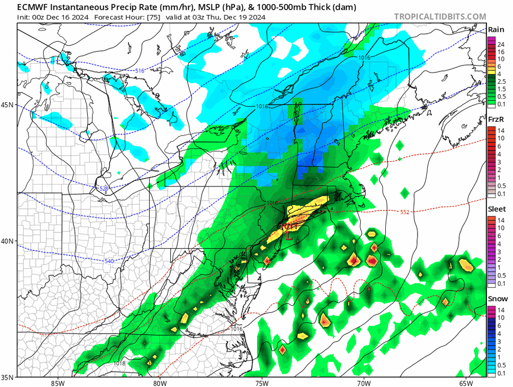
-
December 2024 - Best look to an early December pattern in many a year!
jbenedet replied to FXWX's topic in New England
Another 50+ degree day. really nice in the sun… -
December 2024 - Best look to an early December pattern in many a year!
jbenedet replied to FXWX's topic in New England
Without in situ cold, timing becomes critical. With split flow, timing is especially difficult…odds are great that we miss the big ones. (Jury is out on the 21st for extreme southeast sections) Now the weak open wave storms like tomorrow or the clippers that were rainers for most—that’s the biggest shift that is hardest to anticipate. If these were producing advisory snows in broad areas of SNE we’d be largely normal for the month…So if you’re not factoring a +2-4F in background climate you got screwed. Worse still is you could double down on the lost snow in December and call for a mean reversion in Jan-March which isn’t coming because your snow fell as white rain or just plain rain. -
December 2024 - Best look to an early December pattern in many a year!
jbenedet replied to FXWX's topic in New England
I’m seeing 50 obs at PQI -
December 2024 - Best look to an early December pattern in many a year!
jbenedet replied to FXWX's topic in New England
60F on 12/17 and the pattern hasn't even shit the bed yet. Wiped out a week's worth of BN days with today alone. -
December 2024 - Best look to an early December pattern in many a year!
jbenedet replied to FXWX's topic in New England
@Typhoon Tip There's so many knock on affects... We talk a lot about the gulf of maine....But something that I've started to key in on much more - reduction of sea ice in the great lakes and especially the Hudson bay. The hudson bay could pass for an ocean, given its scale in surface area. If this stays ice free longer, it's not just a shift of a few degrees, but probably 5-10 degrees given the arctic air that it's moderating on its way here... -
December 2024 - Best look to an early December pattern in many a year!
jbenedet replied to FXWX's topic in New England
Bangor Maine with a 50F this morning. That should be good for a +15.... -
December 2024 - Best look to an early December pattern in many a year!
jbenedet replied to FXWX's topic in New England
The warmth ahead is impressive, but to me the lack of cold behind these fronts is the more interesting story. Keep in mind this is *while* the pacific is cooperating... Have to go way up into UP of Michigan or far interior Ontario to even find temps at freezing... https://www.spc.noaa.gov/exper/mesoanalysis/new/viewsector.php?sector=16#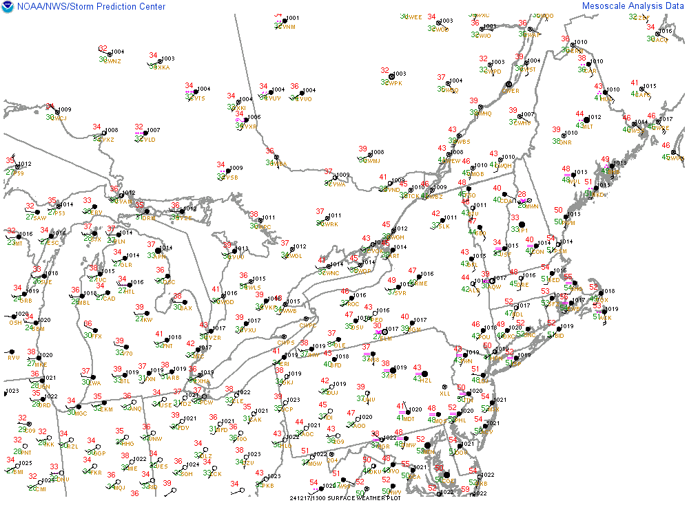
-
December 2024 - Best look to an early December pattern in many a year!
jbenedet replied to FXWX's topic in New England
At least the warm weather around Christmas makes for lighter packing when traveling... -
I dunno ....I read through some of this stuff and I find it all unnecessarily complicated. Gobbledygook.... Keeping it simple.... I see significant differences between the MJO forecast for the GEFS and EPS... GEFS wants to spend a lot of time in phase 7 at high amplitudes while EPS wants to move through 7 at low amplitude and into phase 8 by beginning of the year. For the east, this is amounts to significant difference in sensible weather outcomes given the phase 7 (+AN) /8 (BN) tendencies. The GEFS currently has a lot more company than the EPS... my bet would be accordingly.
-
December 2024 - Best look to an early December pattern in many a year!
jbenedet replied to FXWX's topic in New England
Yea. Again there's no canadian high, and the antecedent is warm. I find when you look to your north/west and see dews at/above freezing in marginal events like this, it's a pretty big tell on rain or, at best, white rain. We're basically relying on wetbulbing and wetbulbing alone won't cut it with this airmass.