jbenedet
-
Posts
6,955 -
Joined
-
Last visited
Content Type
Profiles
Blogs
Forums
American Weather
Media Demo
Store
Gallery
Everything posted by jbenedet
-
Yea. For Death Valley.
-
0z Euro is alone vs GFS Ukie and Canadian. And yesterday’s 12z euro looked a lot like what the rest of global guidance is showing... It’s a high confidence bet still but the models couldn’t make it too easy for us...
-
Just finished walking the dog. Very steamy still. My guess is temps don’t fall much at all from here, given some clouds, light wind...and dews rising slightly into tomorrow morning. 78 for a low tomorrow morning a.m. in Dover, if I had to throw something out there.., What are the record high low temps...?
-
Man up. Winter season is sooo much more exhausting than this. Heat kills many more Americans per yr than TC’s. Probably should focus on the heat if you’re feeling overloaded by “hype “...
-
“WAR strength”. Heh. That’s an unequivocal —NAO next weekend.
-
Sure, What are the limiting factors while it is over water? There.
-
Dry air entrainment only limiting factor, and that will be a function of how organized the circulation becomes. If it tightens up here, it could well create a moisture pocket, and continue to quickly organize. As you noted shear itself is low—modest structural organization will go a long way in this case.
-
The ones with no recurve/trough interaction up through landfall —like this one—are the most dangerous in this respect. Imo. ...
-
For the 4th weekend, persistence bet is the worst of it ends up in SNE and Northern Mid Atlantic. Another “best in Maine” opportunity. Sig -NAO look. The wet get wetter and the dry get dryer.
-
A warmer version of this past Memorial Day weekend.
-
The model crack smoking started out west, and it’s manifesting in real time. The latest GFS runs in the context of the craziness out west makes a lot of sense actually...The yin and the yang. A highly anomalous UL ridge out west...begets a highly anomalous UL trough in the East? Physical equations. Mother Nature finding a way to amplify baroclinic waves with summer climo and temperatures across the CONUS by breaking physical limitations out west significantly to the up side...
-
Versus one year ago. Worse in NNE, much better in SNE.


-
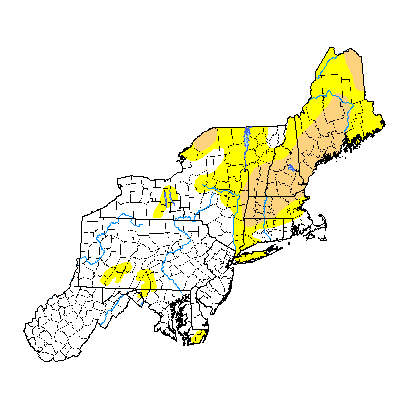
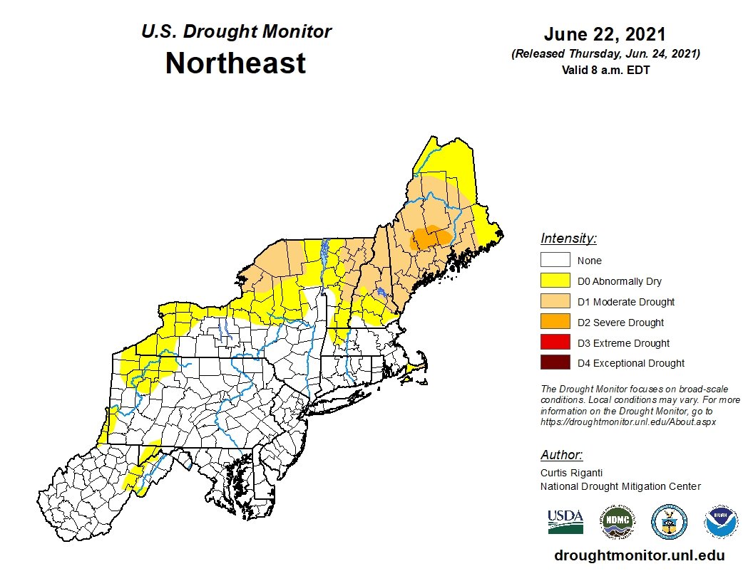
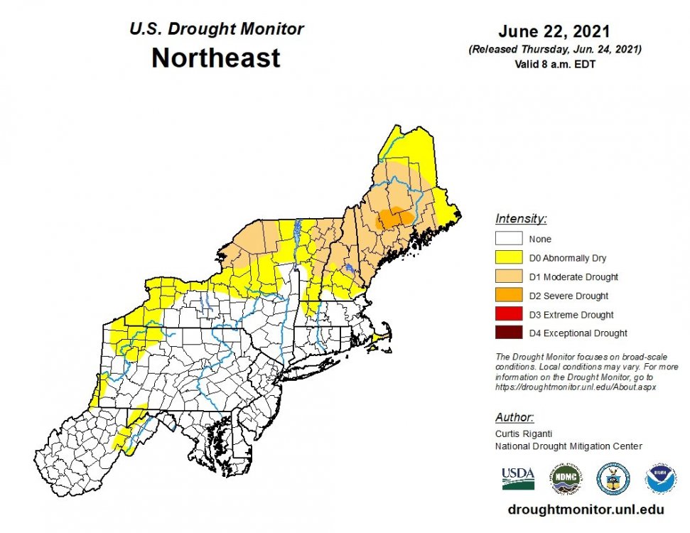
Large increase of drought conditions in NH and Maine. https://droughtmonitor.unl.edu/Maps/CompareTwoWeeks.aspx
-
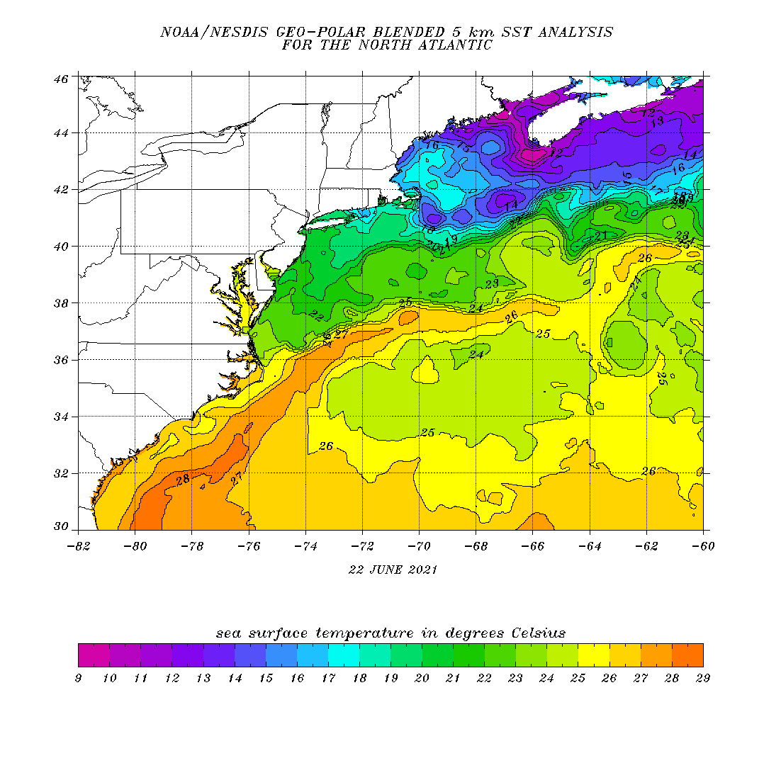
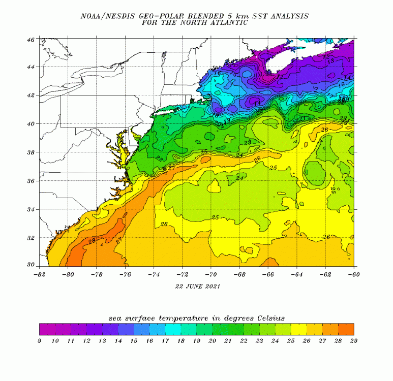
In terms of a tropical threat—the Gulf Stream where this disturbance currently is, is certainly warm enough. The issue I see, especially out 12+ hrs is dry air. Does still look like it will be an important pc of Friday’s weather forecast though...
-
Probably going to end up with 0.25” for today and yesterday, combined. Now back to a stretch of fair weather.
-
Teleconnection wise this could be transient. Looks like the WAR flexes over very short term and then we’re back in a -NAO ish regime. MJO phase 1 aligns similarly.
-
Looks like persistence this week. Largely dry fropa in northern and eastern areas followed by Canadian airmass.
-
If NNE doesn’t cash in on appreciable rain the next 2 days, drought conditions going to jump this week. Starting to see shades of drought in the vegetation now, even in southern most areas.
-
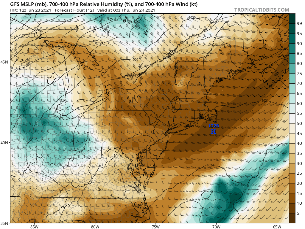
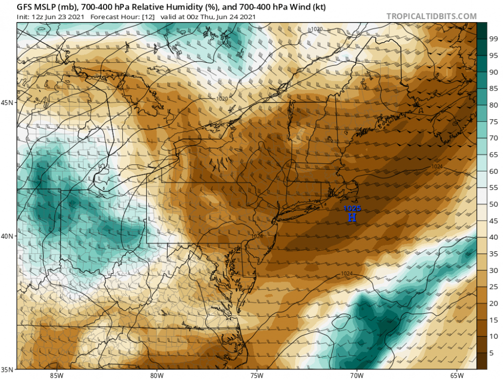
GFS/GEFS hinting at tropical development off the SE Coast around day 4, and surface HP precluding a quick escape East. Not much of a signal but it’s late June in New England and the summer doldrums...so..we watch....
-
0.5” - 0.6”for DAW and PSM in 3 days. Points ~50 miles north probably ended up with half of that and surface HP is once again, overhead.
-
Yea and west. This really effin’ died as it moved East. I’ll be happy with 0.2” at this point.
-
That helps explain what I’m seeing in the local rivers lakes and streams down here near the coast. Vegetation is green but the rivers, lakes and streams are indicating closer to severe drought conditions.
-
There’s something to be said of this heat and how it contributes to the real long term drought conditions in terms of rivers/lakes/ponds/streams. I live adjacent to a cove that’s overflow from the cocheco river. This cove looks like it’s at risk of turning into a canyon and yet we’re in a mild drought. Neighbor who has been here since 2013 said he’s never seen it this low. I believe him. How many will be losing their river front views?...Subtle and a real medium term risk...
-
Pretty damn impressive heat for late spring.
-
I DGAF about futures or 1hr/1 day whatever. Algos will whipsaw whichever way over that time frame to throw off trend followers and dumb money. This news of the fed turn tilts everything back in favor of bears now. That’s all you need to know.