jbenedet
-
Posts
6,955 -
Joined
-
Last visited
Content Type
Profiles
Blogs
Forums
American Weather
Media Demo
Store
Gallery
Everything posted by jbenedet
-

August Disco 2021. Do record dews continue?
jbenedet replied to Damage In Tolland's topic in New England
NHC should have a lemon off the SE coast. Looks like a non-negligible chance at one of those last minute OBXer’s... Nah instead, what is most likely to happen —if something does get organized—is NHC throws up odds when we all already see a TD on vis. -
August Disco 2021. Do record dews continue?
jbenedet replied to Damage In Tolland's topic in New England
In August this is a signal for a Mid Atlantic/New England TC threat Just Sayin’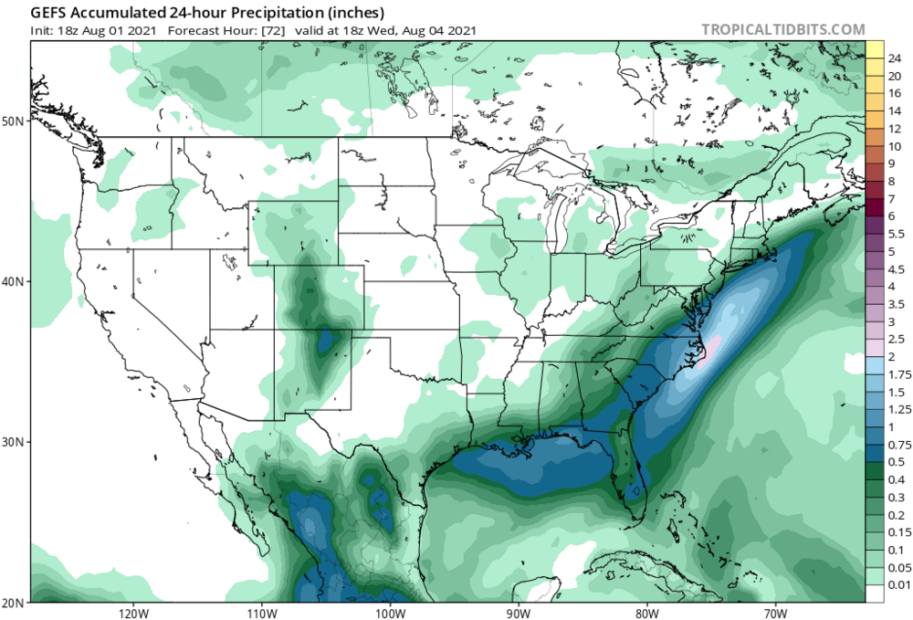
-
August Disco 2021. Do record dews continue?
jbenedet replied to Damage In Tolland's topic in New England
Yes -
August Disco 2021. Do record dews continue?
jbenedet replied to Damage In Tolland's topic in New England
One of those two disturbances on the GFS, Tues and Wed is going to hit us hard. Just a matter of which one. More than likely the 2 weak disturbances are really one, more cohesive tropical/st system...Major guidance just hasn’t resolved it yet. That’s my best guess anyway. -
If you’re going to get a TC up here you need a synoptic setup similar to Tues to Friday, next week. That’s a window for big rains *if* the sleeping tropics could stir something up off the SE coast. A stalled frontal boundary on guidance shows the potential. MJO to phase 8 and timed with a significant pump of the WAR. It’s as if Kevin has written the script for next week.
-
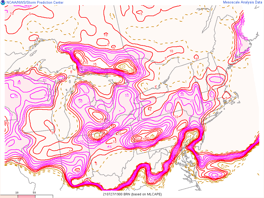
I like BRN’s 15-30 as a general rule of thumb for good chance of severe t-storm conditions. I 84 west up to southern NH away from the coast.
-
Reminds me a lot of winter. Trough overhead but no CP air masses to be found. High temps are BN when we’re socked in but just about across the board, dews are way up and night time temps are at/above normal.
-
All the record breaking started in June...I mean, just overlay this pattern onto late July and August climatology.
-
Perfect weather for the gardens. Yesterday I yanked my withering snap peas and planted carrots and lettuce for a second season harvest.
-
That’s awesome. My tomato plants are finally fully recovered from the drought and severe heat in June. I did what I could to get out ahead of it, but it was too extreme as to not impose a shock. It was a several-week set back but plenty ripening outside right now... Not to digress..but most amateur gardeners think their plants aren’t producing much bc the soil is lacking nutrients—but if the plant itself is otherwise healthy and green, it’s most likely bc it is lacking water. Fruit and vegetables are ~90% water. The plant will conserve water, if water isn’t in surplus, and that means poor yield.
-
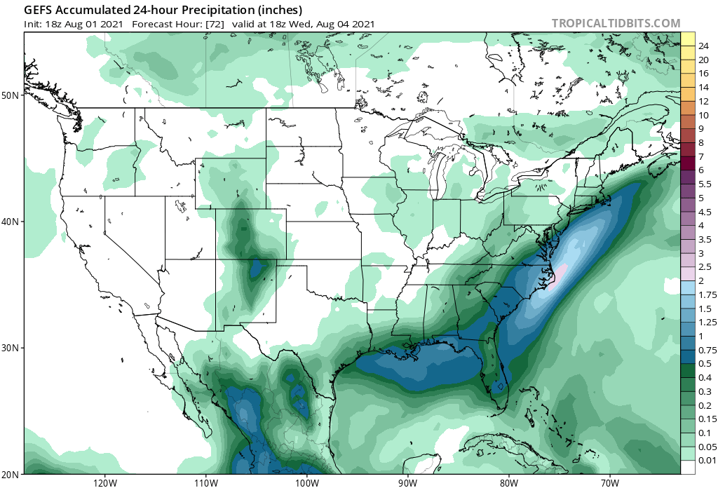
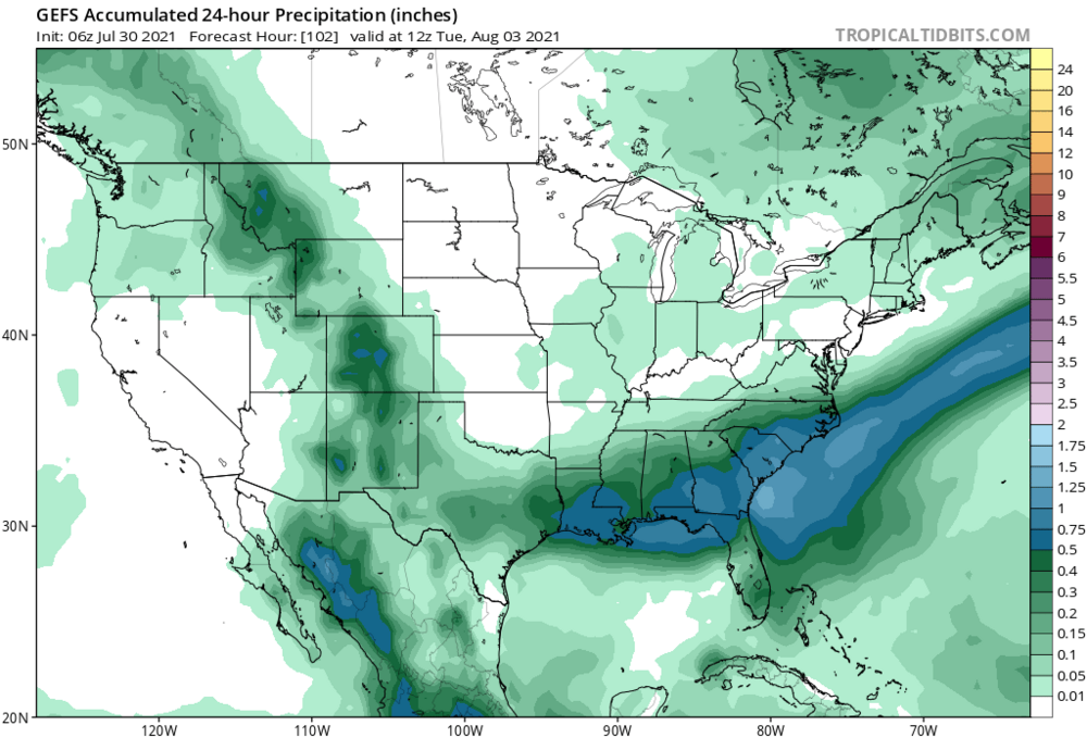
The GEFS and EPS take this over Boston. If it’s a non-event, it won’t be bc of the track.
-
Not your classic TC, long wave trough interaction. It’s really more of a TC and potent shortwave interaction. I dunno what climo is off the top of my head but from what I recall, late spring or especially fall is when we have these come up our way due to more meridional flow that accompanies these seasons. We’re getting into mid July. We don’t have a big Bermuda High..What gives? I’m seeing surface temps in NNE in the 60’s while Areas of extreme northwestern Canada are pushing 90. A lot more baroclincity around the CONUS than one would expect. And that means more UL jet dynamics than one would expect. That’s my best guess as to what intensification the models curiously are seeing.
-
Looks to be hugging the western side of the cone since the 5a.m. update, but that’s just by eye. The track is still North or ever so slightly west of north. Not seeing an East component yet.
-
Highly Asymmetrical appearance; highly asymmetrical impacts. You could be 25 miles west of the center and be experiencing much better weather than those who are 150 miles to the east. For all the disorganization Elsa is maximizing impact by maintaining the center off shore allowing tropical storm impacts to affect the entire west coast of Fla. The eastern side is also aligned with the background flow, adding to the surface wind-speeds.
-
Today will be better than expected outside of East Maine. We are all drying out. It’s got a 70+ feel even up here
-
I’d say eastern SNE is very much in the game. I’m not seeing a deep enough trough to make it interesting for points further north and west.
-
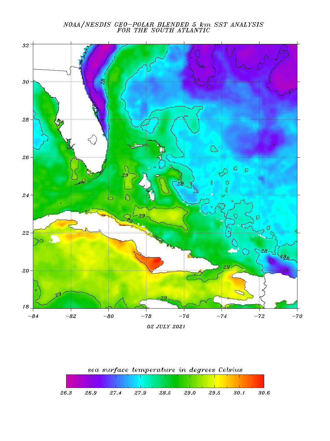
The impediments regarding fast forward speed and significant land interaction —hispaniola, and Cuba have been greatly reduced. And now Elsa is over the warmest SST’s in the Caribbean. This is still a very interesting forecast. Relative to most recent guidance, surprises to the upside in terms of intensity are far more likely than the opposite...

-
Usually this is capped by conditional instability—when there’s a deep UL trough overhead. You reach the upper limit and pay for it in terms of clouds and showers later. It’s nature’s quid pro quo.
-
Weaker storm, not vertically stacked means a much further west track, as the low level easterly flow predominates. My initial thoughts on an earlier recurve were wrong despite the intense trough over the eastern CONUS for this reason. The GEFS is illustrating this quite well now. I think risk is now tilted in favor that Elsa ends up west of the current NHC cone. And that would translate to much less land interaction with Cuba and a lot more time over open water in the GOM. And we all know what that means in terms of vigilance. A weaker storm over the next few days could mean a much stronger storm in the end.
-
This really is a warmer version of Memorial Day wknd. I’d be seriously enjoying these rainy cool breaks if not for the terrible timing...
-
My guess is the first trough misses but influences a more northerly track. At that point it depends if a ridge builds over the top of it, or another deep trough comes in first and sends it OTS. Landfall discussions are pointless at this juncture. I’m just saying the initial recurve happens earlier and makes it an east coast threat instead of a west coast FLA., GOM, threat.
-
My guess is this ends up much further east. SE coast threat. Big trough over the east—much earlier recurve. Trough will miss but influence a more northward track than current guidance.
-
Yea I see that. That is my base case but CPC certainly seeing something quite different. Hedge accordingly.

-
I’m just hoping for clouds at this point...
-
I can’t stand this weather. It’s not even July yet and I if I had to guess I’d say I have seen 10+ days of 90+ highs and 70+ lows already this year. We are going to get a wonderful break but it’s certainly far from over. The low temps have consistently been running well above normal. A 70+ low in summer is feeling quite normal, expectations wise, unfortunately.