-
Posts
7,773 -
Joined
-
Last visited
Content Type
Profiles
Blogs
Forums
American Weather
Media Demo
Store
Gallery
Everything posted by jbenedet
-
We've seen a great improvement thanks to technological enhancements and fine-tuning the theory. Not even debatable. My basis is we're stagnating here, and it's not because of the former; but an over-reliance on it. And some take this further with an arrogance to ignore everything else, "we know everything, that's relevant to weather forecasting". No, we don't. In mathematical terms, we've hit a forecasting asymptote. More effort of staring at models is not creating more accurate forecasts.
-
Yes and it's also why experts, generally are terrible forecasters. They tunnel. They are a great resource but they don't understand (or value) the present outside of their very narrow focus.
-
Also, I've learned in the art of forecasting, it's really much less about seeing into the future, and instead fully (and accurately) understanding the present. Models can hinder forecasting ability, if misused. We all want to see an image of the future. It's eye-candy and easily abused. Addictive. If you get the best picture (wholistic) view of the present, you can then better predict the future. To KNOW the present is to see the future. I've become a zealot for Lorenz and chaos theory. If you are after accurate forecasts: Know the initial conditions as best as you can; forget most everything else.
-
I don't do this anymore. The pay-off is not worth the risk. And by risk, I mean opportunity cost. I have learned; mostly the hard way. Now I monitor the weather and try to improve my forecasting abilities to enhance the productivity of my outdoor hobbies; mostly gardening. Much better balance of risk/reward.
-
You were spot on about how active this winter was. I'll def give you that. Nice call in that regard. Marginal boundary layer temps prob cost me 30" in white rain this year. Snowfall accums are a bitch to forecast; vast majority don't appreciate how right you can be, and still be wrong. It's extremely stressful for that reason.
-
I was down in Greenville SC recently and you could see into the past how the base of the longwave troughs were displaced too far west for us this season, persistently. They didn't have snow to show for it, but the landscape looked like it had been shocked into cold many times this winter. Just 500 miles in longitude but that difference really meant a lot for SNE/CNE and into SE NH. You can see it even on latest guidance. Interesting...
-
Agreed. It's like Jan - early March were all, mostly late November; with brief winter interludes. With the sun doing it's thing, now we have late March/early April looking sensible weather. Seasonal, for the most part. Still not pretty but at least bare ground and longer daylight hours make outdoor spring activities possible. I'd really love a late March warm front past Bangor, right about now....
-
Some more tidbits for the naturalists: Friend spotted large hungry bear in Barrington, messing with his bird feeders last night. Out from hibernation. Cocheco is least frozen since mid January. Both observations following a pattern of "normal", and no big warm fronts. Oh yea, and the latest guidance looks like persistence. CPC is also warm. I'm calling this winter over for SNE into SE NH. We spring.
-
DSD. We 50 today.
-
wow. that's remarkably low for PWM.
-
The plows sending the road slush into mounds and piles, which then mitigates melting does a lot to make it seem like more. Another reminder of what could have been, with temps 1-2 degrees colder. But any untouched surfaces are ready to melt out in a day or two.
-
I took a pass on analyzing this one bc the expected significant BL issues. I have had enough of this for 3 seasons. The ratios this year have been abysmal.
-
And I think you had to measure at peak rates and peak storm to see those numbers. My "7" is less than half just since evening and overnight, due to ongoing melting.
-
Lol this graphic which leaves out the Monads, Berks, and ORH hills. Missing a datapoint for Portland - 7" there? "where most of us live" map. Lame. AF.
-
I believe the euro also far outperformed the GFS in terms of QPF. GFS was ridiculously overdone.
-
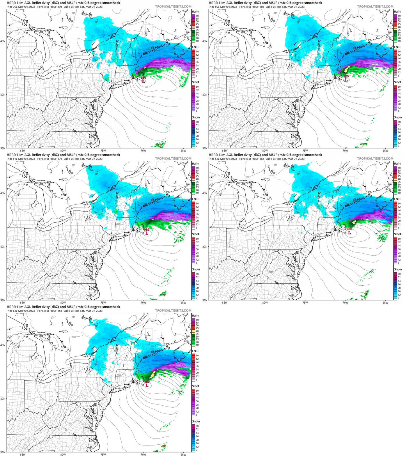
GFS was way too cold at surface and missed the H7 issues that even made it's way up here for a few hours, with sleet. That's where it lost to the mesos and euro. Otherwise it had a good handle on the H5 evolution.
-
It's beautiful out with paste on everything and sky brightening up. Pleasent to be outside; not cold. Was sweating while doing some light shoveling. Cleaned off the car with 3 gentle pushes. Heavy wet snow can have its clean up benefits if you beat the refreeze.
-
-
Looks like back end of the goods already in Central NH. Maine FTW. PWM will finish up nicely on this.
-
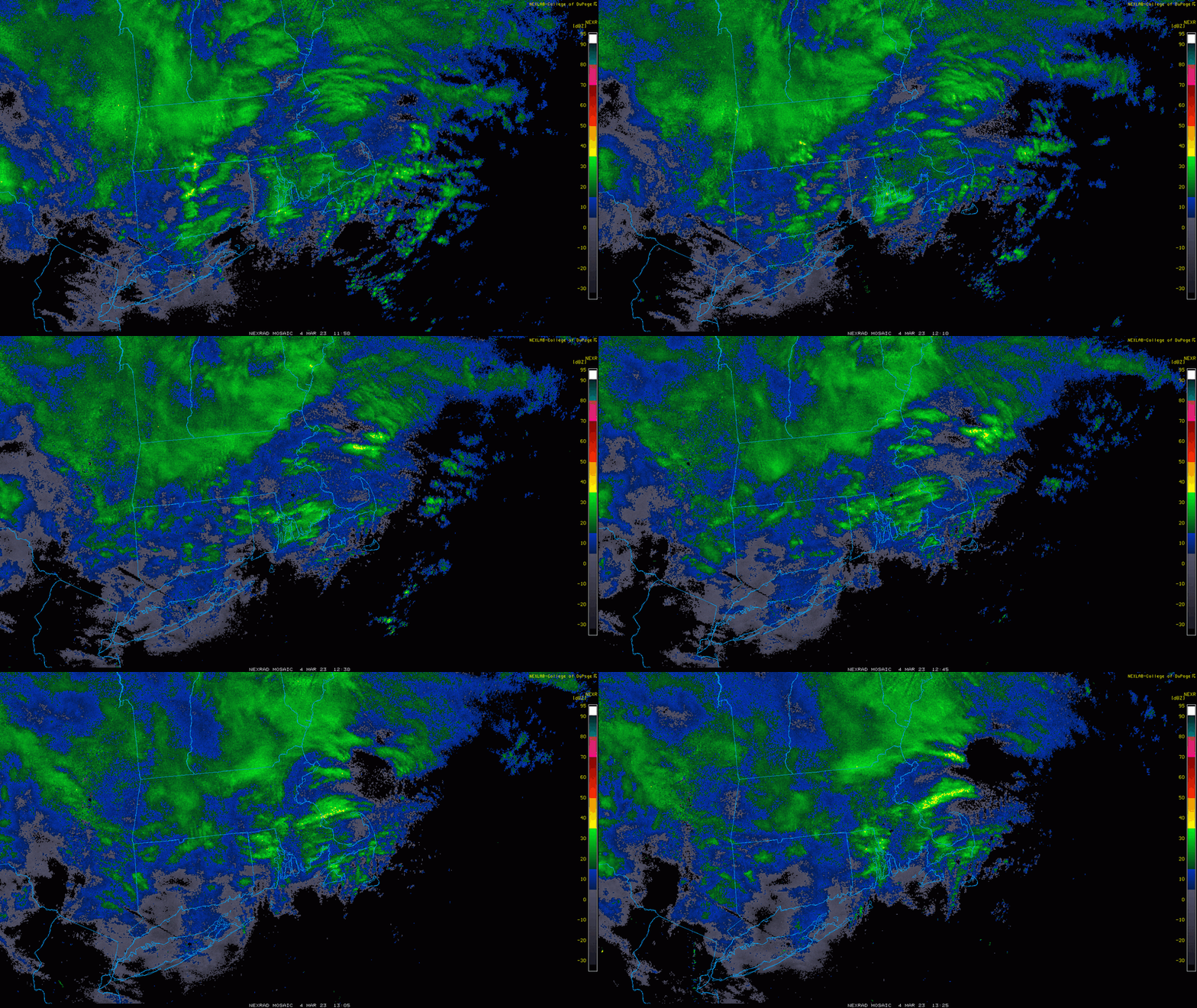
@OceanStWx snow growth dramatically improved past hr. moderate snow. Looks like this is the test here.
-
You’ve been in a great spot many times this season. This one especially. Cheers.
-
Yea still plenty of the storm left. My bet continues to be that rates are gonna have to be high end to stack, as we’ll be 33-34 ish during that window. And this system just doesn’t have the classic CCB dynamics to get excited on that front.
-
Pretty sure the peak measurement was 6 a.m. here for the storm. I don’t think we stack from here.
-
Looks like we peaked at 4” on cold surfaces. Heavy wet paste. Since that point we’ve already seen compaction and melting to more like 2-3” Rates have picked up but snow growth very poor, and often mixed with sleet. .
-
Speaking for south/eastern sections - The warmer than guidance temps were interesting to me because winds become easterly tonight, overcast rolls in. It's not a good wet bulbing setup. Temps will be stubborn to fall, and dews will rise ahead of the precip. We're also seeing more sun than guidance advertised. Add warmer ground, less snow pack. All these little things matter at the margin. Again, it will snow, but how much stacks is the real outcome we're interested in. 32 vs 33 matters A LOT if it endures. Of course, you interior guys in CNE/NNE can continue to not GAF about this.


