jbenedet
-
Posts
6,963 -
Joined
-
Last visited
Content Type
Profiles
Blogs
Forums
American Weather
Media Demo
Store
Gallery
Everything posted by jbenedet
-
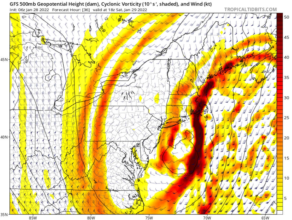
 I agree that’s an important shift. If you can make it out at a North America “view” without straining your eyes it’s not noise. That’s a 50 mile shift southwest with the H5 occlusion. Big deal for mid Atlantic and the west crew.
 -
To me, the risk for small corrections is tilted west given the H500 cut-off timing/location south of LI. The surface will follow the H5 low, it’s just a matter of sooner or later. Right now GFS and euro are saying later. So that’s the qpf output for this scenario. What if it happens sooner?

-
Yea I say it is. We can get philosophical about this with semantics, and all but the UL Long wave trough *is* our storm.
-
Heh. I mean, it’s been so flippin cold out—all flakes count. It will affect totals despite the meager rates.
-
Already reports of steady light snow in Eastern PA. You guys in CT should keep an eye on this.
-
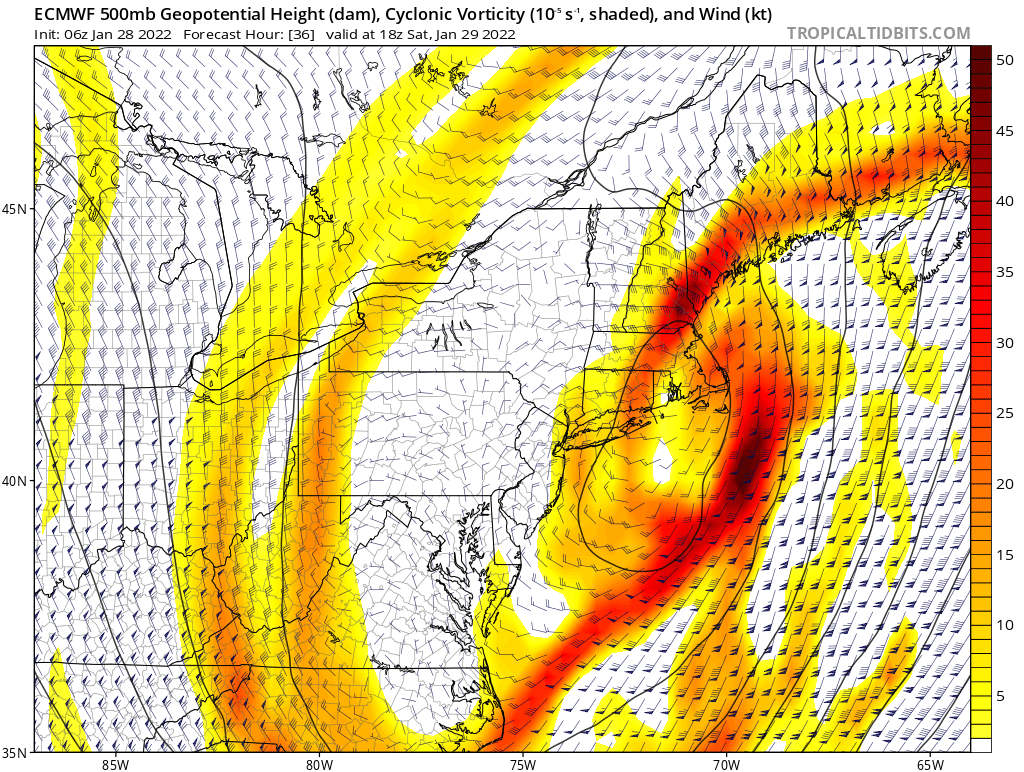
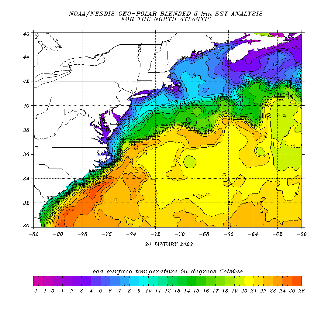
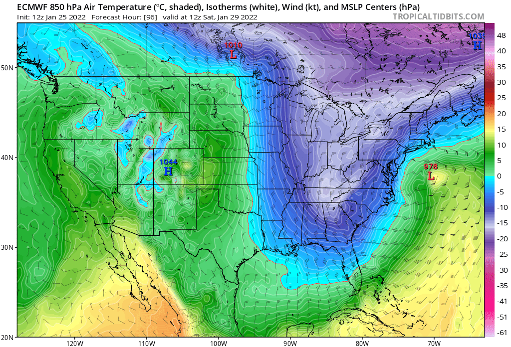
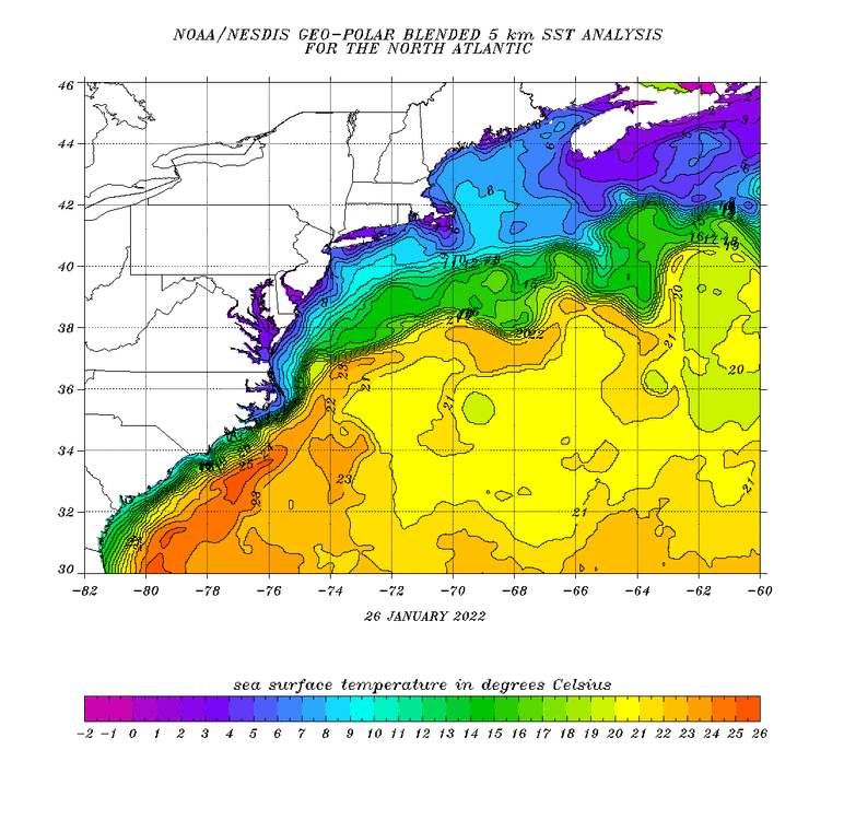
As I mentioned many days ago that warm core/sub tropical structure on guidance is causing chaos (additional uncertainty) in the phasing and resolving the best area for surface pressure falls. More tropical-like it is, the later the H5 capture. Outside of the SE coast, SST’s are not supportive of a tropical system. Period. So the system will quickly gravitate towards baroclinicity. The question remains how fast? I’d hedge sooner vs later given the temps over the northern Gulf Stream are closer to 70F vs low 80’s during tropical season. Conversely if this was late November I’d be hedging the other way. I do think the hook back scenario is likely and it will be more pronounced the longer it takes the tropical component to shake its “warm-core” predominance.
-
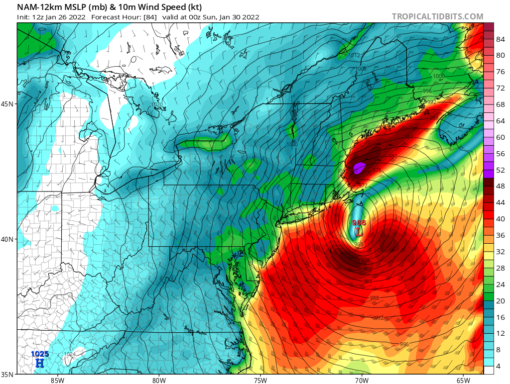
Also this track and timing with respect to stall and H5 phase presents the biggest impact for wind and coastal flooding. Nasty for eastern MA.
-
Yes and essentially proves my point. Sarnia is the same latitude as the central gulf of Maine—Portsmouth NH. That’s your extreme high end up here.
-
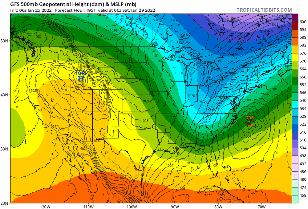
I mean, we've seen triple phasers before -- max potential usually in the 960's at 40N? what is the history of non-tropical lows sub 960 at ~40N. I don't know of any 950's examples in my lifetime. I think anything lower than that is suggesting a warm-core sub tropical entity, which never made sense in peak winter climo. I think 965ish should have always been the extreme high end bar for non-tropical low such as this, at 40N. 960 ish further north in the GOM. The 12z euro, verbatim flirts with this max potential.
-
sweet. the arctic circle meets the tropics right in our backyard
-
lol. These metaphors man... I mean, this is supposed to be a hobby. Ya know, as in "enjoyable" or "fun"?? Christ. I don't think I've ever felt that bad about anything even shit work/projects I couldn't wait to finish up with.
-
I believe the early H5 capture scenario - ~200 miles south of LI would translate to significantly more qpf in the Northern Mid Atlantic than the 12z NAM just output.
-
euro at 24 looks more amped vs 6z. West.
-
And zoom out to the scorecard for winter - even worse. Most will probably gloss right over this, but that link is the most important post this morning. Had no idea the GFS was having such a poor winter season. Euro clear leader. Definitely instructive, especially while the pattern has been largely consistent over most of that time series.
-
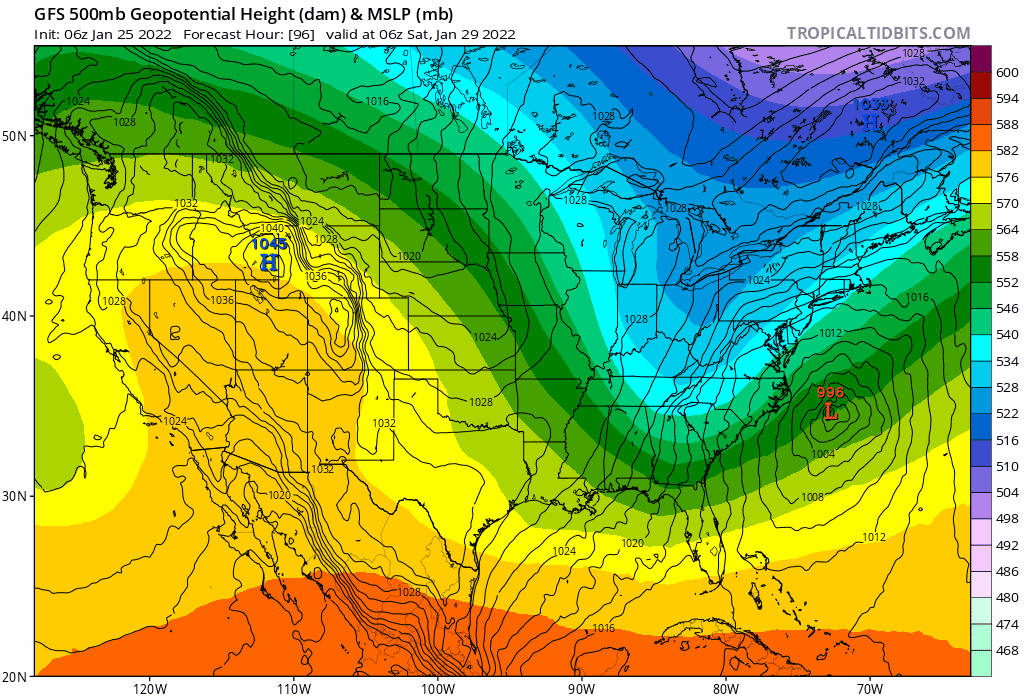
Good points. I like a balanced discussion. As I watch the 12z NAM roll to hr 42 and also look at that trend Gif I posted of the GFS—look at that pacific ridge axis-now as far west as Vancouver at that hr. Never say never, but this is NOT a long-wave spacing/setup for down east ME and Nova Scotia, to take the brunt. To my mind the betting risk is highly asymmetric in favor of west of current guidance.
-
Most are looking at the surface off the east coast, but the trend at H5 on the GFS is fantastic, with the trough orientation trending negative, sooner and better alignment/phasing between northern and southern streams. I say keep this trend going and worry much less about UL heights off the east coast in a situation such as this where there is no blocking. Guidance notoriously under-amplifies UL heights downstream of a potent shortwave. I’ll take that risk any day over UL trough orientation/position. The latter is much more important at this stage.
-
Sure? I mean, to me I think the risk is Friday impacts to school and evening commute are much greater than consensus right now.
-
NAM (of all models) has snow starting for most by Friday p.m. Western Areas early afternoon. Tucked = earlier. tick tick
-
You can buy, I'll sell. If it happens to be right that will increase uncertainty "chaos" with regard to the H500 capture. We won't know until inside 24 hrs, nevermind 96. to me the surface reflection is ~100 miles west at that hour, and there is no warm occlusion/core.
-
Wonky look. Warm core? As much as I like this solution, this doesn't make meteorological sense in January.
-
I'm guessing that sea eagle will be leaving it's new pad in boothbay Hahbah. Kinda pissed I missed the chance to head up there.
-
Yea, high amplitude long wave pattern, but very fast flow. +NAO, +AO. We have seen this time and time again translate to a much earlier/faster start time, 12 hrs+ at these lead times.
-
Yea and it would come in much faster. 12 hrs+. Would be a Friday/Saturday impact, rather than Sat/Sunday
-
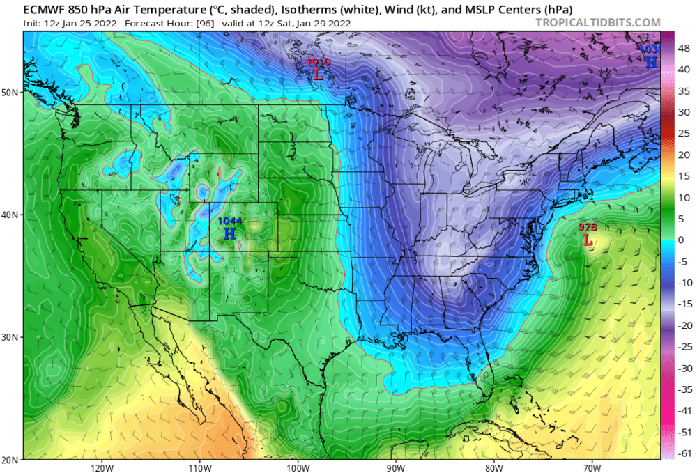
The western Ridge keeps trending further west with time on guidance at around hr 72. An axis over western Washington state without any blocking in eastern Canada is typically a recipe for a cutter or very tucked in track. If the northern stream and southern stream cleanly phase early—around hr 72, this comes much further west than current guidance consensus—there’s plenty of “room” in terms of wave spacing.