jbenedet
-
Posts
6,963 -
Joined
-
Last visited
Content Type
Profiles
Blogs
Forums
American Weather
Media Demo
Store
Gallery
Everything posted by jbenedet
-
Snow cover will be gone here Wednesday. Warm front timing keeps being pushed forward on guidance. Will hit the low 40’s Wed evening with dews.
-
Which is kinda what you want - no? I want to see through the aesthetic.
-
Through Wed much of this will be gone. I think Wed will take care of much of what's left. Just the piles. Trace to 2" upstream nashua area.
-
Timing is biggest issue right now. I believe it will speed up a bit, flow is very progessive. But you're right if I had to find one criticism for this potential-- it's timing.
-
Even the Ukie is trending toward a 1045 + Bermuda High. Robust Tropical connection. Torch it.
-
This is SW/SSW. It's the classic orographic assist up the eastern Apps right up into York ME. @dendrite isn't in as good a spot for this. Snowpack, elevation, longitude, will cap potential in his back yard. Long 60's for the NH Seacoast away from the immediate shore. If I had to pick - Nashua may be good for 70.
-
I also don't believe the fropa Friday will translate to colder than normal temps. Pacific looks torchy. I think the weekend temps trend higher vs current guidance. More like early spring.
-
This look is 60's deep into New england pretty easily. Teleconnections; everything. Thursday looks even better than Friday. Locally 70 in spots. Bank on it. Only question is whether records will fall...
-
With the current guidance advertising the track as OTS or graze, the recent pattern shift, with tendency being AN UL height anomalies over our heads should —all else being equal—help us out significantly in bringing this closer to the coast.
-
 Some areas in NH just north/west of DAW must have received a nasty ice up. Farmington, strafford, Deerfield, area, I’d think. In between DAW and CON basically….any local reports around here? Judging by CON they had > 0.25” ice. Not sure how well it accreted though..
 -
We know. ice?
-
The surface hp is pressing even more on 12z Nam. Can't see how the location and timing of this press won't have big implications into the favored cold tuck locations.
-
Sneaky surface high showing up in QC, across guidance. Have to believe this results in a cold tuck in NH, away from the coast. Tough forecast for DAW.
-
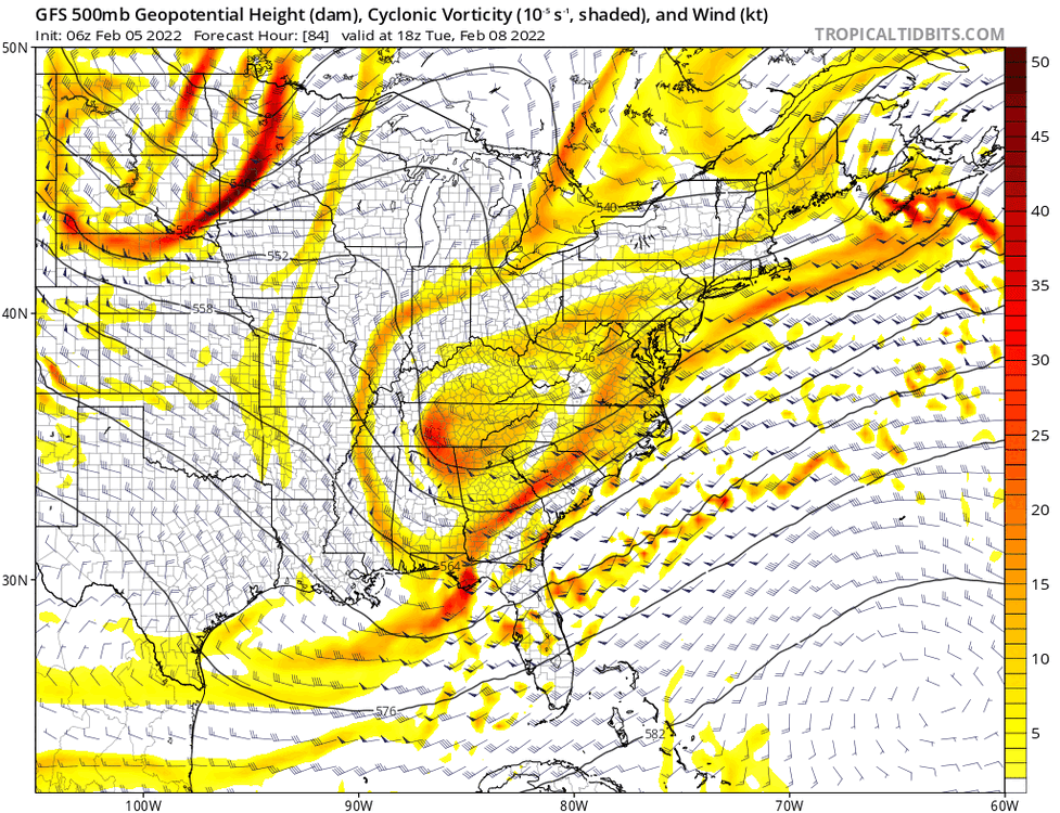
And the GFS now looks the best at H5 after being the last model to catch on. Model chaos, with too many small disturbances in the same region, difficulty resolving which one will amplify. We know—based on our climo—that baroclincity strongly favors shortwaves that amplify along the SE coast. My read is the GFS could use a “climo correction” or “parameterization” in the eastern CONUS. Anyway, significant positive changes on the GFS, albeit coming from a very disorganized state. The latest depiction is clearly worth tracking for SE NH.
-
Roads were awful this morning. Even the Spaulding. Worse than if we had 12” of snow. Can’t sleep on these events if forecasting for events is your game. Guess they couldn’t treat in advance with the heavy rain, washing everything off.
-
GFS slightly colder at the surface again in SE NH. By 6z tomorrow looks nasty. I’d be working from home if not for wrapping up an audit…ugh… I think the mesos showing rain at that hr will be, in actuality, freezing rain…Hoping we go to sleet quickly as the back door slams…
-
As you mentioned before, makes most sense that the surface temps are too warm. So corrections from less rain to more ice much more likely than less rain to more snow… I don’t like seeing all that plain rain on mesos on northeast winds. Makes me think column is warm everywhere but the surface, which is below freezing.
-
To my mind there should be a more north/south orientation of the ptype in eastern New England as the northeast CAD presses southwest. If the airmass to our north wasn’t cold, I’d understand a lag—but it’s not…it’s very cold…all models agreed on that…
-
This is interesting, I’m plain rain at this hour and raining several hours after according to NAM, on strong northeast winds. It’s as if there’s a back door front that the mesos don’t care to resolve.
-
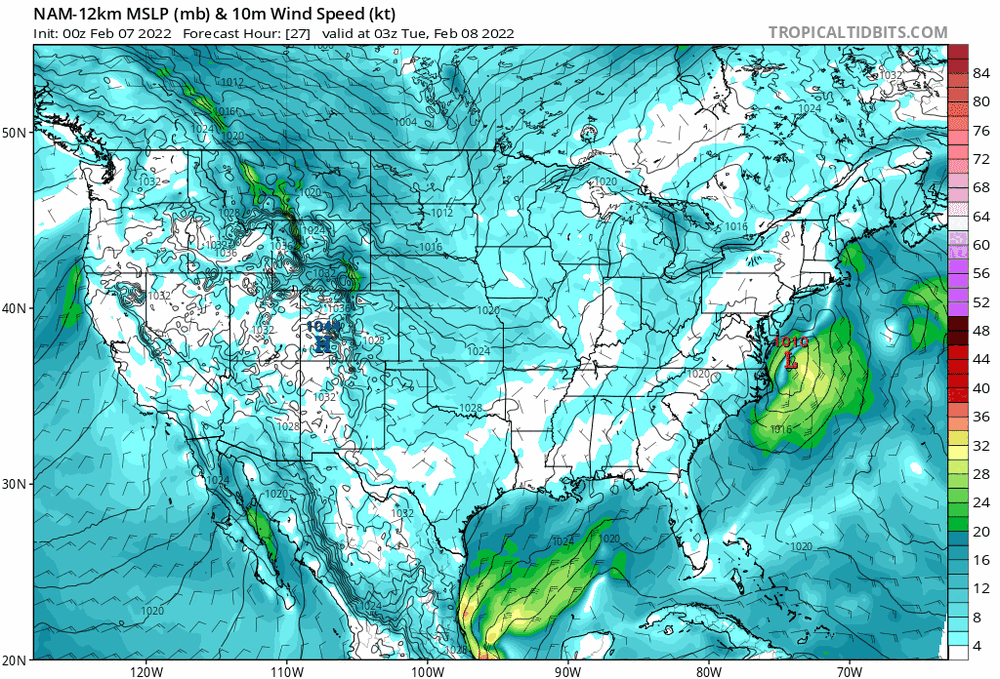
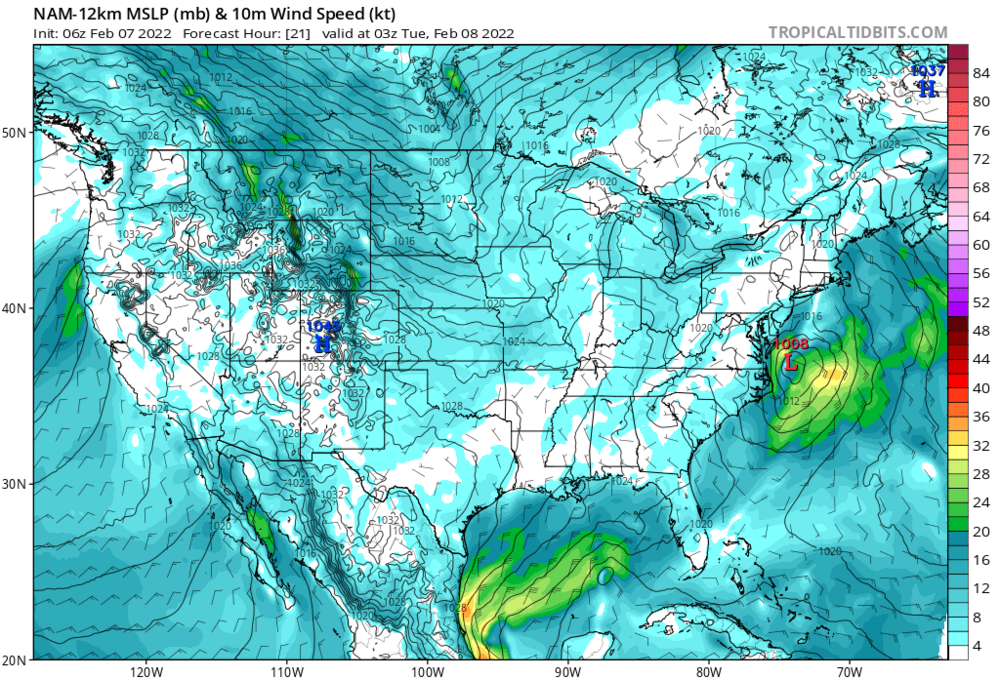
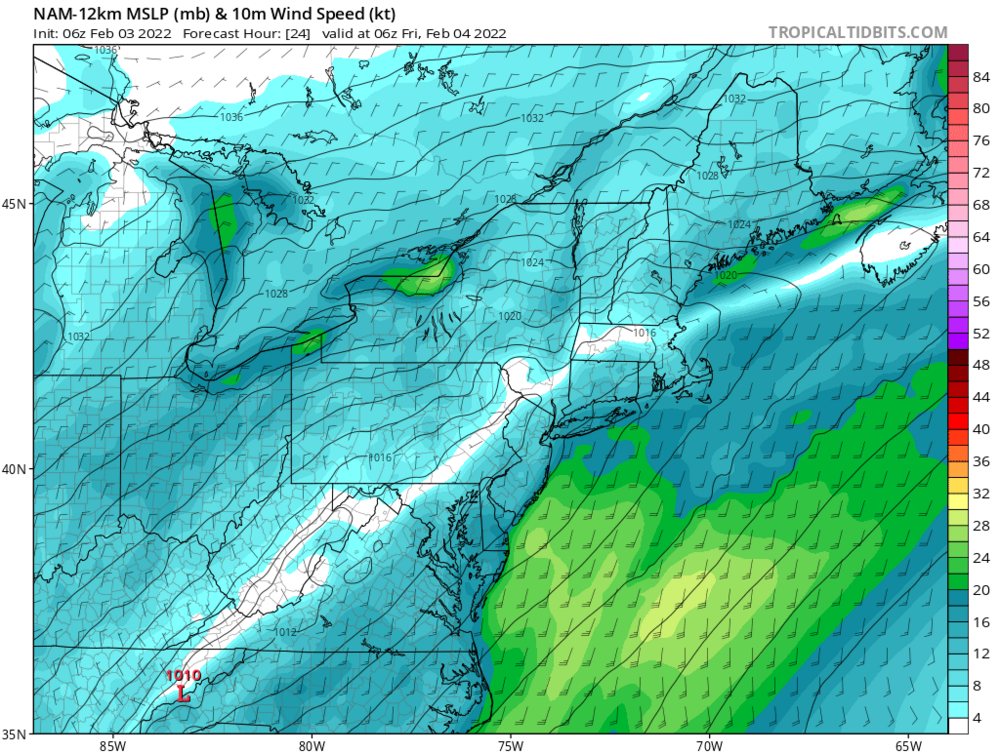
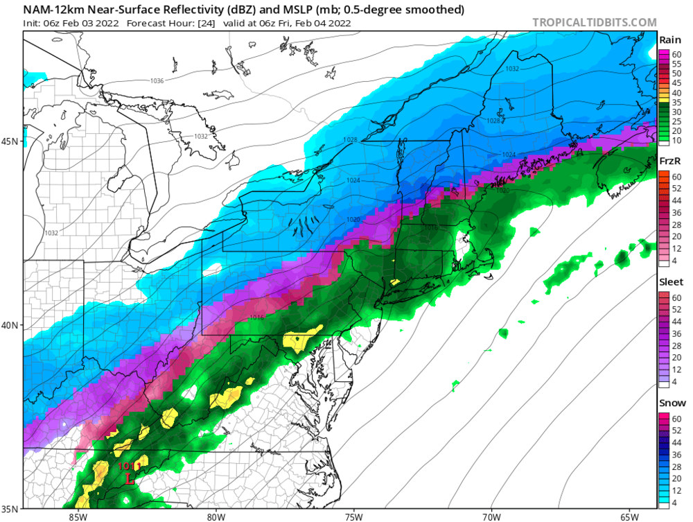
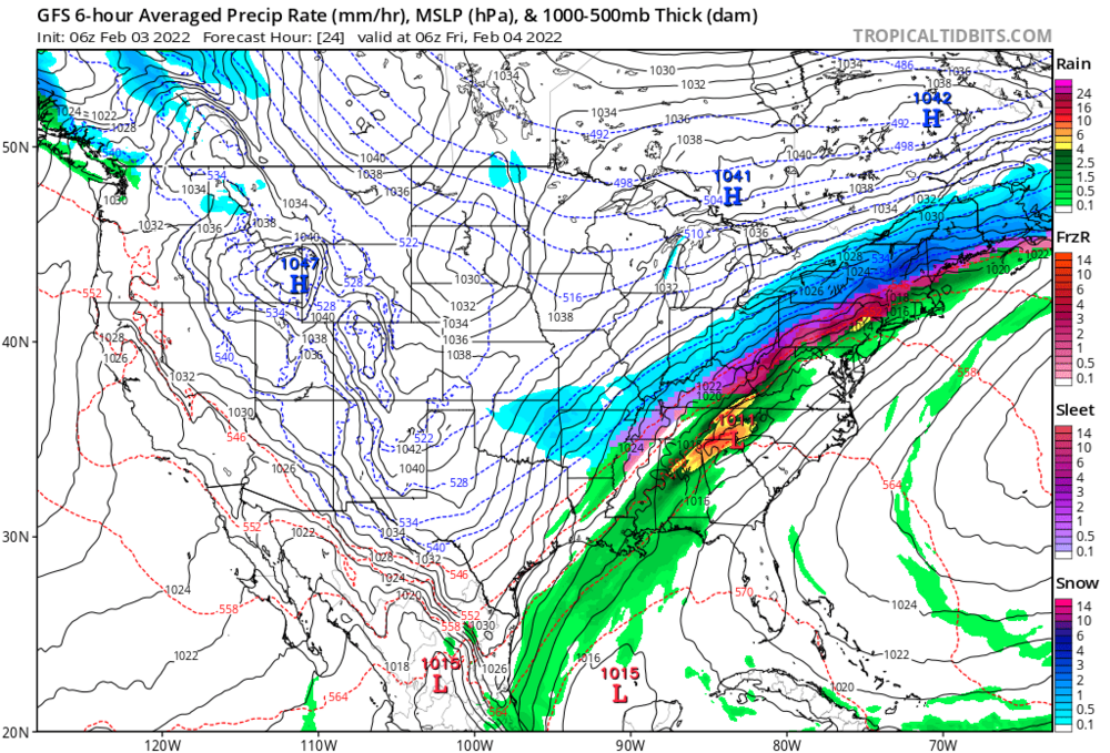
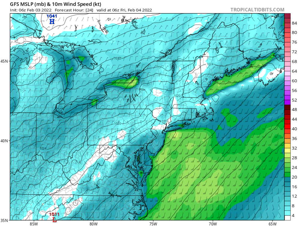
1011 mb low over mid Atlantic and 1042 mb high over southern Quebec at 6z Friday, with meso lows to my southeast. Winds are ripping out of the northeast in my backyard and…the mesos say…rain? And the GFS has the surface low moving south of the cape. A non-event? What’s especially interesting about this up here, is it’s not your typical cold drain. It’s a literal switch—more similarities to a strong back door in eastern New England than a run-of the mill front. Once that high builds into southern Ontario the CAD is northeasterly, NOT northwesterly. Big difference imo. The latter means non-event—we cool as the precip moves out. Either the GFS is completely OTL on these larger scale features or I’m frigid by 6z Friday with a sig frozen (mostly snow) event.
-
I agree for vast majority of the subforum. The CAD comes in like a wall, and all at once. Not a ZR risk—sleet or snow. I think the sig ZR threat is Thursday in eastern PA and NY, when the CAD is “oozing “ down the apps and before the hp builds strongly to the north. Southwest MA and northwest CT, maybe too, but much less confidence.
-
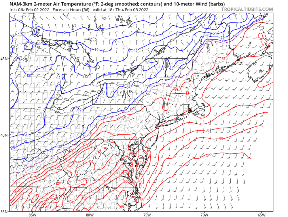
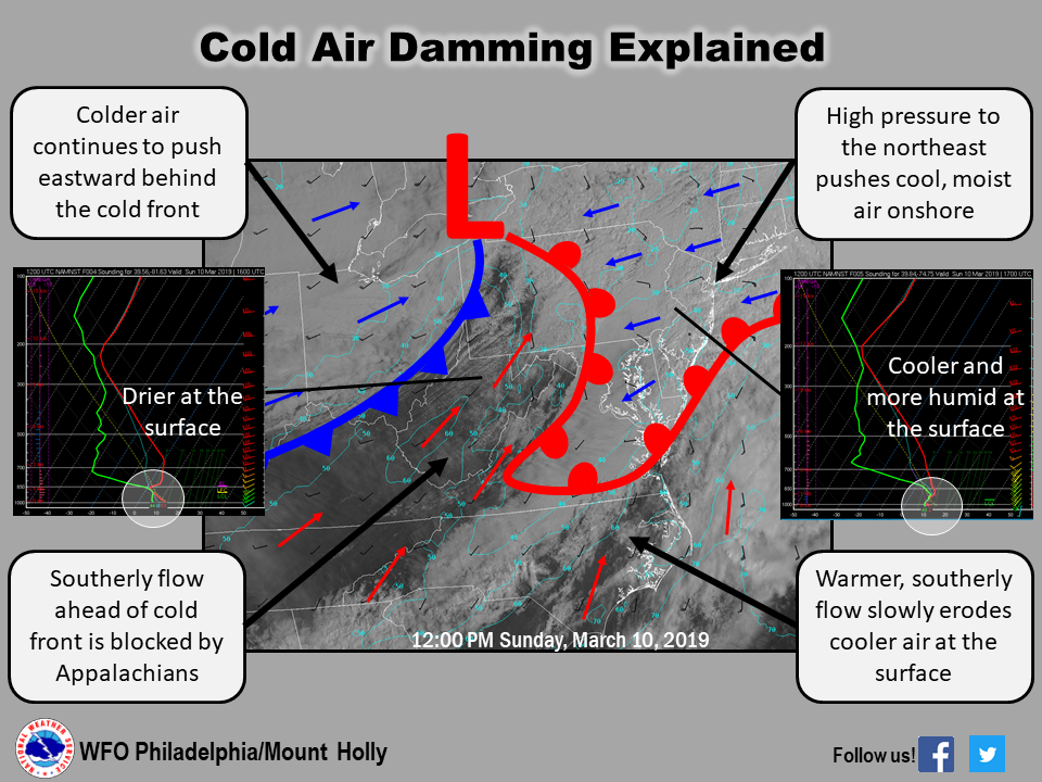
Classic, with the 3k now showing the 40F isotherm stuck across Maryland midday Thursday. Tic toc tuck.
-
And to better illustrate…what will be the gradual capitulation on the mesos…
-
Cool. Now everyone does. You made a funny. You’re welcome.