jbenedet
-
Posts
6,963 -
Joined
-
Last visited
Content Type
Profiles
Blogs
Forums
American Weather
Media Demo
Store
Gallery
Everything posted by jbenedet
-
And then the 18z GEFS, for the same storm system— snowing at this hr on the 18z GFS. H5 not so bad….”workable” 850 and below…

-
It’s all kinda backward. Usually mets complain about amateurs not using H5 enough; I think most lately are guilty of not testing those juicy H5 depictions by seeing what the model output is showing at those same hrs @ 850 and below. Red flags.
-
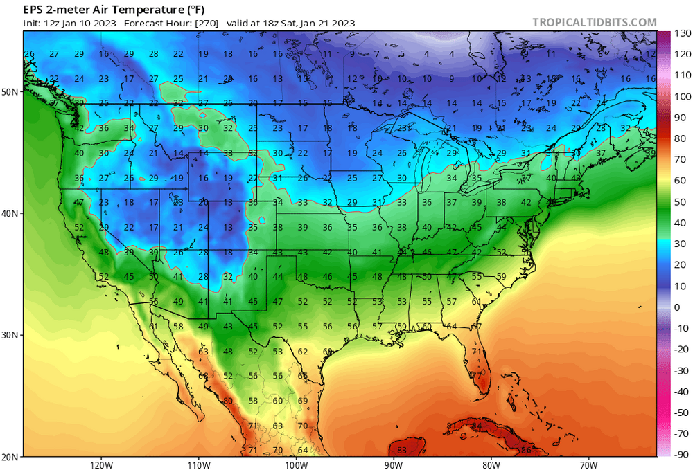
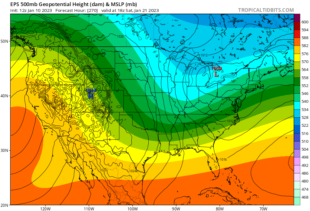
The beatings will continue until morale improves. H5 keeps roping in the long range model junkies with looks like this. Here’s the EPS with a pretty damn similar look to @brooklynwx99GEPS H5 clip. But then you go and look at the surface and it’s cooked. And with no blocking? This is a worse depiction than what we have coming on day 3; it’s just not resolved yet.

-
A -NAO would go a long way
-
Not for nothing but that analog quite literally has the ridge and trough axis about 500 miles further east. BIG difference. And this season isn't one I'd be discounting it. Persistence is a biatch. Assuming it's correct anyway.
-
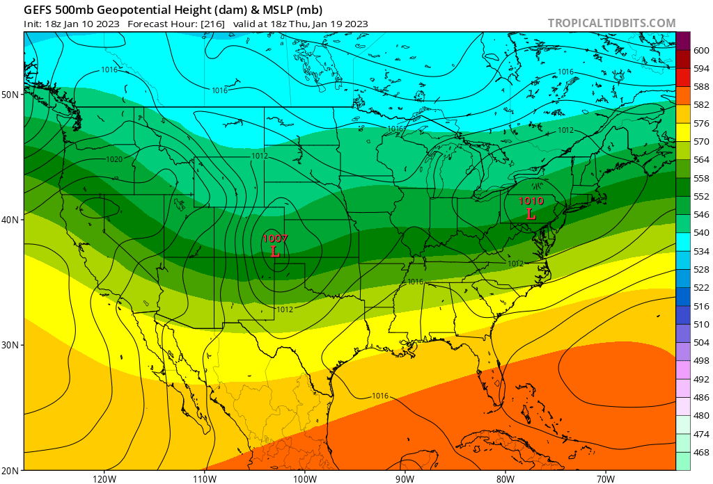
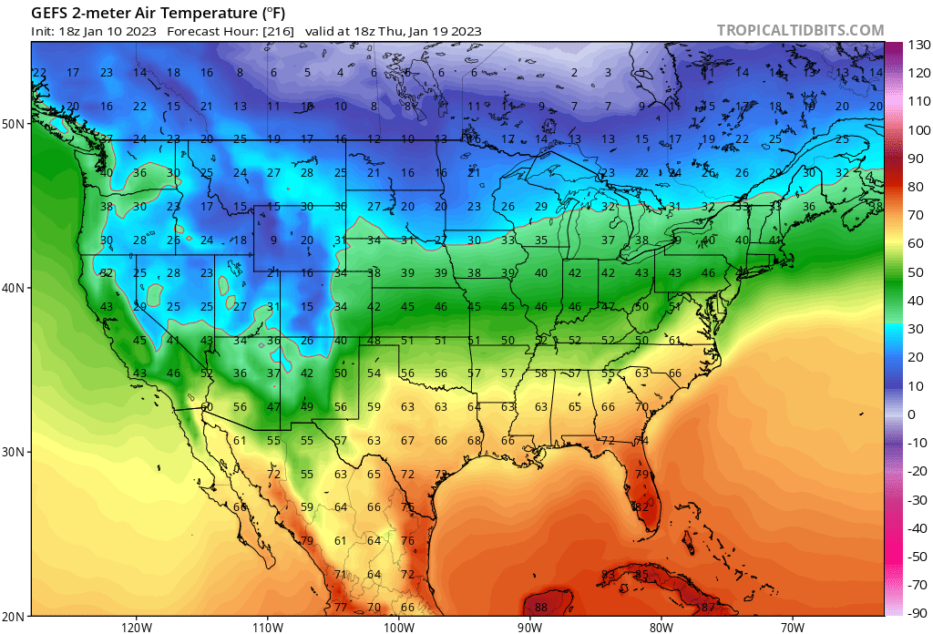
This trough and ridge axis is actually too far west, by a good 500 miles. Congrats buffalo? For us it's still a risk for cutters, with no blocking when a strong shortwave hooks up with the arctic in the mid-west. Weaker waves will threaten warm sectoring SNE and eastern areas into coastal maine. Good for the far interior. With the background warmth we'll have around this time (vs climo), I'm not a fan of this look for the subforum in general.
-
The consolation prize for this MLK weekend rainer, is planning a trip further north wouldn't have helped much, or at all. Talking Sunday River or Jay Peak to find skiable conditions, and that's too far for most. I believe the North Conway ski mountains will be in rough shape. Even wildcat in Gorham, looks sketch.
-
Makes sense. But right now? Flip a coin. That's what such a high level of run-to-run inconsistency tells me. GEFS/EPS say there's a non-negligible chance of something more. It's also further out in time - day 5. Probably can't toss this aspect until we see consistent runs like that on Thurs. This has been a season of tucked secondaries. Albeit crap ones. I'm on board for both these attributes.
-
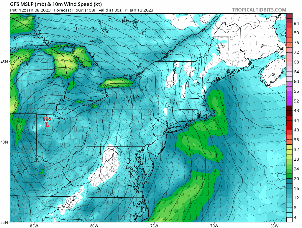
A glorified fropa. West cashing in on this makes sense given the way the BL floods with marine air in the east, out to the CT river, and NNE into New Brunswick Canada. Eastern Upstate NY best spot currently, Vt, Berks right behind. And ironically that ocean influenced Surface WAA that skunks us is what largely lays the ground for secondary cyclogensis, with UL height falls right behind it. We don't have a cold press, or surface high anywhere in the northeast by the time this sets up, so I don't see why the SLP can't Bee-Line it to Caribou.
-
This is a pretty effin' hilarious H5 look, when most are hungry for snow. Late October/early November vibes. I know I know it's one run of the op at hr180. But it isn't exactly la-la land "clown range" time frame either at day 7/8. Maybe we look for records in the other direction?
-
I hate these secondary frontal wave looks - the BL takes a lot more time to cool than the snow maps portray. 37/31 and mod snow doesn't pile up - and temps are warmest when the precip rates are best. And then you have warm, wet ground preceding it. It takes a lot to go right for it deliver something more than the nuisance variety. Vermont and the NH whites may able to cash in, especially with some orographic assist. Elsewhere don't like this look at all. But we'll watch...
-
CON-fluence. That is, you have been conned. Canadian High runs East, surface cold doesn't press, bulk of it stays bottled up in QC and NB. +NAO look.
.thumb.gif.7ec602a1e015f68b4a4fb8aa4f18c4b2.gif)
-
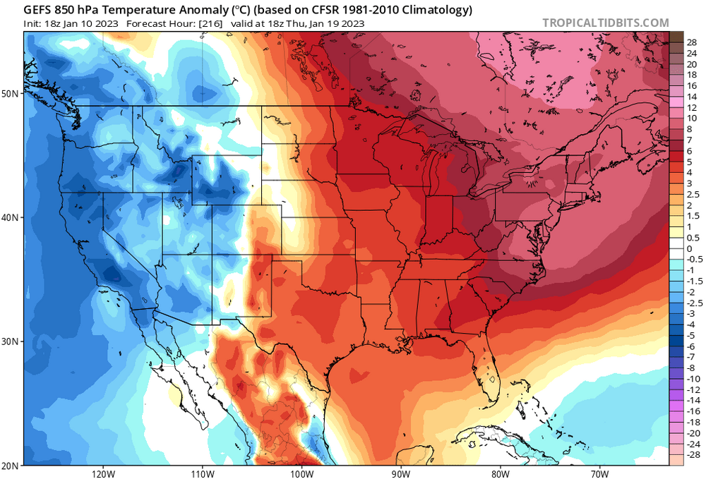
@WinterWolf is special. It must be black or white! Do Global Sea Surface Temperatures. Do the east Pacific Now do the Gulf of Maine. Of course I can see this data and appreciate that it’s affecting our climate at the *margin*. Meaning: cc is happening and yet, we absolutely can have another 2015 winter season. The marginal warming has killed our totals on *marginal* events. The prevailing story this year is the best cold being delivered in the west, central and even Ohio River Valley.
-
Really can’t ask for a better HP in Canada (can it get any better than that??) and that’s what worries me. There continues to be a surface high off the SE coast—or said differently: our Canadian high extends all the way to Bermuda . Winds are easterly throughout. Major run to run constant is east Canadian cold that wants to escape east rather than drain south (a +NAO red flag). Also tendency is for the Canadian high to retreat rather than anchor. The 12z GFS was probably best run in this regard, so far and yet still a warm outcome for most. The surface temps on the 12z GFS are bogus with Easterly/southeasterly winds ripping all the way up to York Maine, starting at precip onset0z Friday. Way too cold. This run would be an end to end soaker for the sea coast of NH. Imo, still very unfavorable odds for big snows outside of Winne on north line across NNE.

-
DAW low of 31. PSM 32. Guidance:

-
Yea. Pretty sure all guidance busted way low on temps for the overnight. An inch of glop has staying power if you can get a hard freeze right after it. Instead ground isn’t even frozen so with the overnight melting, soil soaked it right up. Back to brown pretty quick
-
What’s a snowblower?
-
Yep the same birds out and about since Mowvember. There were signs.
-
Temps stayed way up all night with the overcast, apparently. Doesn’t even look like we fell below freezing. Driveway 75% wet, and clear of the 0.5” that accumulated on it last night.
-
Still haven’t had to clean the car off this season. White rain ftw.
-
Most surfaces an inch or less. Pretty incredible seeing the background surface warmth today. Especially DAW on north. Most impressive since I moved here in 2015. Noted.
-
Wet roads in Rochester NH. Eyeballing less than an inch on grassy surfaces. Melting inhibiting accums. been snowing light to moderately since 9.
-
You're right that it is confusing the way I wrote that. I edited it. But what I meant was a track with an early H5 occlusion that slides south of New England (generally favorable to snow) still ends up WARM.


.gif.0bfc6ed1b64b1a0663cb32d03649f1e2.gif)