jbenedet
-
Posts
6,963 -
Joined
-
Last visited
Content Type
Profiles
Blogs
Forums
American Weather
Media Demo
Store
Gallery
Everything posted by jbenedet
-
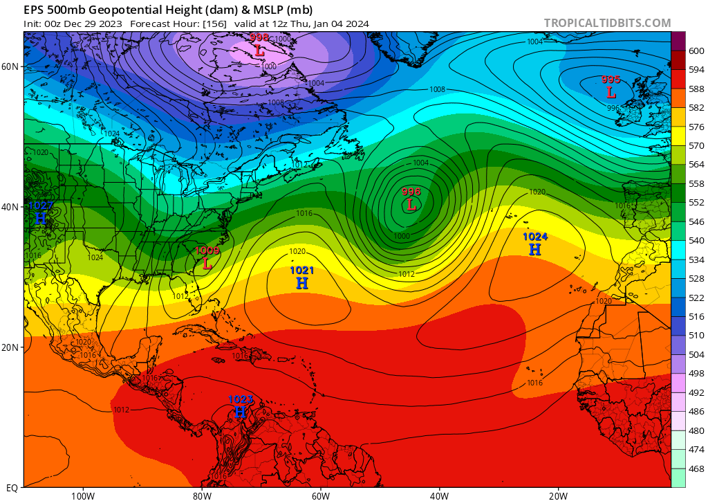
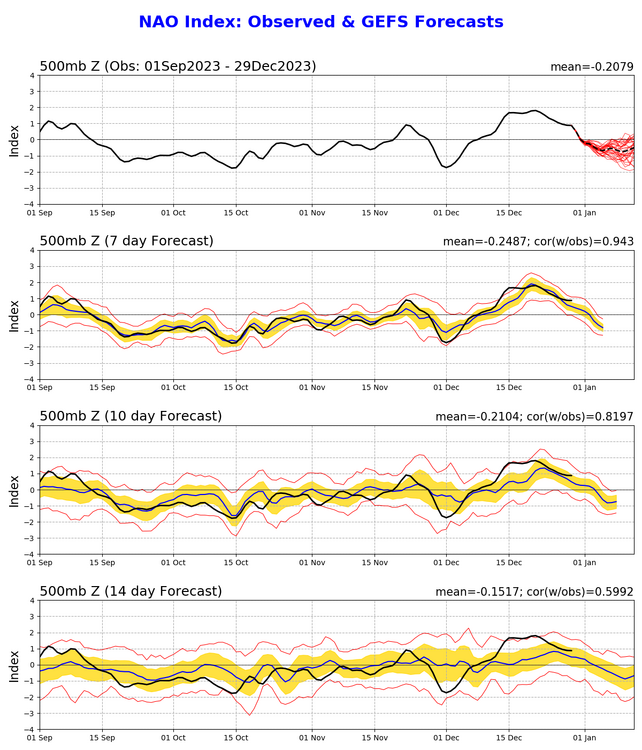
I’m in general agreement with all of this. But just want to highlight surface highs can make sneaky appearances. For one, this map doesn’t at all align with -NAO look in the western Atlantic which is forecasted in the teleconnections out ahead of the Jan 4 disturbance. The 6z GFS op is starting to pick up on it… I believe that trend is real. Too much of a good thing for us northerners, maybe not for the south coast. Heads up Mid Atlantic.

-
This is kinda my point all the time; makes no sense to use calendar climo if the world around you doesn’t match it. We have Dec 29th sun, that is all. If the landscape is similar by mid Jan, better off using Nov climo as a guide until/unless winter makes a sustained run to take us back towards mean conditions.
-
The 6th-7th threat looks gone to me; no way to get this up to our latitude until further notice. Focus is on the prior shortwave; around the 4th. I think this one trends south too, but it will end up a much closer threat, than the latter. Worth tracking. My guess is first shortwave is centered around the Mid Atlantic, the second the southeast. The snippets below are concerning the Jan 7th disturbance.

-
No upper level ridging in the western Atlantic. Not a hiccup; it’s the sticking issue for this one, I’m afraid. Congrats Asheville.
-
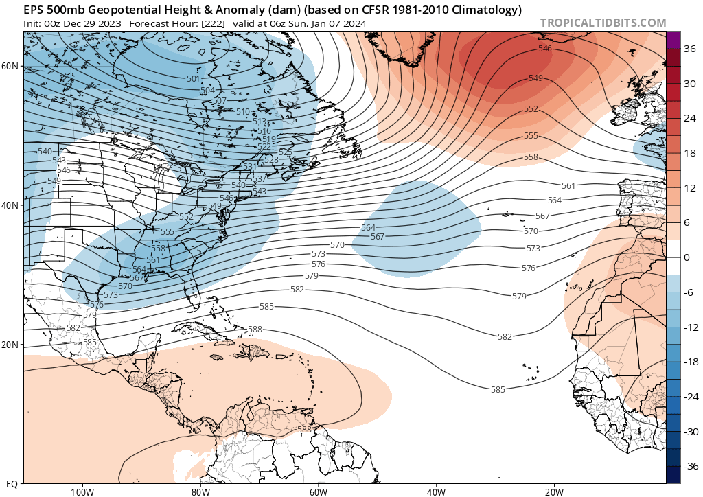
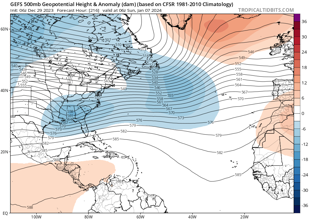
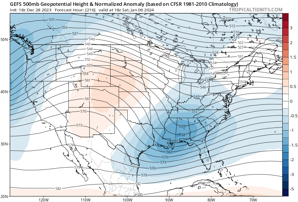
I mean it looks like a big system. Tearing a hole in the upper atmosphere has no problem yielding sufficient cold in winter, generally. That’s a given. The general tapestry at the surface looks BN in the south; N to slightly AN to the north. Common layout for Southern snowstorms.
-
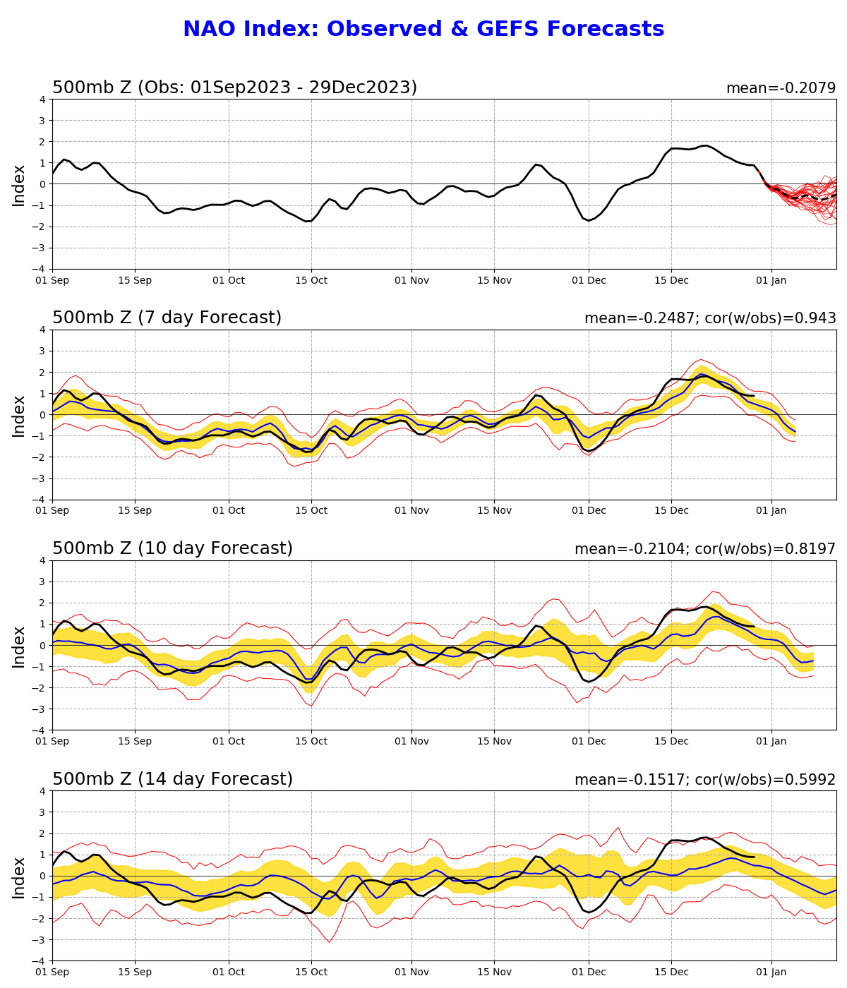
Gonna be cut-off happy, me thinks. It’s generally colder so it does mean snow wherever that happens. I like south better than north right now. Gonna take some time for guidance to come around to it though. Big changes in the NAO still have to materialize.
-
Yea I’m not worried about ptype with this, as I believe it hooks up with the mid levels. The +temp anomalies I’m seeing on guidance in the north has me thinking the real risk is in missing out is that it’s a southern snow storm—>mason dixon on south. That’s what is being hinted at. The Teles will also be primed to phasing during that window—early phase/cut-off,
-
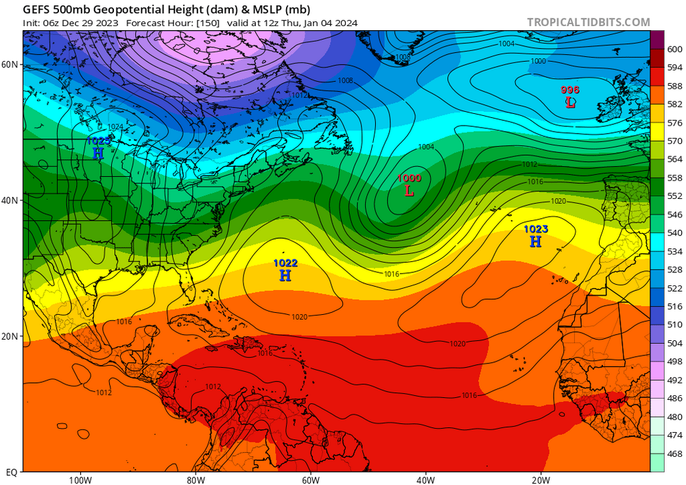
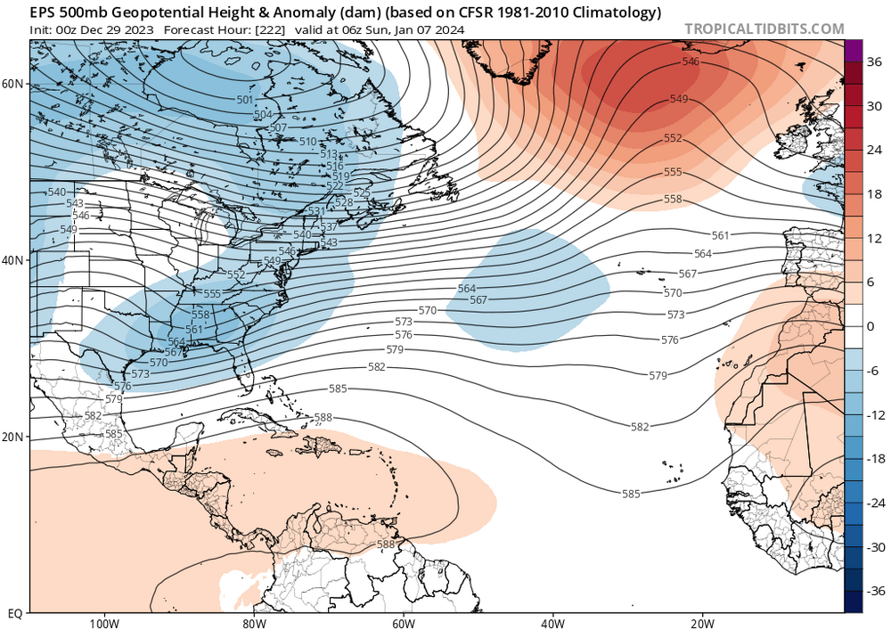
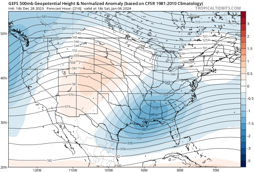
Jan 6 - 930’s in the GOM. 6z GFS. Wonky run much? Point remains this is the best window for a big snowstorm in the east. Pattern doesn’t look good beyond it either, which brings it into even greater focus. Looking at the teles, my “best guess” take is the current evolution is going to change this from a NE threat to a Mid Atlantic/Southeast snow storm. Phase of Northern Stream/southern stream likely, but much further southwest. There’s some hints showing up on this in the GEFS/EPS with T 850/T surface anomalies positive to the north with deeply negative south of mason Dixon. Anyway, we watch.
-
Eh. Sure. Perhaps we’re not evaluating these maps similarly. I’m doing more than just reading T values/anomalies but keying on which air masses are where. I.e., if signs indicate CP airmass just to our north/west, I wouldn’t be making the observation. I’m in agreement that this window is best in a while, but still doesn’t look good imo.
-
I’m gonna be that guy again, but current guidance shows BL warmth during that 4-6th timeframe. It’s not prohibitive to snow, but def limiting. POP also highest where surface is warmest. Still a ways away but as I see it, not enough to get excited about until/unless some big changes on the ensembles.
-
Congrats. Where in SC (specifically) you moving from?
-
What’s prompting the move? I’m asking because I’m strongly considering a move to the area you’re leaving.
-
I am still finding it remarkable how immediate term guidance has been 5-10 degrees too cold region wide on days like today.
-
Wherever lucky enough to clear, 50’s achievable.
-
It’s actually green more than brown.
-
https://www.nohrsc.noaa.gov/nsa/
-
We’re now tracking behind month ago snow cover.
-
def not. Point is, balance of guidance has the core of the PV towards the mountain west. That latest run of the GEFS looks best though for our region. But some caution on that—it’s a bit misleading— you can still see height falls greatest over the SW on that run.
-
Warmer during the extended Christmas weekend, than it was during the extended thanksgiving weekend.
-
Reposting, as GEPS in general alignment with the GEFS at same timeframe. Take away this far out is some confidence building on severe cold in early to mid January out western half CONUS. UL Ridging in the east..
-
If you’re looking for significant cold this is a West of Mississippi River story. Several pieces of guidance are pointing in this direction. At this point, I think the East-central US has some reason for excitement in January; I.e. big snow potential. Not seeing this elsewhere at the moment. This is a N to AN look for the east coast, AN favored in the northeast.
-
Occam’s Razor. A “simple” hypothesis is one that doesn’t make unnecessary assumptions, not one that is conceptually simple.
-
100%. The foundation of NWP is chaos theory. I don’t believe most in here understand this, or they think they do but in reality, they don’t at all. They’ve never seen it demonstrated, explicitly. This stuff pisses me off to no end because the physical equations are robust; it is rock solid theory. It’s the future telling that causes the significant error bars; especially 5 days + out. It’s the addiction of wanting to see the future which has people abusing the modeling tools available to the general public and entrenching in the masses minds that atmospheric science is more BS than macroeconomics. Taken together, observations are far more powerful (skill-wise) than hypotheticals built on representations of the global atmosphere 2 weeks+ out which are then used to make regional forecasts. No Skill! In other words, more work analyzing does NOT translate to more accurate forecasting results. It just means more jargon and BS explanations that dupe the naive and ignorant, “this guy must know something.” It also means forecasting accuracy is likely lower because it is more clouded, staring at variables as if they are knowns, when in reality they are unknowns because at future time points they are very poorly resolved or not resolved at all. When it comes to complexity, most often, the simplest explanations are the most accurate ones.
-
Someone got the AC on down there at the south shore. 35 at PSM and PWM. No wind. As normal as you get for the calendar.
-
Currently 35 at Portsmouth. Average high for the date at Portsmouth NH: 36 Fake cold.