jbenedet
-
Posts
6,955 -
Joined
-
Last visited
Content Type
Profiles
Blogs
Forums
American Weather
Media Demo
Store
Gallery
Everything posted by jbenedet
-

At least it's something - Jan 16th Snow/Sleet/Ice OBS Thread
jbenedet replied to The 4 Seasons's topic in New England
Mood snow. very light. Vis > 1.5 miles. cold. dry. Too much of the latter.. Whatever flake falls counts but it's taking hours to add up. probably 1.5" even though it started around 5 a.m. Now fighting subsidence overhead. -
Good baseline forecast is the part 1 of the Jan noreaster. Thump 2-4", warm-up/ "dry slot", end.
-
The warm/NW trend likely isn't done, based on the UL jet position. But tricky forecast seeing how far out ahead the precip moves in, before the warming at 850, and below.
-
The precip will outrun the mid level warming, so that's likely the big help (differentiator), accums wise..
-
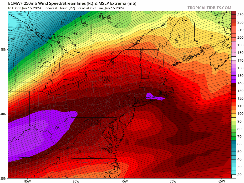
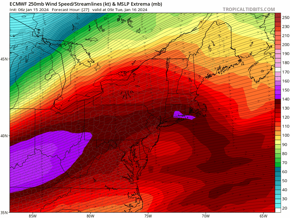
The 250 mb jet is really far north on the Euro/GFS. The winter storm that had the 850 Mb low cut across SE MA and Boston, and ptype issues thorughout, the jet was like 150 miles southeast of this position...
-
I got no horse in this race, but this trend is a PITA for BOX. Probably why they are gun shy. At least this is why I would be... Doesn't help either with how cold biased the GFS has been up until go time...

-
MJO progression slows dramatically as we head into phase 6, which is our warmest phase for Jan/Feb.
-

-
You’re in Lancaster PA. I’m in NNE. I’m talking wrt my region, not yours. My dude.
-
Furnace to me is +20. That’s near peak winter climo so it’s 55-low 60’s as high confidence attainable in SNE. Maybe a peak day or so within which challenges ATH’s closer to 70 in local spots. That’s my current thinking.
-
If it isn’t transient the regional climate is effffed lol
-
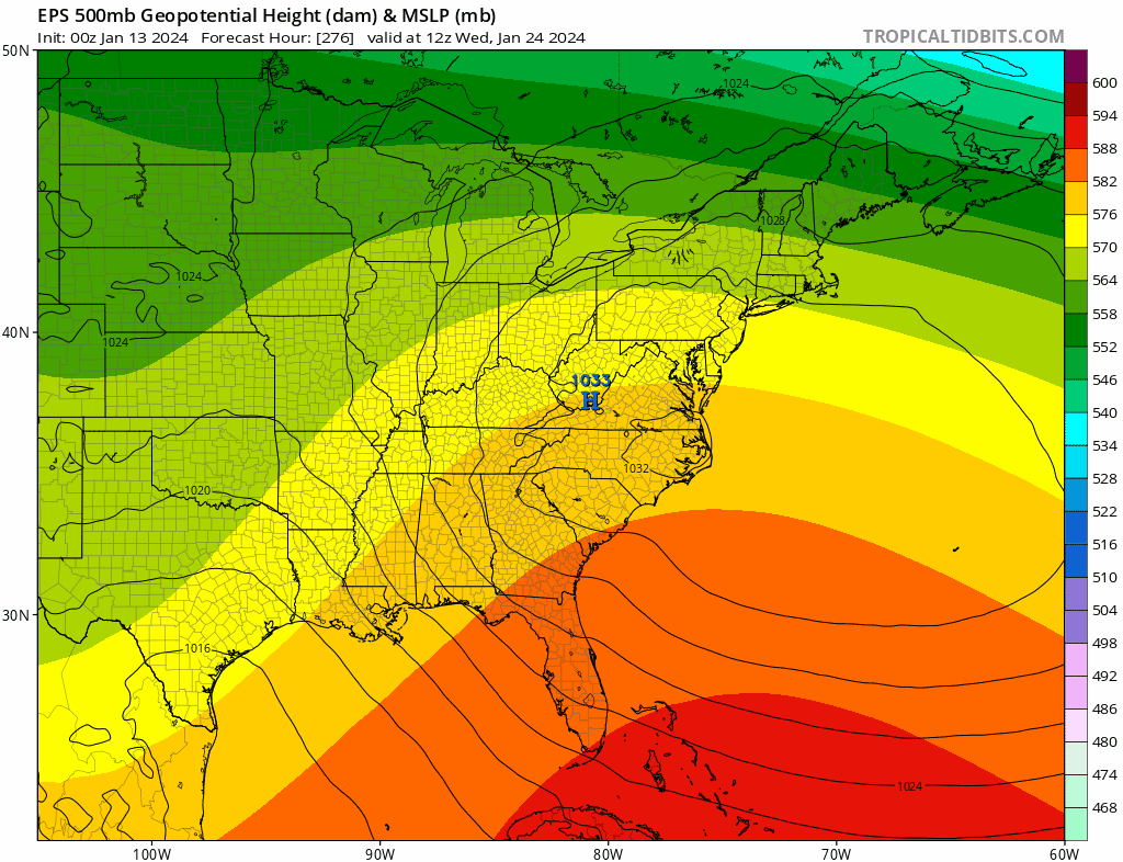
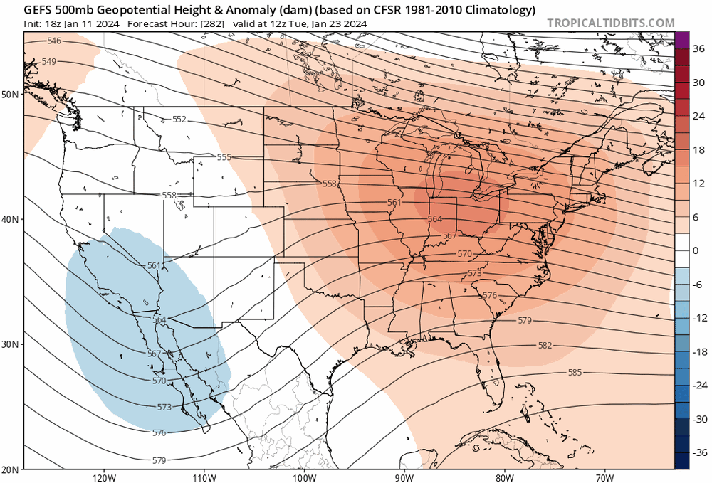
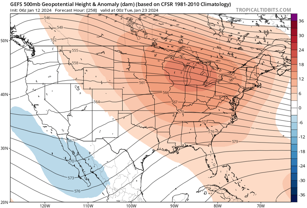
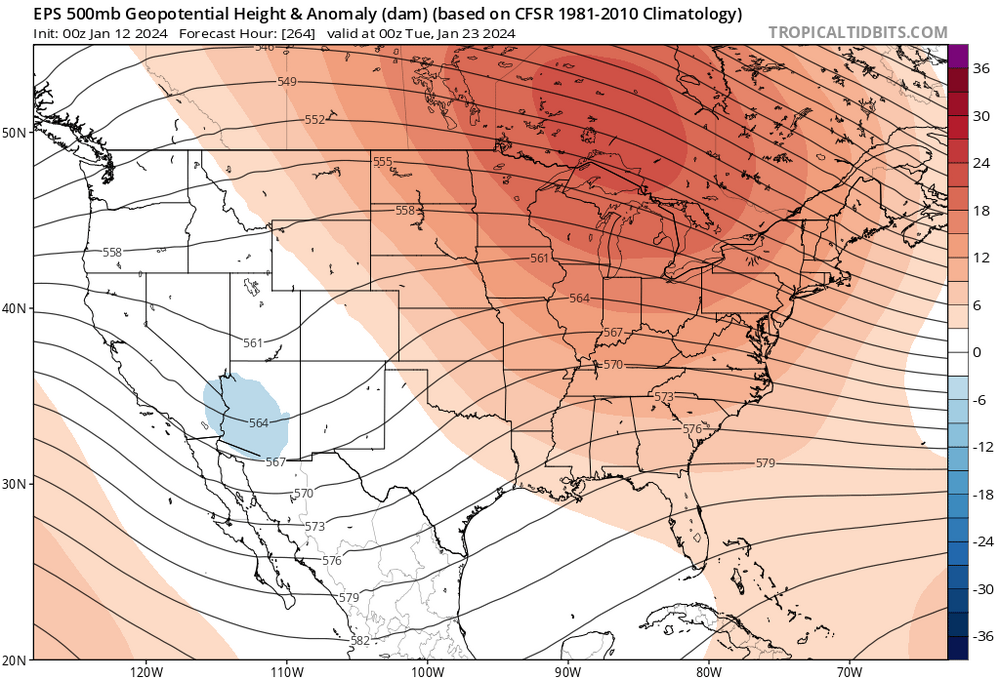
This look on the 23rd with the subtropical jet and a developing (significant) western Atlantic ridge is ….
-
We have about a week in 4-6 at high amplitude. Highest of the winter season. This is also immediately following peak ENSO conditions. phase 7 is most likely destination thereafter which is also +AN. I’m expecting a furnace in the northeast; but it won’t be reflected in guidance until we’re much closer in, around the 20th.
-
1/13/24 Sultan Slicer #2 - Heavy rain, snow, wind?
jbenedet replied to Torch Tiger's topic in New England
BOS: 60/51 -
1/13/24 Sultan Slicer #2 - Heavy rain, snow, wind?
jbenedet replied to Torch Tiger's topic in New England
Many areas in SNE gonna push 60 before this front clears. Could be a helluva nice afternoon in southeast sections to even Boston maybe… -
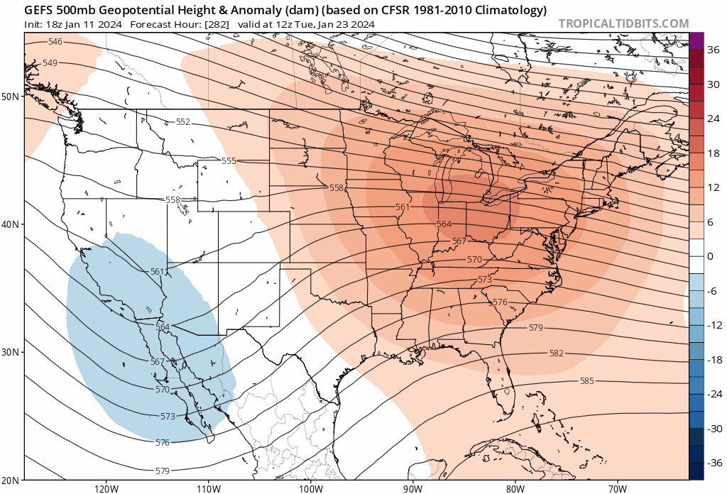
If you want to read 384hr+ on the GEFS/EPS. Go for it. The irony is, verbatim, we lose the -NAO, and the long wave ridge placement out west is approximately 750–1000 miles too far west —the northeast will be prone to cutters and warm sectoring with that look. This especially true in eastern half of New England. Doesn’t take much to see, just look under the hood of the same guidance you’re referencing. End of the month—as advertised—the pacific improves, the east coast worsens. Not saying it will play out that way, but if you take off the snow goggles…that’s what it is right now.
-
Patience.
-
The Jan 20th to end of month period looks like an El Niño induced furnace. Hang on… Today’s 12z GFS hr 240+ just an appetizer.
-
1/13/24 Sultan Slicer #2 - Heavy rain, snow, wind?
jbenedet replied to Torch Tiger's topic in New England
Much nicer day than day prior to last storm. Higher High—> Lower Low. I’m expecting a bigger wind/rain/coastal flooding event in Seacoast NH. -
1/13/24 Sultan Slicer #2 - Heavy rain, snow, wind?
jbenedet replied to Torch Tiger's topic in New England
-
Can’t handle the truth.
-
1/13/24 Sultan Slicer #2 - Heavy rain, snow, wind?
jbenedet replied to Torch Tiger's topic in New England
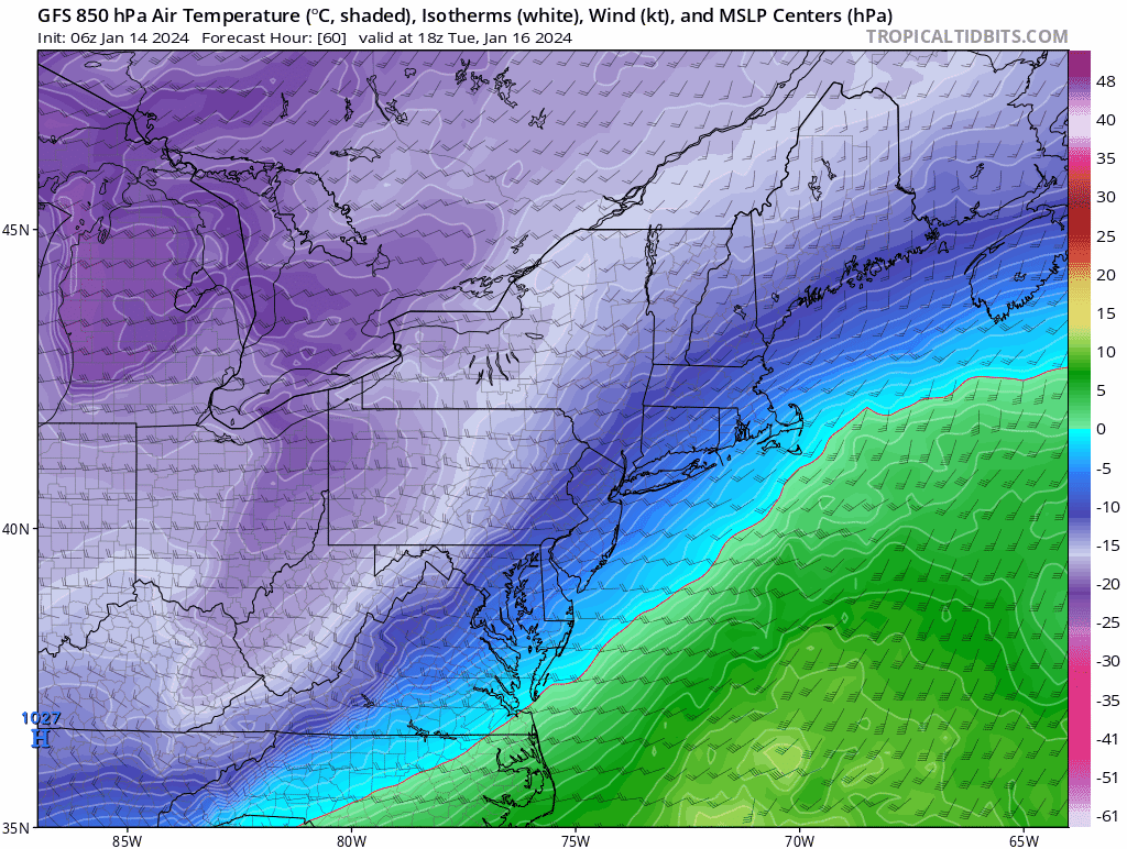
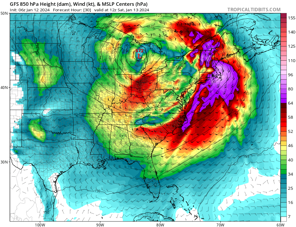
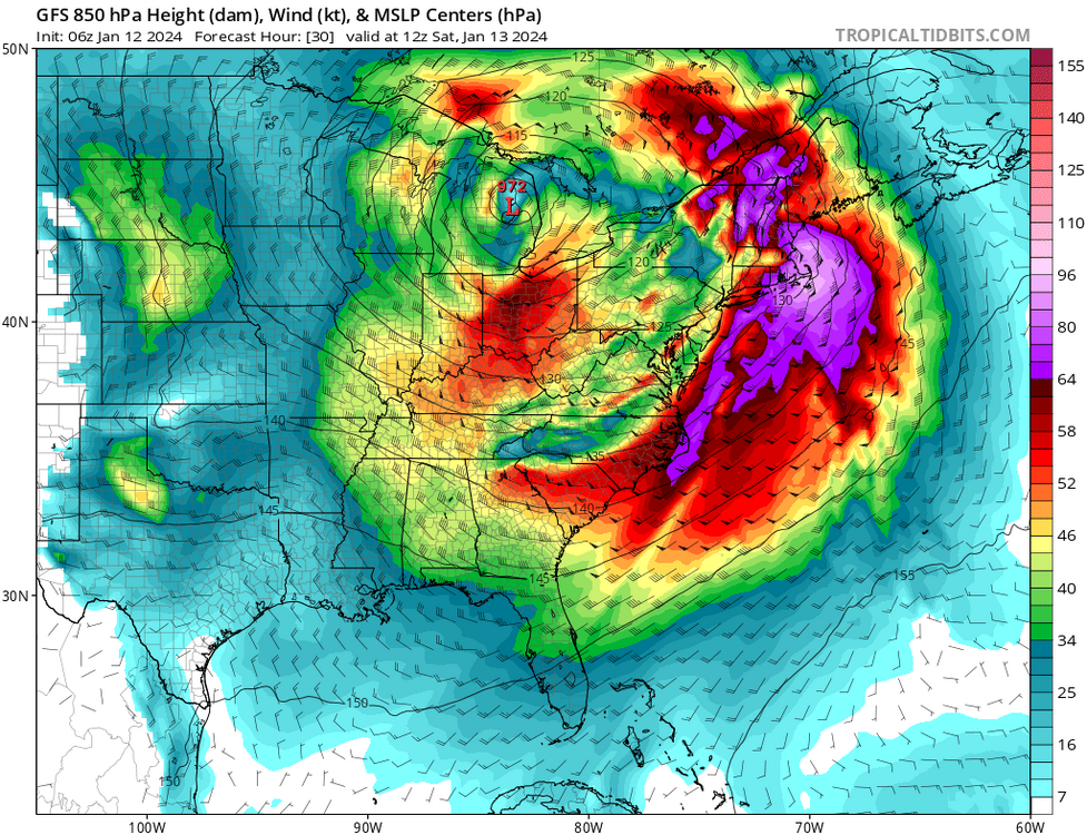
The wind and hydro threat looks more impressive than the previous stemwinder -Warmer antecedent airmass… Much higher dews. -less snow cover; reduce chances of low level inversion. -Southeasterly fetch tracing back to Bermuda. -low level jet pointed perpendicular to larger area of New England coastline. Very high wind threat looks to be in much more densely populated areas. Not a “just in Maine” story. SE MA, Boston in focus. -Deeper low ~972; vs 977 at our latitude.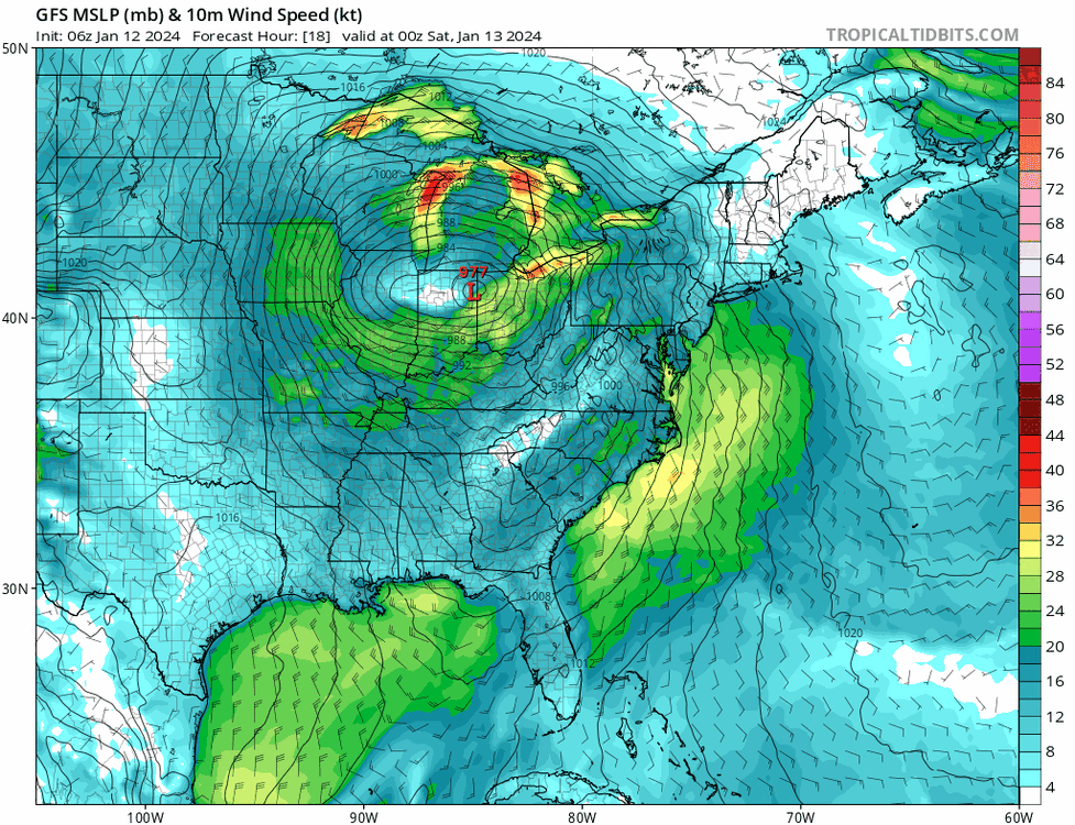
-
-
I’m not looking out that far. Post Jan 20th increasingly looks like a torch period, a window of a week or more.
-
I don’t like that the El Niño forcing calmed (relaxed) this month; while El Niño state actually intensified to major territory. I believe that means it is more likely that it makes its biggest appearance yet, as MJO 4,5,6 at end of the month.