jbenedet
-
Posts
6,955 -
Joined
-
Last visited
Content Type
Profiles
Blogs
Forums
American Weather
Media Demo
Store
Gallery
Everything posted by jbenedet
-
It’s just night and day. The globals were showing a TS yesterday at this time frame, and we have a major. That’s my main point.
-
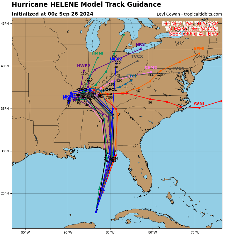
Clearly with still a non-negligible southerly component to track. We have had the early part of the trajectory shift more south than consensus; it has acted to offset a big change in the landfall location despite the more aggressive recurves being modeled upon closest approach to Florida’s west coast.
-
Hurricane models crush the globals again on short to medium term intensity guidance.
-
Yea and in turn much stronger impacts with wind and surge on the southeast side, much less on the northwest side.
-
For Helene, the hurricane model verification performance for intensity was generally much better vs the globals; especially early on, whereas the globals performed much better on track.
-
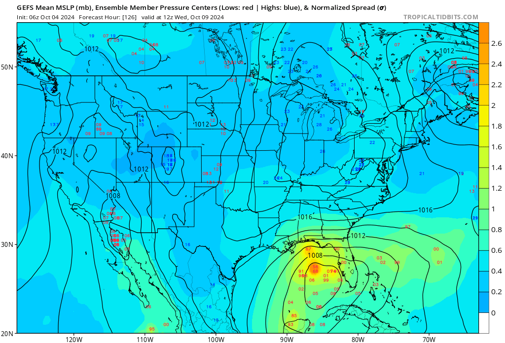
It makes sense with the forecast jump given the organization today to achieve a well define LLC. That was the key hurtle, because once the structure is established it has tons of time by Gulf TC standards. I’d love to see the statistical distribution of TC intensity in the gulf vs time (once LLC established) over open water. At over 84 hrs there’s got to be a lot of company in the major+ category.
-
Just a hair below major at 110 mph. I guess they don’t have the confidence for “major” headlines yet. That’s fair and reasonable at this stage.
-
Forward velocity really picks up after Tuesday and is an important factor for landfall impacts. Looks like another highly asymmetrical impact threat with just south/east of landfall having worst impacts, just north and west, much less.
-
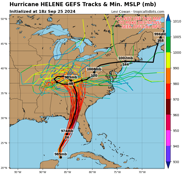
Every hurricane season, we know the Gulf is a latent heat powder keg for TC’s. However, land interaction and very limited time over water are the primary limiting factors. If those aspects are eliminated, intensity forecasts are generally in the realm of a major. Milton will be maximizing its time (84hr+ with a well defined center of circulation ) over the open Gulf, as did Helene. A difficult thing to do any year but happening twice now 2 weeks apart. Given this, and latest guidance —globals and hurricane models— assuming the CoC gets better defined here within the next 24 hrs, a good baseline bet is Cat 3 upon closest approach to west coast of Florida.
-

2024 Atlantic Hurricane Season
jbenedet replied to Stormchaserchuck1's topic in Tropical Headquarters
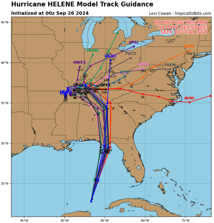
That’s landfall inside day 5 on the GFS. Model verification score go way up from here; i.e; we’re going to lose the awful run to run model variability on the global ops today. -
2024 Atlantic Hurricane Season
jbenedet replied to Stormchaserchuck1's topic in Tropical Headquarters
Still a very persistent signal for a TC development inside day 5 and having significant impacts on high population areas of west coast of Florida, from Tampa to Fort Myers. The latest ensemble guidance showing everything from TD intensity to major before weakening. Very heavy rainfall is the best bet at this stage. This should be getting a lot more attention than it is currently.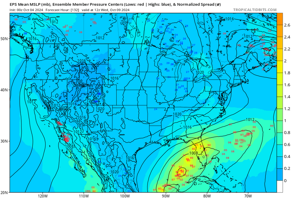

-
Now do cat 4.
-
The front is going to retrograde west, in a bent back fashion wrt time and latitude. I think there’s an error trap to see the current position of the front as the furthest extent west Helene can travel.

-
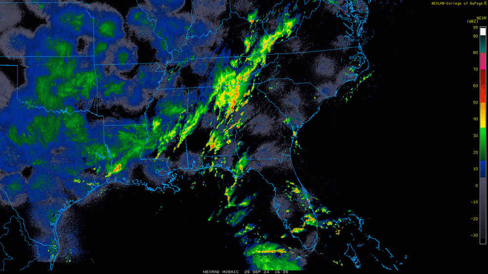
Currently has a Cat 3 look on IR.
-
-
There was ~100 mile shift west to the landfall location on 0z Thurs guidance vs 18z wed.
-
We tried to tell em. I don’t see any mechanism for this to weaken until the center passes. Very serious situation evolving on the fresh water flooding front….
-
That boom moment is rapidly getting pulled forward. I.e. there is a subtle acceleration to the “steady” intensification happening at the moment.
-
Give it six hours.
-
It was about 100 miles west of Tallahassee. The rainfall threat with Michael was much lower than is with Helene. That’s why the natural disaster risk is overall higher imo. We are also going to see a stronger storm (higher wind and overall rainfall) further inland due to the UL vort phasing and PRE. So I think the power outage risk is higher generally for a much larger area.
-
Talahassee, Atlanta.
-
18z GFS did not reach this min pressure until 6z-12z tomorrow.
-
Now the guidance that had a TC genesis with a very weak start are rapidly losing betting odds. Right initially…not translating well at the moment… 995 mb, sure, but looks very healthy from a satellite presentation standpoint. I wouldn’t be sticking with the more conservative guidance right now. Balance has shifted slightly in favor of more aggressive now…
-
Significant -NAO patterns are good for displacing climatological patterns. This syntopic interaction and extra tropical transition is common to what is experienced in the northeast; unusual in the southeast…
-
You can see a PRE setup pretty clearly on the major guidance, but it’s obvious on the 12z CMC. Most guidance currently centered around Tallahassee for the best forcing.