-
Posts
3,816 -
Joined
-
Last visited
Content Type
Profiles
Blogs
Forums
American Weather
Media Demo
Store
Gallery
Everything posted by backedgeapproaching
-
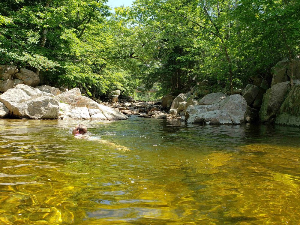
Got up to the lake today, nice sunny warm-ish day for swimming and cool comfortable evening to enjoy some adult beverages.
-
Whitefield NH, which is a rad pit, was 44F last night. Guess your on some type of hill which isnt going to radiate much. 1500' isnt created equal in NNE. Alex at 1500' will radiate like crazy being in an elevated valley, you at 1500' maybe not, guess we will se moving forward.
-
Your going to need a crash course on the microclimates up there.. Alex is king radiator.
-
August night of yore where the temps are actually cool. 50s before 10pm..we take. 59F currently.
-
Summer 2020 Banter and random observations
backedgeapproaching replied to Baroclinic Zone's topic in New England
They haven't been delivering to SVT for that long..maybe less than a year in would say? I actually saw an end case in Shaws that had it on sale few months ago, so not exactly flying off the shelves. I think like you mentioned in another post, maybe my palate has changed, but there are many other IPA/DIPA offerings that I enjoy more that are delivered locally. -
Yea PF, today was a perfect late July day, high of 80 dews around 60 with almost wall to wall sunshine. Warm enough to swim in the sun, but also super comfortable just relaxing in the shade. Low of 56 last night felt nice too.
-

Summer 2020 Banter and random observations
backedgeapproaching replied to Baroclinic Zone's topic in New England
Exactly what I do. Dump and then just throw some more dirt on top each time -

The 2020 Lesco & Lawn Thread
backedgeapproaching replied to Damage In Tolland's topic in New England
https://www.homedepot.com/p/Ortho-Weed-B-Gon-16-oz-Chickweed-Clover-Oxalis-Killer-for-Lawns-Concentrate-0396410/203686814#customer_reviews This is your best bet from big box store stuff. They are hard to eradicate, may take a couple of apps. -
My kids have been doing so much swimming this summer, feel like they will become Olympic backstroke medalists...ha. My brother-in-laws parents bought a second (actually third or fourth) house here in town that has the rare VT unicorn--inground pool. We got the Ok to use it whenever we want since the house is empty and they are literally never there. With how warm it's been we have using it 4-5 times per week, been nice with pool temp in upper 70s to 80. Between the lake, river and pool, lots of water activities. I'm not a fan of heat by any means, but the warms waters are nice side effect.
-
Definitely worth the the southern exposure and warm house to get those views, amazing! But you also had the passive solar in winter i would assume which would be nice. Afternoon shade from trees is huge in keeping house temps down, especially upstairs. My sister in law has a 250 yr old farmhouse with mimimal to no insulation, but they have massive Maples that shade the house from like 1pm on, so it keeps it somewhat bearable. I also rarely get lows above 70..think I had 2 so far. It was 71 last night. So I run window fans most of the time..but I will run AC if lows are upper 60s which brings high dews also if lows are that high. Cool nights in mid 50s to 60 work well like you said cooling house and keeping it cool next day. We also have insulated cellular shades and close them up and all windows shut to keep it cool. But like I mentioned being in full sun, that only buys so much time if temps get to mid 80s.
-
Yea, dont how Jspin went without AC the last few days /nights. I normally turn them on around 11am and then run them for most of the "hot" part of the day and maybe off for a few hours in evening and then back on for sleeping all night and then off again in the AM at wake up. My house has zero shade this time of year also, so it warms up quicker. Up to over 5" for July precip after the rain this morning, so prob pretty close to average keeping things nice and green. This is my fifth summer here and it's amazing how consistent the precip has been for the most part over the summers months keeping vegetation green. Being well inland and the terrain I would assume helping out.
-

The 2020 Lesco & Lawn Thread
backedgeapproaching replied to Damage In Tolland's topic in New England
Lawn here actually looking best it has in a while. Surviving the heatwave so far of 81F and 84F the past 2 days. -

Summer 2020 Banter and random observations
backedgeapproaching replied to Baroclinic Zone's topic in New England
Sugarloaf and Metherb been MIA for months its seems. I know many posters take breaks, hope that's it. -

The 2020 Lesco & Lawn Thread
backedgeapproaching replied to Damage In Tolland's topic in New England
I picked up 3 bee balm plants late last year on sale for $3 at a local nursery l, forget the name, but they're pink and loaded with bees also. Nice to see. -
Right, it's not like it was some super anomalous cool shot, just pretty much normal like you said. Felt good though compared to recent weeks. Even down here average low is about 59 right now, and my low was 58, so again pretty normal. I remember a few years ago 4th of July was really chilly at night. I remember being outside with multiple layers and blankets later at night..must have been low-mid 40's I'm sure for low, like you said balancing out those lows in the 60s.
-
30" here with an average prob in the low-mid 80"s. More awfuller. I have mentioned this before, but I honestly think Bennington VT had under 10"..like 7-8". Absurd even for Bennington standards, they still prob average 60-65". 15-16 was all time rat in SVT.
-

Summer 2020 Banter and random observations
backedgeapproaching replied to Baroclinic Zone's topic in New England
Similar down this way. My wife works for a real estate company and out of state buyers are purchasing stuff sight unseen, cash, within hours of some homes being listed. Ever since I've been here its normally a really slow market with most stuff being listed for many months and even on and off for years. Just today someone from NY called looking for a rental during the school year to send their kid to one of the schools here, budget was 10k month for the rental. -
Yea, no valley/downslope screw jobs in that east/west jack zone. Even Bennington had 20-24".
-
Last night was first time a long while it seems we got down into the 50s. Total COC today and perfect evening unfolding...
-

Summer 2020 Banter and random observations
backedgeapproaching replied to Baroclinic Zone's topic in New England
Posted this yesterday in the NNE thread, just wanted to put this here as well. This Facebook post was yesterday, there were 5 positive Covid tests from just this one clinic in town here. My wife is friends with the Doctor at the clinic and they had 26 more positive cases just today. 31 in 2 days in a small VT community seems like a big outbreak. -
Damn, looks like a possible covid cluster here locally in Manchester. 5 positives in 1 day from a town of 4500 people seems pretty high. It's been zoo of out of staters the past month or so, which I guess was expected with stuff reopening.
-
Some house shakers rolling through..been a quite a while since I can even remember any thunder and lightning that wasnt 20 miles away.
-
All water holes nice and warm with the pretty much sustained sun and warmth..felt like mid 70s maybe..kids enjoyed a nice dip
-

The 2020 Lesco & Lawn Thread
backedgeapproaching replied to Damage In Tolland's topic in New England
I know this is a broken record at this point, but what the hell is going on there? Looks like a plowed field ready for some crop planting. At this point maybe just hope weeds grow and fill in the all the bare spots? -
Some serious bad luck Gene to only have 3/4 of inch in 6 weeks. Think you will score some decent rains the next few days. Picked up around .60" or so today through 3 or 4 different cells rotating through from the north. Much needed.


