backedgeapproaching
-
Posts
3,819 -
Joined
-
Last visited
Content Type
Profiles
Blogs
Forums
American Weather
Media Demo
Store
Gallery
Everything posted by backedgeapproaching
-

January 16 2021 - Inland runner Rain/Snow/Wind
backedgeapproaching replied to Baroclinic Zone's topic in New England
I saw that. Think that is a running total for at least 3-4 days if not the week. I noticed they haven't reported anything in a few days. There is no way in heck that is 24 hours. Nevertheless, conditions are really good up and down VT right now. -
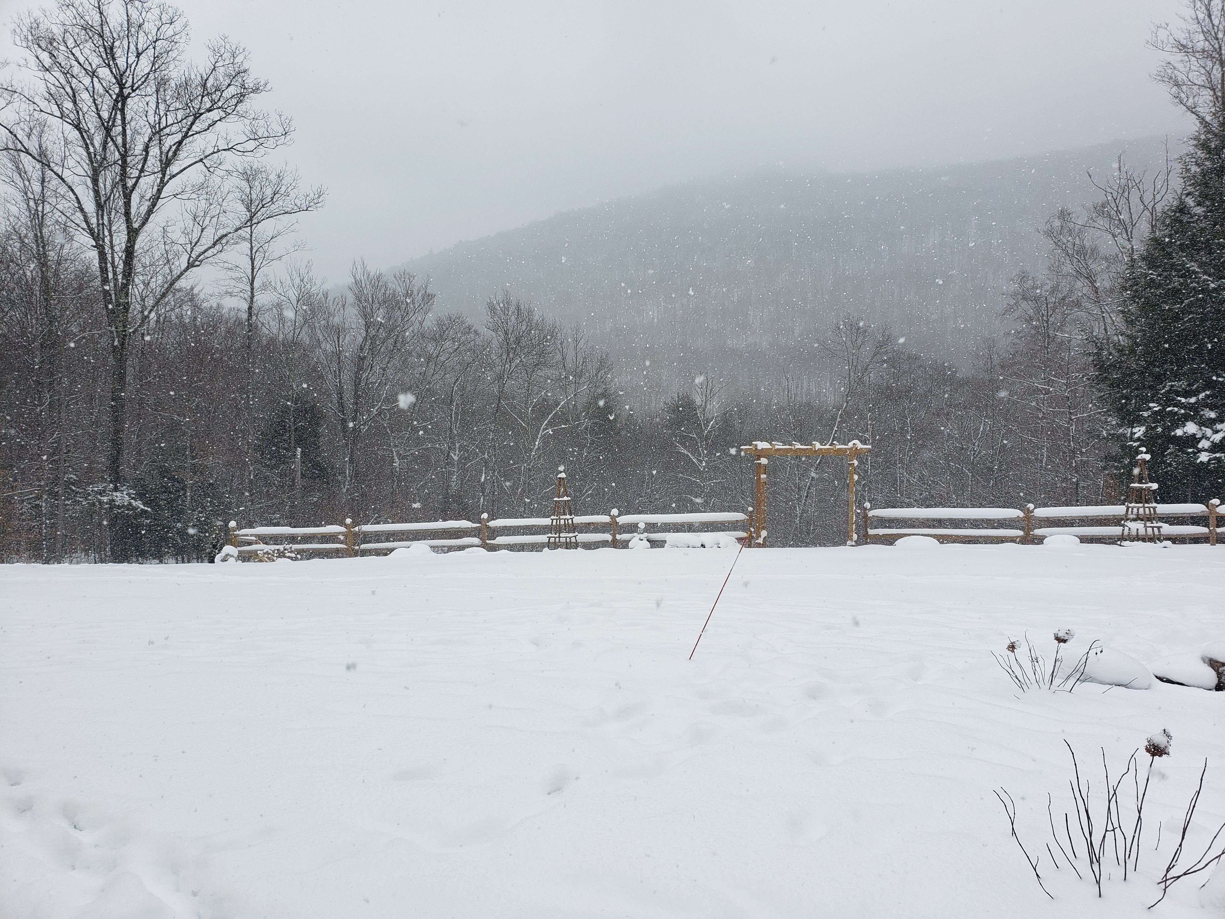
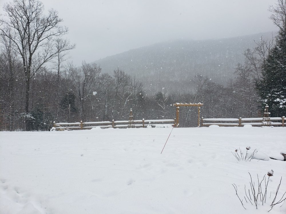
Upslope building pre-arctic front in SVT and Western Mass. 5-6" new past 24 hours here.
-
Just need a "Feel the Bern" sticker on the back to complete the package. Wonder if Phin would like one of those?? lol How are studded tires on dry highway?
-
Growing up in PA I don't think I even knew snow tires existed I never knew anyone who had those in the Philly suburbs--doesn't really make sense down there, lack of snow and everything is paved. Even when we did weekend Pocono trips, never recall any issue--whether FWD, RWD, AWD.
-
I have snows on my car and wife has all seasons..both AWD. Never really had an issue here in the valley. Kind of sketchy at times heading up the mountain to Bromley/Stratton area if its coming down--but I will say the road crews do a really good job for the most part and never had too much of an issue. When we were house shopping a few years ago we looked at a few places that were in the 1800-2200Kft range on the east slopes. Some of these places were isolated and tucked away up hilly driveways/back roads. AWD and snow tires would be an absolute must in some of those areas if you were trying to get in and out on daily basis. A couple I had trouble with in my car with snows and AWD---tucked away in deep evergreen shaded roads that became pure ice without snow cover.
-
Just pounding. 1" in 30 mins. Massive flakes--roads should be fun taking kids to school.
-
January 16 2021 - Inland runner Rain/Snow/Wind
backedgeapproaching replied to Baroclinic Zone's topic in New England
Just was curious and went back to look at those March 2018 storms. Woodford reported 100" on the nose in 13-14 days..lol. So 5-6ft OTG certainly seems right in line with compaction. -
Nice--glad you guys could get a little of the fun too--even if its just an inch or two.
-
Right, and .5" certainly isn't going to be 10:1 as we know.
-
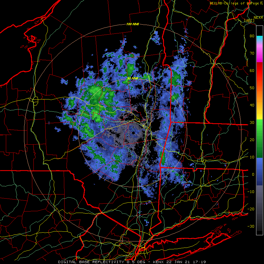
-SN falling here now. Radar looks real good for you guys in N Greens--there's radar echoes backing up in N NY through Canada. Another fluff bomb refresher.
-
-
Days and days...and days--lol.
-
Nice. 11.8" since that time here--which is pretty solid for my location.
-
I thought about that too recently--feel like its been a while since we had a string of those--or any for that matter.
-
-
Another 1.3" overnight. Great pattern--lol. Big flakes coming down now. 24F
-
This thread has turned into an Ansel Adams gallery. Epic shots everyone.
-
1.9" on the board when I got back home this evening. 14.1" over the past 4-5 days at the homestead--we take.
-
January 16 2021 - Inland runner Rain/Snow/Wind
backedgeapproaching replied to Baroclinic Zone's topic in New England
Would need a snowcat to get to your house as they stop plowing it up to a certain point in winter. If you theoretically had a house there, you would have been floating down to Bennington after Irene--crushed that ravine. -
Days and days continue with a little fluff.. Looks like a quick 3/4 of inch maybe. Keeps the boring pattern somewhat interesting at least. Heading to up Snow Valley for a few hours this afternoon..should be a solid base up there.
-
My wife's real estate company has added a bunch of newly licensed Real Estate Agents trying to get in on the boom. Problem is there are a ton of buyers still, but inventory is low after the past 9 month COVID buying frenzy--at least locally here.
-
January 16 2021 - Inland runner Rain/Snow/Wind
backedgeapproaching replied to Baroclinic Zone's topic in New England
I don't think Mitch gets to 80F that often either and is 400ft lower. I think 83-84F was his high last summer, not sure how many 80F+ days though. -
January 16 2021 - Inland runner Rain/Snow/Wind
backedgeapproaching replied to Baroclinic Zone's topic in New England
Yea, they would have to bulldoze that whole neighborhood. -
January 16 2021 - Inland runner Rain/Snow/Wind
backedgeapproaching replied to Baroclinic Zone's topic in New England
Grandfathered in? -
January 16 2021 - Inland runner Rain/Snow/Wind
backedgeapproaching replied to Baroclinic Zone's topic in New England
Single family are mutli-million for sure. Even the twin townhouses slope side are 7 figures.