Tullioz
-
Posts
2,469 -
Joined
-
Last visited
Content Type
Profiles
Blogs
Forums
American Weather
Media Demo
Store
Gallery
Everything posted by Tullioz
-
Average Temperature: 32.5° Highest Temperature: 66.7° on the 29th Lowest Temperature: 7.9° on the 23rd Daily lows below freezing: 27 Daily lows below 20°: 13 Precipitation: 1.23" Snowfall: 5.7"
-
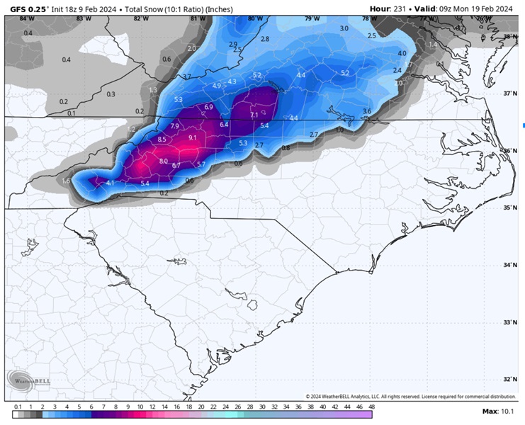
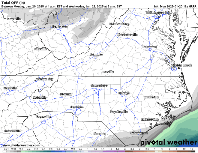
I posted the quantitative precipitation maps earlier this morning. I prefer to use them to recognize trends rather than snowfall maps in situations where precipitation type isn't in question.
-
The NW trend continues on the NAM as well.
-
The HRRR has shown a significant NW trend since the 18z run.
-
Unfortunately, the mean is being heavily skewed by just a handfull of members.
-
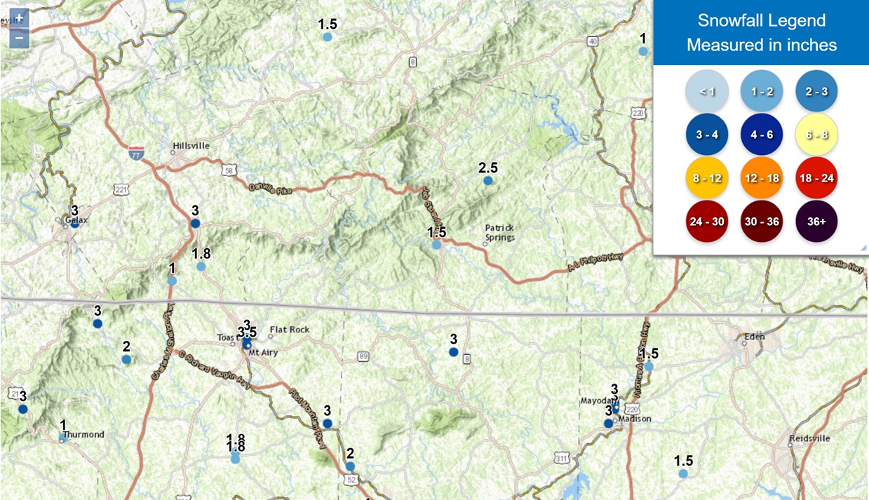
 The report of 2.4" in Eden is an error. It should be 4.2" instead.
 -
1/10-11 super awesome winter SE OBS thread
Tullioz replied to strongwxnc's topic in Southeastern States
A view of the road in front of my house just west of Eden this morning. The final band of snow moved through around 2:50 AM. It remained all snow here and I ended up with a storm total of 4.2".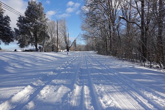
- 510 replies
-
- 13
-

-
1/10-11 super awesome winter SE OBS thread
Tullioz replied to strongwxnc's topic in Southeastern States
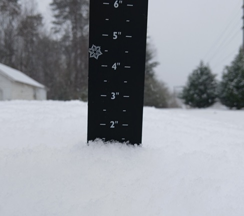
Just shy of 4" just west of Eden. It's still snowing at a light to occasionally moderate clip, but I'm not expecting much more in the way of accumulation with the back edge rapidly approaching. I didn't notice any mixing at my location during the entire event. 25.5°/25.0°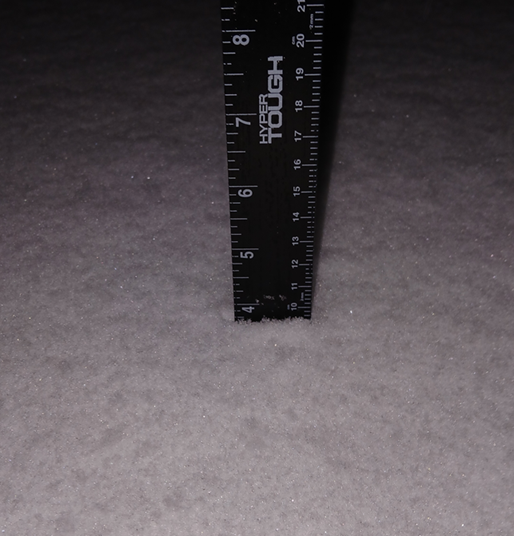
-
1/10-11 super awesome winter SE OBS thread
Tullioz replied to strongwxnc's topic in Southeastern States
All snow here so far. -
1/10-11 super awesome winter SE OBS thread
Tullioz replied to strongwxnc's topic in Southeastern States
1.75" so far just west of Eden. Moderate snow now. 25.9°/25.1° -
1/10-11 super awesome winter SE OBS thread
Tullioz replied to strongwxnc's topic in Southeastern States
Flurries have begun in Eden. 31.1°/16.8° -
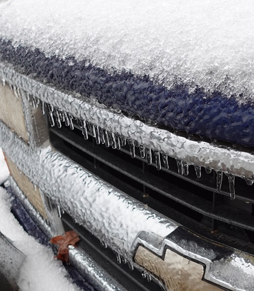
I ended up with a glaze from the freezing rain overnight with an average of .06" on tree branches. The temperature hovered around 30° overnight, but has risened to 31.8° since sunrise.
-
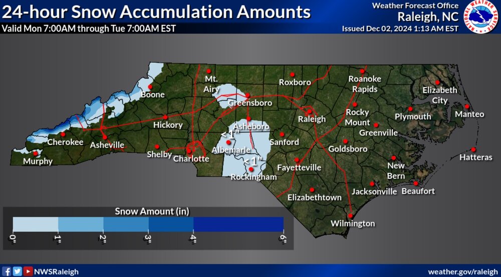
That map shows some areas in and around Eden getting 3 to 6 inches, but I only measured 1.5" at my location just west of Eden. I also drove around the northern part of Rockingham County and nowhere did I see accumulations close to those shown on that map. Below is a map that has more realistic numbers. https://www.weather.gov/source/crh/snowmap.html?sid=rnk

-
Snow is beginning to taper off now. I measured just under 1.5" on the top of my car. The temperature dropped to 29.5° during the heaviest snow and has since gone up to 30.2°.
-
Moderate snow just west of Eden with a nice dusting. The temperature dropped from 36.7 to 31.9 in 20 minutes.
-
The 3K NAM, is showing the possibility of a few flakes as the precipitation moves out.
-
I wasn't able to pull up any updated maps on that page either, but I was able to find the map below in the statewide maps section. https://www.weather.gov/rah/nc#snow
-
It's fake. If it were real, it would have been included in their most recent Facebook update.
-
I haven't been able to find it on the GSP NWS website or on their social media pages. I would be skeptical of its authenticity until it comes from an official source.
-
Yeah, anyone under the age of 35 either wasn't born yet or doesn't remember the winter of 1993 and the years leading up to that winter. I did measure an inch of snow on February 26, 1993, but prior to that, I had gone more than three years without seeing accumulating snow in Rockingham County. As bad as this current streak of snowless winters has been, the early 1990s were worse in this part of NC.
-
I agree. My area averages around an inch of snow in March, and as recently as 2018, there was a dusting of snow as late as April 7th. There were also three separate snow events in March of that year, totaling close to 10" for the month, with 3" of that coming on March 24 and 25th. Today is only February 15th, and we still have six weeks to work with. I know the ensambles and other long-range guidance do not look good at the moment, but just a couple of weeks ago, these same forecast tools were showing a great pattern for the period we are in now, and look how that turned out. I'm with you; I think many areas outside the mountains will see some winter weather before this season is over.
-
Looks like a lot more coming after that.
-
30 years ago, it wasn't much different in my area than what we are experiencing now. That was when I experienced the longest streak of snowless winters in my lifetime. It was a terrible period of time for snow lovers around here. It's still more than a year away in my area before that happens. Looking back at my records, Eden went from December 13th, 1989, to February 26th, 1993, without accumulating snow. 3 years, 2 months, and 14 days.
-
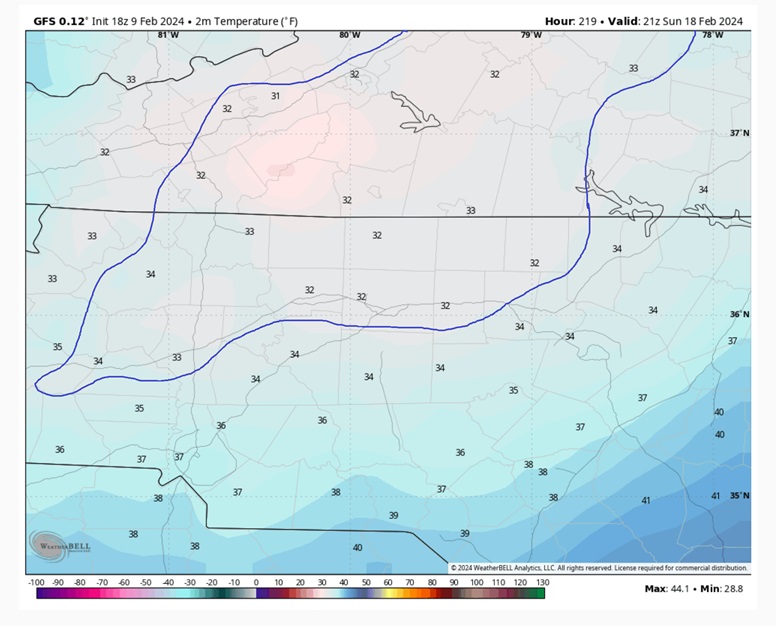
WB maps are showing surface temperatures near freezing during the heaviest precipitation.
-
It would be a nice event for the foothills and NW Piedmont of NC.