Tullioz
-
Posts
2,425 -
Joined
-
Last visited
1 Follower

About Tullioz

- Birthday 02/28/1967
Recent Profile Visitors


-
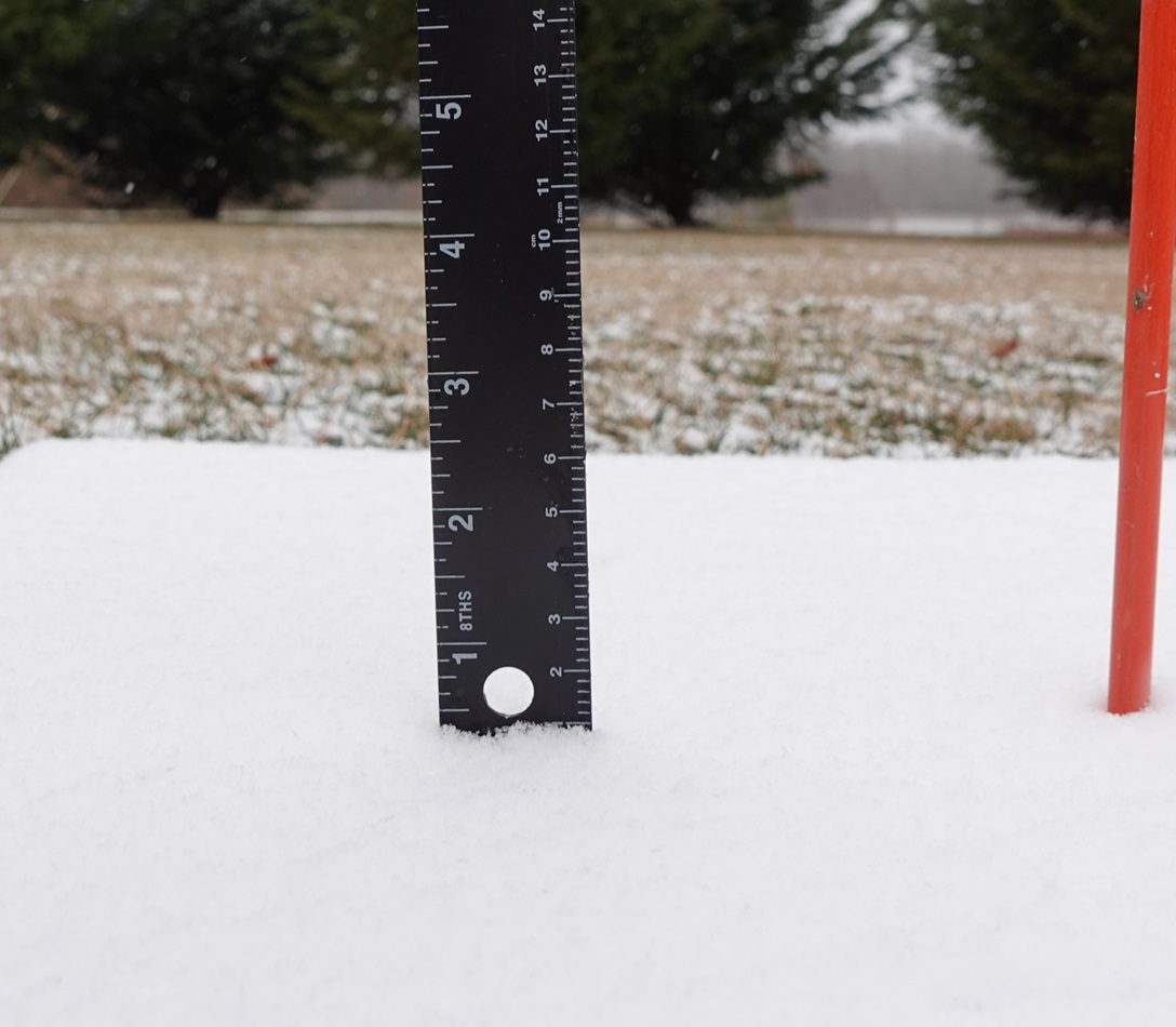
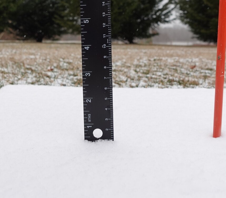
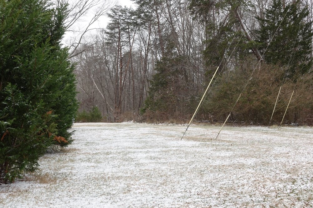
I measured .4" yesterday and .8" today for a two day total of 1.2" just west of Eden.
-
I measured right at 1 cm/0.4" of snow at my location just west of Eden. Light snow continues, but looking at radar, it should be tapering off in this area shortly.
-
Flurries in Eden. 28.2°/15.4°
-

February 19-20 Major Winter Storm Threat
Tullioz replied to NorthHillsWx's topic in Southeastern States
I always look for the GRAF on X, and there are usually one or two local or regional meteorologists sharing it there during significant weather events. -
February 19-20 Major Winter Storm Threat
Tullioz replied to NorthHillsWx's topic in Southeastern States
If the Euro is correct, the cold temperatures during and immediately after the storm could rival what we saw in January in the western piedmont.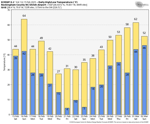
-
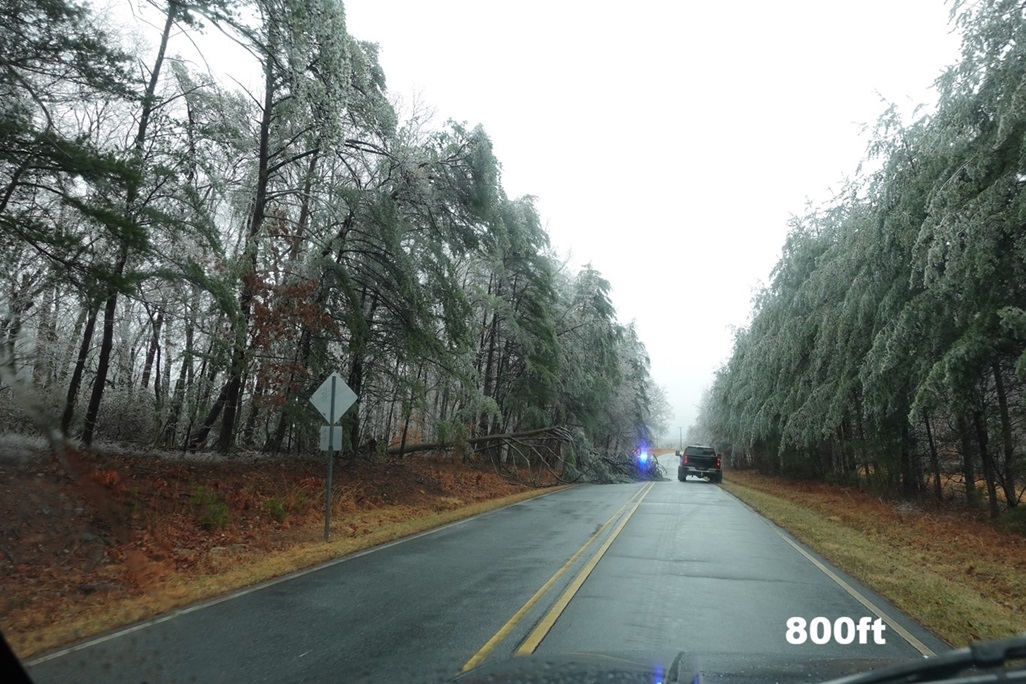
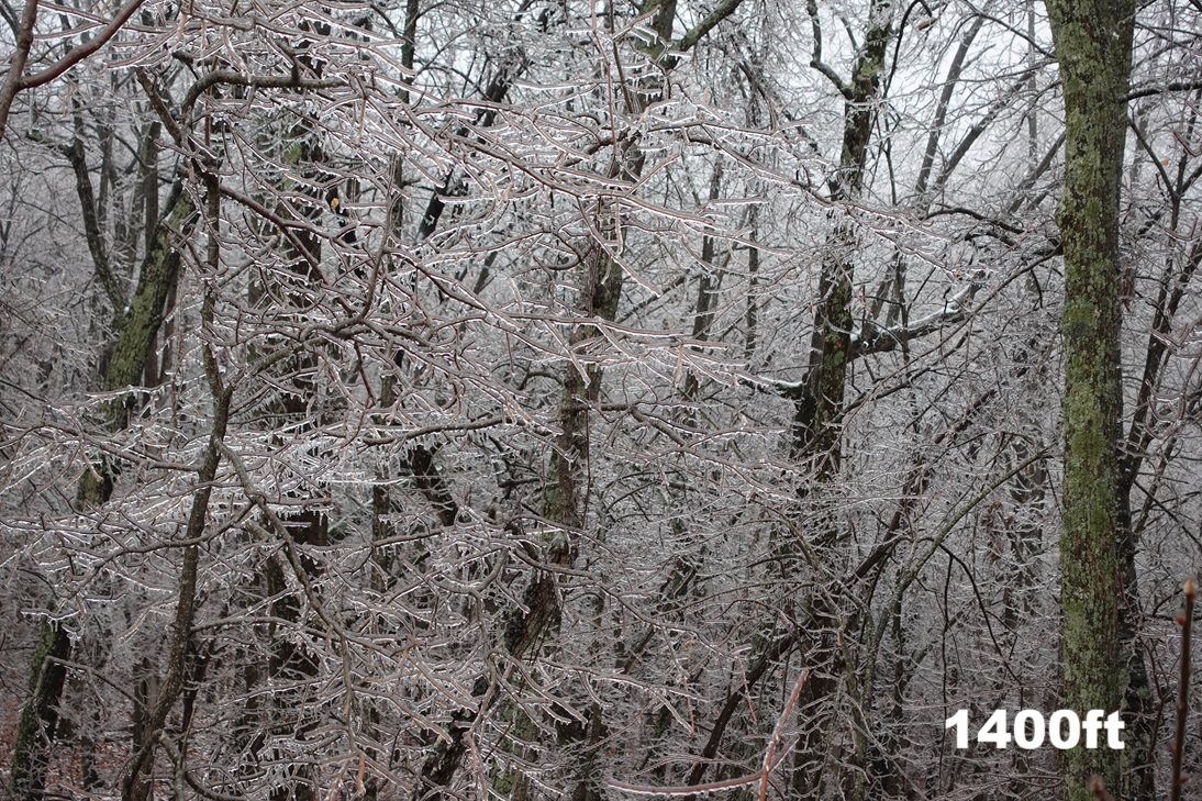
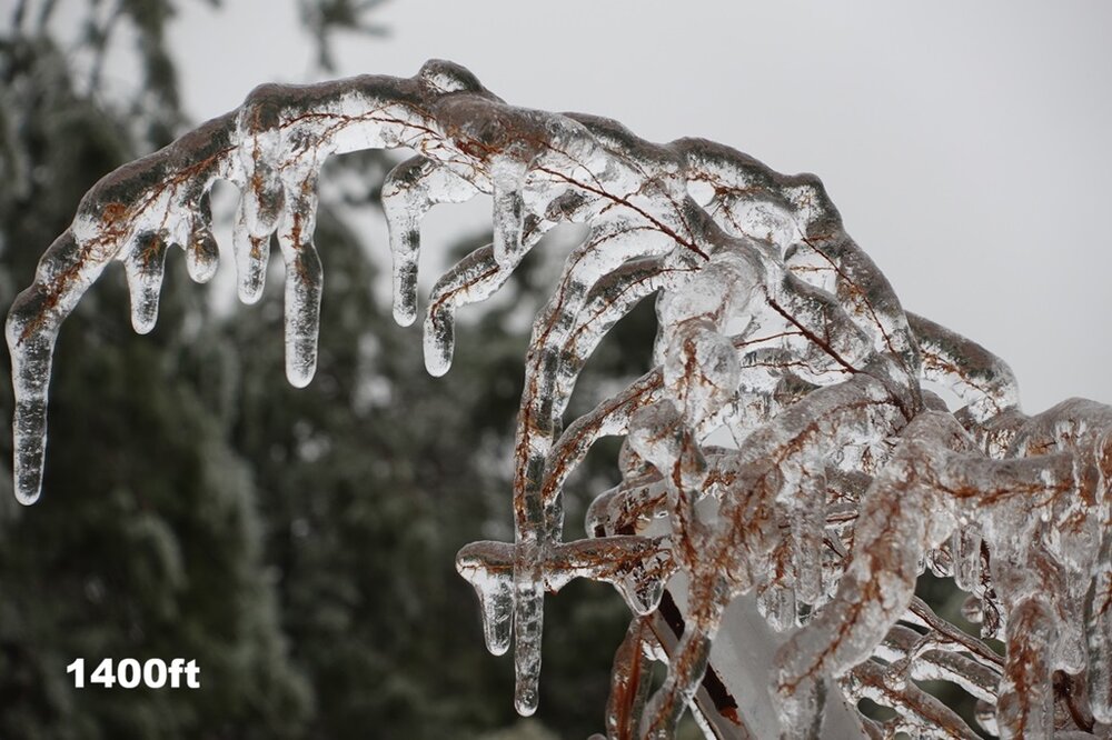
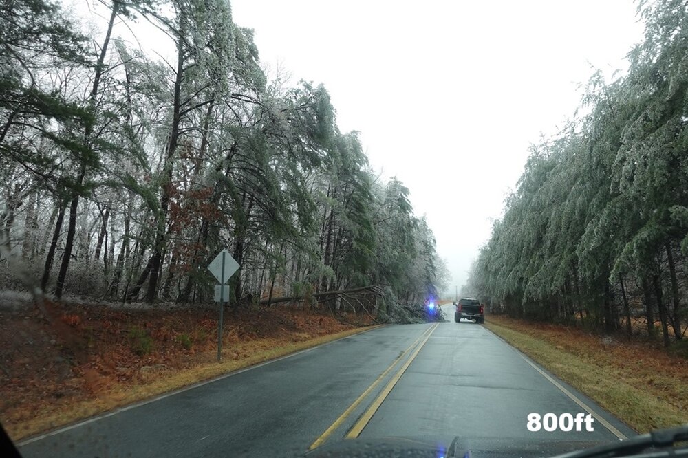
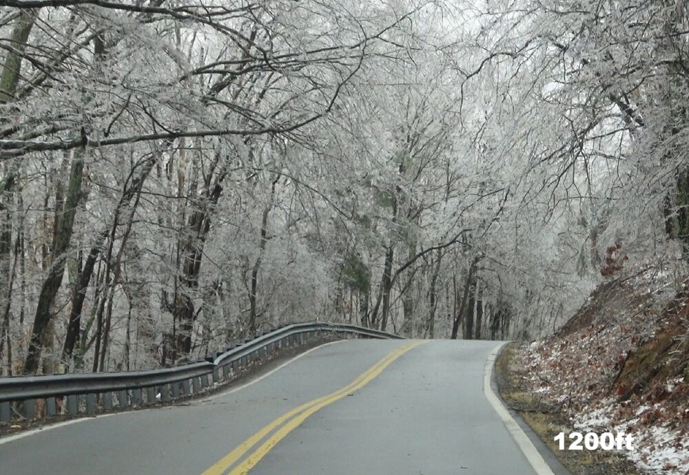
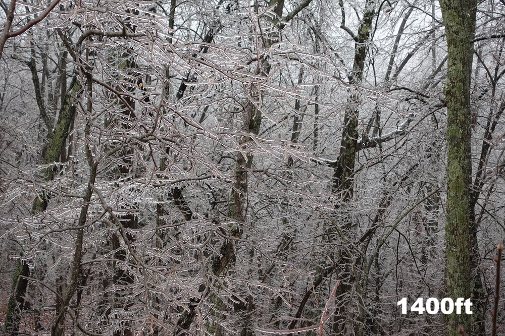
Ice accumulations were elevation-dependent around my area. The elevation at my location is 700 ft, and there was only some light icing in the tops of the trees. I drove around and found that roughly 800 ft was the cutoff for decent icing. Areas above 800 ft saw around .10", and once above 1000 ft. 25" to .50" accumulations could be found. The highest accumulations I found were near Chestnut Knob in Ridgeway, Va., at an elevation of 1,400 ft.
-
My current temperature is 31.8° after a daytime high of 33.8°. The dew point is 31.6°. Both the temperature and the dew point have been slowly falling since 2pm.
-
Received a light coating of snow and sleet overnight. Precipitation has ended for now. 32.4/32.1
-
30.4° at my location just west of Eden. The dew point is 28.6°. A few stations are reporting 28° along the NC/VA border in Stokes and Caswell counties. I expect the temperatures to rise a little once clouds start to roll in.
-
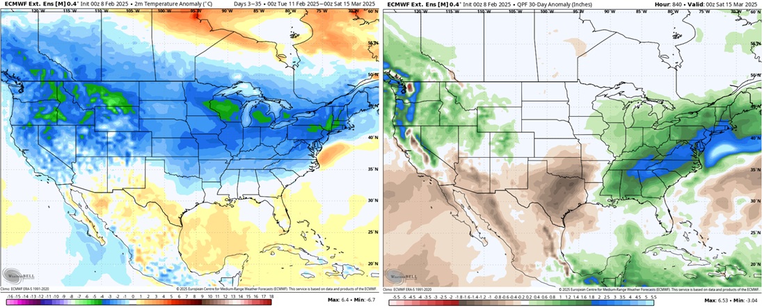
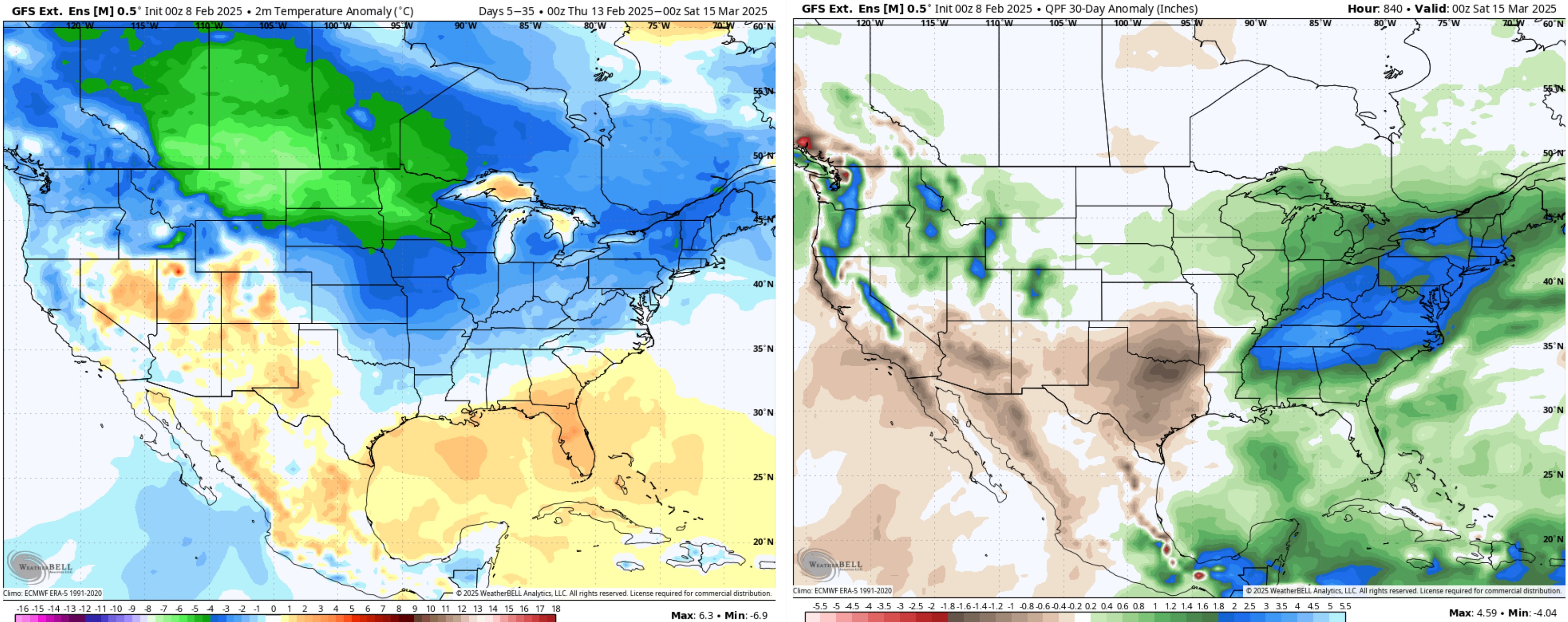
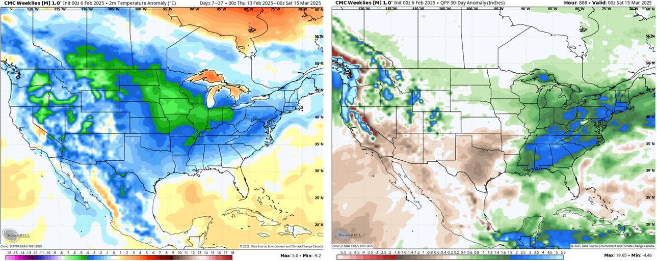
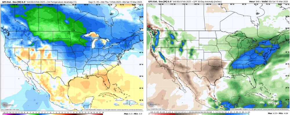
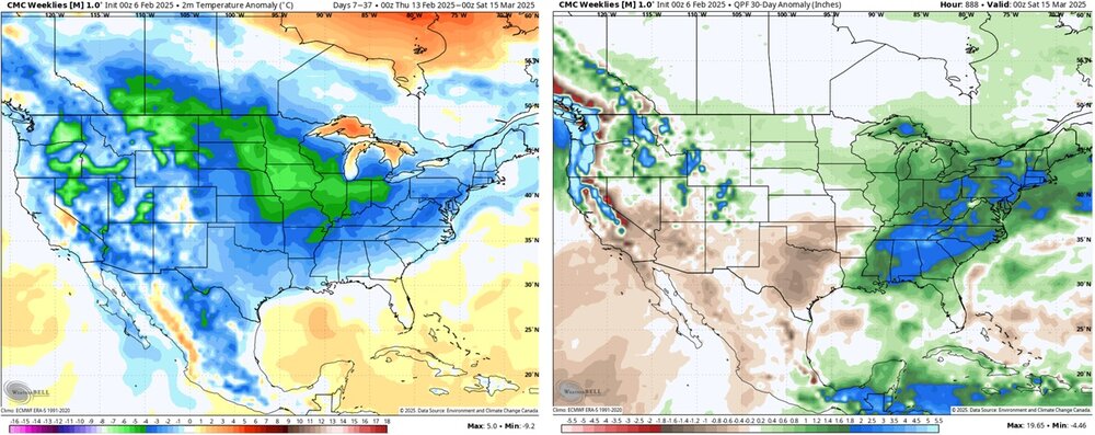
Not everyone. Outside of the mountains, I think the northwest piedmont and foothills will see at least two chances at seeing accumulating frozen precipitation between now and the end of the month, and the extended products look encouraging going into mid-March. I'm almost as excited today as I was heading into early January at the prospect of seeing a significant winter storm at some point over the next two weeks.

-
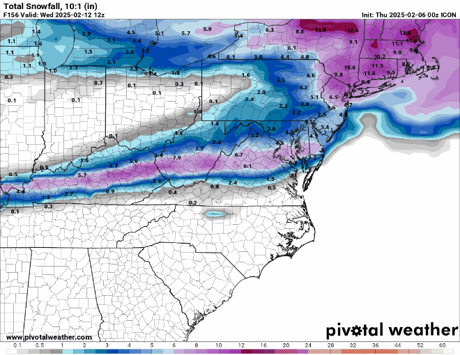
The 12Z ICON came in quite a bit south compared to the 00Z run.
-
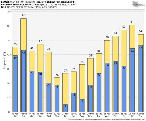
Average Temperature: 32.5° Highest Temperature: 66.7° on the 29th Lowest Temperature: 7.9° on the 23rd Daily lows below freezing: 27 Daily lows below 20°: 13 Precipitation: 1.23" Snowfall: 5.7"
-
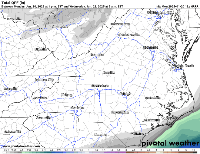
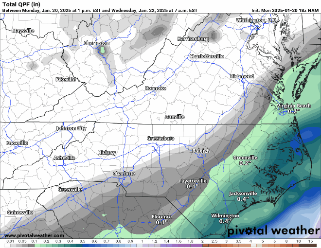
I posted the quantitative precipitation maps earlier this morning. I prefer to use them to recognize trends rather than snowfall maps in situations where precipitation type isn't in question.
-
The NW trend continues on the NAM as well.
-
The HRRR has shown a significant NW trend since the 18z run.