

BombsAway1288
-
Posts
1,428 -
Joined
-
Last visited
Content Type
Profiles
Blogs
Forums
American Weather
Media Demo
Store
Gallery
Posts posted by BombsAway1288
-
-
54 minutes ago, Beachin said:
Nam looking like 12z again
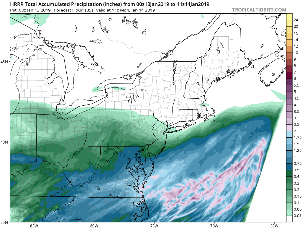
Here is long range hrrr
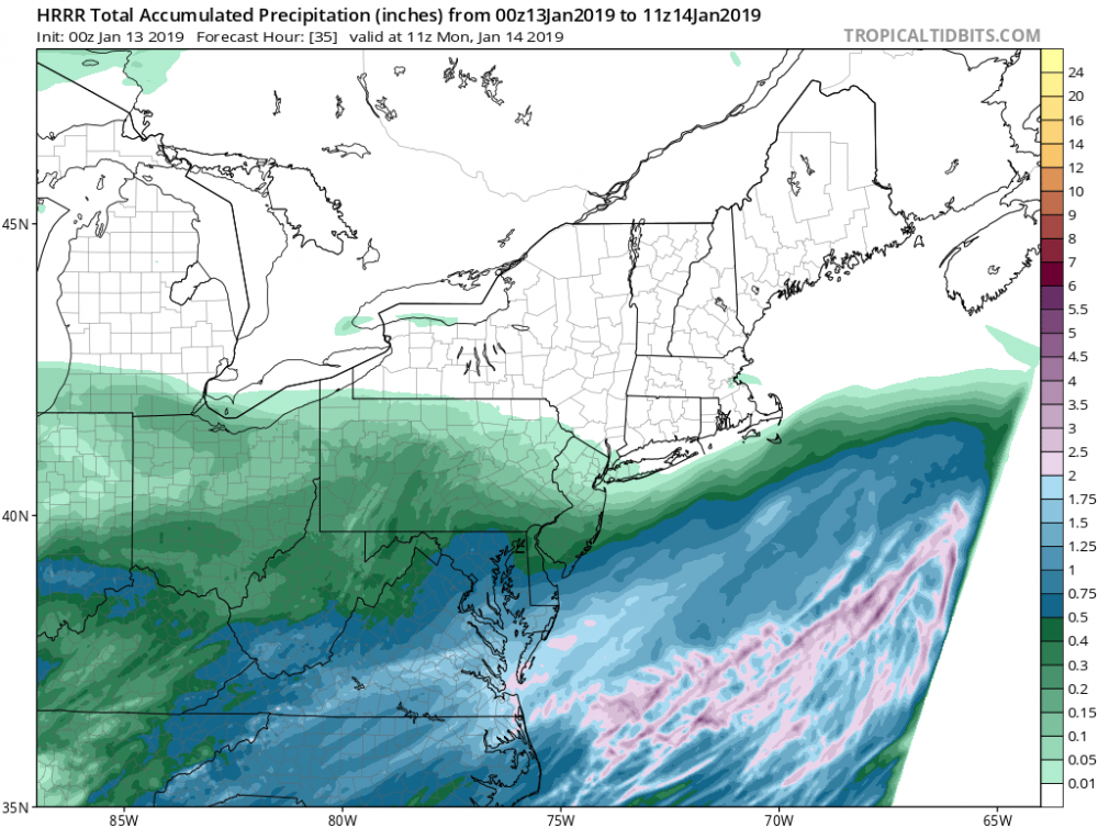
I wonder where that idiot troll who said the HRRR was only showing 0.3” qpf for DC is now? Hope he’s seen this.
Congrats on what looks like an overperformer there. Been a while since your area jacked/trends kept getting better and better as the event got closer.
Expecting us to get into the goods in the next two weeks hopefully. Have a putrid 1.5” here in East Boston, MA so far. Hoping for a 2015 type repeat here for the second half! Probably not a popular thought in this sub forum but congrats on tonight and enjoy it!
-
 5
5
-
 1
1
-
-
28 minutes ago, TheSnowman said:
That's my Snowstorm Present for Ray haha!
Did he say Ray's Name? I gave bomb the whole name.
Lol once again Pete B mentioned it this time saying "Some controversy regarding the top spot. After speaking to someone who is close to the reporter of the 31 in Wilmington" he then said the same thing about the 6 hour clearing method saying "this is the right way to measure snow" and "the NWS said 'what? 31in is too high' but I think it's good and very close to the 28.3 report Methuen." Lol this is getting hysterical.
-
6 minutes ago, TheSnowman said:
That's my Snowstorm Present for Ray haha!
Did he say Ray's Name? I gave bomb the whole name.
He didn't meantion him by name and by seeing what you posted just before me answers how he found out about it, but he definitely thinks it legit by his "discounted by some" tone and the fact that he said it on-air
-
1
-
-
2 minutes ago, dendrite said:
Ray's going to have to join the Pete B fan club now. He's hanging pics of him in his old HS locker as we speak.
Lol yeah he does get a lot of bashing on here but I don't think he is terrible. First winter watching him and have noticed a warm, anti-snow bias but his delivery on TV is one of the best
-
4 minutes ago, TheSnowman said:
Pete Bouchard answered my messages about Ray (WHY does this only allow for a 92KB picture!? Ugh. I'll copy and paste) -
"Ahh...the old school measuring method. According to the NWS Chat boards, they thought it was overdone. Eric Fisher presumed he measured the snow from the previous storm? (Don't know where he got that info.) I asked on the board whether they would accept it, and they said since he wasn't Skywarn, they would omit it. Then it was posted again this morning before they again struck it from the list. Honestly, I can see how he could get 31. It's a tried and true method! And the RIGHT way to measure snowfall."
Well there we go. You got to it before me
-
Pete Bouchard on his 5pm broadcast while showing the totals graphic with Methuen as the highest said: "The real jackpot, 31in in Wilmington. Old school measurement of 6 hours of snow, clear the board. 6 hours of snow, clear the board. It was discounted by some." I guess he checks in on this board or contacted Taunton to know about the 6 hour clearing method you used but nice shoutout to Ray anyway. By his tone it sounded like he was buying the 31
-
3
-
-
1 minute ago, Ginx snewx said:
The observer lives in Winthrop that's where the stats are from, strange folk up there in Boston
Wow that seems very strange as there could be quite the difference in snow totals from Winthrop right on the coast to downtown Boston like yesterday. I thought I got more than 14.5in. I'm sure this has been discussed at nausium in here before regarding Winthrop basically being used for bostons official records
-
Did anyone notice that the Logan reports and Winthrop reports are lock-step the same, even reporting times? Is it always like that? I know they're right next to each other but it seems strange that there wouldn't be at least a tenth of inch of difference. Is it the same person reporting for both locations but only actually possibly reporting from one and sending in two different reports?
-
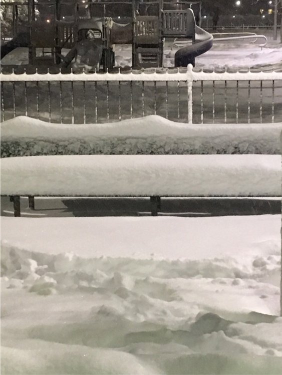
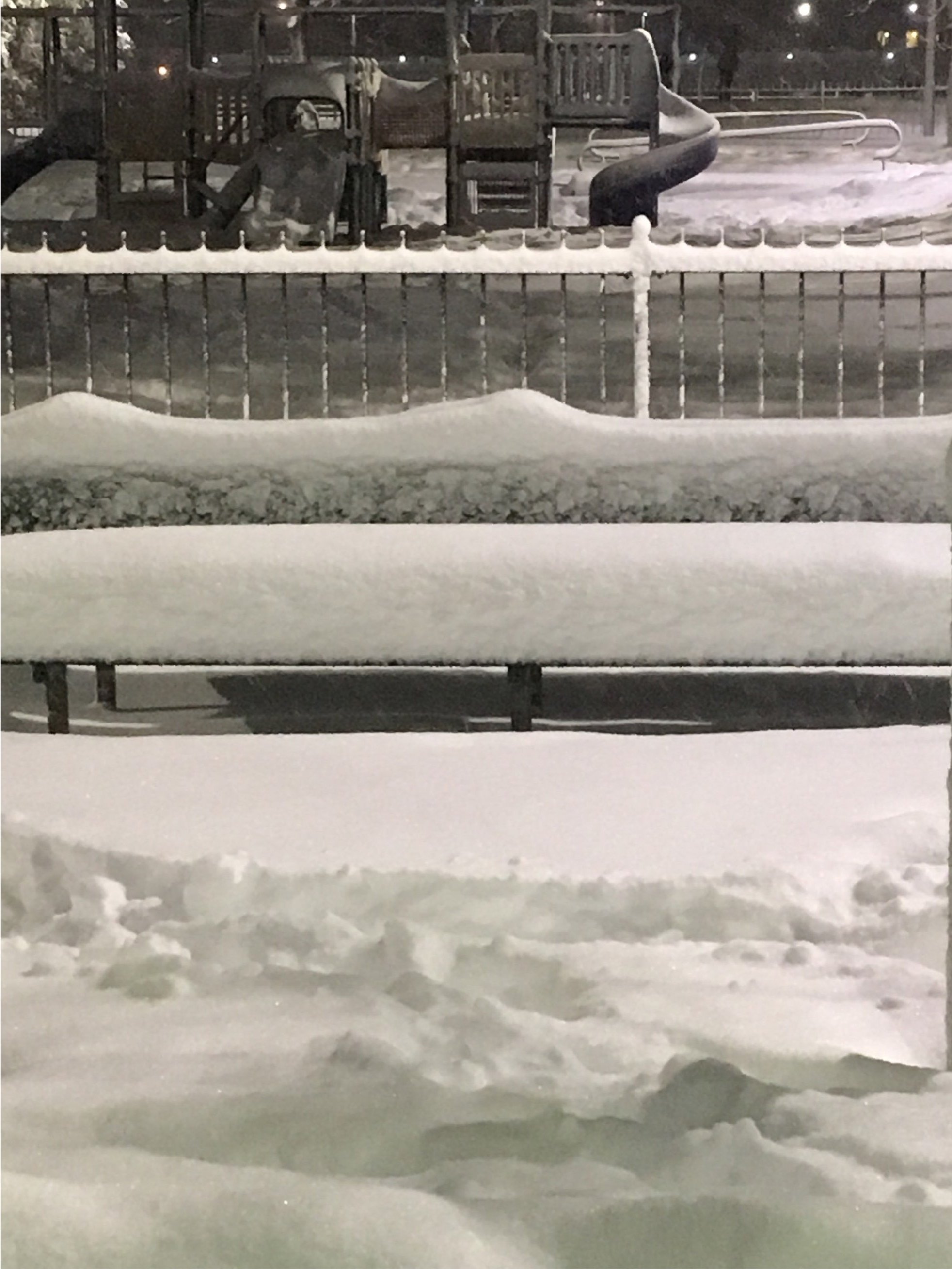
This was taken in a park in Eastie right next to the airport on the west side. Didn't measure. We'll see what Logan reports at 1am. What do you guys think?
-
Does anybody know how to attach pictures on here taken from an iPhone 6? I tried to attach one and it keeps saying that it's too big
-
3 minutes ago, eekuasepinniW said:
The deathband is weakening/contracting.... so of course now I'm getting the heaviest snow of the day.
At least you're in it. It hasn't moved anymore east from the back Bay Area and probably won't while we smoke exhaust
-
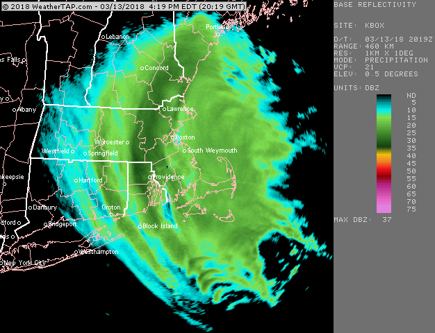
7 minutes ago, ORH_wxman said:
Yes...you can see it happening out by ORH now...but that is good for eastern folks to try and kep the party going into after hours
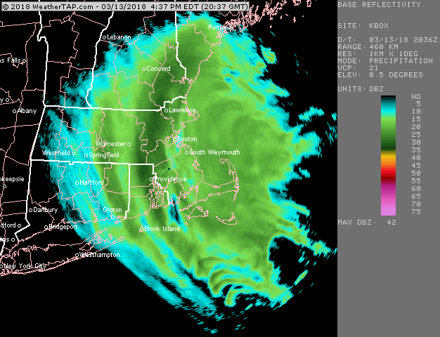
The leading edge of the megaband hasn't moved its eastward progression for the past 30 min. Think we're gonna be shutout from it?
-
1 minute ago, ORH_wxman said:
It'll get you...there's really good F-GEN at 700-500 over E MA right now. That means the forcing is still strong so the bands should continue to generate as they slowly crawl eastward.
I really hope you're right. You are 95% of the time. I've just had 0 luck my whole life when it comes to banding
-
5 minutes ago, ORH_wxman said:
Time for BOS to cash in now...looks like its finally getting there. That 128-495 zone just continues to get nuked
I don't know if it's gonna get to us in Eastie. Just in subsidence right now that will probably continue
-
8 minutes ago, weathafella said:
Logan has been heavy snow since 8. The 1pm snow measure should be fun.
I'm just east of Logan and we have at least 6-7in. Haven't been measuring, just eyeballing. Wouldn't be surprised to see a 10 spot at 1 pm IF this keeps up
-
38 minutes ago, henry1978 said:
I'll reserve judgment for the next few hours for our southernmost weenies who always get screwed. See how this shakes out. I'm sure rex tillerson is really melting down about now.
Oh boy. You must be that 25th amendment guy judging by your silly political references. Thought you disappeared. Please for the love of god keep your political bs out of this thread for the day
-
Yeah nothing but rain here. Oh well, too warm I guess
") good night
good night
-
On 6/16/2017 at 11:35 AM, SACRUS said:
That time of year as the 4th comes into view on the longer range guidance.
EC/GFS indicating a back and forth pattern so timing between heat and storm will be the key here. Overall appears closer to avg but pending on storms and ridge (rebuilding) could see some sneaky heat. More to come as we get into range
Honestly, we're not going to know anything until 2-3 before the 4th. Last year leading up to it everyone was touting warm and sunny conditions all weekend. Turned out to be crappy, cloudy and rainy. The previous 2 years to that were in the 70's with Hurricane Arthur just offshore in 2014. It's all nice and good to be optimistic if you want hot and sunny weather but going by our luck with Memorial Day and this general unsettled pattern we're in I'm expecting some type of rain but we just won't know anything for weeks from now
-
Gusting to 163mph. Pretty impressive, if accurate.
January 12-13th Cold Smoke Obs and Nowcast
in Mid Atlantic
Posted
Very true. The whole metro coast really did get in on a lot of good action. Really stood out here with the over 100” in the second half for KBOS. Something I’ll never see again most likely