ILSNOW
-
Posts
1,508 -
Joined
-
Last visited
Content Type
Profiles
Blogs
Forums
American Weather
Media Demo
Store
Gallery
Everything posted by ILSNOW
-
6z Euro
-
Not liking the look of this. How far west is this going to go?
-
18z EPS
-
18z Euro
-
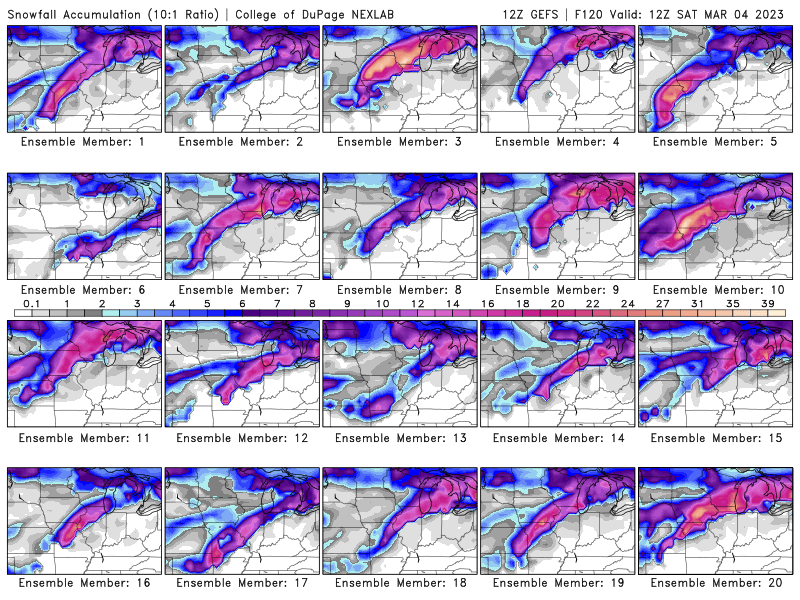
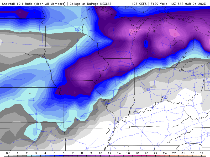
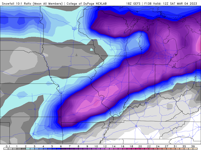
18z GEFS
-
alek and ice
-
-
Some nice hits trending towards a Wisconsin hit
-
12z GEFS
-
12z GFS ice and snow
-
EPS 6z
-
Best model
-
GEFS
-
18z GFS is south and weaker ( where have we seen this before) then 12z and prolly more realistic 12z
-
-
-
I agree the GEM is a dumpster fire model. Long live the King (GFS)
-
12z GFS if only (prolly an MSP special) and the GEM which is slightly different
-
GFS on its own chance of verifying 0.000000001
-
Now ??

-
32/30 here in Buffalo Grove with light freezing rain trees are icing up quickly
-
0z NAM is ugly
-
18z Euro FRAM
-
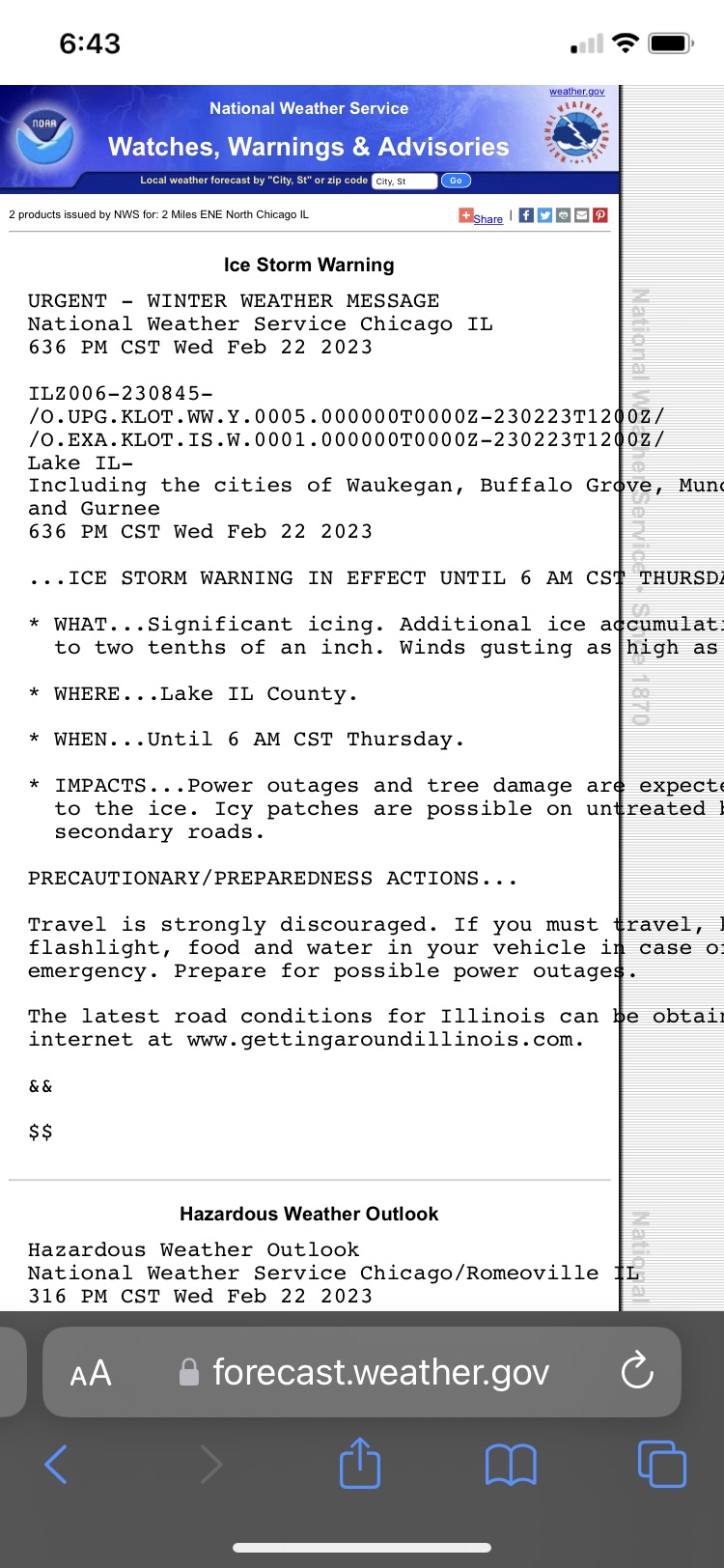
KLOT discussion by RC
-
KLOT went with Winter Weather Advisory ILZ003>006-220500- /O.NEW.KLOT.WW.Y.0005.230222T1200Z-230223T1200Z/ Winnebago-Boone-McHenry-Lake IL- Including the cities of Rockford, Belvidere, Crystal Lake, Algonquin, McHenry, Woodstock, Waukegan, Buffalo Grove, Mundelein, and Gurnee 300 PM CST Tue Feb 21 2023 ...WINTER WEATHER ADVISORY IN EFFECT FROM 6 AM WEDNESDAY TO 6 AM CST THURSDAY... * WHAT...Freezing rain and sleet expected. Total ice accumulations of two to three tenths of an inch with locally higher possible near the state line, while total sleet accumulations up to one half inch. Winds gusting as high as 35 mph. * WHERE...Winnebago, Boone, McHenry and Lake IL Counties.