

ILSNOW
-
Posts
1,508 -
Joined
-
Last visited
Content Type
Profiles
Blogs
Forums
American Weather
Media Demo
Store
Gallery
Everything posted by ILSNOW
-
12z NAM apparently didnt get the message. Why is this model even around any more. We are within 24 hrs of a potential storm and most models have no precip in the Chicago area and this model has a 13 inches . It should be replaced by a dart board. At 18z is will go from 13 inches to 0.
-
so Chicago goes from WSW to partly sunny highs in the low 40's!!!!!
-
Euro caves
-
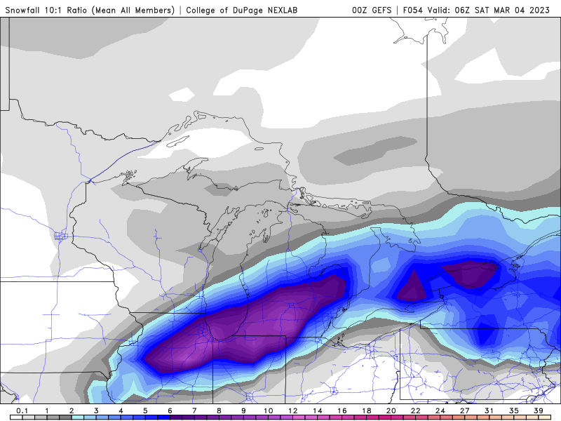
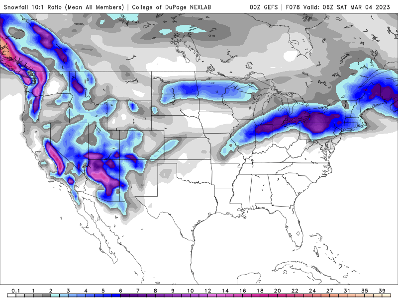
0z GEFS
-
NAM hasn’t gotten the south and east memo (YET)
-
Would love to see EPS if you can share
-
Euro goes south and east
-
yes the mean remains NW of the op run
-
Chicago NWS snippet Forecast soundings have continued to show that a rain and snow would be the dominant precipitation types with a sharp gradient separating the two p-types across the area. Recent trends have stared to hint at the idea that areas north and west of I-55 would be the most favored for snow and potentially heavy snow as the aforementioned enhanced forcing interacts with it. Given that surface temperatures are forecast to be around freezing the snow would likely be a wet snow with ratios on the order of 8:1 to 9:1. While it is still too soon to narrow down the exact location of where this heavy snow band would set up it is looking like areas under this band could see accumulations in excess of 3 inches which would lead to hazardous travel conditions during the day on Friday, but especially during the afternoon hours.
-
looks like the NAM from the old days when we would always get 1 huge run before it came back to reality.
-
18z NAM snow depth and Kuchera
-
is this good!!!!!
-
12Z EPS
-
12z
-
6z Euro
-
GEFS follows the op run
-
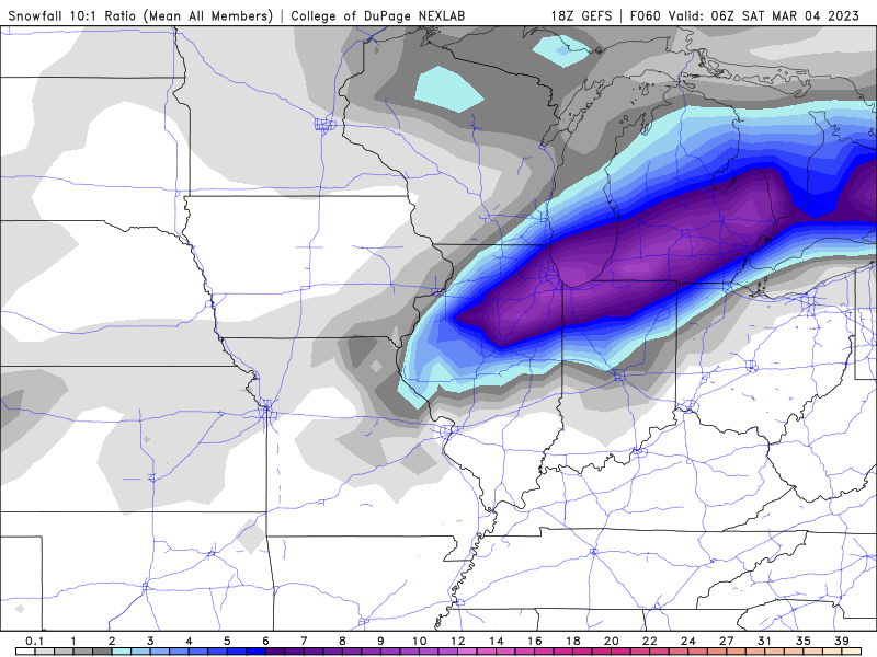
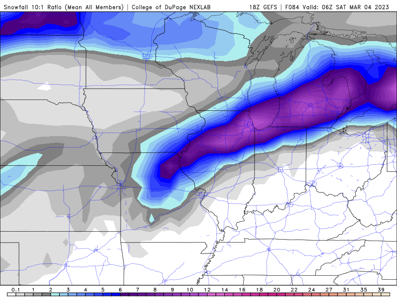
18z GEFS (either op run is an outlier or there are amped runs well northwest)
-
18z GFS
-
18z NAM Kuchera while the 18z RGEM says what snow for IL. Michigan does well.
-
12z EPS at 10:1 ratio might be high
-
-
GEM is slightly different from NAM and GFS
-
-
12z GFS keeps most of the snow out of Wisconsin
-
12z NAM


