ILSNOW
-
Posts
1,508 -
Joined
-
Last visited
Content Type
Profiles
Blogs
Forums
American Weather
Media Demo
Store
Gallery
Everything posted by ILSNOW
-
December 11th-12th Potential Winter Storm
ILSNOW replied to Thundersnow12's topic in Lakes/Ohio Valley
snippet from Chicago NWS The primary forecast challenges in the extended period continue to focus on the evolution of a storm system that is likely to impact the area late Friday through Saturday night. This storm system promises to bring a significant amount of precipitation to the area, but mainly with most of it falling as rain over central and eastern IL into northwestern IN. However, the potential exists for significant snow accumulations for at least parts of far northwestern into far north central IL and points northward into WI. Therefore, we could see a very sharp gradient between significant snow, and little to no snow somewhere right across northern IL, possible even nearing parts of the western/ northwestern suburbs of Chicago. Model and ensemble guidance is in decent agreement with surface low pressure taking shape over the southern Plains on Friday in response to the approach of the upper level low currently off the Baja of California coast. The exact track of the surface low is always key to determine where the accumulating snow will fall. Current indications continue to support a northeast track of the low from near STL early Saturday morning, to northwestern IN early Saturday afternoon. This track, would favor the main area of accumulating snowfall to be roughly across my northwestern areas, namely the Rockford metro area and possibly as far southeast as parts of the far northwestern Chicago suburbs. Mainly a rain event looks to be in store for much of the rest of the region. We will have to continue to watch this closely as even a minor shift in the expected track could change this scenario, so stay tuned! -
December 11th-12th Potential Winter Storm
ILSNOW replied to Thundersnow12's topic in Lakes/Ohio Valley
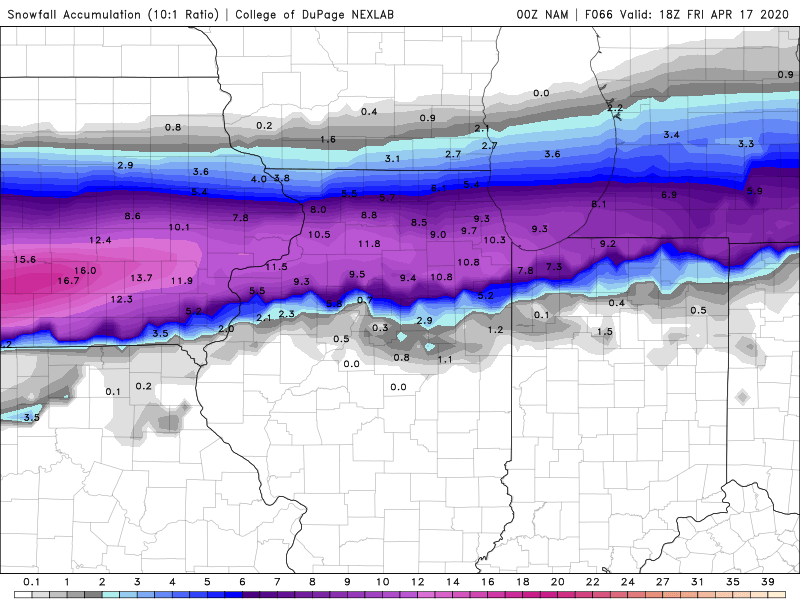
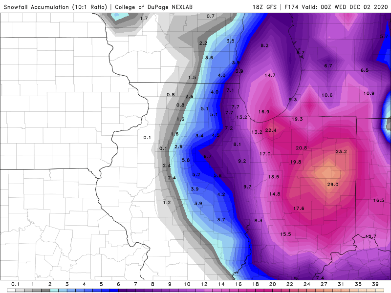
10:1 snow map clearly overdone (prolly cut it in half) -
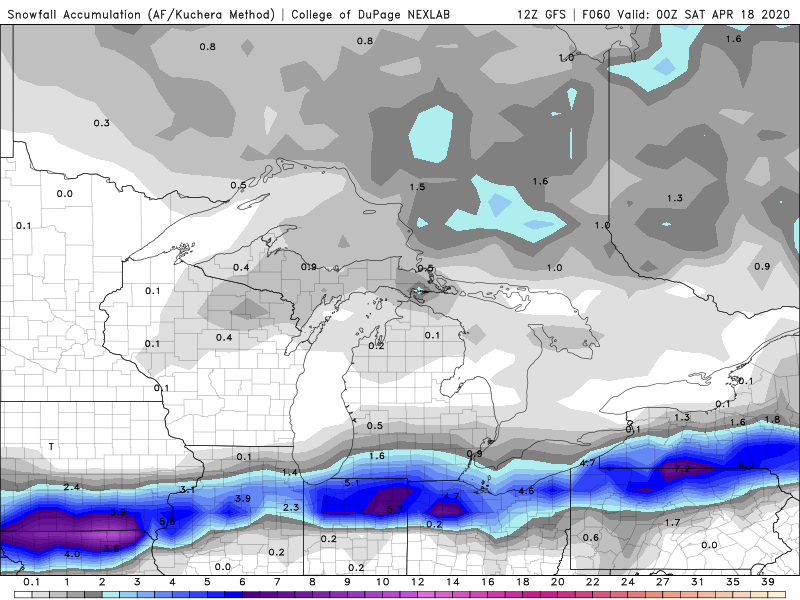
December 11th-12th Potential Winter Storm
ILSNOW replied to Thundersnow12's topic in Lakes/Ohio Valley
12Z GFS Nice storm for northwestern IL and SE Wisc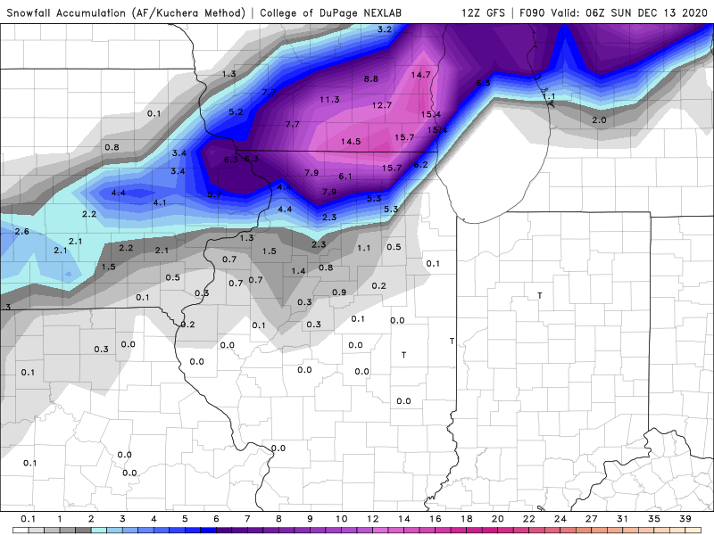
-
November 30-December 2 *Potential* Winter Storm
ILSNOW replied to Hoosier's topic in Lakes/Ohio Valley
this is correct map. Thanks Hoosier -
November 30-December 2 *Potential* Winter Storm
ILSNOW replied to Hoosier's topic in Lakes/Ohio Valley
-
Alek to your point.
-
IL just announced that there were systems issues with calculating the # of deaths during the past 24 hours and that todays # will be adjusted upward tomorrow.
-
12,702 new cases in IL with 43 additional deaths. A new record for the 3rd consecutive day.
-
10,573 new cases in IL with 14 new deaths.
-
10,376 new cases in IL with 49 deaths
-
9,935 new cases in IL today
-
3 here nice surprise
-
latest from LOT
-
GFS says Alek busts high
-
NAM settling back south toward other models
-
1.3
-
GFS north as well
-
-
Euro fake snow
-
84hr NAM doesn’t look bad if you extrapolate out it would be 38 and partly cloudy in Chicago at 90 hours!!!

-
Mid-week potential of something somewhere
ILSNOW replied to Chicago Storm's topic in Lakes/Ohio Valley
I hope the 2:11pm winter storm watches sent out by the Chicago nws are auto generated because they r still calling for 6 plus inches and we r likely to not get 6 flakes -
Mid-week potential of something somewhere
ILSNOW replied to Chicago Storm's topic in Lakes/Ohio Valley
18zGFS remains on the north side of models with the southern Wisconsin area getting just shy of 1 foot -
Mid-week potential of something somewhere
ILSNOW replied to Chicago Storm's topic in Lakes/Ohio Valley
Izzi with a great write up