DownS.EasternVa
-
Posts
37 -
Joined
-
Last visited
1 Follower

About DownS.EasternVa

Recent Profile Visitors
1,250 profile views


-
Richmond Metro/Hampton Roads Area Discussion
DownS.EasternVa replied to RIC Airport's topic in Mid Atlantic
-
Richmond Metro/Hampton Roads Area Discussion
DownS.EasternVa replied to RIC Airport's topic in Mid Atlantic
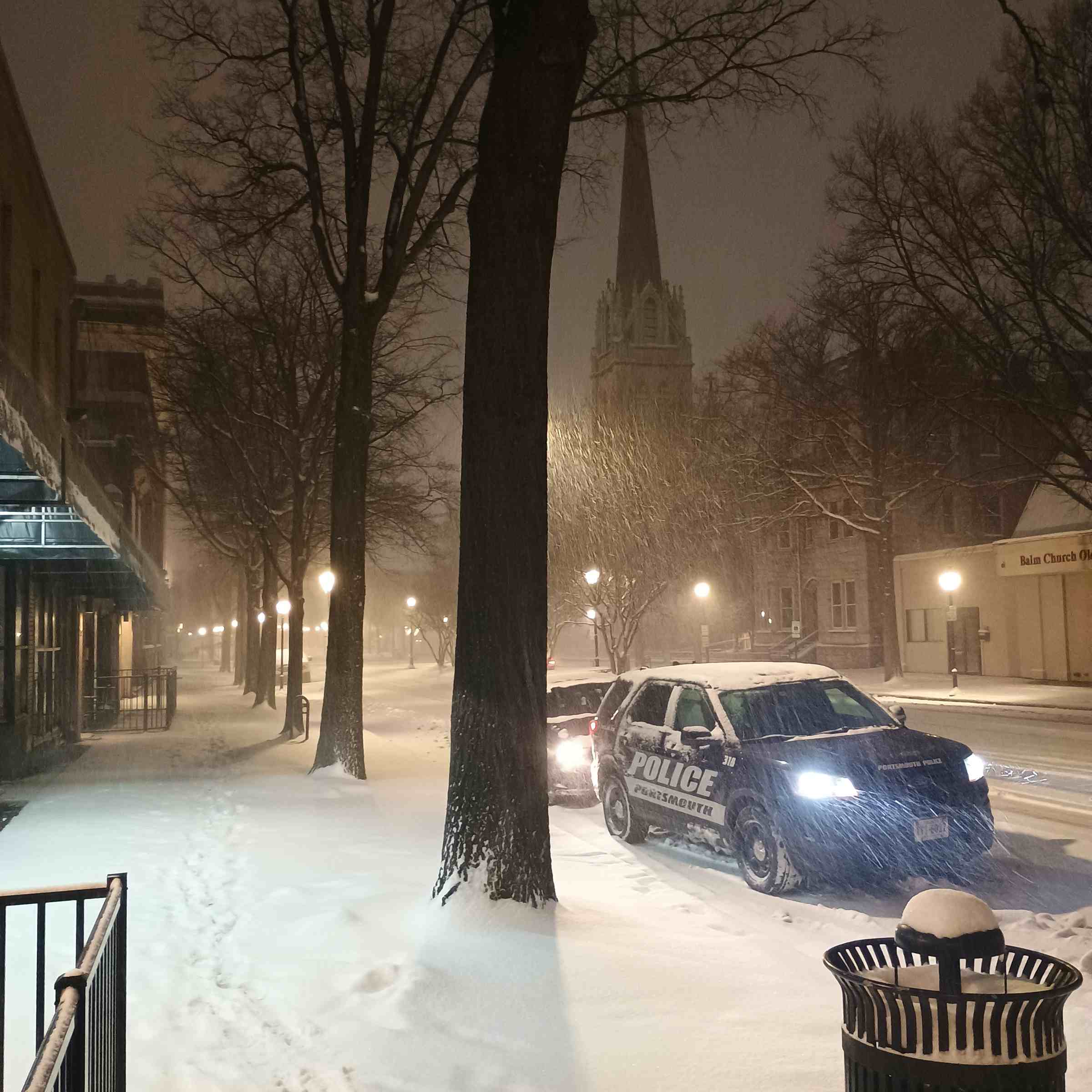
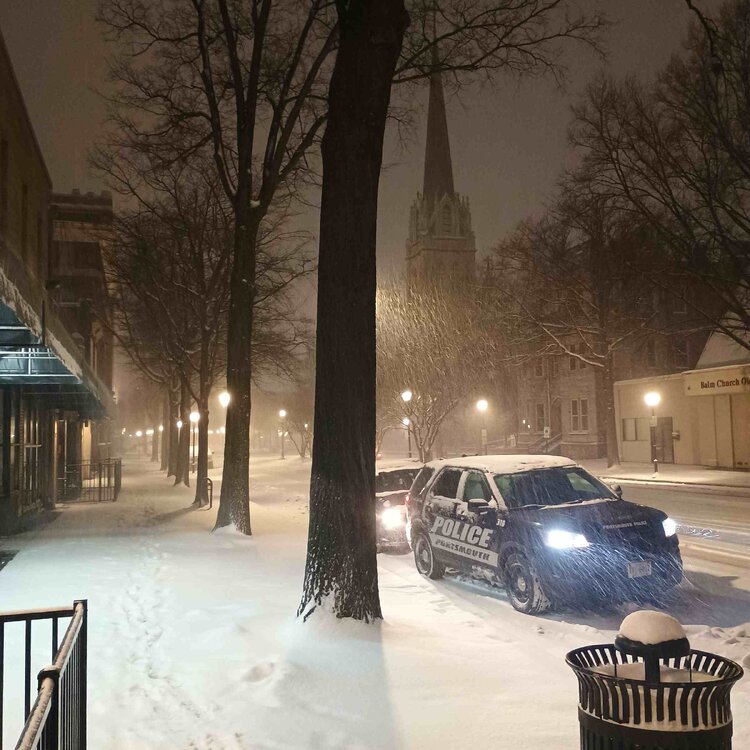
Yeah Portsmouth Va is ALL SNOW absolutely ripping pushing 5 maybe 5.5 inches. -
Portsmouth, Va absolutely pouring ALL SNOW closing in on 5 inch probably.
-
Richmond Metro/Hampton Roads Area Discussion
DownS.EasternVa replied to RIC Airport's topic in Mid Atlantic
Nice band moving North toward Northern half of S.Hampton Roads should pick up accumulation fast. -
Richmond Metro/Hampton Roads Area Discussion
DownS.EasternVa replied to RIC Airport's topic in Mid Atlantic
That's just the way things go in Hampton Roads sometimes, it is always great to see it come down. With that said HR usually never score big on the 1st snow of the season, just an observation from being here my whole life. It is encouraging to get snow early on though, and we usually pull a rabbit or 2 out the hat when it's especially cold on the east coast. Overrunning system are always tricky around here too, the warm nose is always on the table with those set ups, even when it's 28 degrees unfortunately. We never get good snow if both Richmond and NOVA are receiving anything (sorry not sorry) even 1 in amounts. Another observation for HR peeps on overrunning events, always look to Raleigh, 10 out of 10 if Raleigh is have mixing issues we're having mixing issues. Storms got to be way south, Wilmington,Charleston area for good overrunning event around here. With that said 12z guidance is pretty intriguing for HR, pressing artic cold and Miller A's are our wheelhouse. -
Richmond Metro/Hampton Roads Area Discussion
DownS.EasternVa replied to RIC Airport's topic in Mid Atlantic
GFS trending colder for Hampton Roads as well, 32-33 the entire event. -
Richmond Metro/Hampton Roads Area Discussion
DownS.EasternVa replied to RIC Airport's topic in Mid Atlantic
GFS just dropped a bomb on all of Eastern VA -
It'll torch, at the wrong time as usual. Like late December thru mid-March. Then we'll have a pseudo winter in Spring that delays the good spring days. Been this way for about a decade now SMH.
-
Potential 1/28-1/30 2022 winter storm
DownS.EasternVa replied to Prismshine Productions's topic in Southeastern States
Sleeting in SE VA -
Richmond Metro/Hampton Roads Discussion
DownS.EasternVa replied to RIC Airport's topic in Mid Atlantic
Not much virga in this area -
Richmond Metro/Hampton Roads Discussion
DownS.EasternVa replied to RIC Airport's topic in Mid Atlantic
Precip started alot earlier in Hampton Roads maybe a good sign for points westward. Strong dusting in Portsmouth snow flurries/ showers for an hour or so. -
Snow flurries/ showers for about an hour in Portsmouth, Va have a dusting on everything so far. Also started about 3 hrs earlier than modeled in fact no model had this band that has set up.
-
Grace is getting her act together fast this morning, HWRF keep a more northerly component to Grace. The globals more of a west motion, wouldn't a stronger system pull more northward?
-
This system has potential its looking pretty good on satellite, outflow looks to be much improved too. It also has potential to miss the islands to the north calling it now this system will be a beauty.
-
Yeah this one has hurt alot in Norfolk we've been sitting between 33-36 for 4 days with pouring rain. This could of been an epic period for the entire east coast had the PV came east...