

TheBudMan
-
Posts
400 -
Joined
-
Last visited
Content Type
Profiles
Blogs
Forums
American Weather
Media Demo
Store
Gallery
Posts posted by TheBudMan
-
-
14 hours ago, DotRat_Wx said:
Health scares like some of us have are a good reminder to cherish every day. Life is short. Smile and greet the people in your neighborhood. Ask your co-workers how they are doing. Keep in touch with family as much as you can. All the money in the world cannot replace misspent time focused on the wrong things.
Most of all, take your personal fitness seriously. Obesity keeps our Healthcare system in business. You only get one body. Take care of it. Keep that heart pumping and the cardiovascular system healthy. Not only will it make you feel better, even give you a buzz during the day, but it will improve healing and circulation throughout your muscles and joints. Thus leading to better aging. I'm trying to buy back in myself. Been killing the peleton. Didn't do it this week. Bummer.
I just got off my ride @DotRat_Wx, lets go get yours !!!
-
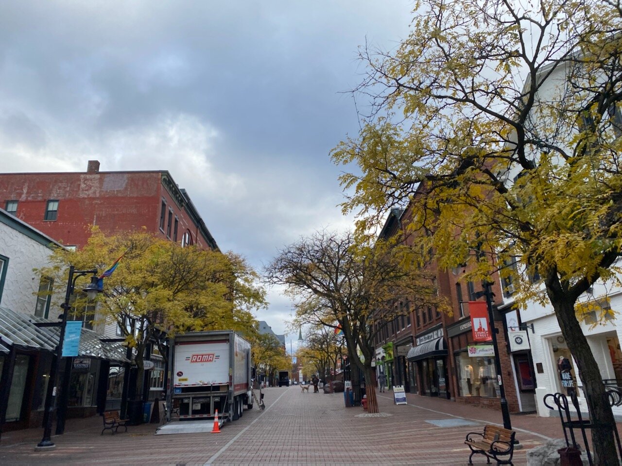
2 hours ago, klw said:
More BTV foliage talk:
Those trees look very different at ground level and actually turned yellow weeks ago.
I took this photo about half an hour ago:

Quick walk to Foam Brewing #beer
-
Jay wants

-
Just pouring rain outside and winds packing a punch. Had 0.7 awhile ago and probably came close to doubling it in the last 45 minutes.
Wanda will look real nice 12 hours from now on satellite
 s
s
-
1 hour ago, DotRat_Wx said:
How is everyone doing?
We are almost there.
I work weekends very early. Getting up at 5:30a these first few brisk days has given me incredible flashbacks to college. Waking up at the azz crack of dawn for football practice. I miss it, but I don't at the same time.
I am very much looking forward to winter. I love it. Such an exciting part of the year. Our first cold shots of air coming our way.
All of this rain and greenery about to be frozen dead within a month. Exciting!!!!
How is the outlook looking? @40/70 Benchmark
Are the hens getting laid? @dendrite
How fat are the squirrels this year? @weathafella
Just wait til @weathafella starts droppin the mutha fuuuuuukkkkkkkkas

-
 2
2
-
-
Ant vs. Nick fight fight fight fight

-
 1
1
-
 1
1
-
-
A Ginxy and Rev special. The moon coming up at Good Harbor Beach and a great Foam Brewing beverage #beer !!!

-
3
-
 1
1
-
-
Under an EHC and we can't even get a post from Wiz ? what gives ???

-
I think we need to have Jay and Wiz snuggled up at the Cape house tonight. Wiz scanning the dark skies over the ocean looking for F4s about to come onshore while Miley Cyrus softly plays in the background and spiders crawl across the floor towards him.
-
5
-
4
-
-
4 minutes ago, 40/70 Benchmark said:
What happened in Clinton, MA yesterday may just be a warm up....one aspect that will be pretty prevalent IMO is tornado risk, and its being glossed over.
You just know @Damage In Tolland is hoping the eye passes about 25 miles to his west RFQ FTW !!!
-
*if* Henri approaches can I request a series of posts from Tip on how he's going to board up his new windows ?
Also do we uninstall when a Hurricane comes ? so many questions for us
-
1
-
-
This is like a winter storm. Can't wait for all the 12Z models to move 1000 miles east and weenies to be crushed. Hopefully the busload of MILFs on the way to see Pickles doesn't turn around

-
1
-
-
Where is Wiz ? We keep getting 384 hr maps of EMLs for days from him and now here comes Thursday and he's on the bench with the scorebook again

 Depending on the model of
choice values range from generally 1000-2000 J/kg on the
conservative side of guidance of MLCAPE with the NAM being a bit of
an outlier with MLCAPE ranging from 1000-4000 J/kg with the highest
values in western portions of the CWA. On top of this will have an
EML moving in aloft on Thursday with mid level lapse rates between 6-
7 degrees Celsius per km and 7.5-8.5 degree Celsius low level lapse
rates. One thing that may help us in the severe risk is it doesn`t
look like things move in until late in the day.
-
1
-
-
I think Tip said we’d see this back off some
@Ginx snewx approved day on Goose Rocks Beach in Kennebunkport !!
-
3
-
-
Prob more
We can adjust up as needed.
The TreeHouse was flowing for @Damage In Tolland today. Angry refills needed quickly watching his Spankees choke. Nothing wrong with that !!-
1
-
1
-
-
Found it thanks.

https://www.spc.noaa.gov/products/md/md1319.htmlDISCUSSION...Associated with larger-scale mid/upper troughing digging in the St. Lawrence Valley/lower Great Lakes region, forcing for ascent with a lead speed maximum (30-50 kts in the 500-300 mb layer) appears to be providing support for an ongoing, well organized cluster of thunderstorms across southeastern Ontario. Perhaps aided by an associated strengthening surface cold pool, this activity has accelerated some (up to 40 kt) over the past couple of hours, and may reach the Ottawa vicinity by around 19Z. Along trailing outflow into the vicinity of its intersection with a southward advancing cold front, additional thunderstorm development and intensification is now also well underway. Supported by moderate southeasterly low-level inflow of moist air characterized by CAPE of 1000-2000 J/kg, this seems likely to continue with the evolution of another upscale growing and organizing cluster/segment possible. This may begin impacting the Ontario shores of Lake Ontario into the Watertown vicinity as early as 20-21Z, perhaps a bit earlier and more substantively than suggested by the latest Rapid Refresh. Although low-level wind fields are generally weak, the effective downward mixing of higher momentum air aloft, associated with the well developed/maturing organized convective system and associated surface cold pools, probably will be accompanied by increasing potential for strong gusts at least approaching severe limits.
I am ready for a derecho into southern Maine at 3 AM. Please make it happen @OceanStWx
-
3 hours ago, STILL N OF PIKE said:
I say this with love
A literal monkey could put a A.C unit in that window ..maybe you need to do a mod like adding a tiny piece of wood so it sits with a better tilt . This doesn’t require pages of discussion Geezus . Buy the Unit , put it in and enjoy the relief . I mean am I missing something ...it doesn’t need to be vacuum sealed To 1/100’th specifications
All @Damage In Tolland wants is a picture of the lawn.....is that too much to ask for ?
-
 1
1
-
-
any hope for next week Tip or do I make like Ray and get into the tub and turn the toaster on ?
-
1
-
-
Just now, HoarfrostHubb said:
Make sure you report to BOX
Report to Jay first, priorities Wiz !!! he's a bigger
than you !
-
1
-
1
-
-
Outflow is great, temp dropped in Reading could feel it come through !
-
Wiz I'd be careful, I hear Springfield is overrun with massive spiders. might be easier to sit in the hot tub and wait for them to come to you
-
Rev getting piggy piled. Hate to see it. No Stein lyrics this weekend needed.Charts! -
Guest appearance in late May by Ray as he preps his 21-22 winter forecast ! Big snow returns
-
1 hour ago, Typhoon Tip said:
This BD is forcing very little appreciable cooling impact ..that's for sure. I mean Bedford MA is 79 F and they are only 10 clicks inland ... Logan is managing to flirt with 70 on a 15 mph E wind in mid May - that's a bit odd actually..
Meanwhile, we're 80 to 83 up and down Rt 2 west of I495 this hour ...
Sensibly it is hotter than yesterday despite being located behind this analyzed front https://www.wpc.ncep.noaa.gov/sfc/90fwbg.gif
Reason? no wind ... I mean the sun is like straight up and down ... almost 72 angle or whatever it's like burning the top of your head just stepping out there.
Still dry air though.
Noticing the ridge trying to rollback in next week, though more longitudinal ... Looks like the layout of a Lakes to New England drechio/MCS ... There's a 570 dm thickness plume ( unlike this dry air ridge this go) skirting along within that ridge bulge, and it gets to about Watertown - Brian - PWM or so ... and some EML looks like it may have gotten peeled away from the SW in that...
Anyway, we may go from mid 80s to low 70s, to mid 80s/72 DP, Saturday thru Wed next week, and with a polar jet just next door over the St L Seaway... could be a legit severe risk in that Tue-Thur time frame.
Of course ...all that's predicated on the assumption that these current looks hold. A couple .. few cycles from now, the ridge may become strong enough to fend it all N, or... not exist as much... in either case... something else -
Tip can post all he wants but any NE Severe ain't for real until King
@weatherwiz starts honking !!!
-
1
-
Wednesday 12/8 Possible Snow/Ice/Rain? Discussion
in New England
Posted
So great to see the posts from Fella ! Happy you're out and feeling better Jerry. Get those muttaaaaafukkas up it's winter baby !!!