TheBudMan
-
Posts
418 -
Joined
-
Last visited
Content Type
Profiles
Blogs
Forums
American Weather
Media Demo
Store
Gallery
Everything posted by TheBudMan
-
Have to use quote from phone Yo @weatherwiz I am in position for Friday severe ! I am in Leraysville PA ready for #damage !!
-
pouring in Reading as I wait for @dendriteand @stormtracker to answer my PM
-
*FIGHT* *FIGHT* *FIGHT* need @Masswx to bring some maturity to this board !!!
-
@weatherwiz go to Brooks BBQ, a few extra pounds on you will make spiders more fearful !!
-
“Cory’s in NYC! Let’s HECS!” Feb. 22-24 Disco
TheBudMan replied to TheSnowman's topic in New England
where is @Masswx ? were his computer prividges taken ??? -
“Cory’s in NYC! Let’s HECS!” Feb. 22-24 Disco
TheBudMan replied to TheSnowman's topic in New England
Man @CoastalWx weening his own kid. You know things are getting thrown against the walls in that house right now. At least we have May 1 season to look forward to, right @weatherwiz!!!! -
That would be great NNE gets whacked while Kev sobs giant tears and joins TeamTorch
-
Friday February 6 FROPA / WINDEX small event
TheBudMan replied to HoarfrostHubb's topic in New England
definitely need to know what we at EasternMassWeather are thinking. @40/70 Benchmarkmust be enraged reading this thread so much ammunition for him in here -
Forget @40/70 Benchmark map when we want accurate predictions we here in EMATT go to @Masswx !!!! Need his updated map... once school ends of course :-)
-
January 2026 regional war/obs/disco thread
TheBudMan replied to Baroclinic Zone's topic in New England
Love @vortex95just trolling @CoastalWx Does @CoastalWxreturn the favor in May when the High Risk day in Oklahoma fizzles -
First Legit Storm Potential of the Season Upon Us
TheBudMan replied to 40/70 Benchmark's topic in New England
Does any of this fall during the Pats game Sunday afternoon or starting overnight ? What time do the Cowboys play Rev ?? #Cancun -
@40/70 Benchmark is sooooo excited that Norlun talk is back
-
November 2025 general discussions and probable topic derailings ...
TheBudMan replied to Typhoon Tip's topic in New England
The old man is back, the hour is near !!! LETS GOOOOOOOOOO -
How does @Damage In Tolland not see that is a perfect pattern for his long awaited damaging cane to SNE. That big Lakes trough during September will chill @CoastalWx weenie but excite Kevin's
-
#ScooterKnows Innocent citizens of NYC now being dragged off the streets by an enraged patrolman [emoji23]
-
July 2025 Obs/Disco ... possible historic month for heat
TheBudMan replied to Typhoon Tip's topic in New England
my lawn is crispy. I am counting on Kevins SevereStormSunday to save my lawn from webbed hands -
July 2025 Obs/Disco ... possible historic month for heat
TheBudMan replied to Typhoon Tip's topic in New England
14 years later (wow !) and its still funny every damn time..... -
2025 Atlantic Hurricane Season
TheBudMan replied to BarryStantonGBP's topic in Tropical Headquarters
this is why the block feature is there. Used it on Curly boy last year and this forum improved immediately. Now its Barrys turn
-
@weatherwiz when does our awesome SNE Severe season start ????
-
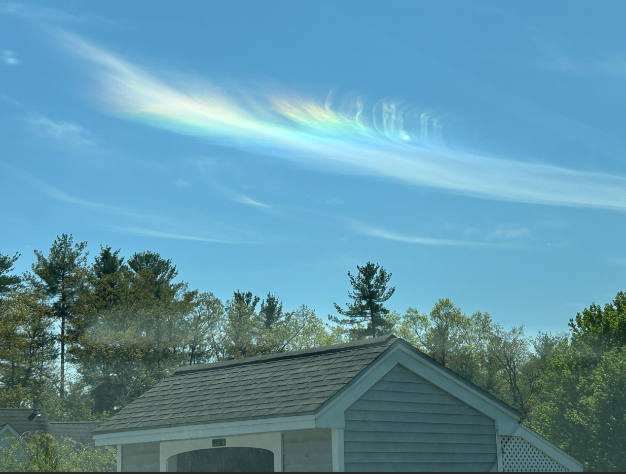
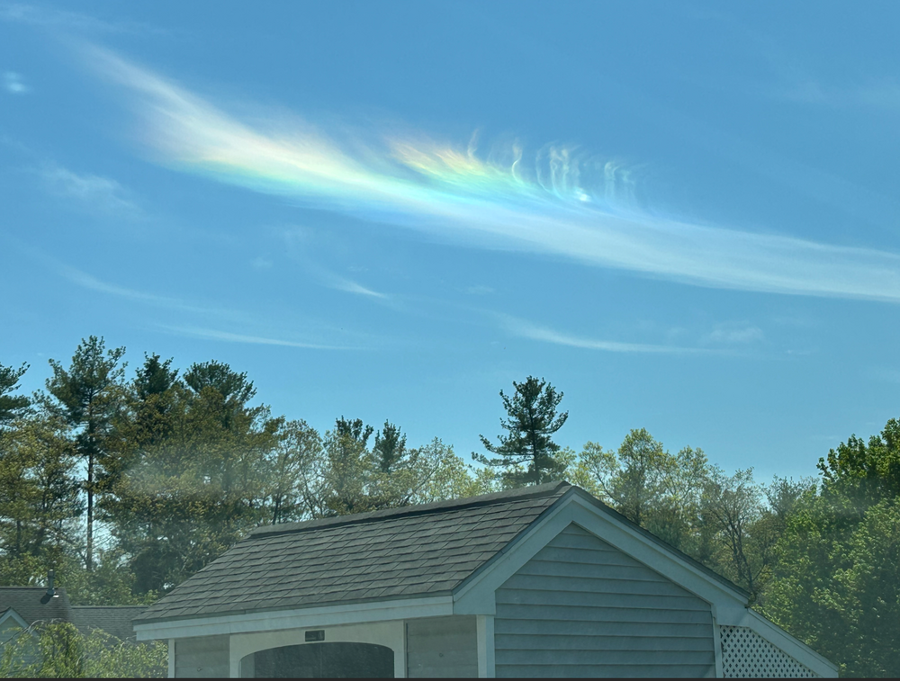
Seen in the skies above the greater Litchfield NH metropolis just now. Does this mean Tatum is magically healed ?
-
Will today be the best severe weather day of 2025 ? The reverse jinx old school SEE TEXT over us and skies clearing. Hopefully somewhere in CT a 78 lb man is scoring a softball game to truly bless us.
-
@weatherwiz 22 days !!! we'll still be talkin not
-
Back when we used to have winters .... Area Forecast Discussion National Weather Service Taunton MA 703 AM EDT Mon Mar 12 2018 SHORT TERM /6 PM THIS EVENING THROUGH TUESDAY NIGHT/... Monday Night into Tuesday... */ Highlights... - Moderate to heavy snow, some locations seeing upwards of a foot to perhaps two feet total accumulation - 1-3"/hr snowfall rates at times, plus winds could yield blizzard conditions with visibility less than a quarter of a mile - Strong to damaging winds, E gusts up around 65 mph possible for E/SE MA coast, brunt of the winds around Tuesday morning - Impacts to the Tuesday AM commute with difficult, near- impossible travel. - Especially the Tuesday morning high tide, strong E onshore flow yielding around a 2 to 3 foot surge, splashover, minor coastal flood issues, especially ocean-facing shores, vulnerable areas impacted by earlier storm systems
-
Phil has come to my house
-
Dave is that an Ego snow blower I see ? What size and do you like it ?