

Silas Lang
-
Posts
733 -
Joined
-
Last visited
Content Type
Profiles
Blogs
Forums
American Weather
Media Demo
Store
Gallery
Everything posted by Silas Lang
-
My feeling right now:
-
I just want a solid 3. Then I will gladly bow out for the year. I don't need a monster.
-
Honestly feel better about the GFS picking up the storm than the Euro. I agree. Seems the GFS has been pretty great this winter. I don't know if it is the particular pattern that's difficult or if the Euro had an "upgrade" at some point, but has not been that consistent this season. Really impressed with the GFS. It has caught trends on the other snows this year before the other models.
-
Wow a lot of good looks there! Most of them look like they work out well. Glad to start seeing some ensemble support for this.
-
*Looks at date* Ha, well hopefully it does not need to be 93 perfect to get snow, but yeah I see what to look for better now, thanks! The Canadian almost has that general look. Really looks like East TN is in a good spot regardless of outcome for Friday to Saturday. We at least have decent odds of seeing some light snow.
-
Yeah, looked similar to the 18z. As it stands, some snow showers/flurries look to be on the menu for Friday. We need the low to start popping in the gulf to get decent snow, right? As I understood it, we didn't really get a whole lot off the huge coastal. Our potential snow comes from more of the lead up.
-
No, please do. Reel this storm in for us!!! I enjoy the posts. Insane looking storm. I would like to get as much as much as the Carolinas, but don't want to get greedy. Honestly I would take a solid 3 inches and cash out for the winter. Had 3 solid coatings this year but all between 1.5 to 2 inches, with various issues (temps, mixing, etc.) Nickel and diming our way to average. Would be nice to get one solid storm for us in the valley. Especially Chattanooga. Y'all need some bad.
-
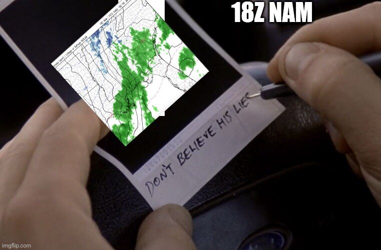
Yeah, the NAM is showing snow for Georgia and Alabama but rain for Tennessee? What's up with that? Looks cold enough, expect for marginal surface temps.
-
Appreciate the play by play, Carver! Glad to see a storm on all 3 models. Though, is it weird that I have more confidence in the GFS now? Seems to be better than the Euro these days. Anyway, do you have good odds of getting this one a little more NW to get more peeps in play? Kept hoping for that trend with the this past one but nada.
-
Nice GFS run. Hopefully the other models pick up on the weekend storm as well. Even have a little breathing room for a NW trend, which is nice. For the borderline Tuesday storm, what's up with the ptypes? Shows mostly rain, but looking at the upper air maps doesn't look like rain? Warm layer somewhere between?
-
Yeah, was kind of surprised. Just drove to Lowe's on Clinton highway and straight up flizzard. Dusting in spots.
- 167 replies
-
- 1
-

-
- frost
- cold front
- (and 4 more)
-
The Canadian is a little closer than the GFS; the Northern low is more on the way out east with high pressure close, while the GFS has it north of the Gulf low.
-
One thing about the mid to long range is that nothing is locked in place. I was just flipping through the past few runs and they all look drastically different.
-
Thanks! This may be a dumb question, but are there any factors that could lead to more amplification of a low pressure in this scenario? Just trying to learn what to watch for here.
-
What do you need to happen to get this NW? I was kind of confused about the suppression since the air is not nearly as cold as similar looking events.
-
Well the GFS and Canadian were a no go for this weekend, though the Canadian showed a good storm for eastern areas next Tuesday. Whatever happens this weekend, it seems the models keep wanting to show something for the valley which is a good sign. Edit: I think the storm showing for next week was shown on another model run a couple of days ago, GFS or Canadian? Is this popping up due to energy left behind or something? Someone more knowledgable than me chime in lol
-
Good news for tomorrow. According to MRX: Outside of the mountains on Monday, low temperatures should be below normal levels given snow pack, even went below guidance for the fcst. Otherwise, expecting a cloudy typical northwest flow day with light snow showers over the northern plateau and central/northern valley with afternoon highs struggling to top the freezing mark north of I40 (and any higher terrain across the mountains/plateau), with low/mid 30s southward in the valley. Given these expecting temperatures, would expect lingering roadways hazards due to remnant snowpack for much of the area that receives ample snowfall tonight.
-
I think some may luck out with the nwf showers in the am as well. Still a lot of leftover moisture from the main system.
-
Yeah, tomorrow is supposed to be pretty cold too. I don't think roads are going to be back to normal until Tuesday honestly. That because of all the ice from the rain underneath the snow.
-
I am eagerly awaiting this band as well. This thing does look like it is moving slow too, which is nice.
-
I like the way you are thinking. If we can squeeze out 3, I will consider this a "boom."
-
Yeah, I am in Inskip. It started sticking around then here as well. Temp is now at 33. Should not have to worry about temps from here on out at least. Roads will probably be pretty slick with all the water.
-
Well on my way to an inch. If this can keep up for a few hours...
-
Finally sticking! Ripping here. We have had some good rates throughout the day. Just never could stick. As soon as the sun went behind the hill: magic.
-
I figured you would do well up there. Too much mixing or not enough moisture? I think you will clean up with the deform band this evening.
