Silas Lang
-
Posts
733 -
Joined
-
Last visited
Content Type
Profiles
Blogs
Forums
American Weather
Media Demo
Store
Gallery
Everything posted by Silas Lang
-
March 11th-13th Winter Weather Event. Winter's last gasp?
Silas Lang replied to Windspeed's topic in Tennessee Valley
There have been a few events this winter that initially looked like big events for the valley but then ended up being like an inch. That has been in the back of my mind. Let's hope this is the one that works out. -
March 11th-13th Winter Weather Event. Winter's last gasp?
Silas Lang replied to Windspeed's topic in Tennessee Valley
Is it just me, or is the changeover happening quicker on the NAM? Comparing run to run the snow line keeps trending east quicker. -
March 11th-13th Winter Weather Event. Winter's last gasp?
Silas Lang replied to Windspeed's topic in Tennessee Valley
I see that snow is sneaking up into the high impact zone. Earlier it was at medium. I will say I like WBIR when it comes to snow forecast. They typically just shave off a couple of inches of the model or blends which is wise. Like you can tell they take into account what the data shows instead of just making up whatever. I like that they are transparent and often even post model runs on their forecast page and try to explain the probabilities in their forecast. Is Howell a snow weanie? Definitely seems more positive than the other guy. -
March 11th-13th Winter Weather Event. Winter's last gasp?
Silas Lang replied to Windspeed's topic in Tennessee Valley
Yeah a quarter of an inch of sleet is actually quite a lot and would make a nice little sheet for the snow. It does not melt as quickly in marginal temps. This was my largest snow of the year with close to 2.5 inches in Knoxville. -
March 11th-13th Winter Weather Event. Winter's last gasp?
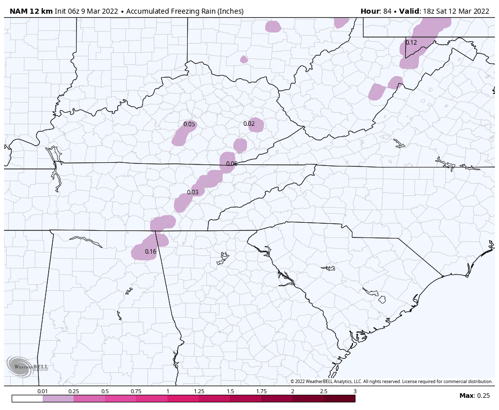
Silas Lang replied to Windspeed's topic in Tennessee Valley
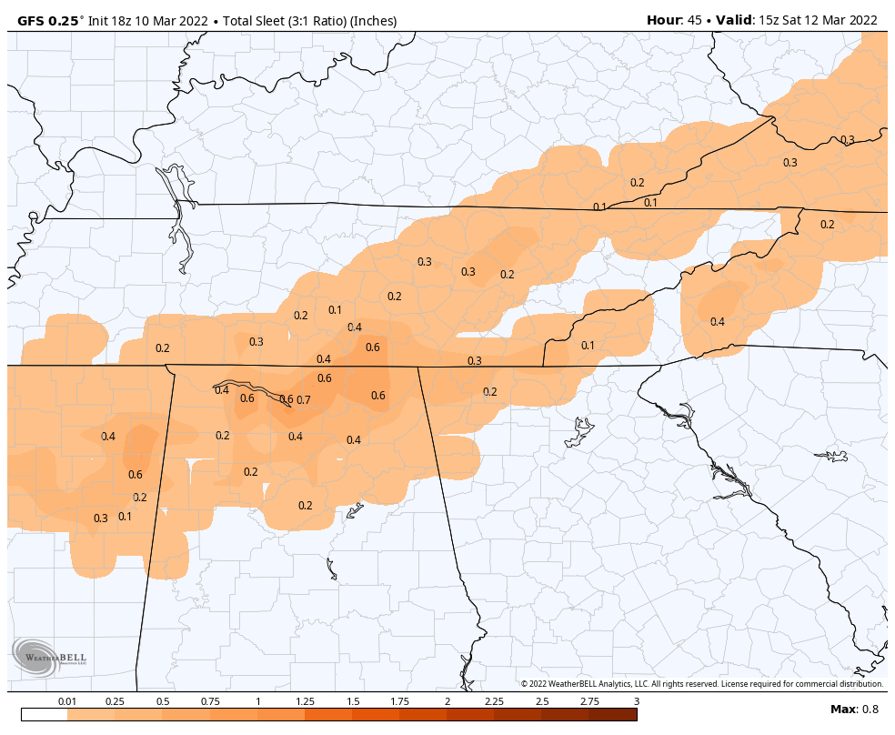
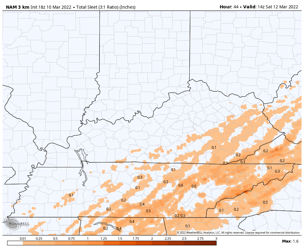
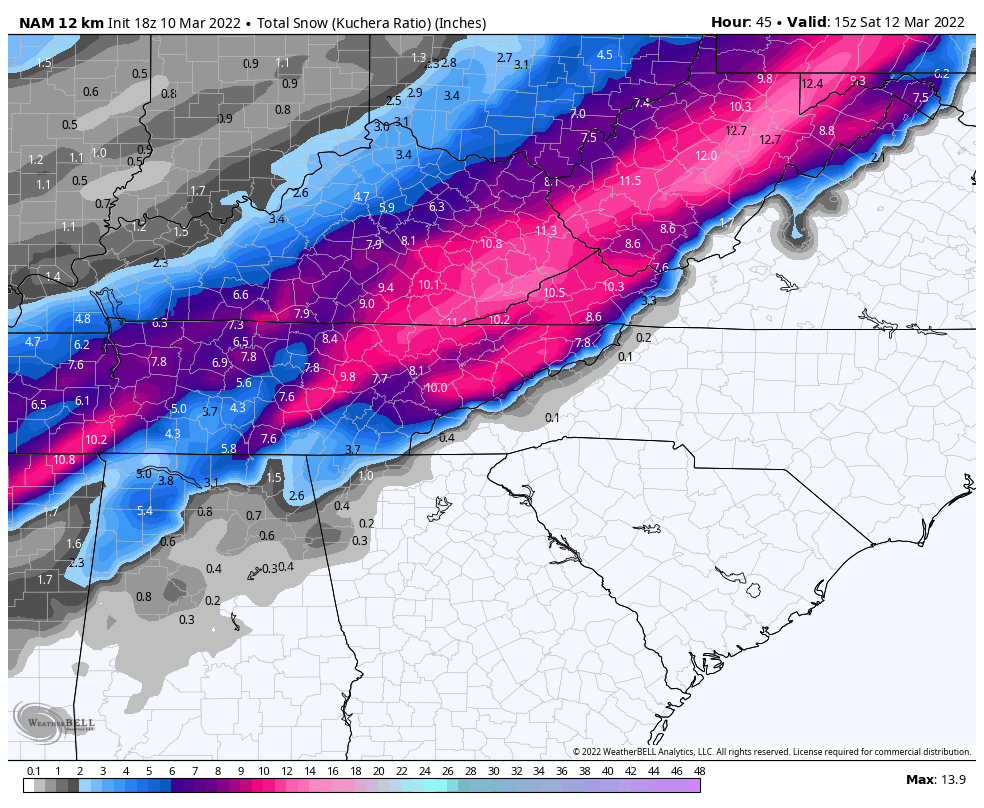
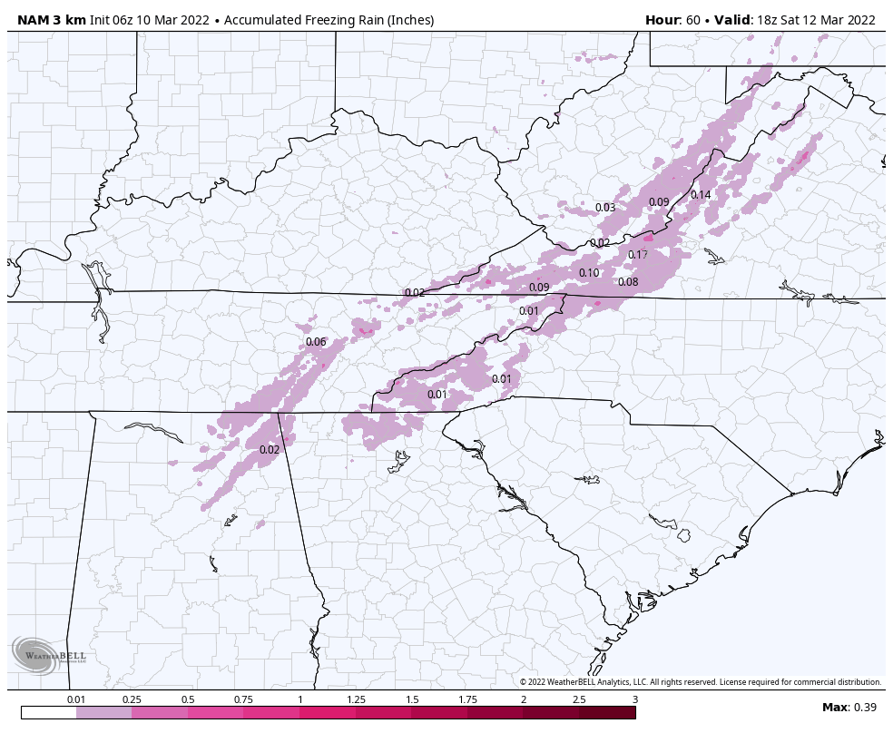
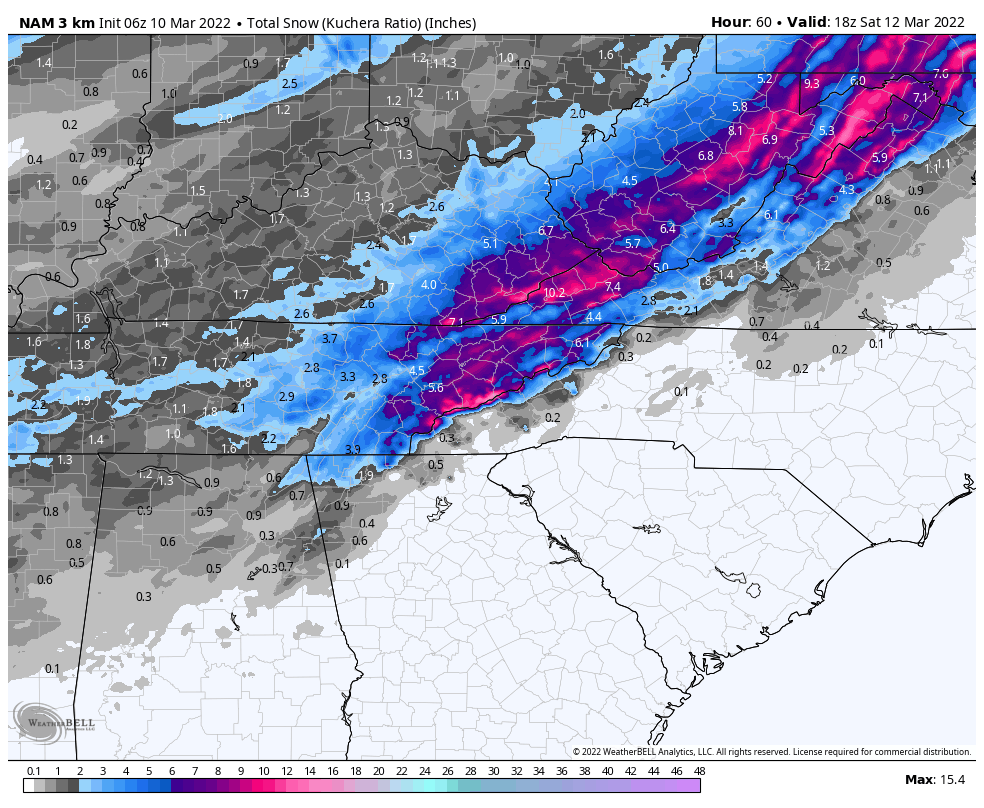
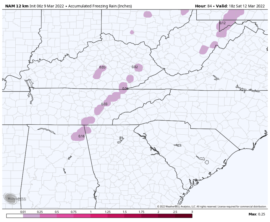
Yeah. I was actually looking at the 3k NAM and there is almost a half inch of sleet in a lot of areas. GFS seems to think less (.20). Adding both with snow maps for reference.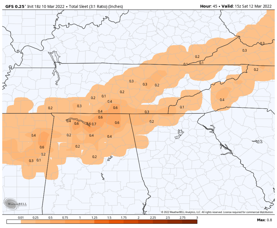


-
March 11th-13th Winter Weather Event. Winter's last gasp?
Silas Lang replied to Windspeed's topic in Tennessee Valley
Oh sorry, there was a little more for the far East. Goodness.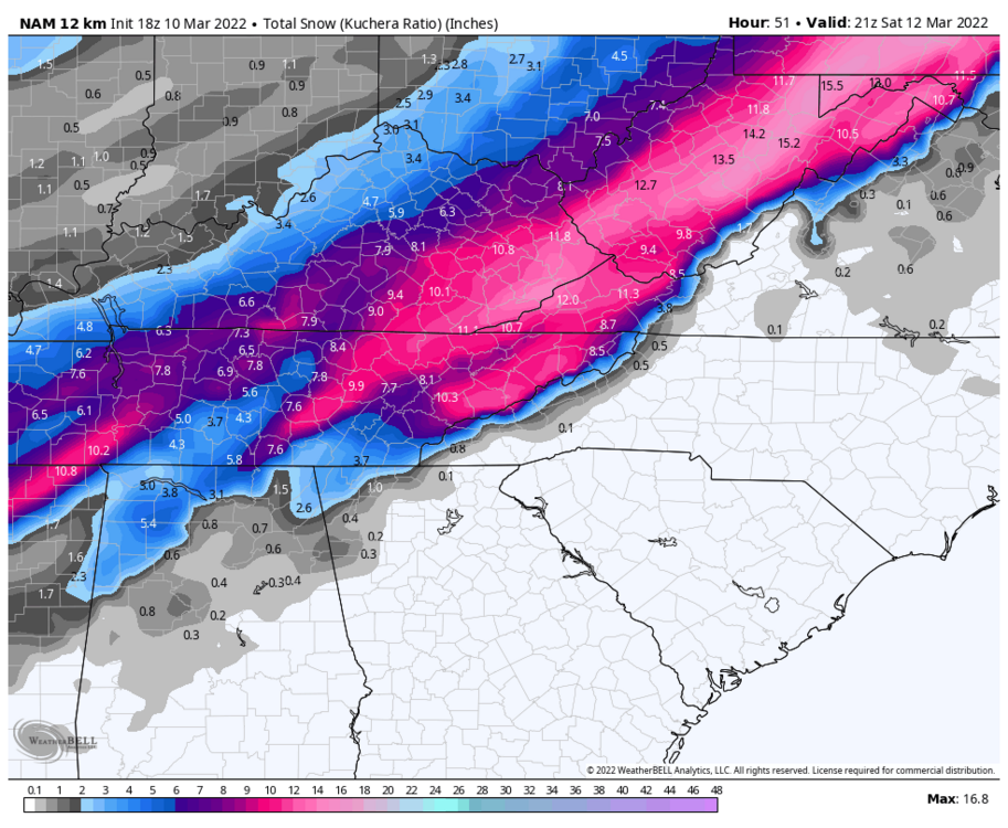
-
March 11th-13th Winter Weather Event. Winter's last gasp?
Silas Lang replied to Windspeed's topic in Tennessee Valley

-
March 11th-13th Winter Weather Event. Winter's last gasp?
Silas Lang replied to Windspeed's topic in Tennessee Valley
18z NAM looking beastly. This thing is amped. -
March 11th-13th Winter Weather Event. Winter's last gasp?
Silas Lang replied to Windspeed's topic in Tennessee Valley
My thoughts as well. The fact that it is a weekend probably makes it easier to downplay. Not the normal early morning rush to worry about. And it is easier to up totals later than downgrade. Most people I spoken too about it don't believe it will snow anyway. "It's been too warm to snow!" Is what I hear at work. -
March 11th-13th Winter Weather Event. Winter's last gasp?
Silas Lang replied to Windspeed's topic in Tennessee Valley
Wow! You were not lying. HUGE jumps. Average went up to 4.5 from 2 in TYS. A lot more big dogs. -
March 11th-13th Winter Weather Event. Winter's last gasp?
Silas Lang replied to Windspeed's topic in Tennessee Valley
I will say, I find the Euro's snow maps to be a little more realistic and more climate based. Higher totals in the mountains and Upper Plateau with a pretty decent hit in the valley and surrounding areas. I am personally just wanting a solid 3 inches at this point. It has remained elusive all winter. Got close one time (a little over 2), with a few one 1 inchers in between. I swear one winter I will probably get my way to average with 30 car topper events. #valleylife -
March 11th-13th Winter Weather Event. Winter's last gasp?
Silas Lang replied to Windspeed's topic in Tennessee Valley
Yeah, absolutely. That also suggests there are going to be some major impacts. Sleet is pretty great at creating some icy conditions even with marginal temps. I also saw MRX mention the possibility of snow shower activity after the main slug of moisture exits. Another good sign. Snow showers after a big storm seems to be common for the big dogs. I have received a rouge inch or half inch from those in the past after the main event. Notice it tends to happen when really cold air is in place as well, which we will have. -
March 11th-13th Winter Weather Event. Winter's last gasp?
Silas Lang replied to Windspeed's topic in Tennessee Valley
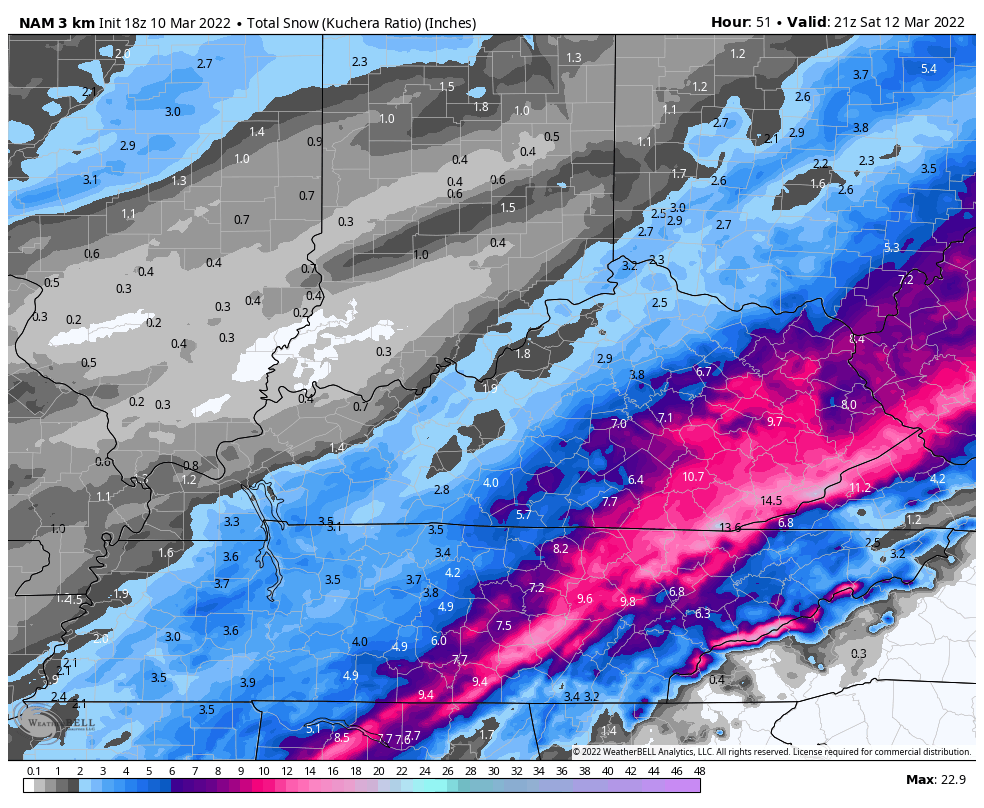
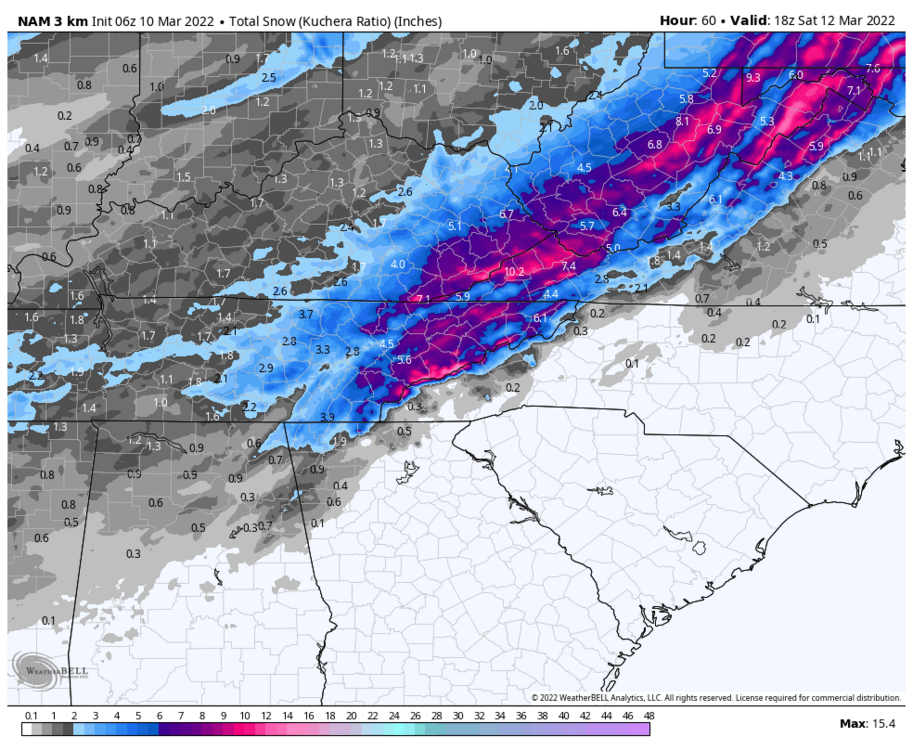
I will say, it does look like there is still a possibility of mixing, so I am still somewhat sceptical of the higher amounts. Here is 3k (which I think has done well with warm layers this winter).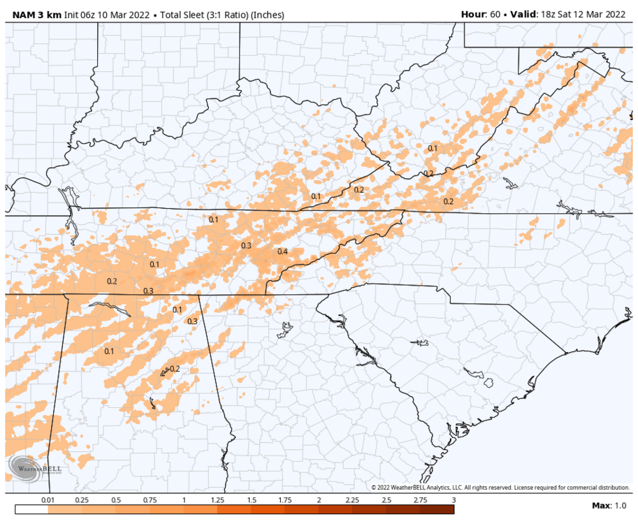
-
March 11th-13th Winter Weather Event. Winter's last gasp?
Silas Lang replied to Windspeed's topic in Tennessee Valley
Wow, great trends last night! The heaviest snow axis is starting to look more consolidated. Noticed that Eastman snow hole has filled in as well. Is there a reason for the better totals out east? -
March 11th-13th Winter Weather Event. Winter's last gasp?
Silas Lang replied to Windspeed's topic in Tennessee Valley
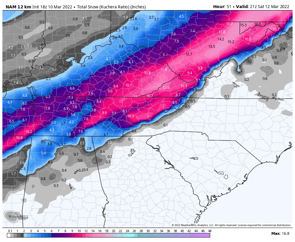
Here is the Kuchera for comparison. Honestly not that different from the 12z Euro.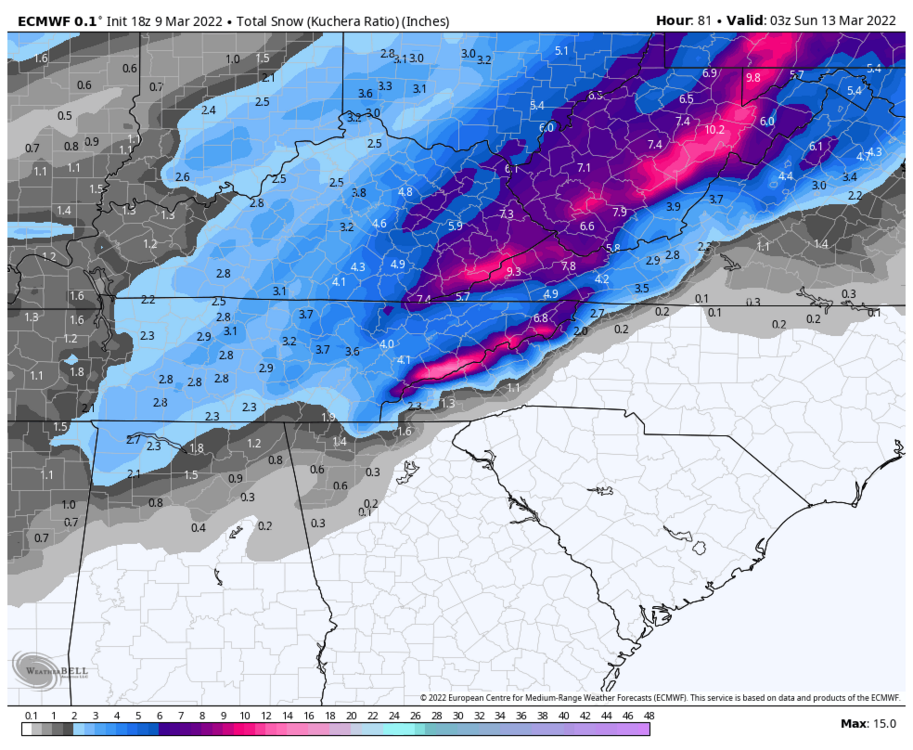
-
March 11th-13th Winter Weather Event. Winter's last gasp?
Silas Lang replied to Windspeed's topic in Tennessee Valley
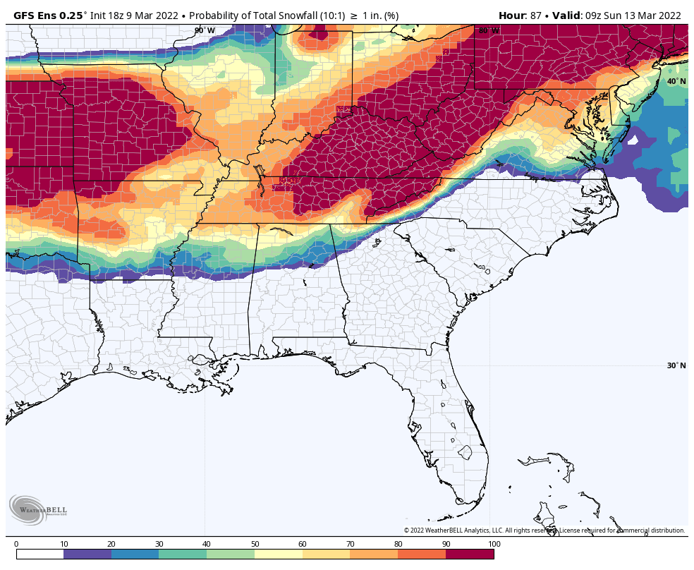
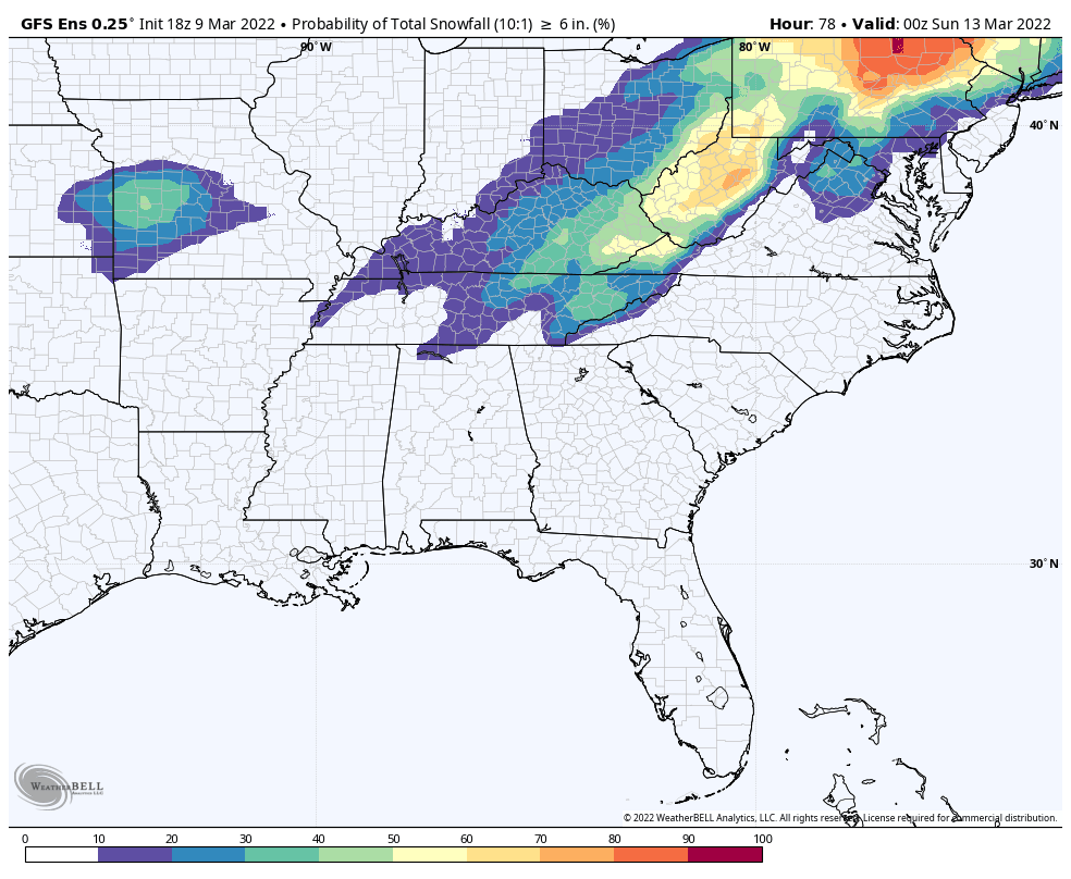
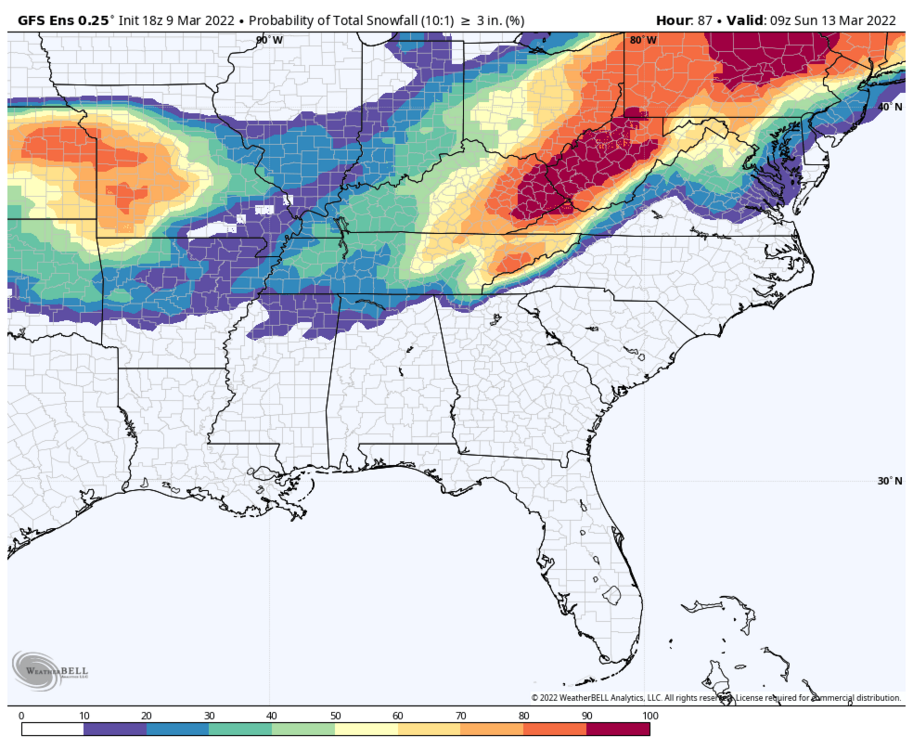
Yeah not bad. Probabilities looking pretty good as well.

-
March 11th-13th Winter Weather Event. Winter's last gasp?
Silas Lang replied to Windspeed's topic in Tennessee Valley
Eh not great trends for East TN on the 18z runs. More mixing. Better for middle and west which has been the theme all year. Is this another Lucy and the football situation for us in the valley? -
March 11th-13th Winter Weather Event. Winter's last gasp?
Silas Lang replied to Windspeed's topic in Tennessee Valley
I think a little less amped is good right now, if only to give us some breathing room in case it comes in stronger like Carvers has been suggesting. -
March 11th-13th Winter Weather Event. Winter's last gasp?
Silas Lang replied to Windspeed's topic in Tennessee Valley
Yeah, I am not really understanding how Knoxville is escaping the warm nose while the Plateau gets a ton of sleet. Has that even happened before? Just usually seems mixing is more elevation dependent. -
March 11th-13th Winter Weather Event. Winter's last gasp?
Silas Lang replied to Windspeed's topic in Tennessee Valley
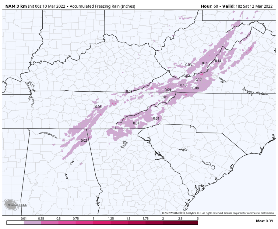
The latest 6z NAM is on board. Noticed some mixing happening. For some reason there is a strip of sleet and freezing rain. Anyone looked at any soundings? Kind of a random strip, but you can see it on some other snow maps too. Southwest of Anderson County on down.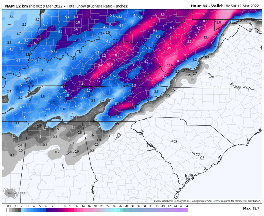

-
March 11th-13th Winter Weather Event. Winter's last gasp?
Silas Lang replied to Windspeed's topic in Tennessee Valley
Lastest 0z NAM looking epic.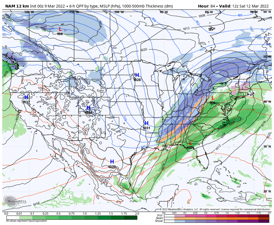
-
March 11th-13th Winter Weather Event. Winter's last gasp?
Silas Lang replied to Windspeed's topic in Tennessee Valley
Thanks! Nice to hear we have some factors working in our favor. I guess that snow rain line being close is why we have seen some lollipops in totals near the east on some model runs. -
March 11th-13th Winter Weather Event. Winter's last gasp?
Silas Lang replied to Windspeed's topic in Tennessee Valley
Carver, is there anything to keep this from going more NW? I've noticed the stronger trend and am kind of worried about an Ohio valley special. A few more ticks west and we could looking at rain. But yeah, it did look like the east was about to get hammered on the 18z and ensemble support is increasing so not really sure at this point. This has the makings of a great storm for the valley if holds. -
March 11th-13th Winter Weather Event. Winter's last gasp?
Silas Lang replied to Windspeed's topic in Tennessee Valley
Wow, that's a solid 4+ inches for East TN and an overall statewide hit. This is definitely the most impressive ensemble support I have seen all winter for a storm. -
March 11th-13th Winter Weather Event. Winter's last gasp?
Silas Lang replied to Windspeed's topic in Tennessee Valley
Wow, the LP looked stronger this run. I guess we don't want it to strengthen too much or it could cut on the other side of the mountains, correct? Is there there anything keeping this from happening?