J Paul Gordon
-
Posts
1,791 -
Joined
-
Last visited
Content Type
Profiles
Blogs
Forums
American Weather
Media Demo
Store
Gallery
Everything posted by J Paul Gordon
-
In a lull now for the last hour. The temperature went up to 36, but my thermometer is tacked on the privacy fence between my place and my neighbor's and tends to warm up this time of day. Not sure how much solar energy is getting through the clouds, but since we are up 2 to 3 degrees from surrounding stations, I wonder. Not a lot of dripping out there yet, though the wind is taking snow off the trees. I'm glad about that; less chance of losing power.
-
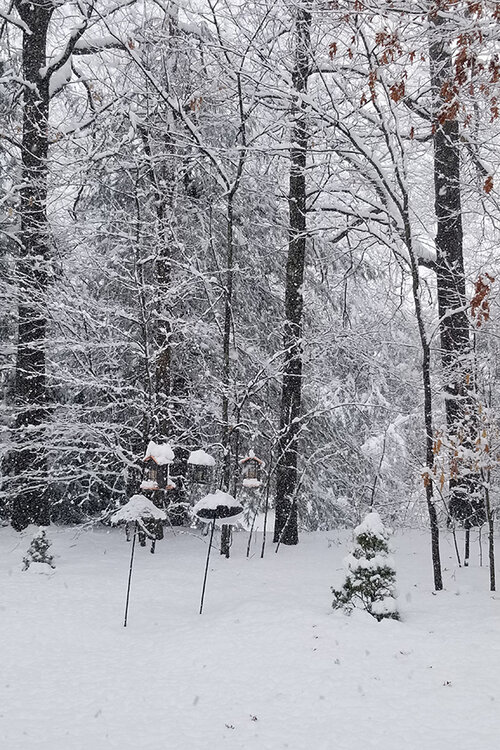
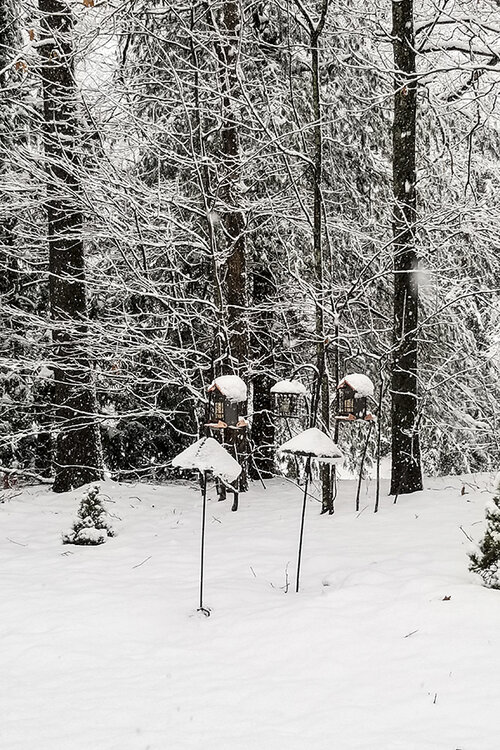
Pictures of snow in the Worcester County low country (elevation 340). We are just west of 495 and a few miles south of Rt 2. Very compact and wet. 8" on the ground due to compaction. Temp now 33 F. Rate has slowed in the past few minutes.
-
I had 7" otg here in Clinton an hour plus ago, and it was just starting to accumulate at my daughter's house in Marlborough, just 15 miles south and east. Still 32F with heavy snow.
-
My pug must have old age sag! 7" on the ground (measured in 3 spots on the lawn); 6 " on the driveway. Very dense and wet and no drifting. Still 32F, and heavy snow.
-
32F. I just took the dog out. She's a pug, and the snow was just a tad beneath her belly, so about 8" on the pavement by that measurement. LOL Coming down heavy right now. Trees are coated, and that has me worried about power outages. The lines here at Ridgefield are below ground, but not the ones that feed us. Too bad our gas fireplace is on the fritz. It's supposed to work without power, but it has to be working in the first place.
-
34F. Snowline is literally a couple of miles to my north/northwest. The temperature dropped from 39 at 7:30 to 34 in the last hour.
-
The last hurrah? Putting all the eggs in the Tuesday 3/14 basket
J Paul Gordon replied to Ginx snewx's topic in New England
Down to 34 from 39 earlier this evening. Dropped a couple of degrees in the last hour or so. The snow line is just about on top of me--two or three miles away to the north/northwest. Unless the temperature is going to rise again soon, it will likely be snowing hours before they predicted it would. School is canceled for tomorrow. No complaints from my 7th and 8th graders and none from me either. I'm just a bit worried about power outages since my gas fireplace chose to stop working yesterday! -
We ended up with about 8" here in Clinton/Lancaster. Areas to the south and southwest (including Worcester city--about 500' lower than the airport) got about half that amount or less. Starting to feel like I'm in the new Lunenburg, but amounts in Sterling and Fitchburg match up. Boylston is only about six miles south, and driving through this morning, they had a couple of inches less. Shrewsbury is higher than I am by about 300' but even less there than Boylston (at the exit onto 290 west). That's been the case all winter. We had a glacial base of 2-3 inches under it. Would that have affected how well the new snow piled on? I've only lived here since last April, but the microclimate seems significantly different from where I lived in Worcester city (Green Hill Park area at 660' elevation).
-
It looks like we won't have to cancel my grandson's first birthday party in Southbridge. We're going to reschedule for 2 PM. They're still calling for 8"+ here in Clinton, but I figure the reality will be much lower. (Maybe 1-3 in Southbridge; 3-5 max in Clinton?)
-
My grandson's first birthday party is scheduled in Southbridge, MA, Saturday morning. When I saw 8-12 for Friday night and 1-3 more for Saturday morning on my Weather Channel app, I felt my heart drop for my daughter and son-in-law (not to mention my wife and me). I can't say I'm sorry to hear the storm will flop south of the pike. We're closer to the NH line, so maybe a few inches here, but Johnny and his little (and not so little) friends will have their party. I'm a snow lover (gotta say more so earlier in the season), but nothing beats a grandson.
-
Feb 28th-March 1st long duration Miller B threat
J Paul Gordon replied to George001's topic in New England
Catholic School where I teach is closed for tomorrow. They go by what the town decides, and Shrewsbury, MA, is known for not canceling until the big caterpillar earthmovers can't move the stuff. Great to have a day off after a week's vacation. I am not kidding. I'm getting old and crabby. lol -
24F/4C About 3.5 inches of cement at Ridgefield.
-
Beautiful weather, 50/37 here right now but sincerly hoping for snow and semi winter cold at the end of next week. I'd be happy to get a couple of weeks of highs near or a bit below freezing and a significant snowstorm somewhere around the very end of the month and beginning of March. Really, our last best chance.
-
The event of the season - 2 days of hell!
J Paul Gordon replied to Go Kart Mozart's topic in New England
Low here -13F; current 0. Tomorrow 47! LOL -
Warmest winter in recorded (since 1892 in Worcester) history? And next year is supposed to be a Nino, so expect another AN winter (probably not as extreme as this, though). This year might pass for a winter in the UK? No really extreme heat but a near-constant run of 40s in the day and near-freezing nights, plus lots of cloudiness.
-
We still have a pretty much solid cover here, too. A little patchy on hillsides that get full exposure to the sun. But it still looks like winter. Must be the water content in the snow because a fluffy type would have long ago disappeared. I'm pretty sure it will be gone for the couple of near-normal days this coming week and the one-day wonder at the end. In Southbridge, MA it's all gone and Worcester looks pretty much the same (at least from 290). 46/35 right now.
-
Still have a solid cover with 4 or 5 inches on the ground here. Expect it will disappear over the next few days. Still, it was nice to have snow on the ground for the last week. Let's hope we get some more for/during the week of winter coming up.
-
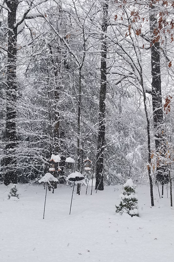
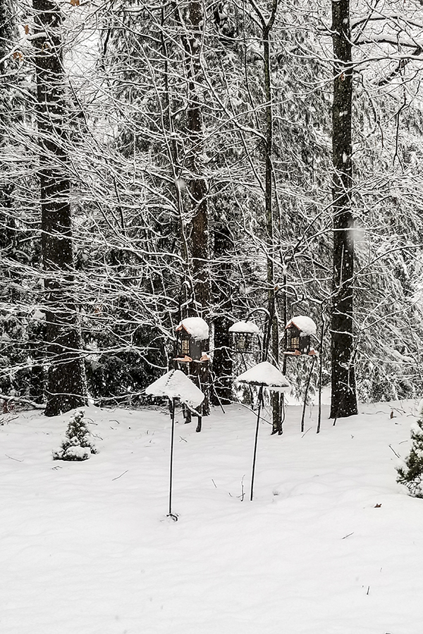
Between 5 and 6 inches since the snow started around noon. This definitely overperformed in my area! Still coming down pretty good but the end is in sight. Trees are clotted with snow. Between last Friday and today, it feels like winter has at least made an attempt to arrive. Hard for me to tell what the snow rates are in my new neighborhood. I used to live on a hill in Worcester and had a good sense of distances. Now I live in a condo developement (practically a town in itself) on a much lower hill and without a lot of landmarks. Must have been down to a quarter mile visibility for a good part of the afternoon/evening.
-
Another shot literally in MBY
-
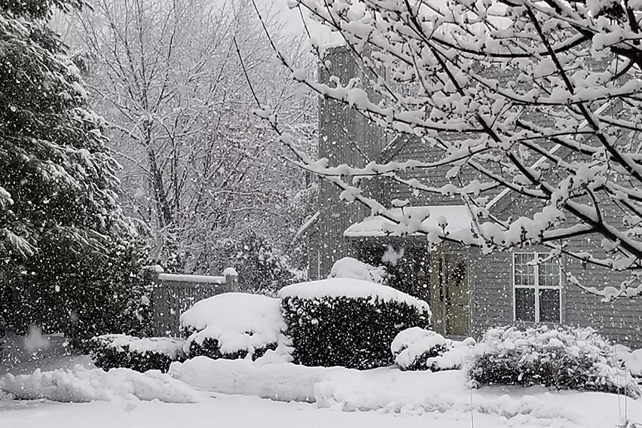
Coming down nicely in Ridgefield, Clinton, MA. About two new inches on the grass and untreated concrete surfaces. The road was salted a couple of hours ago, so it is just starting to stick well there. 32/32, but it feels colder.
-
Coming down hard now. Moderate to heavy snow. 32/32 Winter wonderland out there over the past 40 minutes or so.
-
Hoping for another 2-4 here later, but no complaints. The temperature has been hanging at 32 for about 15 hours. Light accretion of ice on trees but with the heavy sow on them from Friday, we've had a few branches down, mostly on pine trees. Still looks like a winter wonderland out there. Considering what we've had for a "winter", I'm not complaining.
-
Any concerns for icing in the interior? Temp is hanging around between 31 and 32 here for the past few hours.
-
31/31 freezing rain mixed with sleet. It should be an interesting 24 hours. Almost nothing from Friday's snow has melted here. It actually looks like winter. About 4.5 on the ground. Let's hope at least that much more on the way. With temps the way they are right now, I'm not expecting to lose much of what we have. It's already pretty compacted, so unless the temperature spikes, we should hold out OK.
-
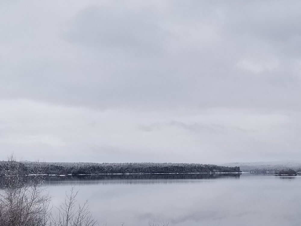
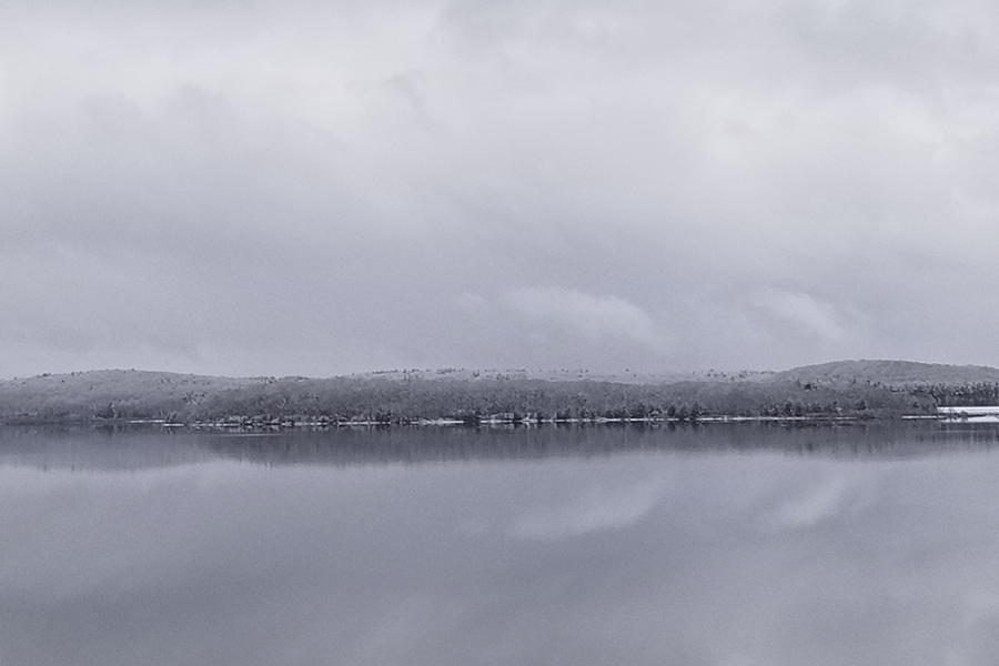
When all was said and done, about 5.5-6" here but not more than 4.5" on the ground (compaction?). Drove to Southbridge today. The snow remained pretty constant from here to Shrewsbury center, then dropped fast as I went down 290 to Worcester. The center of the city didn't have more than an inch on the ground. The area I used to live in near Green Hill had maybe 2". On Rte 20, there might have been a couple of inches on the ground in Charlton, but when I got to Southbridge, it was less than a half inch, and most of it disappeared before I left. Temps were colder than I expected when I got back to Clinton. I was anticipating mid to upper thirties, but when I got home just after 3 PM, it was only 28 in my neighborhood. No melting here today. Pictures are from Wachusett Reservoir ad don't do justice to the actual scene (lousy phone camera).