J Paul Gordon
-
Posts
1,750 -
Joined
-
Last visited
Content Type
Profiles
Blogs
Forums
American Weather
Media Demo
Store
Gallery
Everything posted by J Paul Gordon
-
Still have a solid cover with 4 or 5 inches on the ground here. Expect it will disappear over the next few days. Still, it was nice to have snow on the ground for the last week. Let's hope we get some more for/during the week of winter coming up.
-
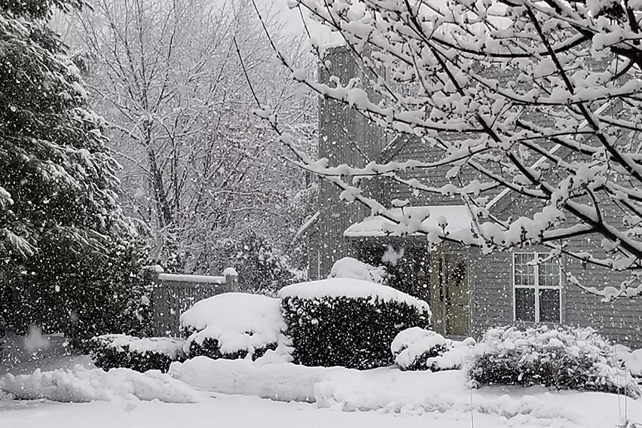
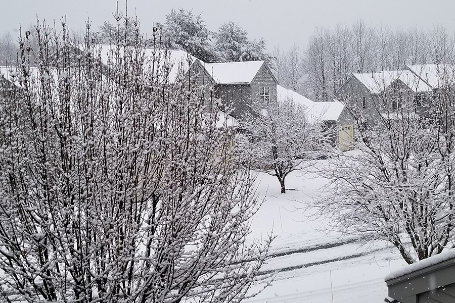
 Between 5 and 6 inches since the snow started around noon. This definitely overperformed in my area! Still coming down pretty good but the end is in sight. Trees are clotted with snow. Between last Friday and today, it feels like winter has at least made an attempt to arrive. Hard for me to tell what the snow rates are in my new neighborhood. I used to live on a hill in Worcester and had a good sense of distances. Now I live in a condo developement (practically a town in itself) on a much lower hill and without a lot of landmarks. Must have been down to a quarter mile visibility for a good part of the afternoon/evening.
 -
Another shot literally in MBY
-
Coming down nicely in Ridgefield, Clinton, MA. About two new inches on the grass and untreated concrete surfaces. The road was salted a couple of hours ago, so it is just starting to stick well there. 32/32, but it feels colder.
-
Coming down hard now. Moderate to heavy snow. 32/32 Winter wonderland out there over the past 40 minutes or so.
-
Hoping for another 2-4 here later, but no complaints. The temperature has been hanging at 32 for about 15 hours. Light accretion of ice on trees but with the heavy sow on them from Friday, we've had a few branches down, mostly on pine trees. Still looks like a winter wonderland out there. Considering what we've had for a "winter", I'm not complaining.
-
Any concerns for icing in the interior? Temp is hanging around between 31 and 32 here for the past few hours.
-
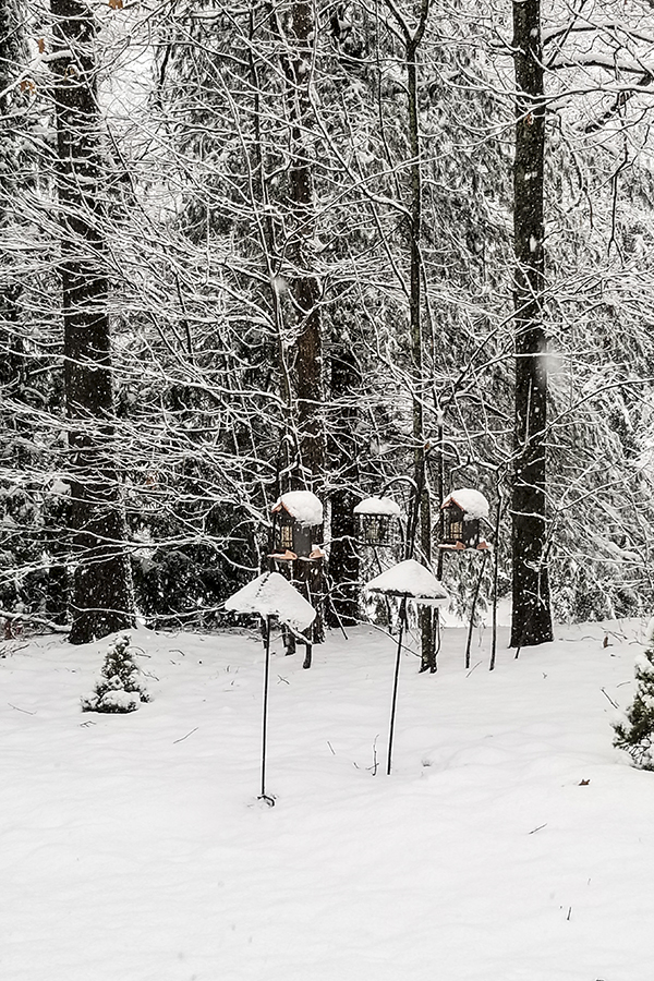
31/31 freezing rain mixed with sleet. It should be an interesting 24 hours. Almost nothing from Friday's snow has melted here. It actually looks like winter. About 4.5 on the ground. Let's hope at least that much more on the way. With temps the way they are right now, I'm not expecting to lose much of what we have. It's already pretty compacted, so unless the temperature spikes, we should hold out OK.
-
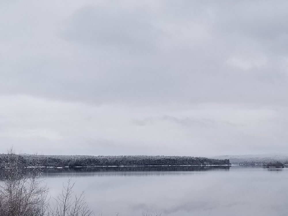
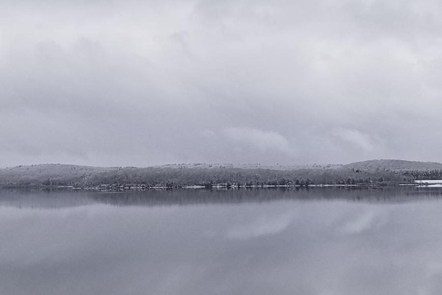
When all was said and done, about 5.5-6" here but not more than 4.5" on the ground (compaction?). Drove to Southbridge today. The snow remained pretty constant from here to Shrewsbury center, then dropped fast as I went down 290 to Worcester. The center of the city didn't have more than an inch on the ground. The area I used to live in near Green Hill had maybe 2". On Rte 20, there might have been a couple of inches on the ground in Charlton, but when I got to Southbridge, it was less than a half inch, and most of it disappeared before I left. Temps were colder than I expected when I got back to Clinton. I was anticipating mid to upper thirties, but when I got home just after 3 PM, it was only 28 in my neighborhood. No melting here today. Pictures are from Wachusett Reservoir ad don't do justice to the actual scene (lousy phone camera).
-
Big flakes almost no wind. 33F/33DP still. Very pretty for November 81st (Or negative March 39).
-
33F/33DP (just went above freezing). 2'' dense snow on the ground here and snowing steadily.
-
33F/32 DP; rain with some sleet mixed in.
-
In Clinton, MA. Maybe 2" by this time tomorrow, three if we're lucky. This is a winter when just white on the grass is a win.
-
34F, no precip here. Good luck to you guys East and SE. We've been inundated here (maybe 5" this season so far), so it's your turn to share the wealth. Seriously, hope you get a nice little hit out east tonight. Would be happy to see the ground white here in the morning. Remember Feb 2015 when we all acted like we'd been cheated if we got less than a foot? Now we're ringing the bells for 3". LOL
-
UPDATE 1/15/2023: Jan 5+ AN; Feb 0-2 AN (warm start, much colder after pattern flip, could come in colder overall if flip comes early.); March 3-5 BN (could be colder). Best chance of serious snow is, second week of Feb through end of March. Remember, this is not science, just gut feeling based on life experience. I thought we'd get killed with a mild and dry Feb. Instead we have a super mild and gray January.
-
About 2" on the grass here, maybe an inch of slop on the walk. 32F/0C. Happy Russian/Ukrainian/Serbian Orthodox Christmas Eve. Got snow on the ground for one of 'em.
-
I pick Ensemble Member 16.
-
Changing my winter "forecast" from this: Dec 3-5 AN; Jan 1-3 AN; Feb 5+AN; March 0-2 BN to this: Dec 3-5 AN; Jan 2-4 AN; Feb 1-3 AN; March 0-2 BN. Figure there may be a pattern change to lower the extreme warmth I had up earlier for Feb. None of it is scientific, but I predicted November would be 4-6 AN and it verified, likewise December should verify toward the lower end (ORH at 1.9+ after the cold spell and it is uphill from here). Snowfall? Looks like it will come in on the low side, too, but thats always a crapshoot. UPDATE: Jan 5+ AN; Feb 0-2 AN (warm start, much colder after pattern flip, could come in colder overall if flip comes early.); March 3-5 BN (could be colder). Best chance of serious snow is, second week of Feb through end of March. Remember, this is not science, just gut feeling based on life experience. I thought we'd get killed with a mild and dry Feb. Instead we have a super mild and gray January.
-
Would be great if we could squeeze an inch or two (or even a coating) of snow out of it this evening, but the chances of that look remote around here.
-
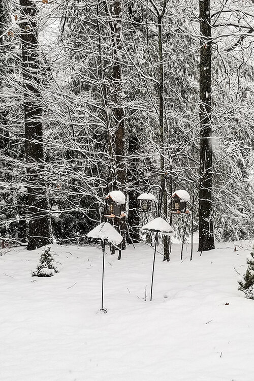
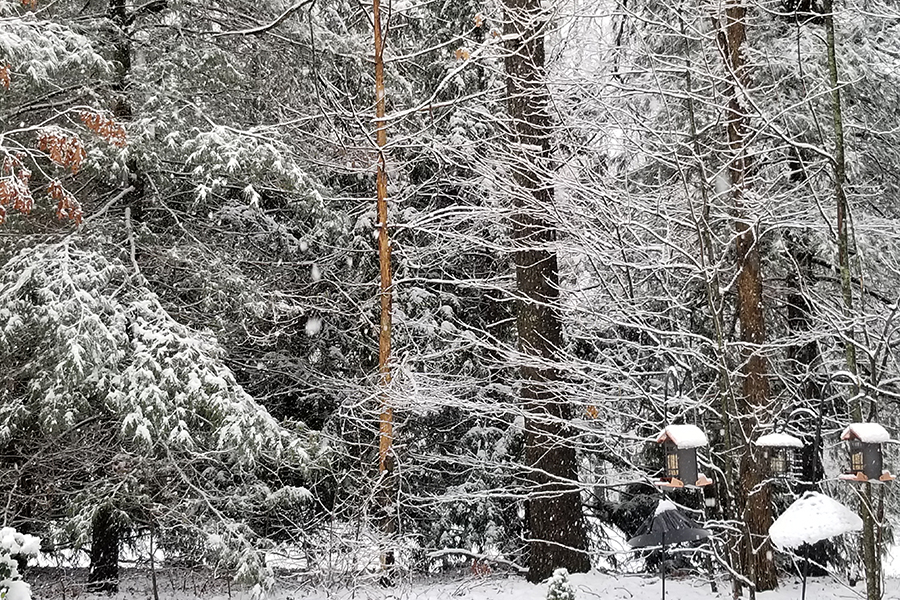
Woke up in the night to some scary blasts here. I thought they were going to take my bird feeders (things weigh about ten pounds each without food so probably closer to fifteen with food). Just pouring now temp 55F/13C
-
Still holding on to my "forecast": Dec 3-5 AN; Jan 1-3 AN; Feb 5+AN; March 0-2 BN with near-normal snowfall despite the temps. The last is really a crap shoot under any circumstances. A couple of good storms in a cold spell in January & March will do it for many. Least certain about the February torch. My Farmers Almanac approach is based on bad memories from the 70's and 80's plus AGT (Anthropogenic Torching)
-
Preliminarily ... a medium impact partial Miller B, Friday
J Paul Gordon replied to Typhoon Tip's topic in New England
Down to 35 here and radar looks like the snow is literally just a couple miles to my NW. Who knows, maybe the grass will be white in the morning. -
Preliminarily ... a medium impact partial Miller B, Friday
J Paul Gordon replied to Typhoon Tip's topic in New England
The great thing about a storm like this is the variation in temp and precipitation over a few miles. Yeah, would have liked to see all snow, but it's pretty cool just looking at some of the pictures and reading the chat. Maybe its because I'm old now, but I don't get nearly so flustered about a near miss in my backyard. -
Preliminarily ... a medium impact partial Miller B, Friday
J Paul Gordon replied to Typhoon Tip's topic in New England
Meanwhile about 12 miles to your southeast Clinton Lancaster line it has been hanging at 38-40 all day with some very heavy rain. There is definitely a 190/Rte 2 line. -
Maybe change the thread title to " We're gonna need a bigger boat"?