J Paul Gordon
-
Posts
1,750 -
Joined
-
Last visited
1 Follower

About J Paul Gordon

Recent Profile Visitors
3,719 profile views

.thumb.jpg.aec747d13df1d95d5fed34574f74d4fd.jpg)


-
28 here now. Took the dog out, sidewalk covered with sleet, trees glistening but with just a trace of ice. Pefect. No harm done and it will look pretty in the morning light.
-
29 Sleet/freezing rain. Hope it goes back to snow for a quick inch or two.
-
Sitting at 33 for hours now. No melting and already pretty much as dense as its going to be. This will be about 10" of proverbial glacier (About 7 today, not out of line with Lancaster 2 miles to my north) plus the five or six inches already on the ground and further packed by today. Glad we avoided the ice. It looks like not far to our north in the higher country they must have gotten hit. High 33, Low 23, Dewpoint(current), 32
-
...Never mind....(Roseann Rosanadana)
-
What kind of illegal street drugs are people taking out there. Looking for massive damage from ice and wind. Think of your f'in neighbors if you don't have the intelligence to worry about your own. Sorry for the rant, but it's insane to want destruction and mayhem.
-
7 or a little better new on the ground but sleet and dense snow packed down. Actual total probably more. Total on ground nearing a foot with all that has gone before. Fitchburg area reporting 7.5 new, sounds real here, too. It looks like the coastal front has set up about 6 miles to my east. 27 here now and sleet. 32, 33, 34 on and east of 495.
-
6-7 inches on the ground here grand total from everything that's fallen this month. Better to the north, worse to the south. No surprises there. By the end of this weekend's storm maybe up to 10 inches after packing down. If the Thursday storm pans out even as a moderate event I'll have more than a foot on the ground for a few days. Good news, the ground has been white for weeks now. It should stay that way til the end of the month. Not a losing situation considering the past few years.
-
Put this up earlier on the Feb Discussion page. Would like one of the Mets to answer. Which scenario seems more likely? Wunderground and Accuweather have more snow on Saturday-Saturday night and colder temps on Sunday 32-34 than earlier. Also, Wunder has 2-3 inches on Sunday, Accu 1-2 and Accu is warning of a potentially serious icing situation. NWS is still calling for temp to rise to 40 with everything going over to rain on Sunday. What's happening that Wunder and Accu have gone for lower temps and potential for significan icing? Why is NWS holding out? I should add that I'm thinking Church (in Southbridge MA) may be cancelled pn Sunday due to clearing issues and that we'll probably be stuck here in Clinton no matter what the weather is down there. Granddaughter's first birthdy party was supposed to be in Church hall after services.
-
Wunderground and Accuweather have more snow on Saturday-Saturday night and colder temps on Sunday 32-34 than earlier. Also, Wunder has 2-3 inches on Sunday, Accu 1-2 and Accu is warning of a potentially serious icing situation. NWS is still calling for temp to rise to 40 with everything going over to rain on Sunday. What's happening that Wunder and Accu have gone for lower temps and potential for significan icing? Why is NWS holding out?
-
I'm figuring that at this time Sunday night I'll have a couple of new inches of wet snow pack on the seven or so inches left over from the previous couple of snowfalls we've had. A slight net gain which will turn into a solid block of ice by Monday morning. Several inches of snow Saturday-Saturday night (meaning 2-4; 3-5 max) will pack down during the rain on Sunday but it will be cold enough not to wash everything away. My big problem is whether my grandaughter's first birthday party in our church hall in Southbridge will get cancelled again because walks and driveway won't get cleared in time for services for the second week in a row.
-
Tracking February 6. Light to moderate event potential
J Paul Gordon replied to Typhoon Tip's topic in New England
High 24, Low 12 2" snow sleet light crust from a bit of freezing drizzle earlier. I guess we did pretty well for the area. We've had a solid cover (except in some really sunny spots and south facing slopes) for two weeks now. Today whitened it all up. Expect a to do a little better Saturday night/Sunday morning. It has actually felt/looked like winter this year, so I won't complain about snow amounts. -
Live in Clinton so maybe 4-6 here, but have to go to Southbridge, probably 8-12 there!
-
North of the Pike Slop Fest Jan 31-Feb 1
J Paul Gordon replied to HoarfrostHubb's topic in New England
Down to 36, rain here. Still a good deal of snow left over from 1/19-20. Unless it turns over, expect that to be mostly washed away. Funny thing is that the ground is virtually bare in Westborough just a few miles south. They're saying 1-2, 1-3, but doesn't look like it will be going over for a while. High 40, Low 22 -
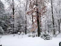
Love it--a week of cold and the ground white, and we still have that beautiful winter light. Perfect. 30F, Light snow an inch plus. Grass is covered.
-
So the original 3-5 we were being called for seems to be correct. Maybe 6 if we're lucky. OK with that, ground white with a waning moon during a frigid snap. It should be our best hit so far. We got 4" last Saturday, but that's gone now. Could be a lot worse, the way this winter has been running. BOX still has us at 8"


